



Hottest day of 2026 from Meteorologist Jim Castillo
CENTRAL COAST HEAT UPDATE
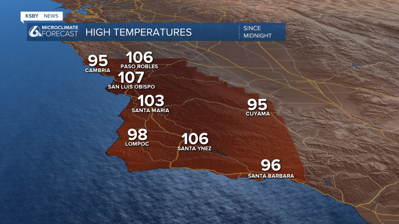
TEMPERATURE BREAKDOWN It's official, Wednesday was the hottest day of 2026 everywhere. A new daily record of 107 for San Luis Obispo. I had to go back to March when we hit 97 twice to find numbers this high. The high in Santa Barbara was 96 degrees. 106 in Paso Robles and Santa Ynez. Wednesday's peak temperatures reached the mid-90s to low 100s even at some beach locations and areas west of the mountains. Interior valleys saw temperatures between 100 and 108 degrees. Overnight lows offer little relief, staying in the 60s and 70s.
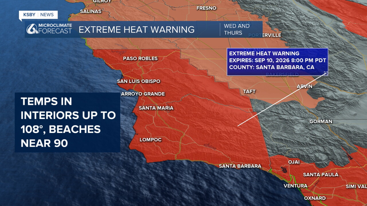
EXTREME HEAT PEAKED WEDNESDAY The most dangerous heat is behind us, but Thursday remains very hot across both San Luis Obispo and Santa Barbara Counties. High risk for heat illness continues, especially in interior valleys and foothills.
Isolated showers and thunderstorms developed Wednesday over the Los Padres National Forest. Activity was concentrated around the Cuyama Valley region. Brief downpours and lightning pushed in from Ventura County.
COASTAL CONCERNS IN SANTA BARBARA COUNTY Elevated surf and rip current risk will persist along Santa Barbara County beaches through Thursday evening. Wave heights of 3 to 5 feet with occasional 6-foot sets. Conditions improve Thursday afternoon as the south swell subsides.
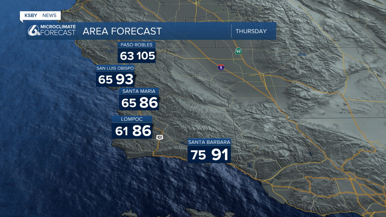
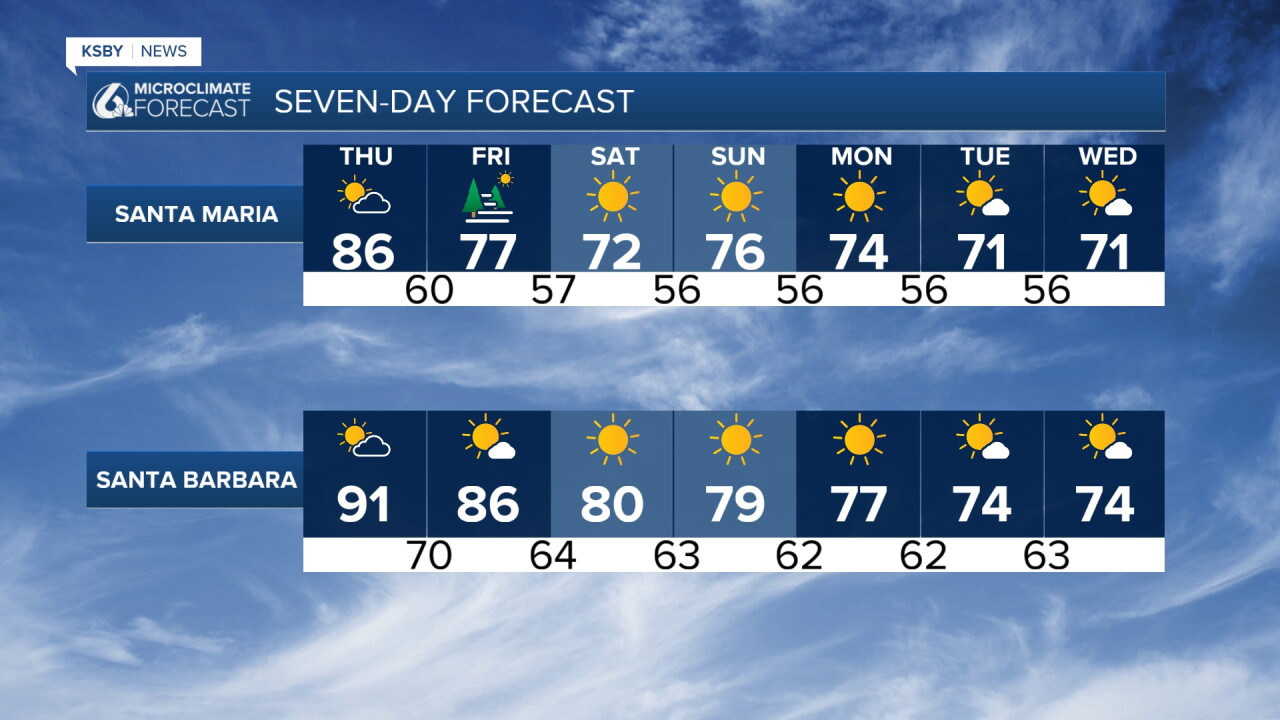
Thursday brings 4 to 10 degrees of cooling west of the mountains as upper-level high pressure weakens slightly. Interior sections see minimal change. Extreme Heat Warnings remain in effect through Thursday evening.
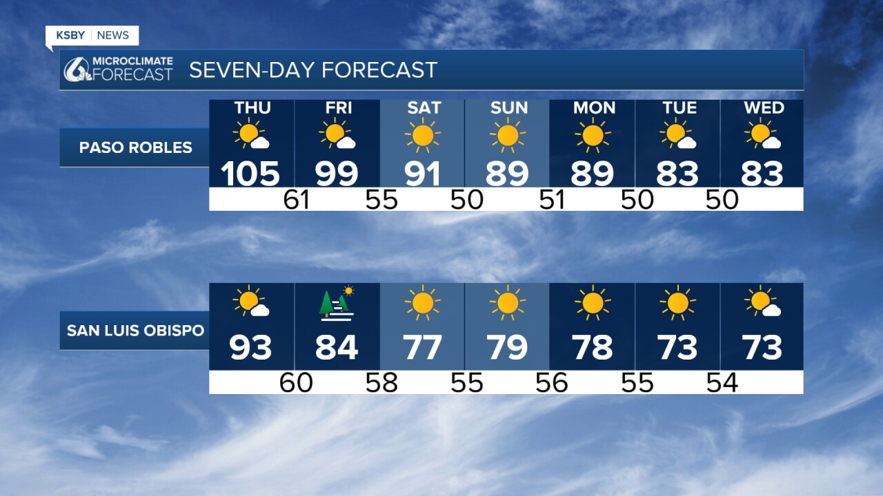
WEEKEND RELIEF COMING Friday and Saturday show a more significant cooling trend. Onshore flow increases, marine layer clouds return to the coast, and temperatures drop 5 to 10 degrees below seasonal averages. Most areas will see highs in the 70s and 80s by Saturday.
WIND CONDITIONS Expect typical afternoon southwest winds of 15 to 25 mph across the Santa Lucia and Santa Ynez Mountains. Gusts to 35 mph possible along ridgelines. Coastal areas remain relatively calm with light onshore breezes.
The dangerous heat phase of this weather pattern concludes Thursday as a more typical marine influence returns to the Central Coast.
Stay cool, Central Coast!
-Jim
