


Happy Sunday, Central Coast!
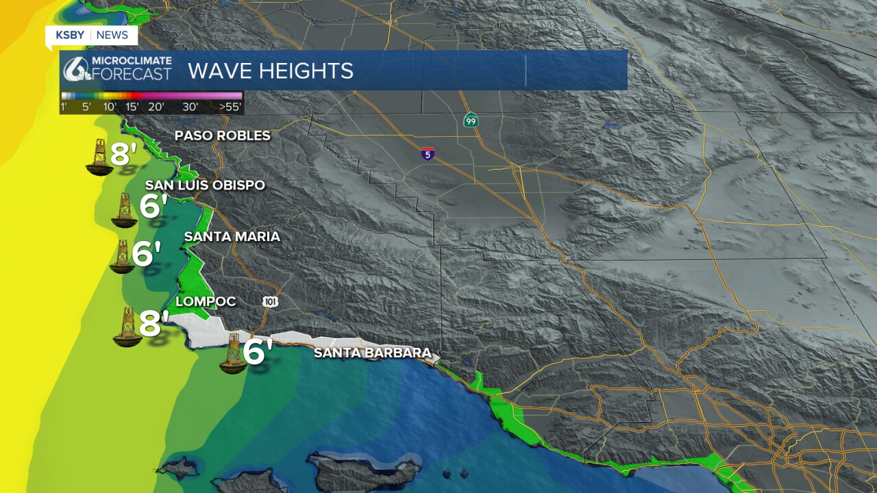
Here's a look at wave heights around 3:30 p.m. Not quite as impressive as the waves we saw on Saturday morning! Even so, large surf and high tides remain a concern. Both the High Surf Advisory and Beach Hazard Statement will stay in effect through Tuesday.
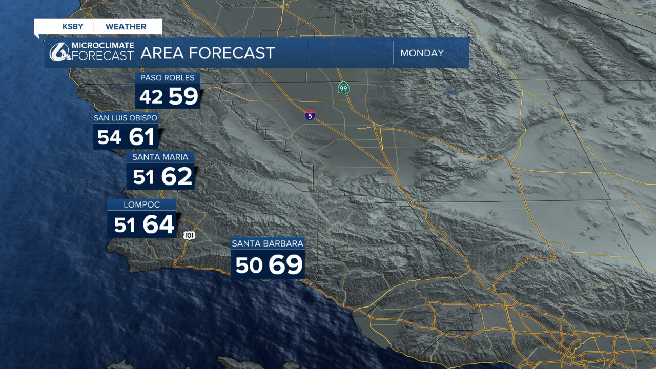
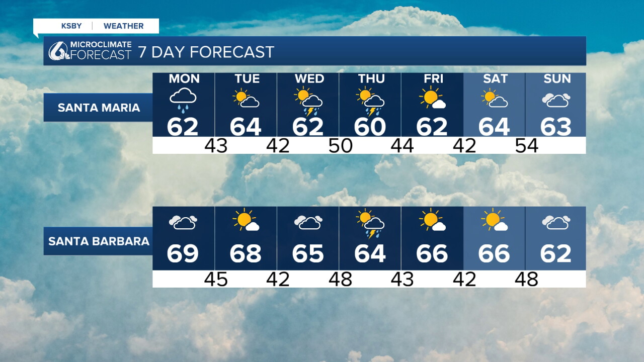
We'll start to see our second round of rain move in overnight Sunday, and many could be waking up to wet weather for your Monday morning commute. Before we get into the timing, here's a quick look at the temperatures you can expect tomorrow.
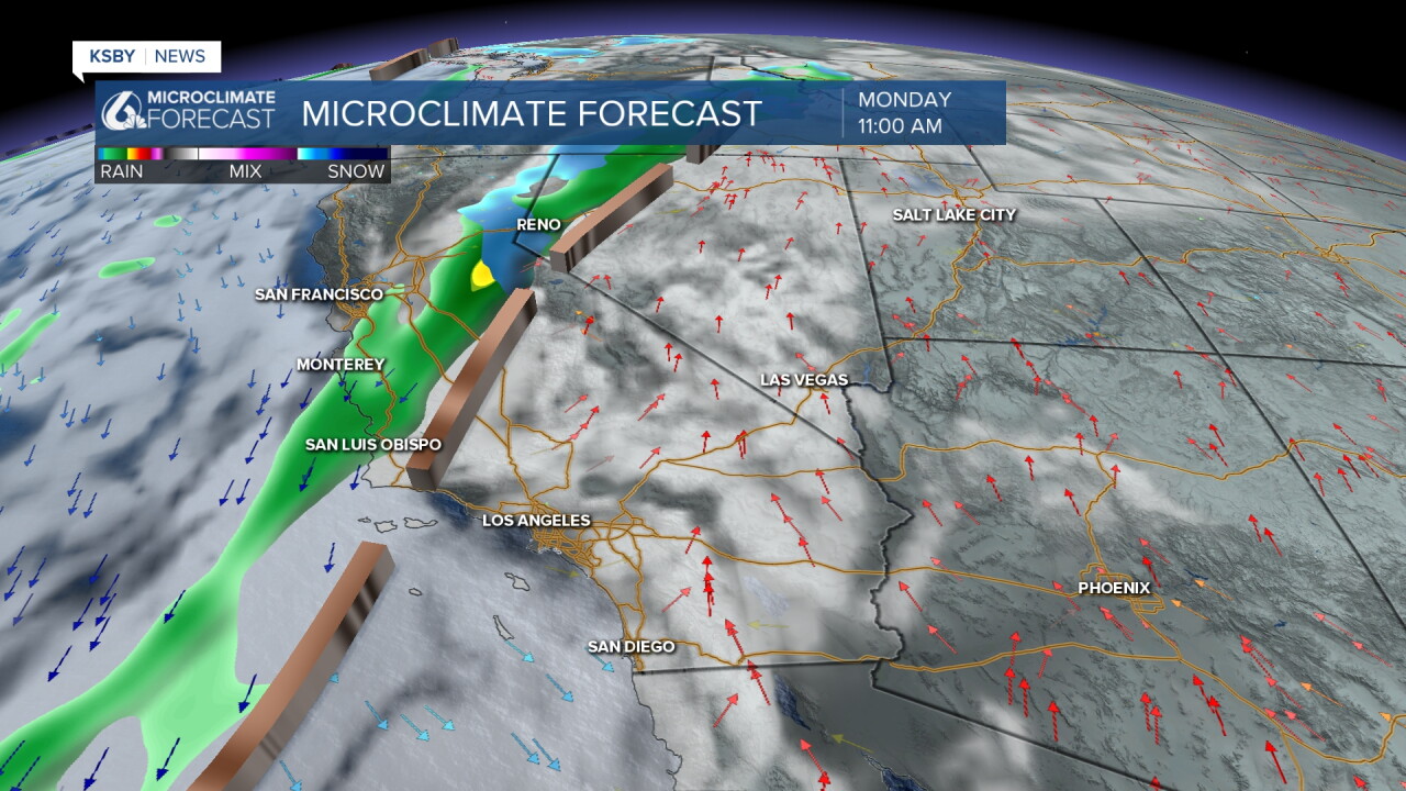
Here's a look at one of our forecast models, showing the conditions expected around 11 a.m. Monday. Other models suggest rain could arrive earlier in North County, closer to 6 a.m.
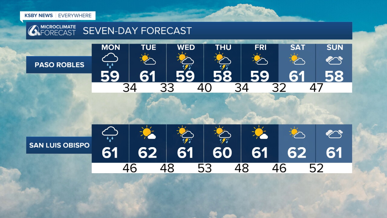
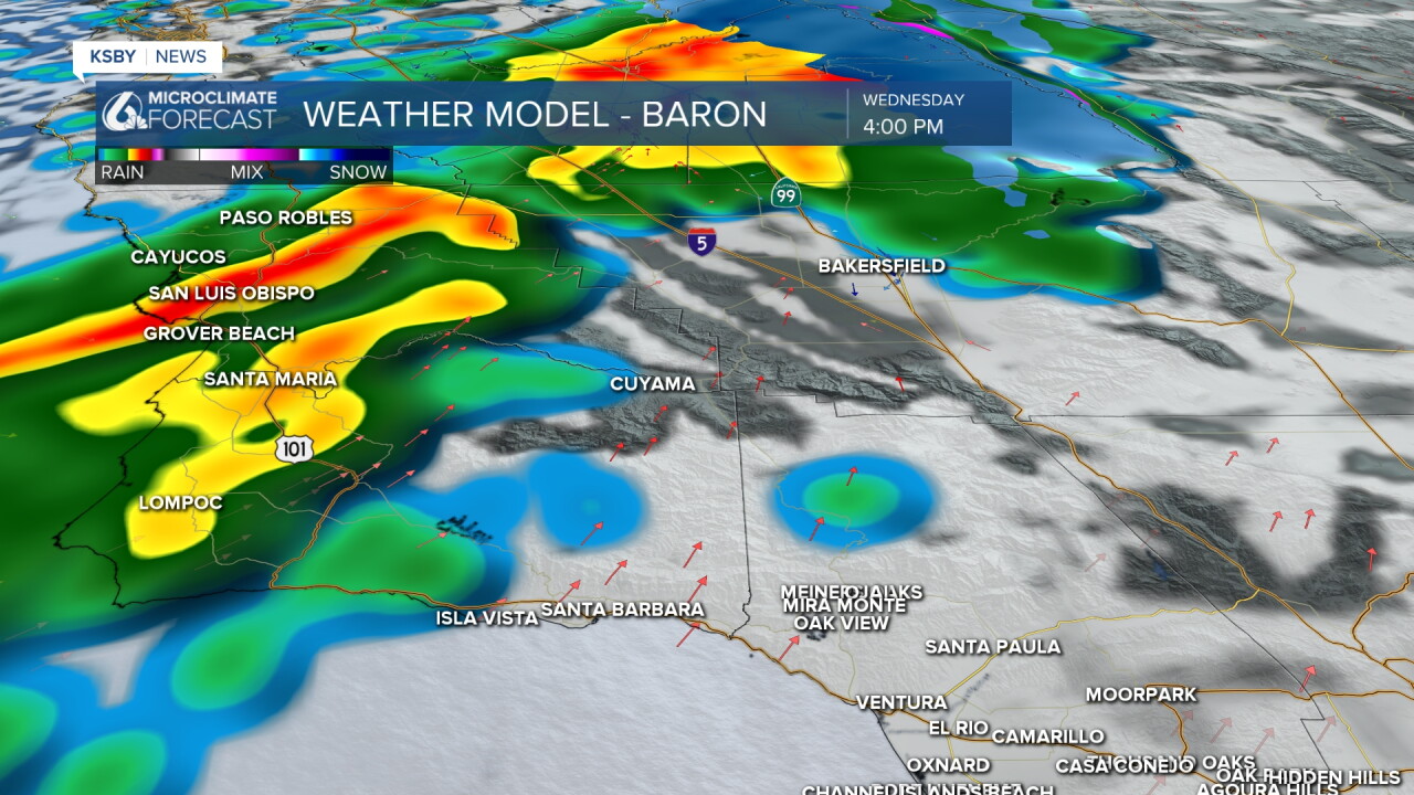
After Monday, we'll catch a brief break from the rain on Tuesday before another, much more substantial round moves in Wednesday. This next system could also bring the potential for thunderstorms and gusty winds. We're still working to pin down the exact timing of this one.
One of our models is showing moderate to heavy rain moving in on Wednesday. As of this weekend, the timing is still a bit uncertain, but current models suggest rain could move in sometime Wednesday afternoon. That could mean rain starting around 1 p.m. in North County communities, reaching the South Coast closer to 8 p.m. Keep in mind that timing could change.
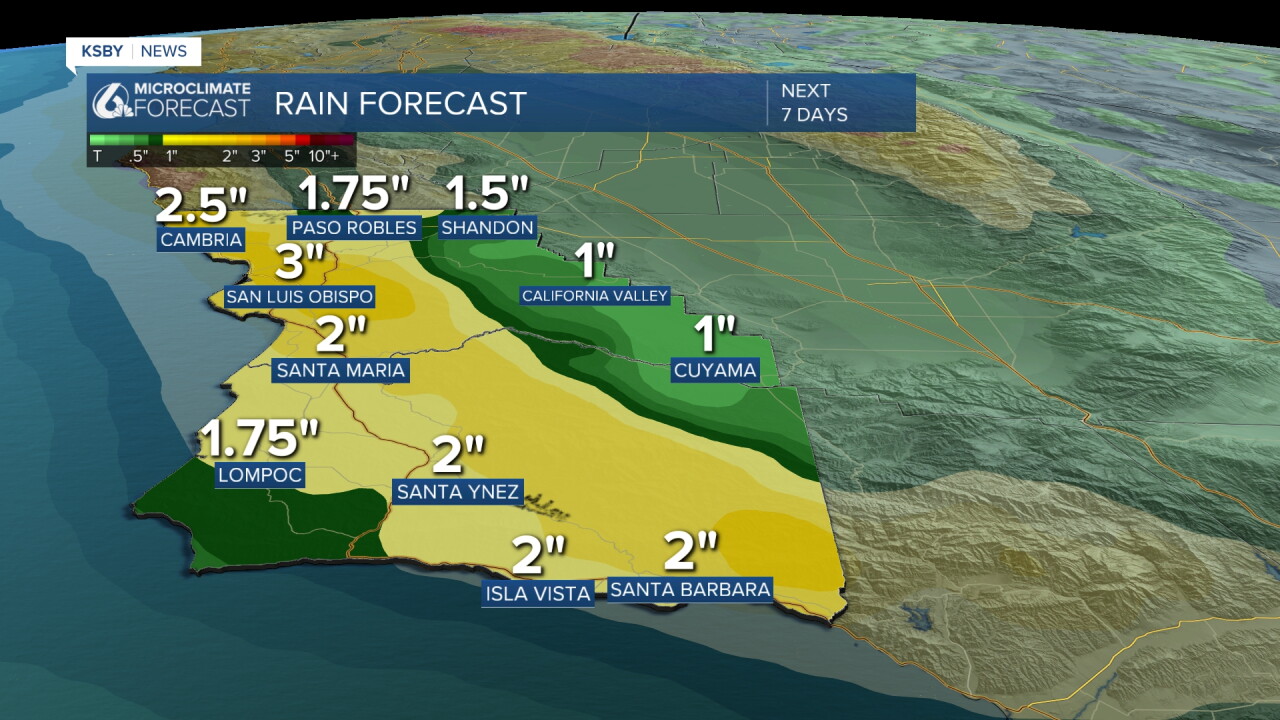
Rain totals have increased compared to what this model was showing on Saturday. These projected amounts include additional rainfall expected through Thursday. We'll be keeping a really close eye on areas with burn scars and road conditions on these days.
Goodnight!
— Leslie Molina
