


Good Wednesday evening, Central Coast!
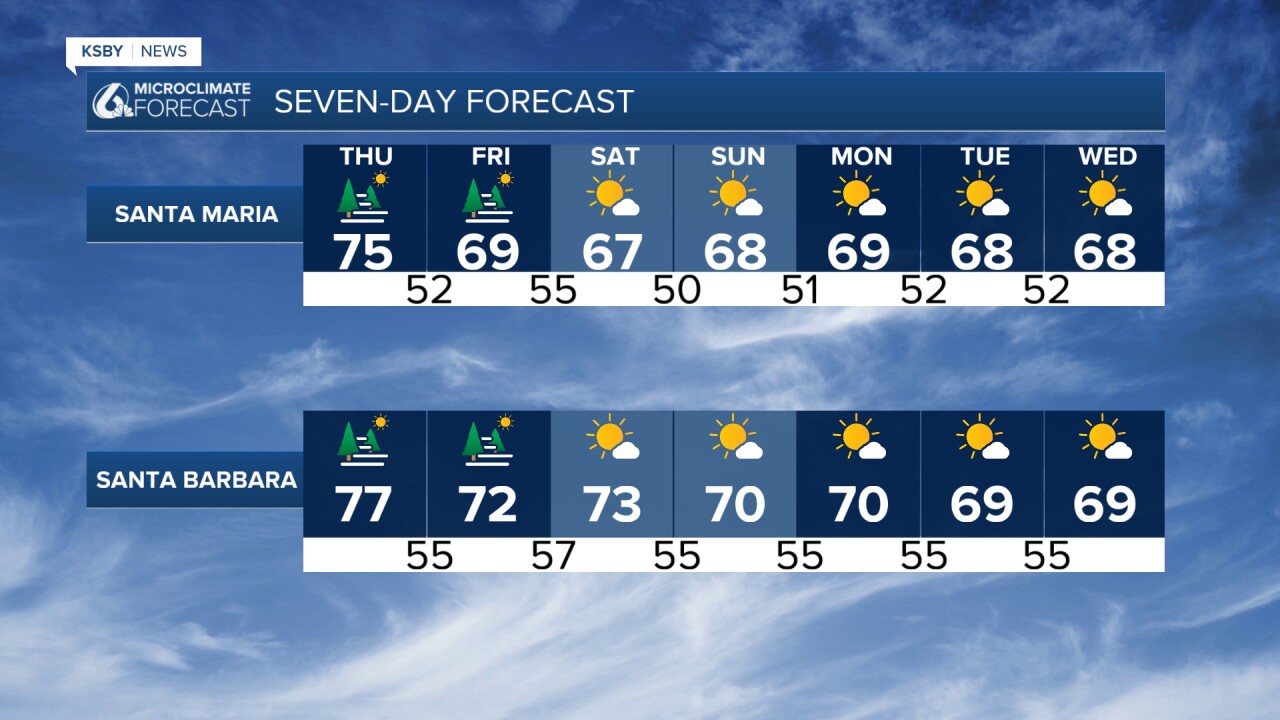
Tonight through Thursday: A shallow marine layer will develop overnight, bringing patchy low clouds and fog to coastal areas. Expect the marine layer to lift by late morning, revealing mostly sunny skies inland. High temperatures on Thursday will reach the upper 70s in San Luis Obispo and near 90 in Paso Robles, with 60s along the immediate coastline.
Friday - Weekend Transition: The weather pattern shifts significantly as a strong high-pressure ridge currently dominating Southern California begins breaking down. A Pacific Northwest trough will dive into the Great Basin, strengthening onshore flow and ushering in a more persistent marine layer. This marks the beginning of a notable cooling trend with below-normal temperatures.
Wind Concerns - Breezy for many areas Friday through Sunday. Sundowner winds will become a story, particularly on Friday and Saturday. Advisory-level northerly winds are likely across the western Santa Ynez Mountains, with the strongest gusts expected Saturday. These dry downsloping winds could reach 35-50 mph in the foothills and mountain areas of Santa Barbara County.
Extended Outlook - An unseasonably cold upper-level low will establish itself over the Great Basin by Sunday, maintaining cool, cloudy conditions through the following Wednesday. The marine layer will become more persistent and deeper, with night and morning low clouds affecting coastal valleys daily. Afternoon clearing will be slower, and some beaches may remain overcast well into the afternoon.
Temperature Trends: After Thursday's warmth, expect a steady cooling trend. Weekend highs will drop to the 70s inland and 60s at the beaches - several degrees below normal for late June. This cooler pattern will persist through the extended period.
The overall pattern represents a classic late-spring to early-summer transition, with the marine layer reasserting its dominance over the Central Coast after a brief warm spell.


Have a great night, Central Coast!
-Jim
