


Good Friday evening, Central Coast!
Low clouds and fog will return each night through the weekend and into early next week across San Luis Obispo and Santa Barbara counties, with a gradual cooling trend expected through Sunday.
A persistent marine layer will continue to influence weather patterns along the Central Coast, with stratus clouds arriving in the early evening hours and lifting by late morning or early afternoon each day. Locations along the immediate coastline — including areas of San Luis Obispo and Santa Barbara counties — could remain cloudy for most or all of the day due to strong pressure gradients keeping the marine layer in place.
This morning, localized patches of dense fog developed across the Santa Maria Valley. Lighter winds expected overnight increase the chance of dense fog returning Saturday morning, as conditions will allow clouds to settle to the surface. Residents in and around the Santa Maria Valley should be prepared for reduced visibility during the morning hours.
In the afternoons, an enhanced sea breeze will bring gusty winds of 20 to 30 mph locally.
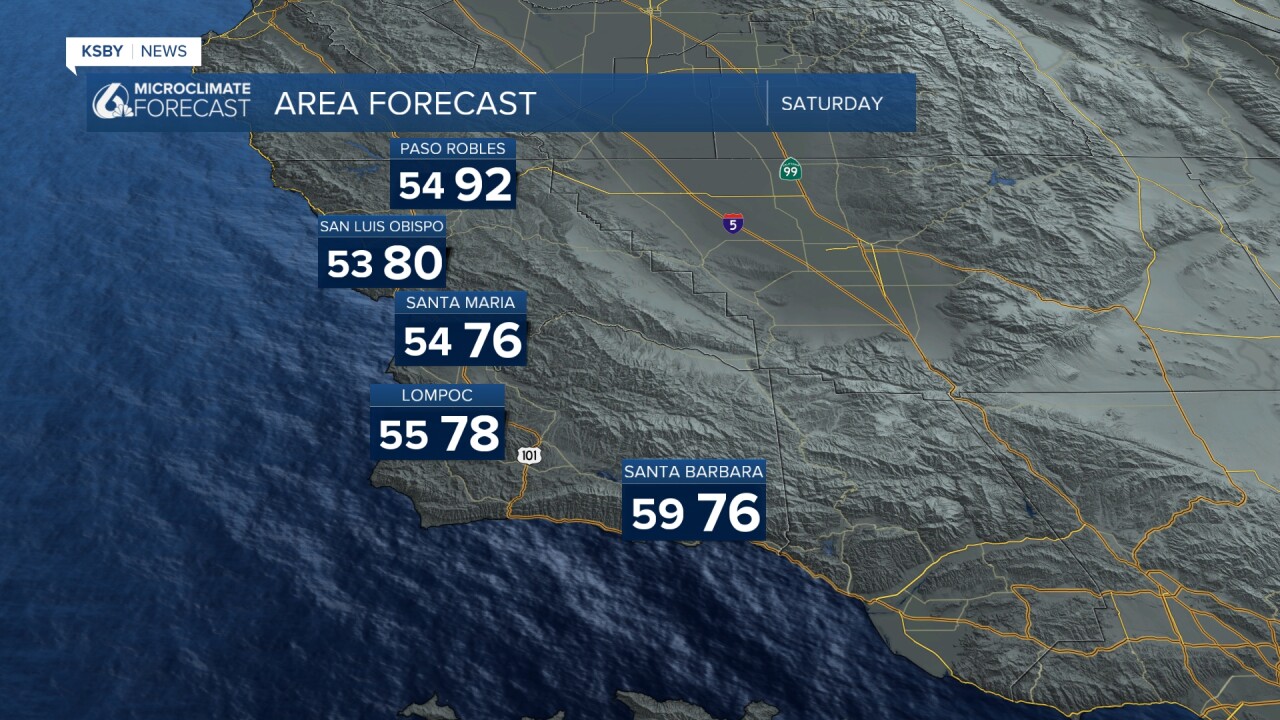
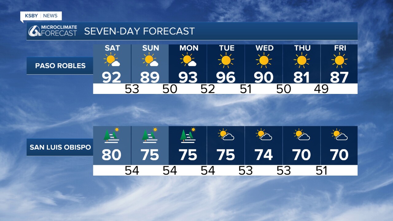
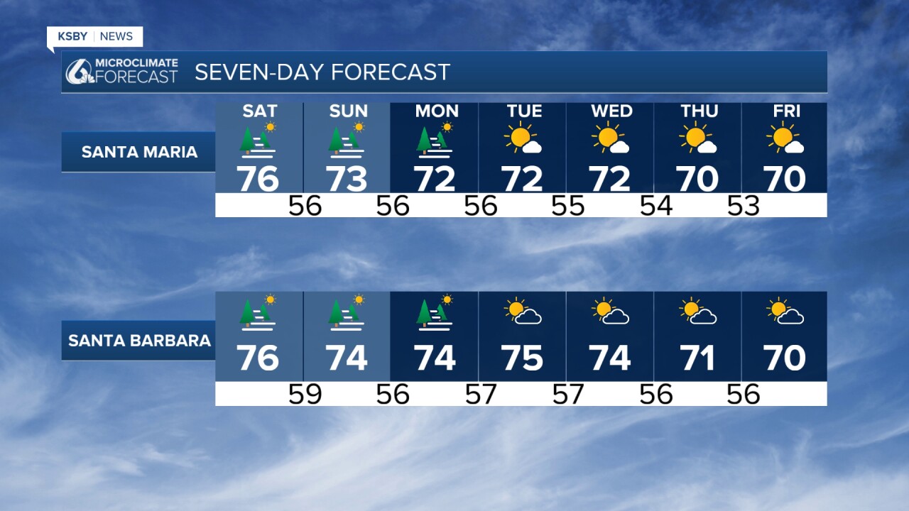
High temperatures will cool slightly through Sunday. Most areas will see readings near normal to slightly above normal, except the coastline, where temperatures will run slightly below normal.
The cooling trend is tied to an increase in onshore flow and expanded marine layer coverage. By Sunday, coastal and valley locations should be fairly close to normal temperatures, while the mountains and interior areas remain above normal.
Looking ahead to early next week, a ridge of high pressure nosing in from the north and west is expected to cause upper-level heights to peak Monday into Tuesday. Despite that, persistent moderate to strong onshore flow will limit warming along the coast and in the valleys, keeping those areas fairly close to normal. However, the far interior — including the Cuyama Valley — could see temperatures running around 10 degrees above normal by Tuesday, with 100-degree readings possible or likely in the Cuyama Valley. Heat-related weather products are not anticipated at this time.
Overall, very typical June weather will dominate the short and long-term forecast across the Central Coast, with the region situated under the southeastern edge of the ridge and persistent onshore flow driving the daily marine layer pattern.
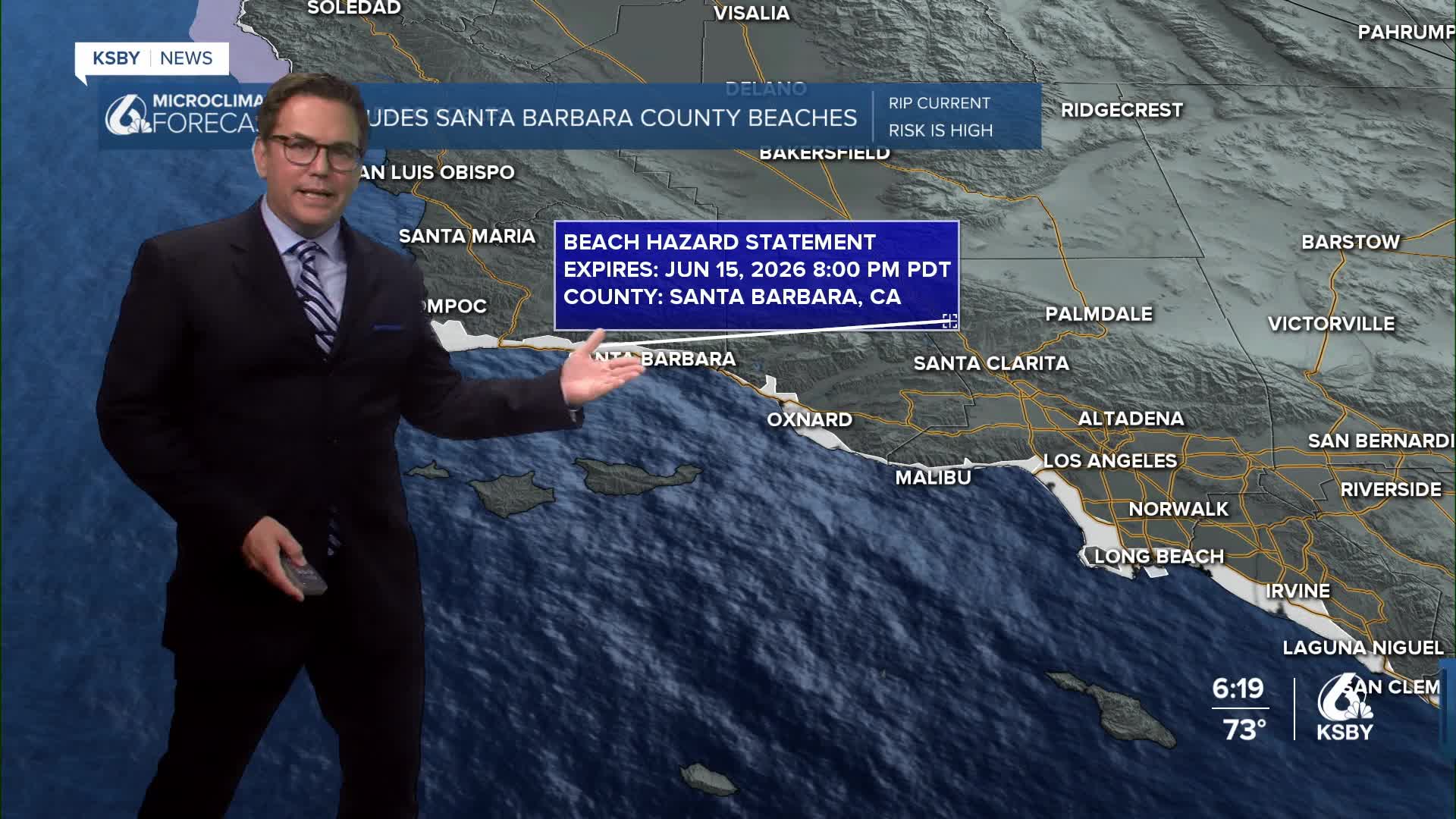
BEACH HAZARDS STATEMENT REMAINS IN EFFECT FROM SATURDAY MORNING THROUGH MONDAY EVENING for the Santa Barbara County coastline:
Dangerous rip currents and breaking waves due to elevated surf of 3 to 6 feet on south-facing beaches are expected. In addition, high astronomical tides of 7.5 to 7.9 feet are expected each evening through Monday. Ventura County Beaches, Malibu Coast, Los Angeles County Beaches, and all Southern Santa Barbara County Beaches. From Saturday morning through Monday evening. There is an increased risk of ocean drowning. Rip currents can pull swimmers and surfers out to sea. Waves can wash people off beaches and rocks, and capsize small boats nearshore. Minor coastal flooding is possible in low-lying areas at the times of high tides.

Have a great weekend, Central Coast!
-Jim
