


Good Thursday evening, Central Coast!
Here's the forecast for San Luis Obispo and Santa Barbara Counties from Meteorologist Jim Castillo.
Tonight through Friday Morning: A weak upper-level ridge currently positioned over our area will give way to northwest flow aloft Friday. Marine layer clouds will push inland tonight and Friday morning, affecting coastal areas and valleys throughout both counties. Breezy to locally gusty southwest-to-west winds continue this evening across the region.
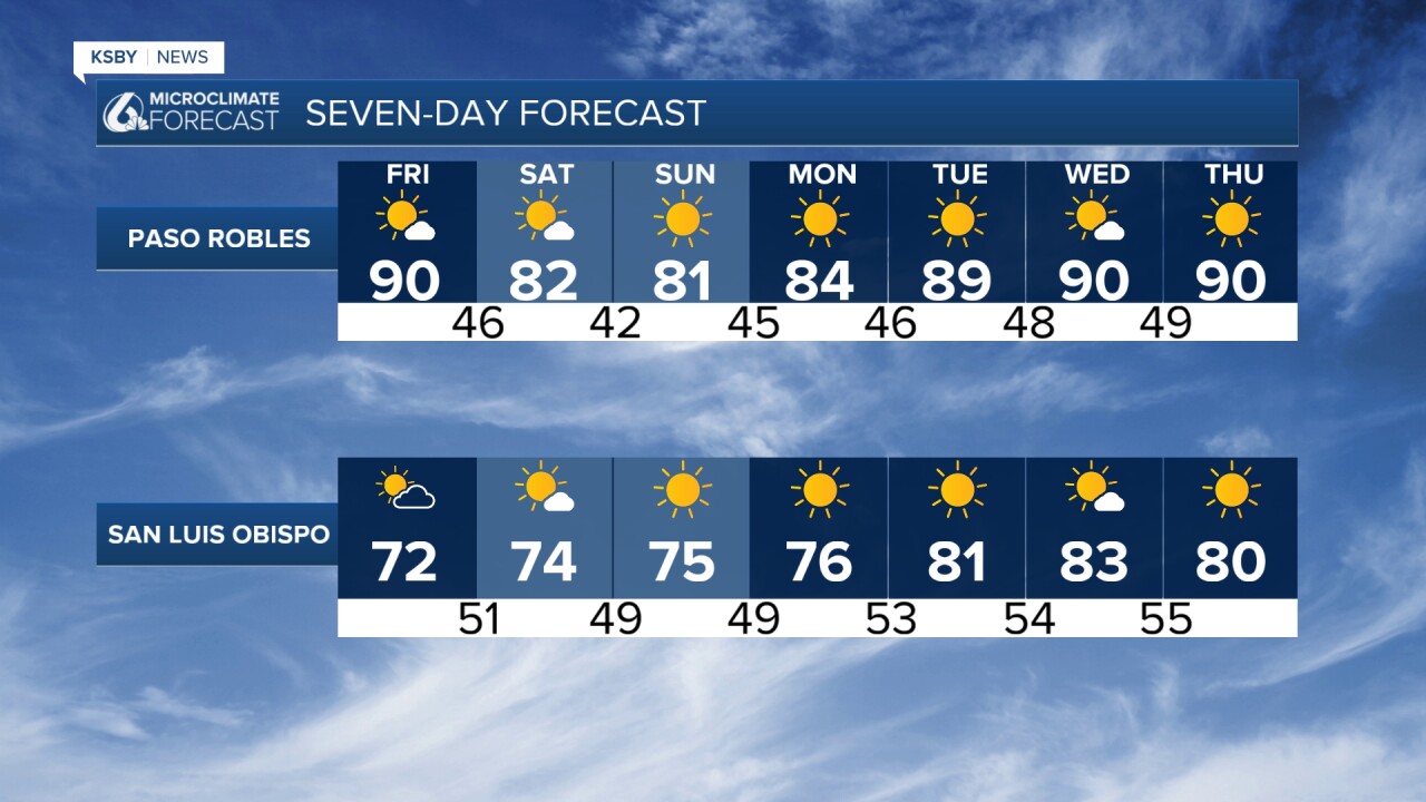
Temperature Outlook: Today's temperatures were a few degrees below normal along the coast and adjacent valleys, while interior valleys and mountains were several degrees above normal. Friday will bring warmer conditions inland, though coastal areas will remain slightly below normal. Saturday and Sunday will have slightly above normal temperatures.
Weekend Wind Event: The most significant weather impact will be strong winds, particularly in the Santa Ynez Mountains of Santa Barbara County. As a potent upper-level trough moves into the Great Basin this weekend, tight pressure gradients will drive powerful northwest winds. Most areas will have NW winds 15-20 mph with gusts to 35 Saturday and Sunday.

Saturday Night Wind Advisory Expected: The Santa Ynez Mountains face the strongest winds late Saturday into Saturday night, with Advisory-level conditions anticipated. Wind-favored passes and canyons could see gusts reaching 55 mph Saturday evening. A Wind Advisory will likely be issued on Friday for this area. A second round of strong north winds will impact the Santa Ynez Mountains late Sunday into Sunday night.
Marine Layer Pattern: Marine clouds will affect the coast and valleys Friday night into Saturday morning, and again Saturday night into Sunday morning. The pattern will cover most coastal and valley areas except the southern Santa Barbara County coast. Otherwise, mostly clear skies dominate through Sunday.
Early Next Week: As the trough moves east, weak offshore flow becomes possible Monday and Tuesday mornings. Northeast wind gusts of 15 to 30 mph may affect wind-prone mountain areas, including portions of the Santa Lucia Mountains and Los Padres National Forest. A warming trend develops Monday through Wednesday, with inland areas seeing the most pronounced temperature rise from mid-70s to low 80s, followed by slight cooling Thursday. Marine layer clouds and fog remain possible daily across coastal and valley locations.
The upper-level low associated with this system should reach central Nevada by late Sunday, maintaining the weather pattern through the weekend.
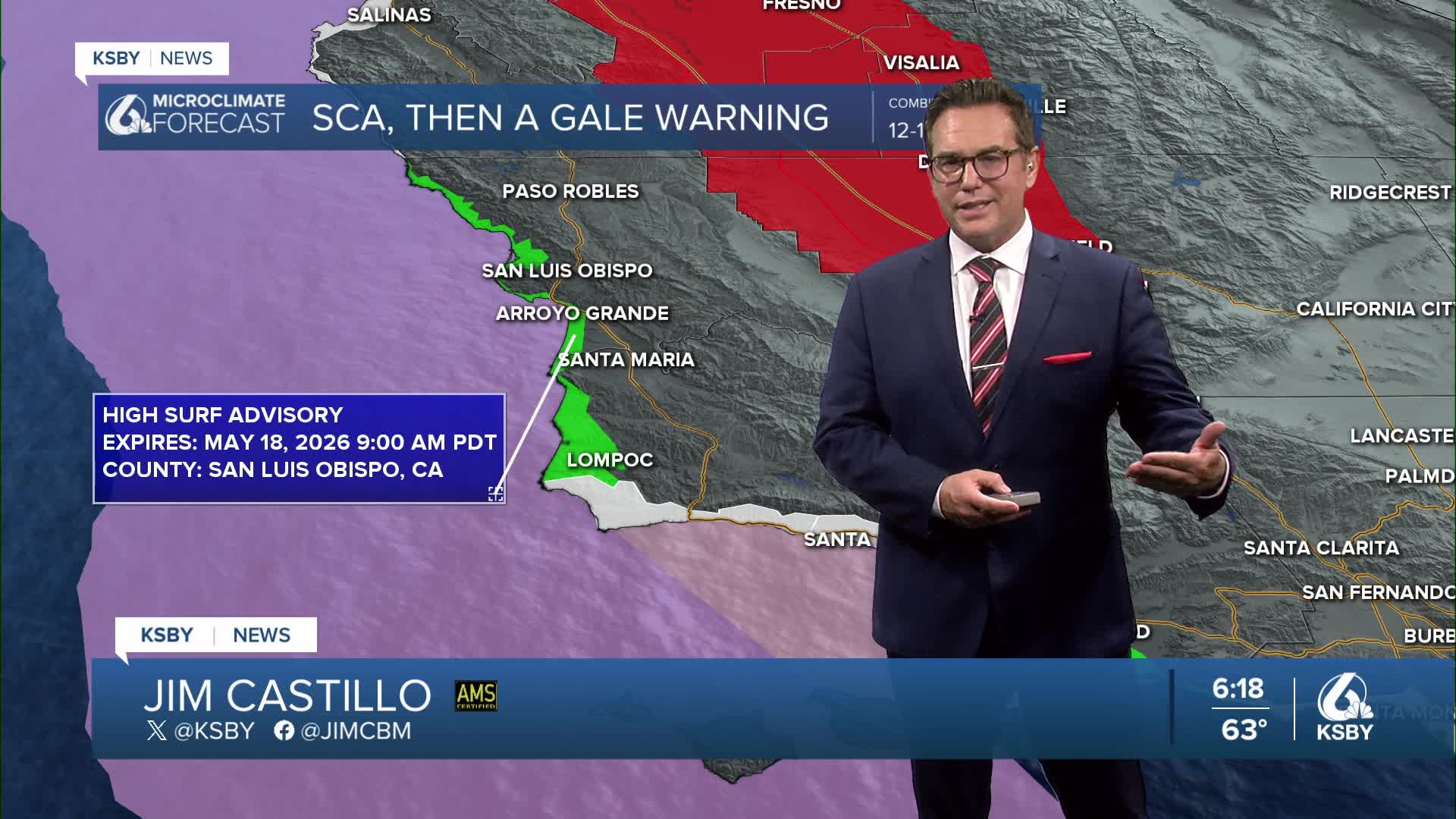
Below: A High Surf Advisory has been issued from 3 pm Friday until 9 am on Monday for the Central Coast. Large breaking waves of 10 to 15 feet with dangerous rip current will be common, especially on the northwest-facing beaches. A Gale Warning has been issued for offshore waters with combined seas of 12 to 18 feet. In Red, there is a fire weather watch for the Central Valley.


Below: Reservoir Thursday with the current levels and the changes over the last week.


Have a great night, Central Coast!
-Jim
