


Good Tuesday evening, Central Coast!
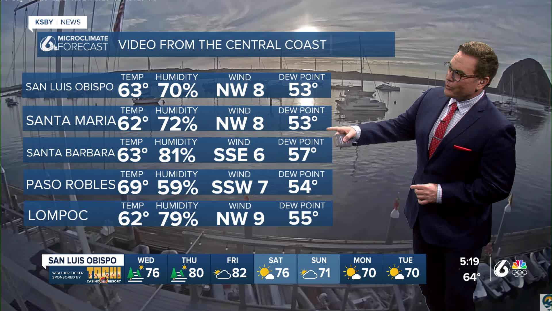
Below are the high temperatures on Tuesday, ranging from 69 in Santa Barbara to 73 in Santa Ynez and 72 in Paso Robles.

Average low temperature and high temperature for the end of February
Santa Maria 43 and 65
San Luis Obispo 43 and 65
Paso Robles 38 and 64
Santa Barbara 45 and 64
Northern California is seeing all the rain this week, while the Central Coast continues to have well-above-average temperatures.
The warm afternoons are thanks to high pressure centered off the coast and to our south in the Pacific Ocean. This high is keeping an Atmospheric River well to the north of San Francisco. A Flood Watch remains in effect in northwest California until 10 pm tonight. A few flood advisories and warnings were issued on Tuesday around Eureka and Crescent City.

American Meteorological Society definition: A long, narrow, and transient corridor of strong horizontal water vapor transport that is typically associated with a low-level jet stream ahead of the cold front of an extratropical cyclone. The water vapor in atmospheric rivers is supplied by tropical and/or extratropical moisture sources. Atmospheric rivers frequently lead to heavy precipitation where they are forced upward—for example, by mountains or by ascent in the warm conveyor belt. Horizontal water vapor transport in the midlatitudes occurs primarily in atmospheric rivers and is focused in the lower troposphere. Atmospheric rivers are the largest “rivers” of fresh water on Earth, transporting on average more than double the flow of the Amazon River.
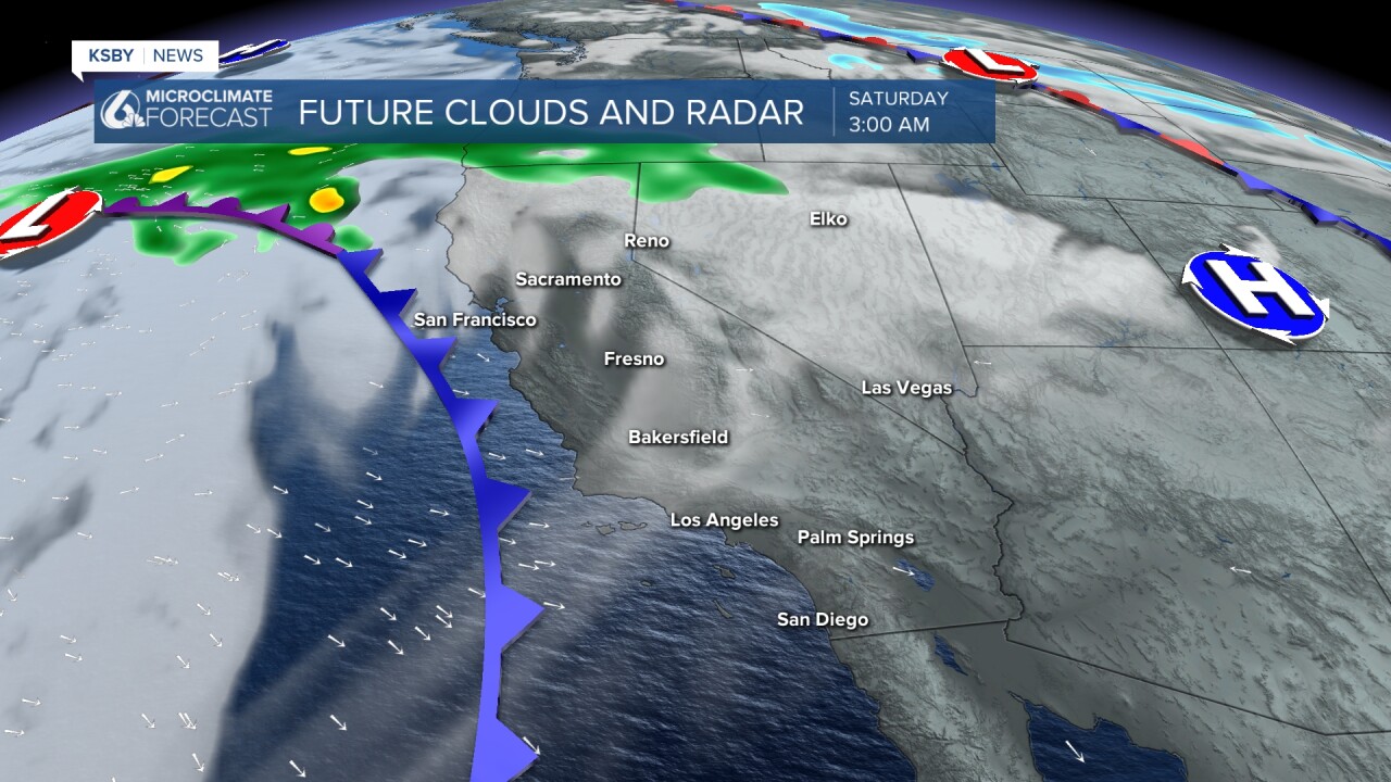
So the Central Coast stays dry this week and the upcoming weekend. A cold front goes through the area early on Saturday, but it will pass through dry, and it will cool us down a few degrees.
Below is a snapshot of early Saturday when a cold front approaches the Central Coast. This cold front is expected to pass through the area dry. Temperatures cool down a bit on Sunday, but highs will still be 5 to 7 degrees above the average.
Tomorrow, lows will be in the upper 40s to mid 50s, and the highs will be well into the 70s. Areas of morning fog and low clouds are likely, then plenty of afternoon sunshine.

Below is a Small Craft Advisory for the Santa Barbara County coast until 4 am on Thursday. Per the National Weather Service: Inexperienced mariners, especially those operating smaller vessels, should avoid navigating in these hazardous waters.

The days to look for some 80-degree highs will be Thursday and Friday.

Have a great night, Central Coast!
-Jim
