


Good morning, Central Coast!
This morning is off to a cloudy and cooler start as marine layer cloud cover and higher humidity extend across our Central Coast communities. This cloud cover is sitting at around 1000 ft in elevation so our peaks and many interior valleys are nice and clear.
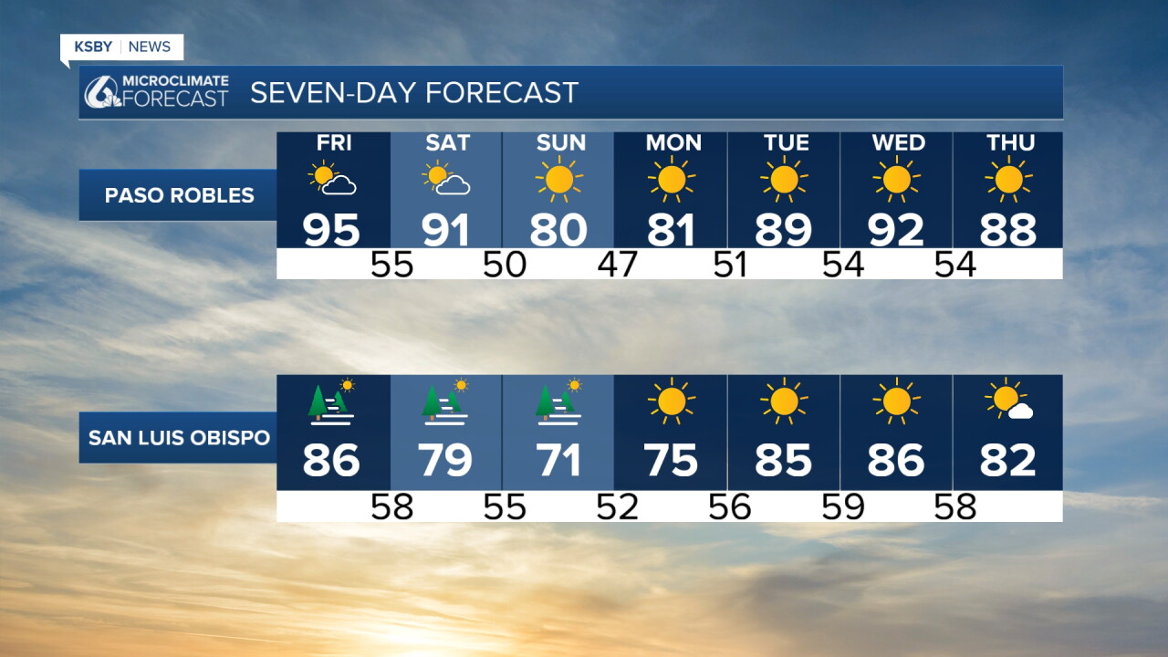
The clouds will clear out by mid morning with afternoon high temps a little above normal for this time of the year. Here is what we can expect!
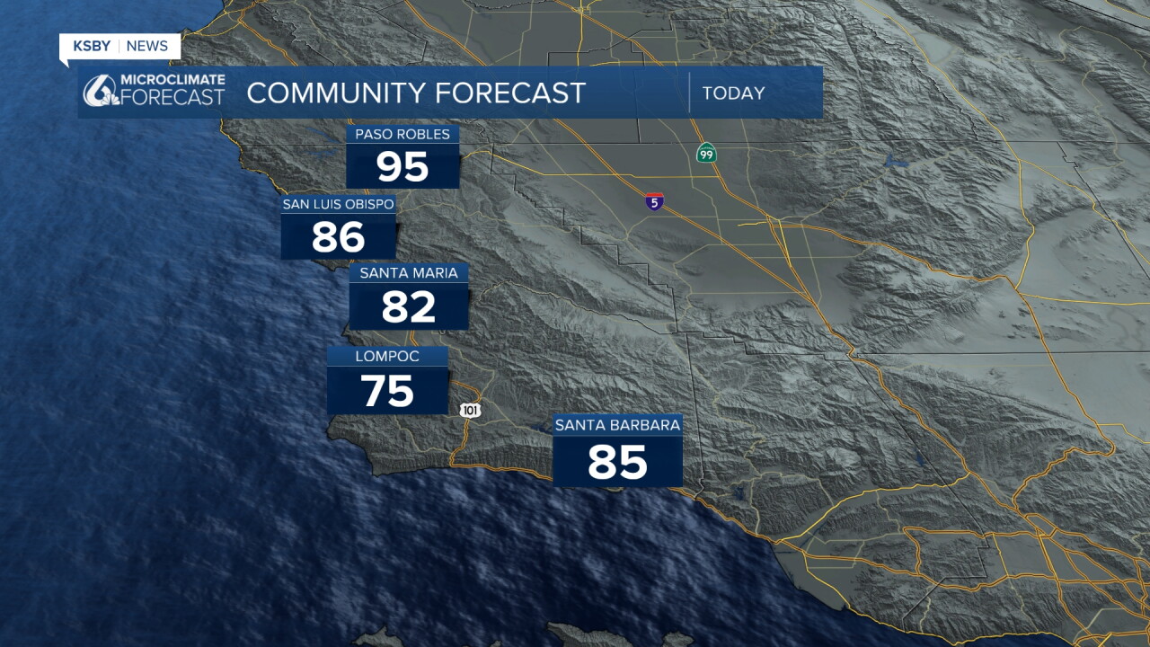

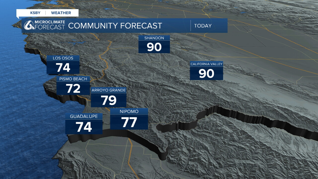
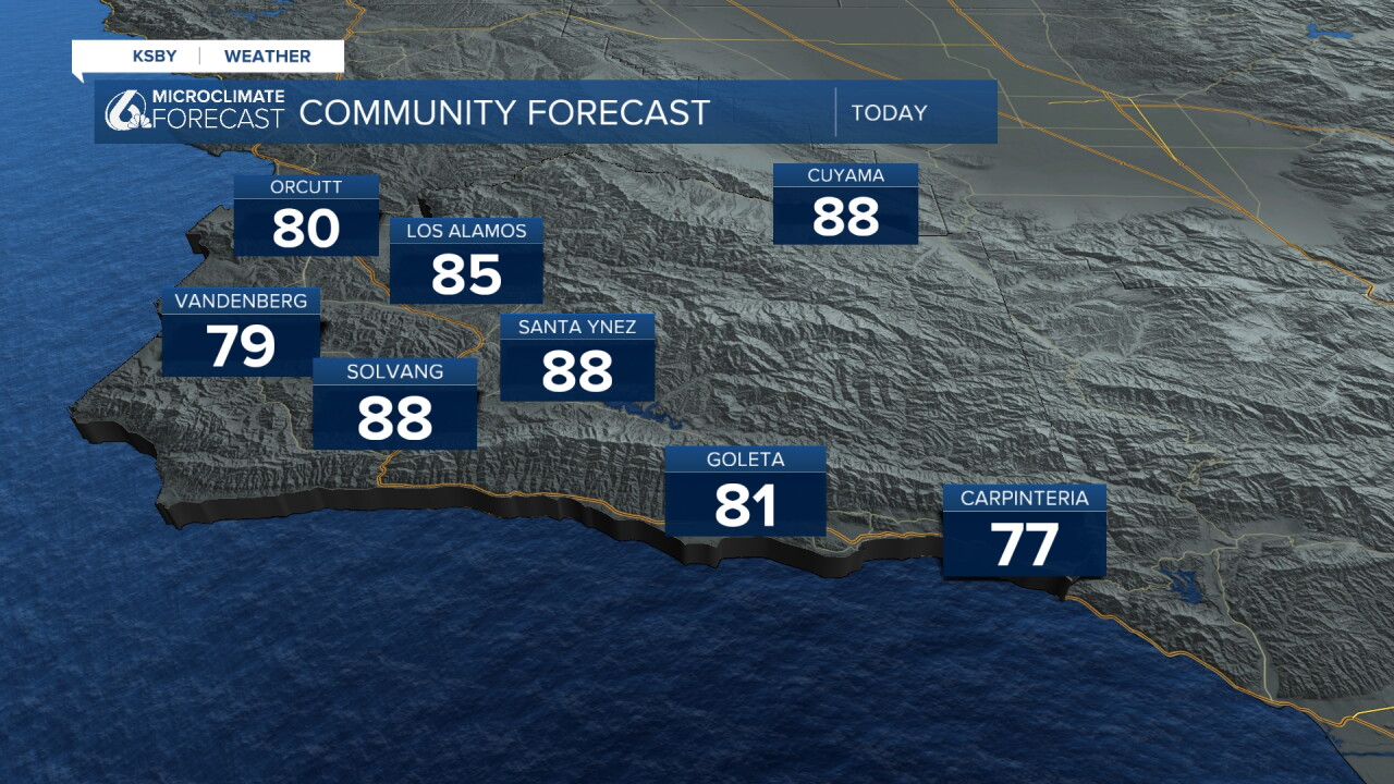
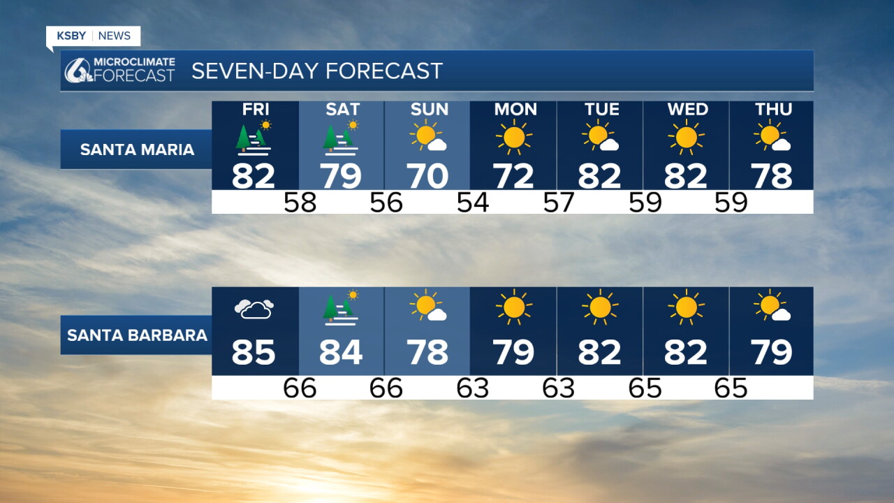
Friday evening the marine clouds will move back in and set up conditions to be comfortable again into Saturday morning. Here is a look at the weekend forecast across the region.
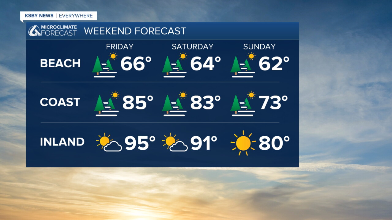
That large cooldown Saturday into Sunday is thanks to a cold front that will push through overnight and drop temps 10 degrees. Thankfully other than some aditional cloud cover that will not cause any major issues to our weekend events.
Here is a look at the events going on this weekend across our Central Coast communities!
Turning to the tropics, Hurricane Polo is shifting course (thanks to Hurricane Odalys) and is now expected to make landfall in Baja Sur early next week. Thankfully that landfall will not impact us but the energy of these storms will kick up more waves and may also bring some coastal erosion to our beaches.
While those beach impacts from Polo are possible Monday and Tuesday, the most significant impacts are expected from Los Angeles County southward to San Diego County.
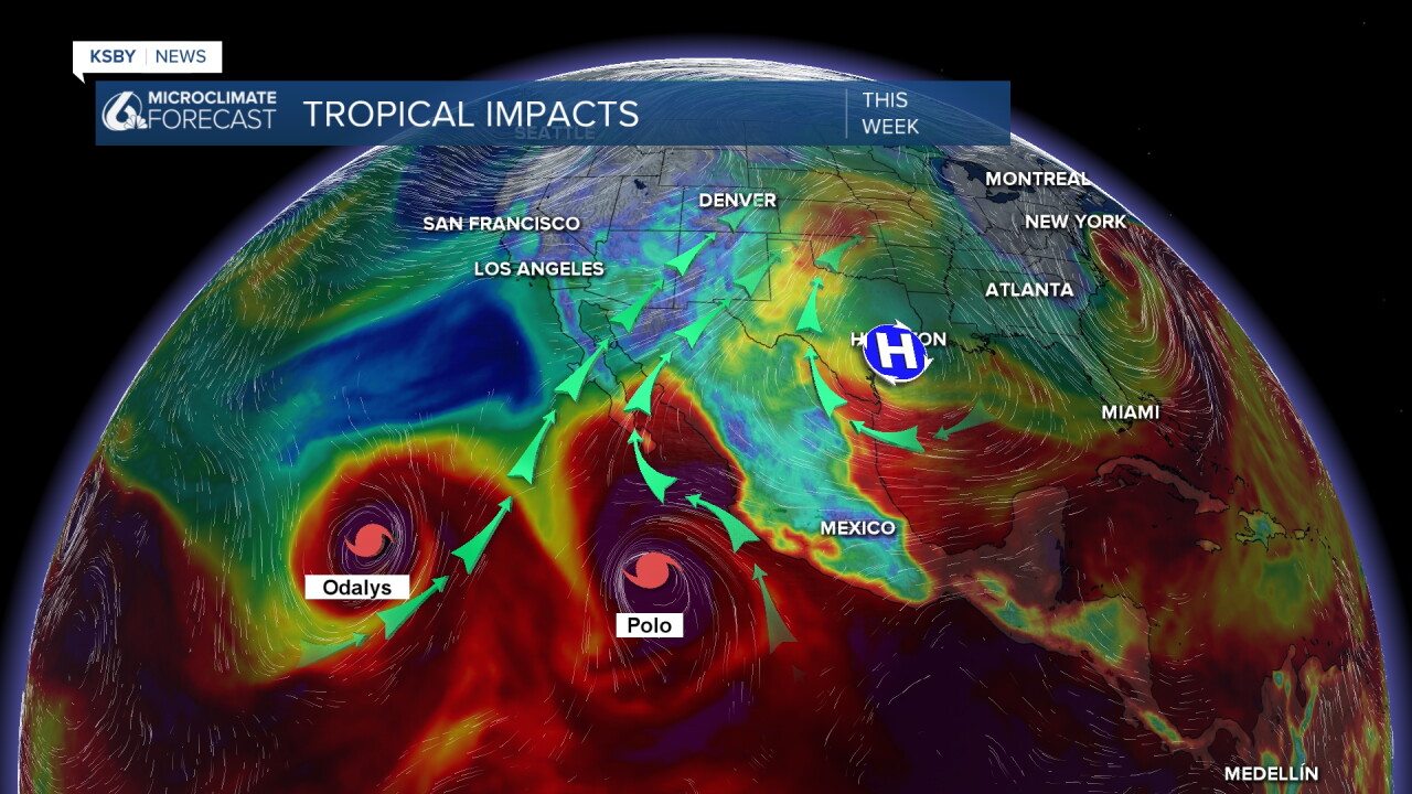
Significant warming later next week is expected as a small high pressure system moves in.
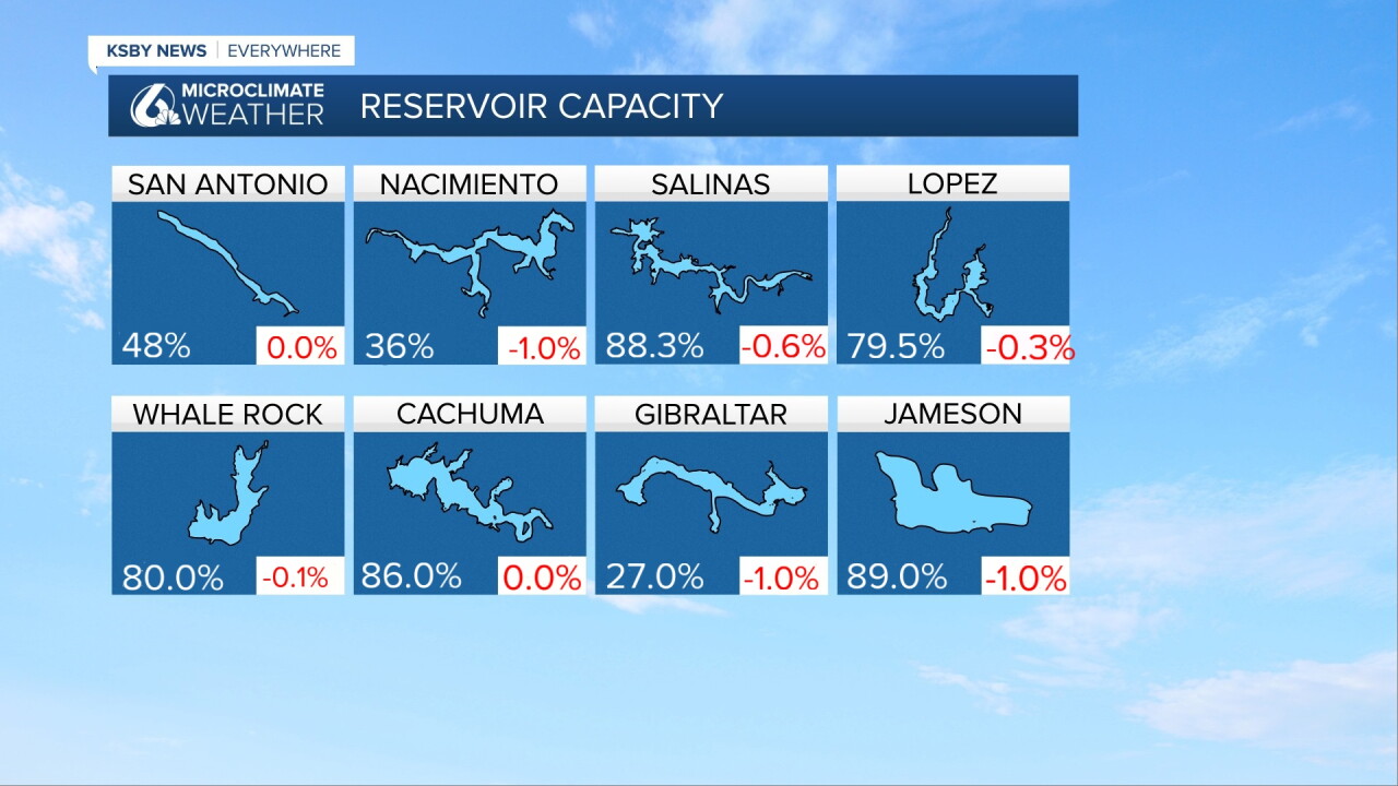
One more note before I go! Here are this weeks reservoir/lake levels with the week-over-week change in red.
Have a wonderful day and a great weekend ahead, Central Coast!
-Vivian
