


Happy Saturday, Central Coast!
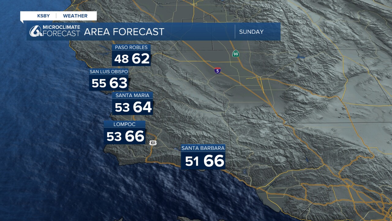
Let's get the temperatures we can expect on Sunday out of the way. There is a lot of change headed our way starting Tuesday of next week, and by change, I mean rain.
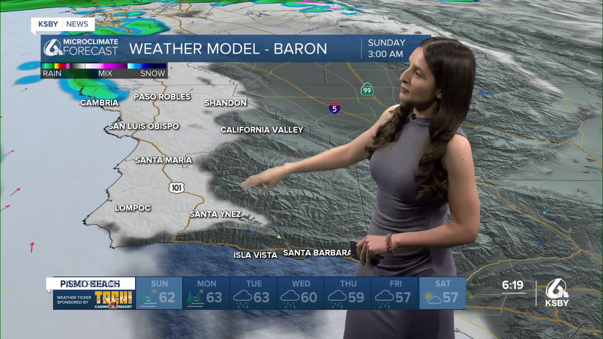
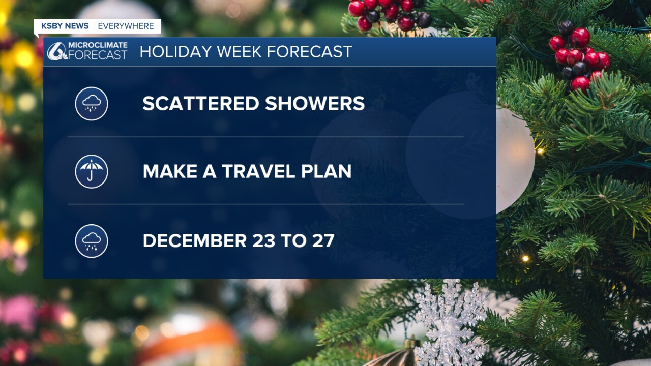
Alright, let's keep it simple before I get into too much detail. This Sunday, the northwestern parts of San Luis Obispo could experience some scattered showers. Most of the rain at this time is happening to the north of our region. Make a travel plan if you do not have one already! Starting this Tuesday, we will see some rain.
Here is what those scattered showers will look like on Sunday. It will start in those early morning hours and continue throughout the day. Again, it will mostly stick to the northwestern part of SLO County. If you plan to head to Southern California for the holidays by road, start this Saturday or plan to do so on Sunday or Monday.

The first chunk of rain could arrive in our region late Tuesday into early Wednesday. This won't be the last of it! We'll continue seeing rain all of next week. Yes, even on your drive or flight back home. Our radar shows that we will experience rainy conditions through next weekend.

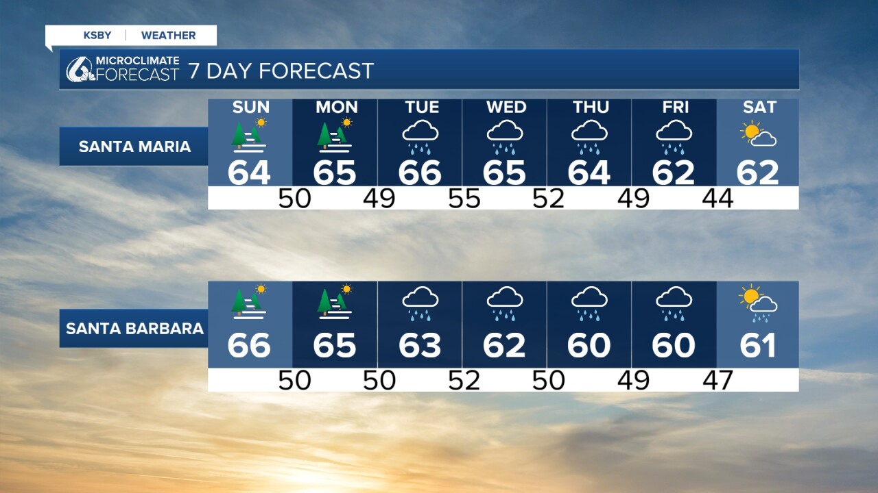
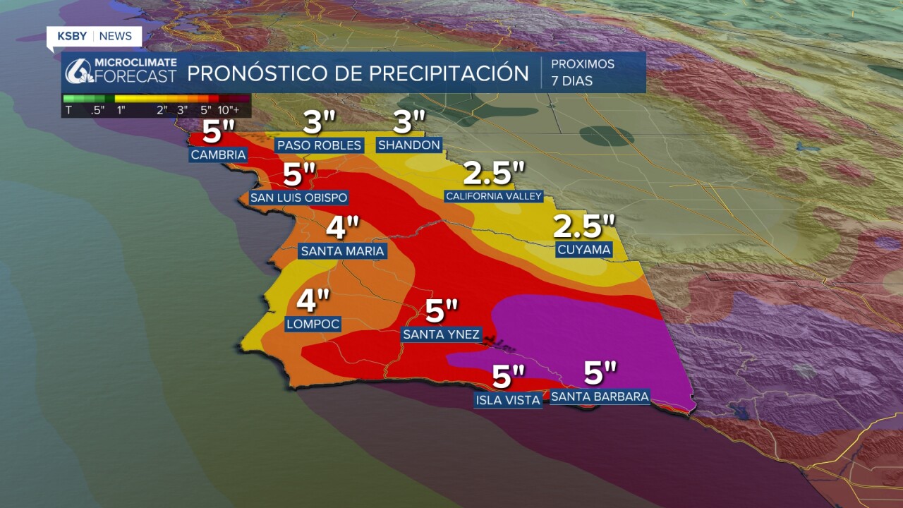
We have held off showing rain totals all week, but now that most of the system is captured in the 7-day forecast, here is a look at what we can expect. It looks like the higher-elevation areas are set to receive more, up to 5 inches of rain. Overall, Christmas week is set to be a soggy one for all of California!

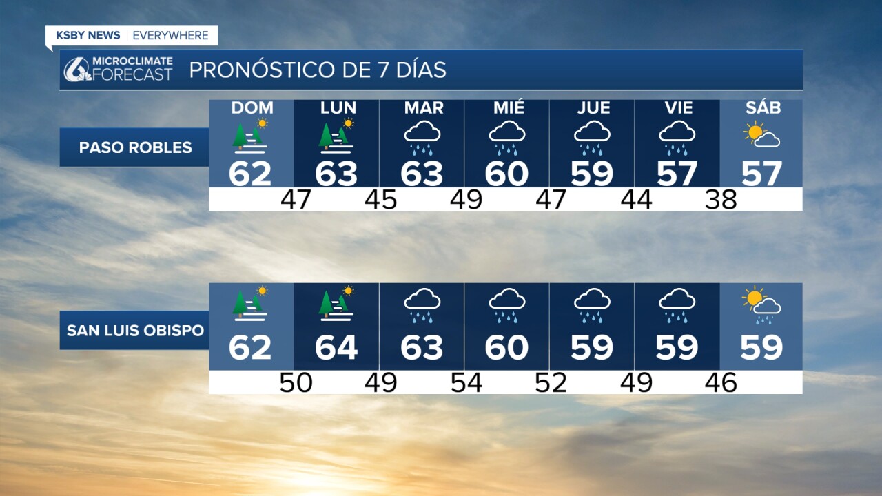
Here is what all of this rain will be looking like in our 7-day forecast.

I am aware that this does not apply to our region, but since many of you will be traveling, I want to give you a heads-up. If you are planning to drive through Interstate 5 or head to the Central Valley, a big chunk of it (including all of Kern County!) is under a flood watch until December 26th.
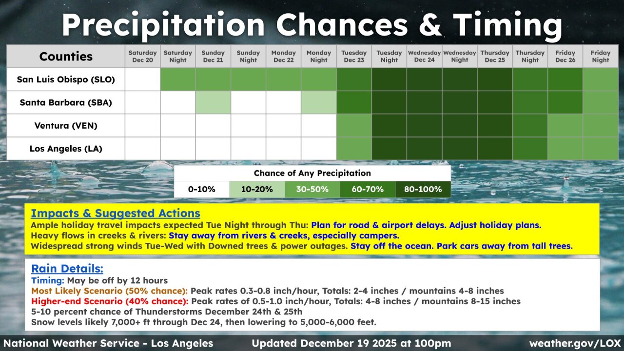
Before you go, once again, I leave you with the National Weather Service's infographic that covers rain chances.

Stay safe and happy holidays!
—Leslie Molina
____________________________________________________________
¡Feliz sábado, Costa Central!
Primero, hablaremos de las temperaturas que pueden esperar para el domingo. Continuaremos observando temperaturas templadas en el rango de los 60. Ahora que ya vimos lo que nos espera el domingo, les explicaré los cambios que experimentaremos en los próximos días.

Antes de entrar en los detalles, les daré una versión más sencilla. Condiciones mayormente secas para el domingo y el lunes. Sí existe la probabilidad de que lluvias dispersas lleguen al noroeste del condado de San Luis Obispo el domingo. Aprovechen estos días para viajar hacia el sur de California o para formalizar un plan. La tormenta que estamos monitoreando está proyectada a llegar a la Costa Central el martes.

Si buscan una versión más detallada, aquí comenzaremos a explicarlo. Este fin de semana, un río atmosférico está trayendo lluvias al norte de nuestra región. Existe la posibilidad de que el noroeste del condado de San Luis Obispo registre lluvias dispersas el domingo. La siguiente imagen muestra que estas podrían iniciar durante la madrugada.

La próxima imagen muestra que el río atmosférico llegará a nuestra región el martes por la noche y el miércoles por la madrugada. Todo indica que estas lluvias se presentarán en tres partes y continuarán durante la Nochebuena y Navidad. Además, nuestro radar indica que existe la posibilidad de que observemos más lluvias el próximo sábado y domingo.

Nos hemos restringido a mostrar los totales de lluvia, pero como ya estamos más cerca de las fechas en que se presentará la tormenta, he decidido mostrárselos. ¡Podríamos registrar 5 pulgadas de lluvia en Santa Barbara y San Luis Obispo!
Nuestro pronóstico de los próximos 7 días muestra toda esta lluvia.
Sé que esto no se aplica a la Costa Central, pero sé que muchos de ustedes viajarán durante las fiestas navideñas, así que les aviso de una vigilancia en el Valle Central. Todo el condado de Kern está bajo vigilancia de inundaciones hasta el 26 de diciembre. Esta vigilancia cubre las autopistas interestatales 5 y 99.

Si tienen más preguntas sobre el pronóstico del tiempo, les dejo esta imagen del Servicio Meteorológico Nacional. En ella explican las probabilidades de lluvia para la próxima semana en inglés, así que les aclaro que cuanto más oscuro sea el verde, mayor es la probabilidad de lluvia en esas fechas.
¡Espero que se la pasen bien estas fiestas navideñas!
— Leslie Molina
