

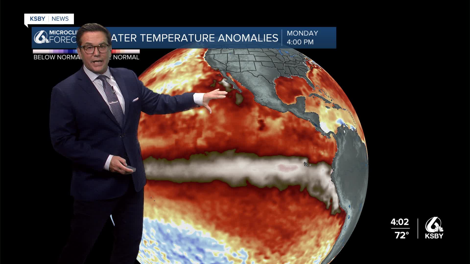


Good Monday evening from Meteorologist Jim Castillo
Here's your Central Coast weather forecast for San Luis Obispo and Santa Barbara Counties
A weak upper level trough moved over the Central Coast today, bringing cooler temperatures and expanding marine layer stratus with patches of drizzle and mist during early morning hours. The upper low positioned nearly overhead supported a deep marine layer with pockets of slow-clearing low to mid-level clouds. Temperatures remained generally in the 70s across both counties.
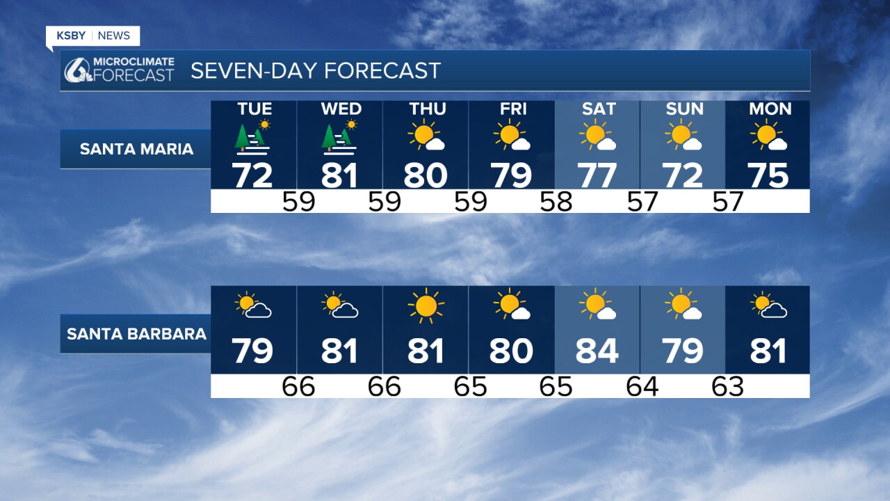
TUESDAY-WEDNESDAY WARMING TREND
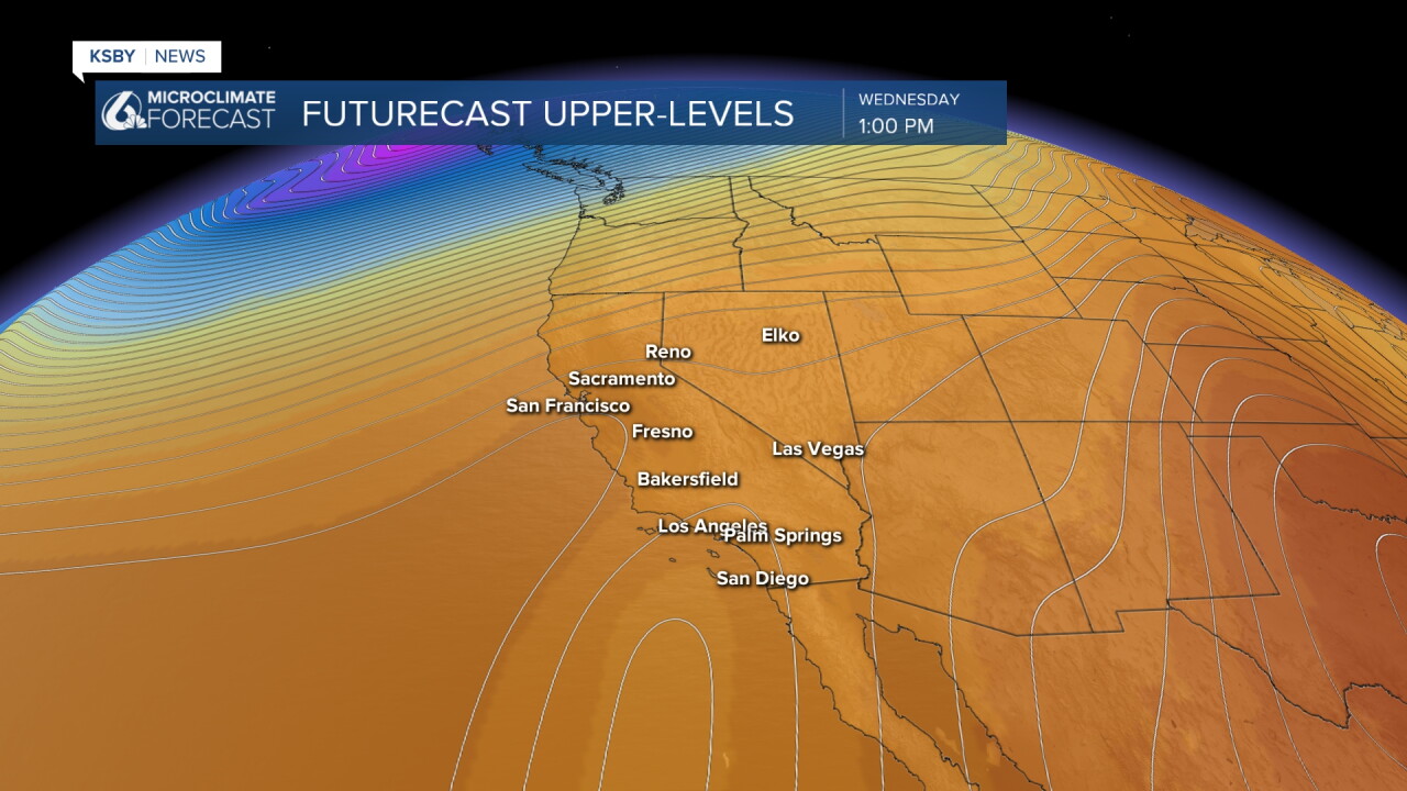
A small ridge will move into the area Tuesday and Wednesday, driving heights higher and creating favorable offshore flow patterns. Tuesday morning will feature weak onshore flow to the east and actual offshore flow from the north. This pattern will significantly reduce marine layer cloud coverage with much earlier and more complete clearing.
Temperature increases will be progressive:
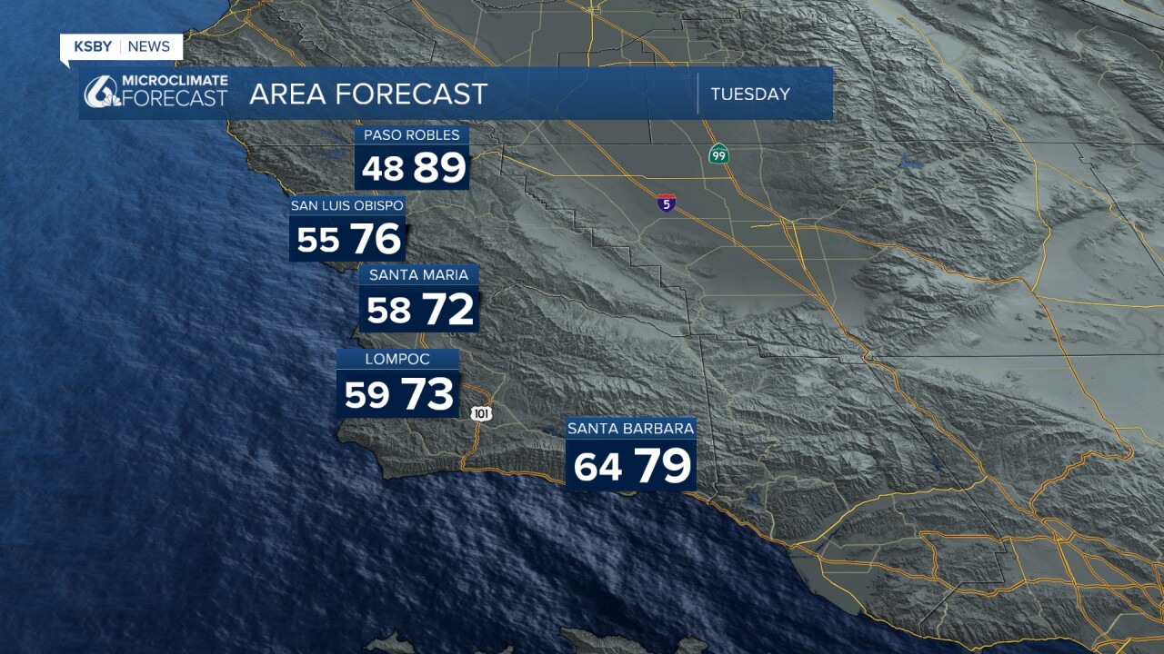
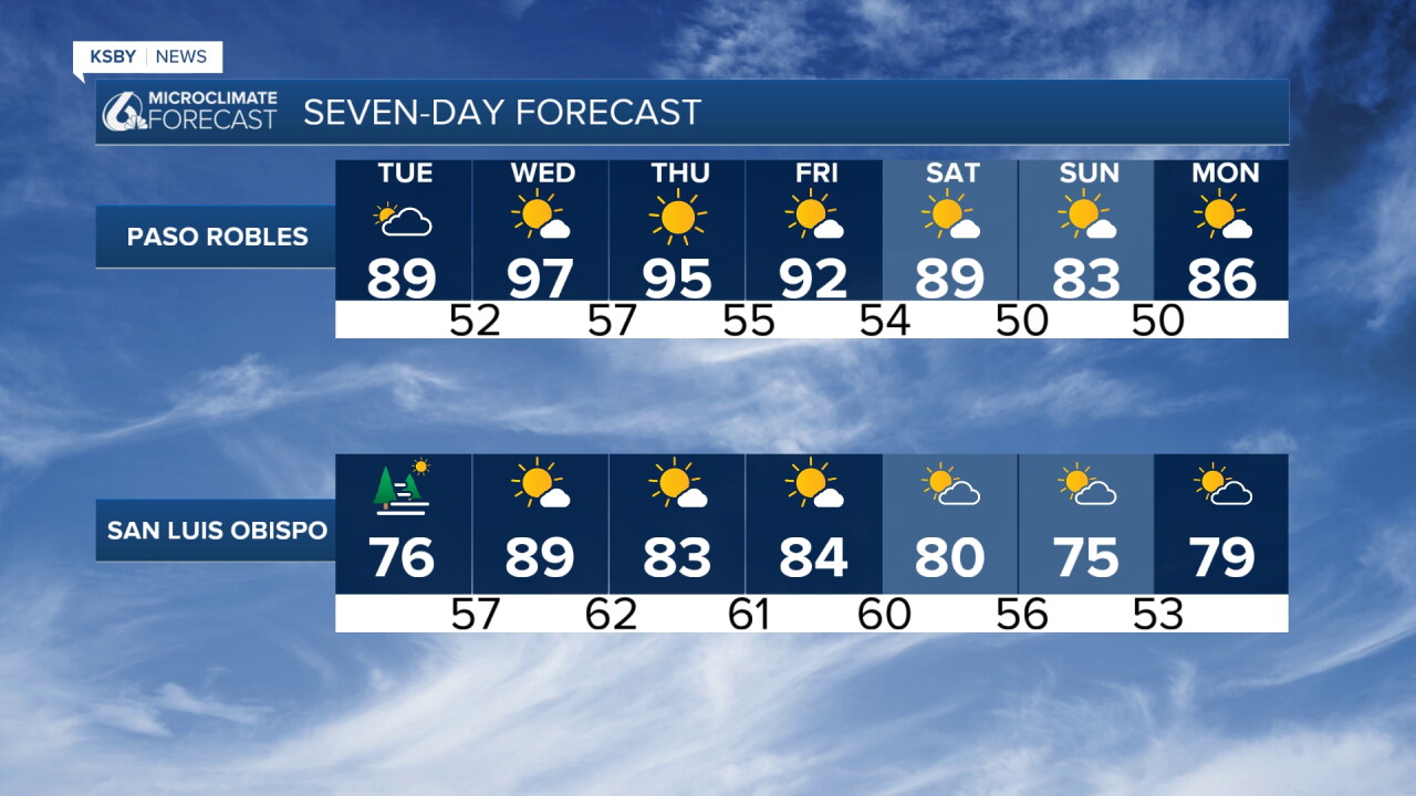
Tuesday: 2 to 4 degrees warmer, locally up to 6 degrees
Wednesday: Major jump in temperatures due to weakened onshore flow
WEDNESDAY PEAK TEMPERATURES
Coastal areas: Mostly in the 60s and 70s
Interior Valley locations: Mostly in the 90s
Breezy offshore winds of 20 to 30 mph are expected across interior mountains and foothills of the Santa Lucia Mountains, Santa Ynez Mountains, and Los Padres National Forest areas within San Luis Obispo and Santa Barbara Counties.
THURSDAY ONWARD
Thursday will see a modest cooldown as onshore flow returns, though above-normal temperatures may persist for one more day. Broad troughing will likely cover the state later this week into the weekend, bringing gradual cooling on most days while maintaining temperatures a few degrees above normal. The significant cooling arrives Sunday.
COASTAL CONCERNS
Distant tropical cyclones may generate another round of swells with large surf and dangerous rip currents for south and southwest-facing coasts by late weekend.
Have a great night, Central Coast!
-Jim
