

Happy Saturday, Central Coast!
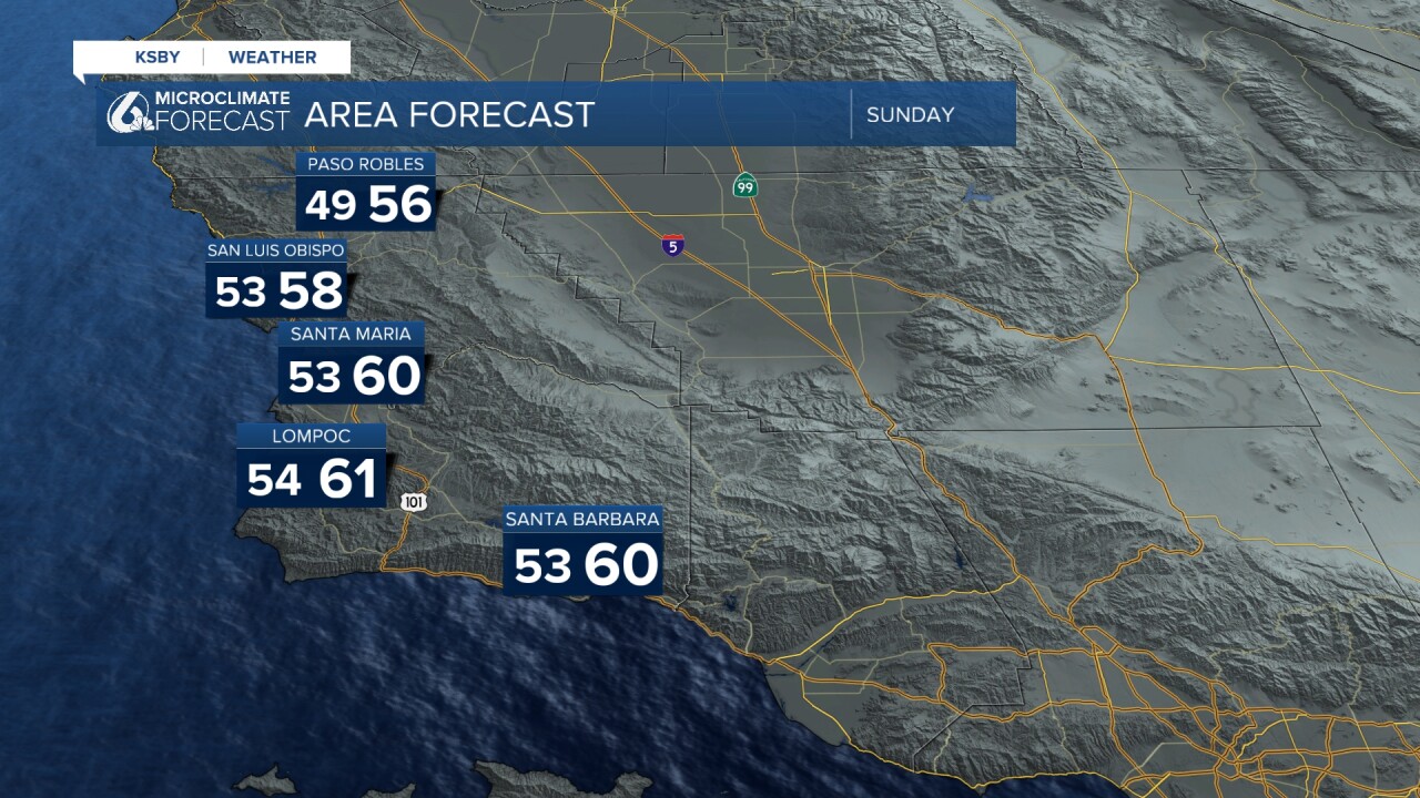
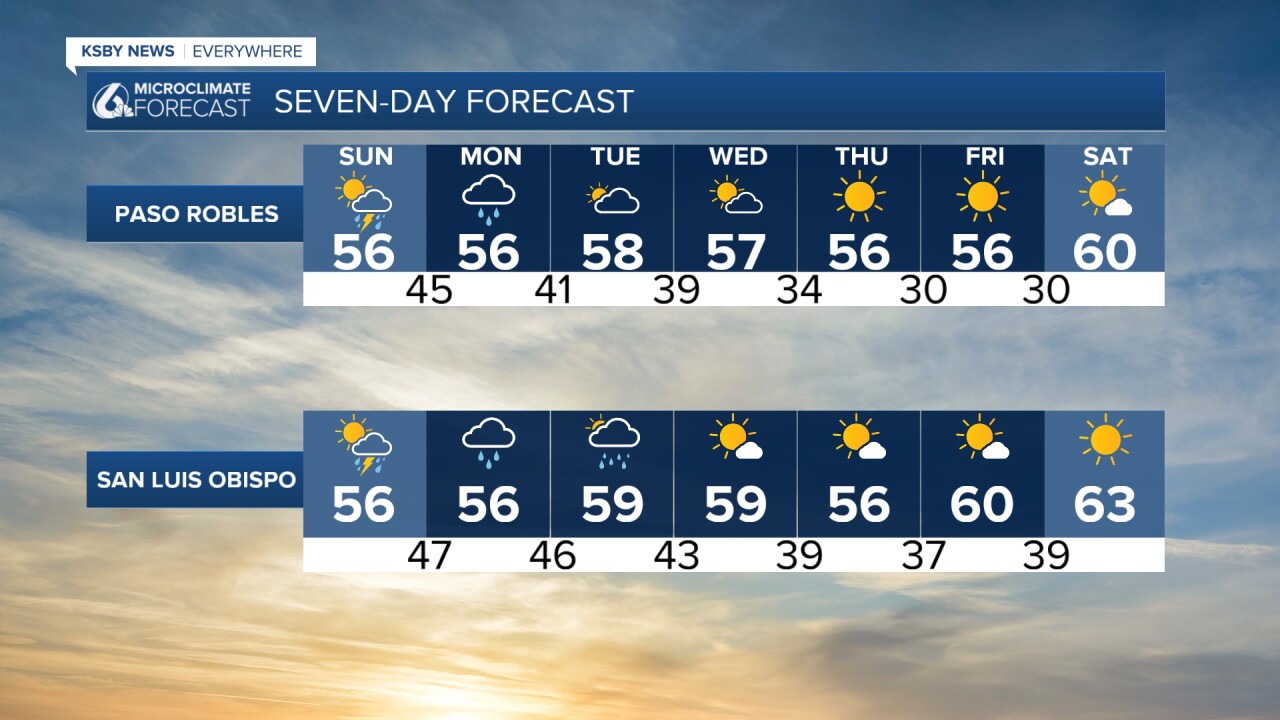
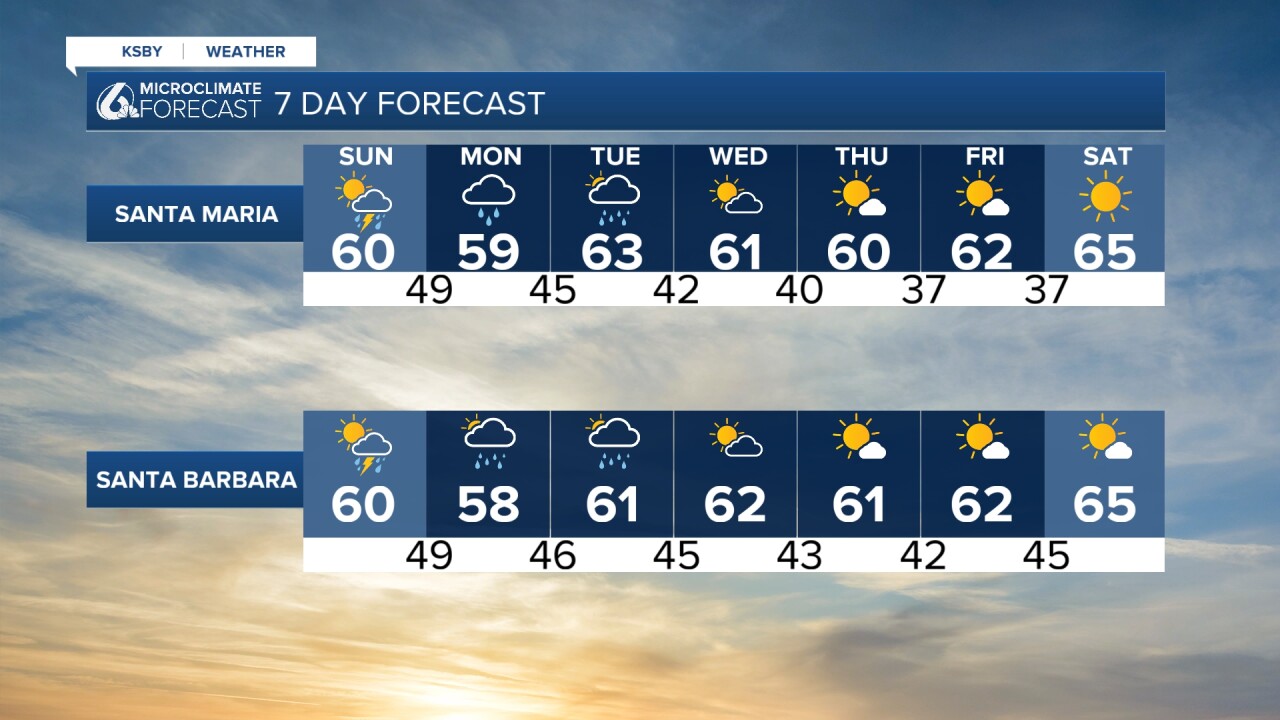
Here is a look at some of the temperatures you can expect this Sunday across the region.
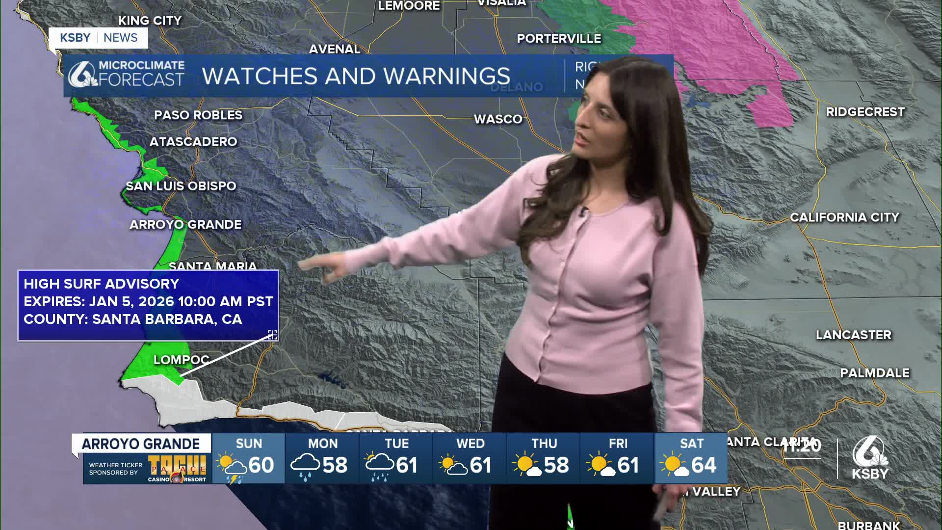
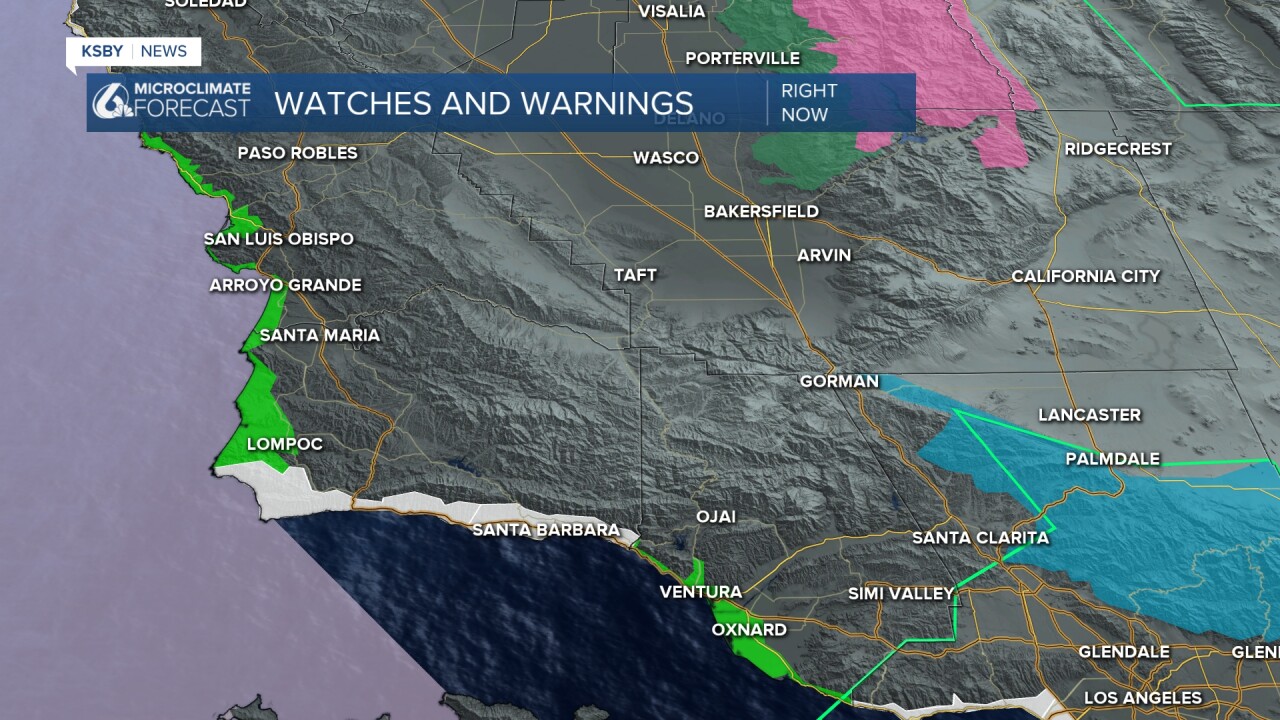
Alright, now let's talk about the Flash Flood Warning that was issued Saturday morning for the Southeastern part of Santa Barbara County. This warning ended a few hours later, around 2 PM. As a result, we reported on road closures, including those on Highway 101. As of 7:05 PM, the southbound #2 lane is open, but all northbound lanes remain closed, according to the California Highway Patrol. There are still advisories in place that are set to end on Monday. These include a Small Craft Advisory (purple), a Beach Hazards Statement (white), and a High Surf Advisory (bright green).
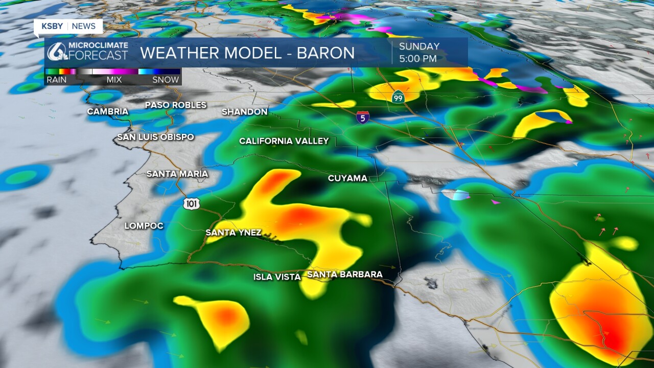
After the overnight rain we received, we've been experiencing light showers on Saturday evening. This will continue into those overnight hours, but change when the next band of rain starts to arrive Sunday afternoon. Expect heavier rain to start a little before noon. Here is a look at what rain conditions will look like on Sunday at 3:00 PM.
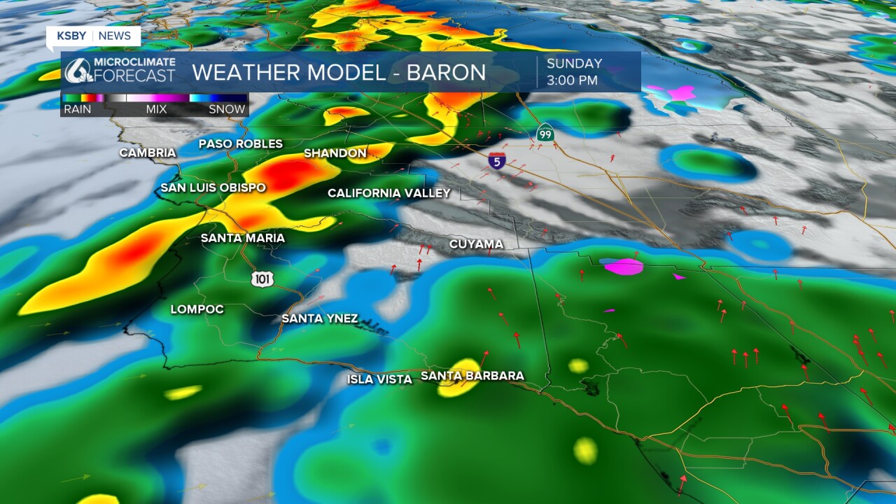
This band of rain will move across the region, and by 5, most of it will be inland and in the south coast. Scattered showers follow us into Monday.
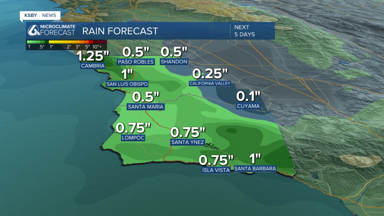
Here is a look at some of the rain totals we could expect to see over the next 5 days.
Despite the rain, the temperatures remain mild and consistent. There is a chance the rain we experience tomorrow could be accompanied by thunderstorms.
Enjoy the rest of your evening!
-Leslie Molina
