



Good Friday evening, Central Coast!
Below: The forecast in Santa Maria on Saturday during the Elks Rodeo. Low clouds and fog melt away just after 9 am with lots of sunshine in the late morning for the Parade.

And in San Luis Obispo, enjoy the Greek Festival. Here's the forecast for Saturday.

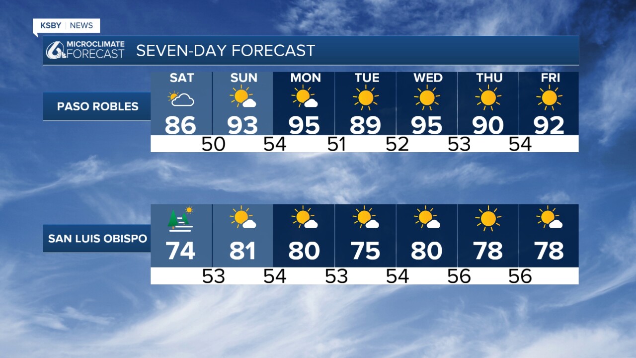
Here's the weather forecast for the Central Coast, San Luis Obispo, and Santa Barbara Counties:
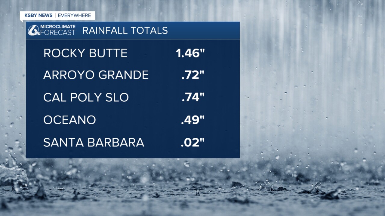
Below are a few of the rainfall totals from this past week. The rain is over, and warmer afternoons are on the way for the weekend.
THIS WEEKEND, a departing upper-level low-pressure system will usher in significantly warmer conditions across the Central Coast region. Saturday brings 4-8 degrees of warming, returning temperatures to near-normal levels after recent cooler weather. Morning marine layer development is expected along coastal areas and interior valleys, gradually clearing by late morning.
Gusty northwest winds will develop Saturday across the Central Coast and southwest Santa Barbara County, though wind speeds should remain below advisory thresholds. These winds will be most noticeable in wind-prone areas.
Sunday marks the beginning of the warmest stretch, with temperatures climbing 5-10 degrees above seasonal averages. Pressure gradients building to the east and north will drive this warming trend. Coastal areas will see highs in the upper 60s to lower 70s, while interior valleys will likely reach the lower 90s. The Los Padres National Forest areas and mountain communities should expect temperatures in the upper 70s to mid-80s.
EARLY NEXT WEEK, Monday continues the warm pattern with the hottest conditions expected in far interior portions of San Luis Obispo County in north county, where highs could reach the low to mid-90s. Offshore flow patterns will weaken slightly, leading to minimal temperature changes along the immediate coast but continued warming inland. Wind speeds will diminish compared to the weekend.
The marine layer will maintain its influence on coastal temperatures, providing natural air conditioning for beachfront communities while interior areas experience the full warming effect.
MID-WEEK TRANSITION Tuesday through Wednesday, we maintain dry conditions, but a weakening trough along the West Coast will gradually restore light to moderate onshore flow. This pattern shift will keep most areas within a few degrees of normal temperatures while maintaining the characteristic marine layer for coastal and valley locations.
- Warmest days: Sunday and Monday
- Peak inland temperatures: Low to mid-90s in interior valleys
- Coastal highs: Upper 60s to lower 70s throughout the period
- Dry conditions persist through next week
- Marine layer returns to moderate coastal temperatures
- Weekend pm winds gusty but sub-advisory levels

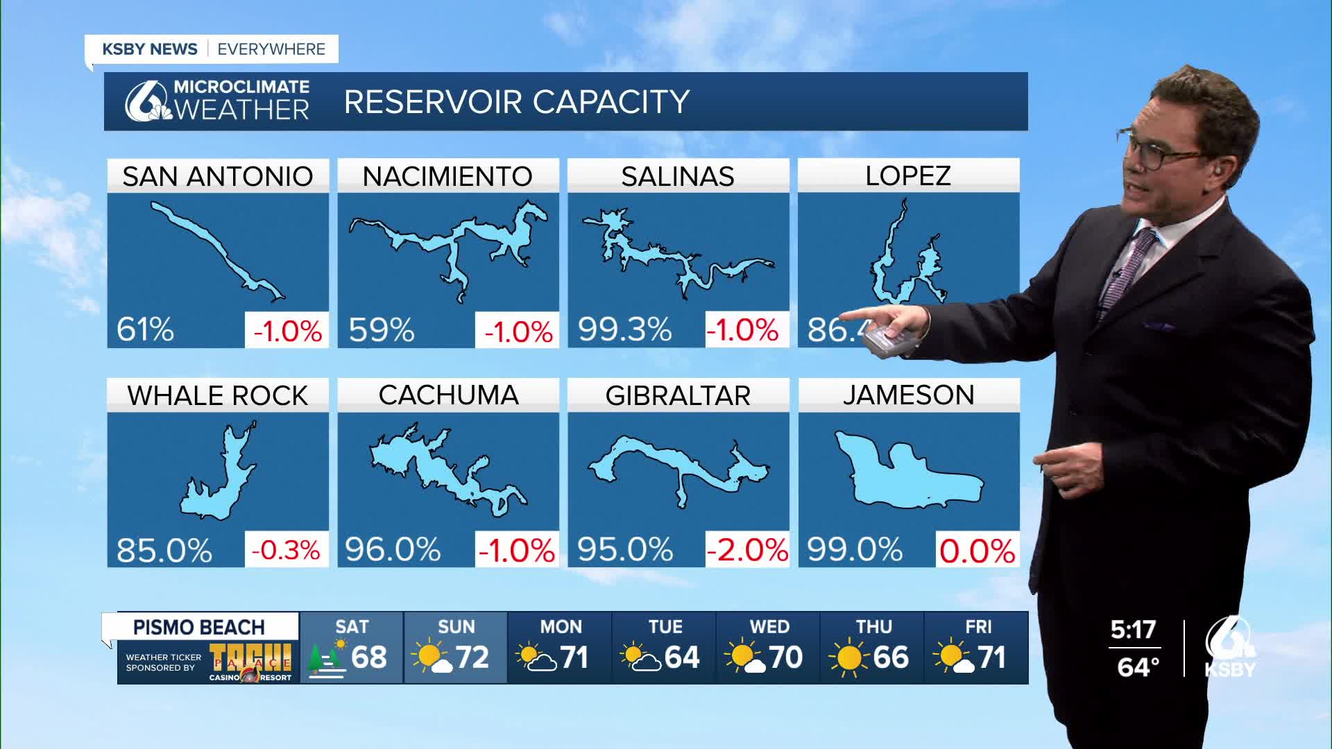
Below: Reservoir levels and the change from a week ago.


Have a great weekend, Central Coast!
-Jim
