

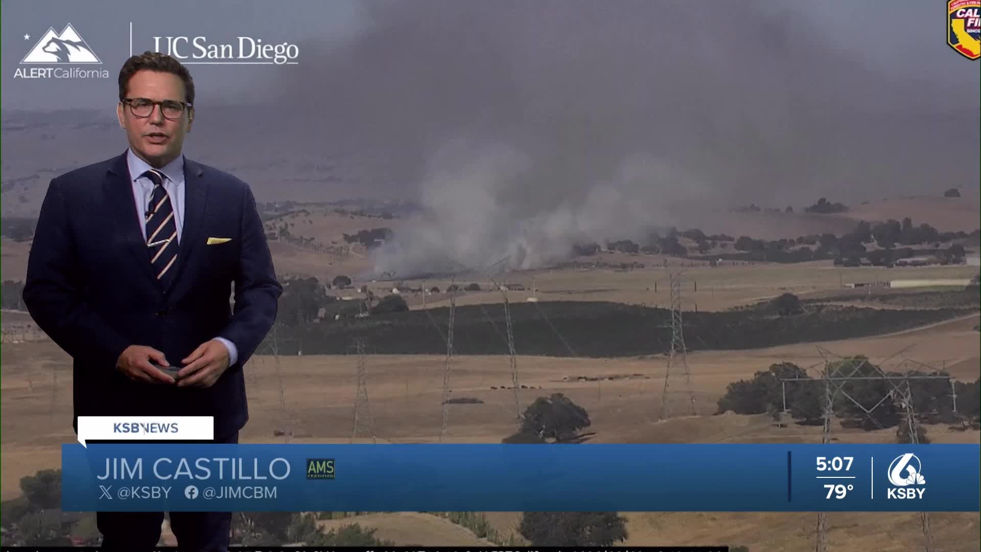


Good Monday evening, Central Coast!
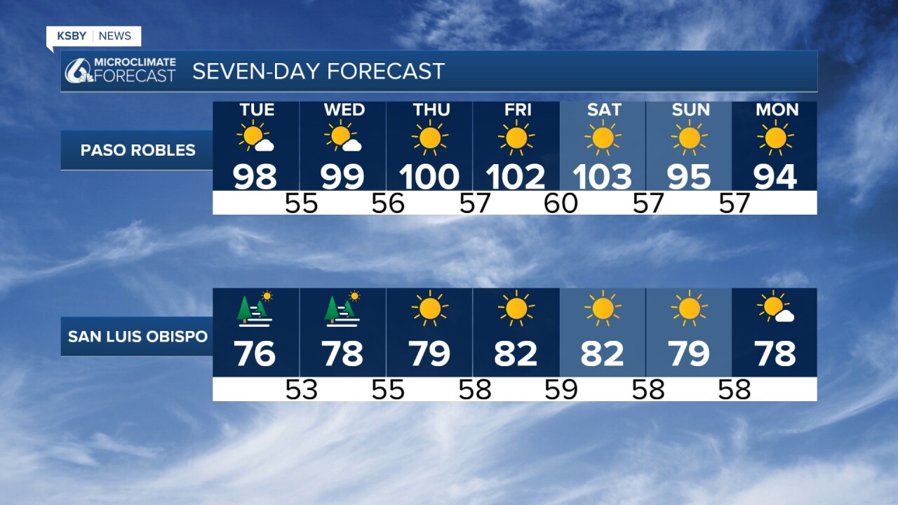
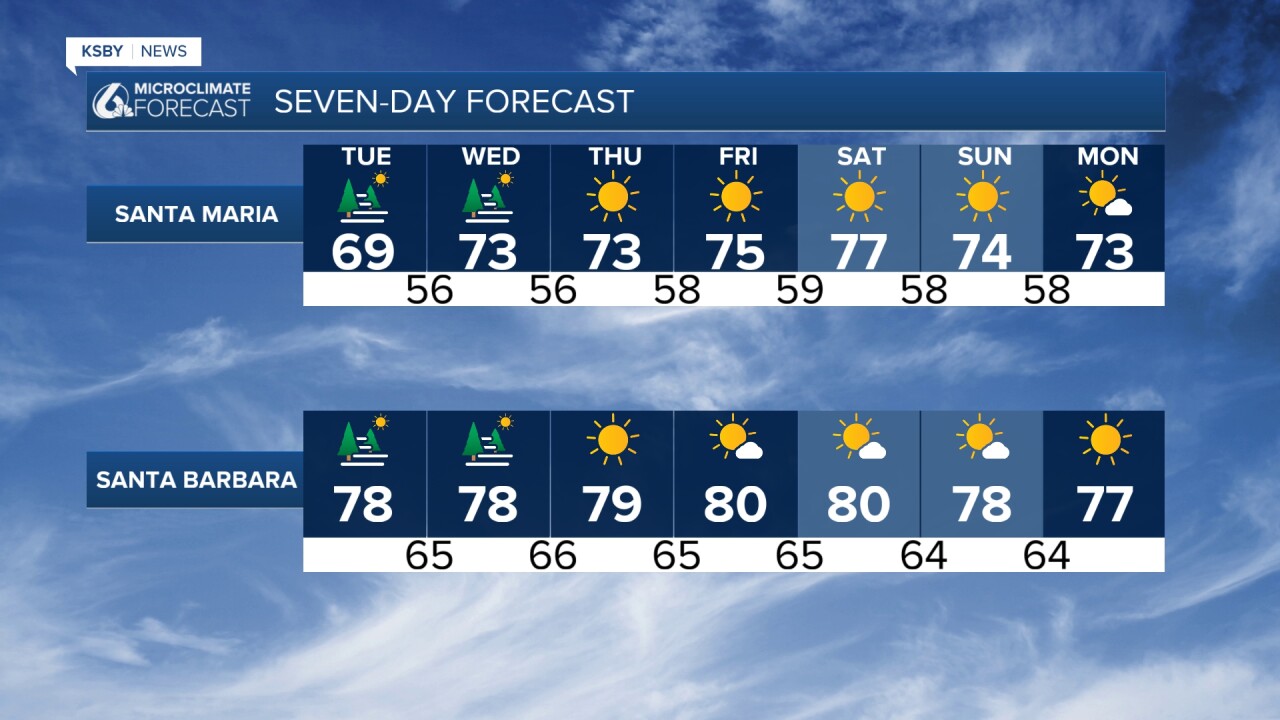
Here is your Central Coast weather forecast for San Luis Obispo and Santa Barbara Counties
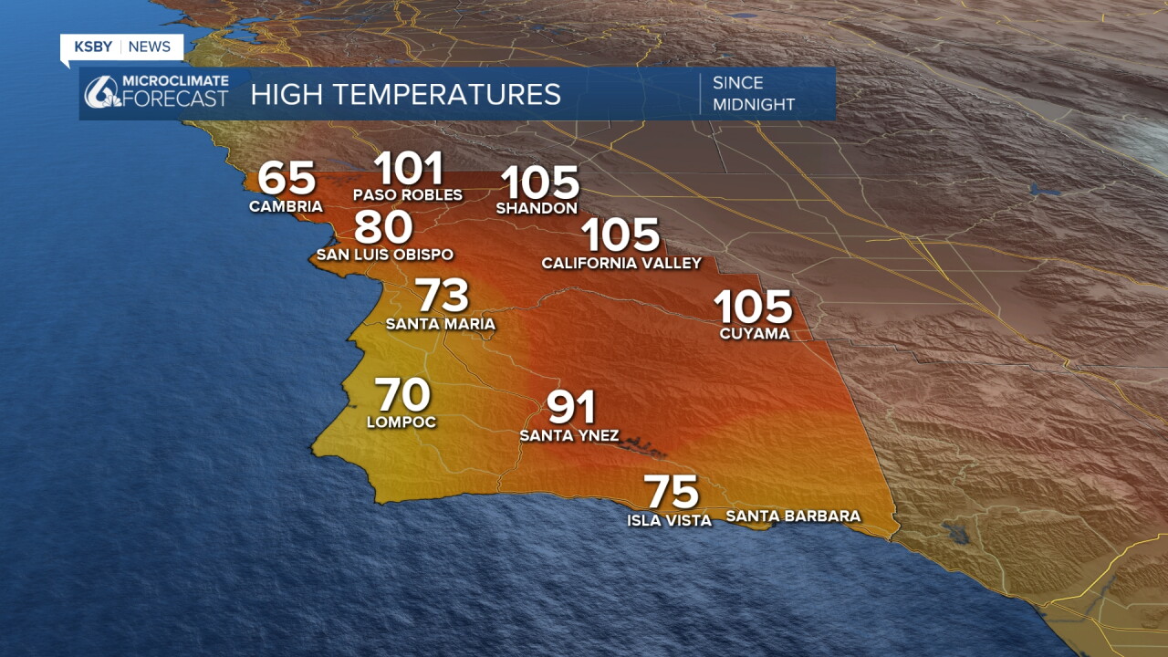
Below: Highs on Monday in both counties.
Paso Robles hit 101 on Monday and in July, Paso Robles was 100 or higher 14 days and the hottest days topped out at 106 degrees on July 15th and 31st.
Current Pattern: Most areas cooled down a bit from the weekend, with well inland areas remaining hot. A persistent high-pressure system anchored over Arizona and the Southwest continues dominating our weather pattern through the week. This setup maintains the familiar coastal marine layer versus interior heat contrast across both San Luis Obispo and Santa Barbara Counties.
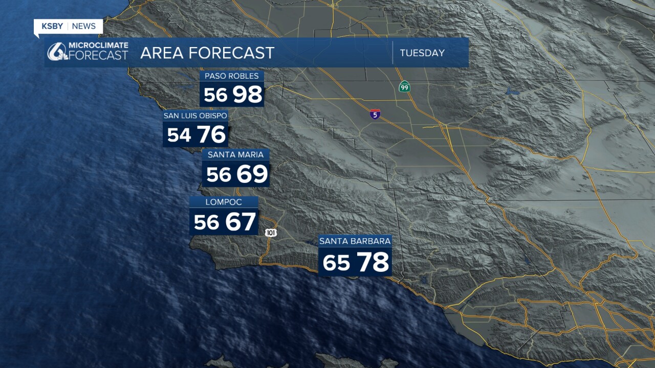
Coastal Areas: The marine layer depth remains shallow, creating low clouds and areas of dense fog along the immediate coastline and coastal valleys. Morning fog may linger into afternoon hours in some locations, particularly near Morro Bay, Pismo Beach, and the Gaviota Coast. Temperatures stay seasonably comfortable with typical summer marine influence.
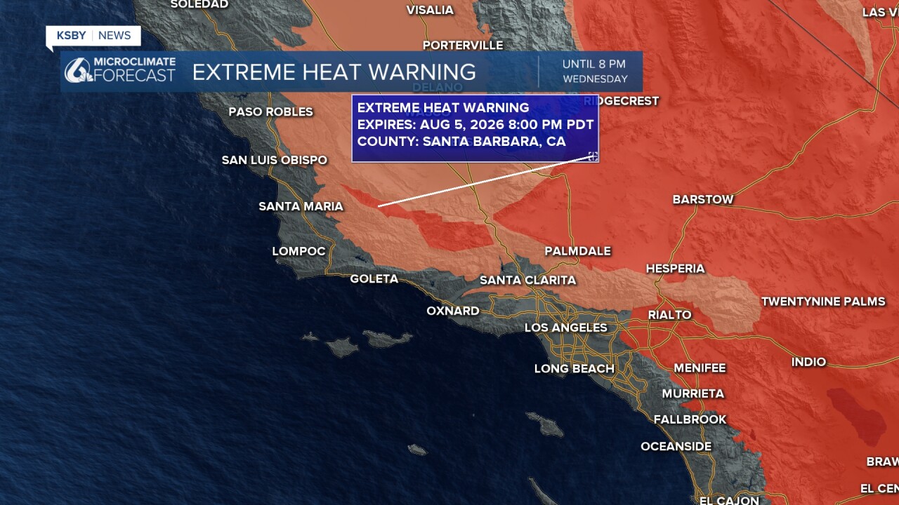
Interior Valleys and Mountains: Extreme heat continues baking interior sections including the Salinas Valley, Santa Ynez Valley, and Cuyama Valley. The Santa Lucia Mountains and Santa Ynez Mountains experience the most intense heating, particularly areas within Los Padres National Forest boundaries in both counties.
Extended Outlook: Late week brings additional warming potential as onshore flow weakens, affecting even some coastal-adjacent areas.
Pattern Change Coming: Ensemble models show promising signs of high pressure weakening over Southern California beyond this weekend. This suggests a significant cooling trend ahead, with temperatures potentially dropping to near or below normal levels for late summer.

Have a great night, Central Coast!
-Jim
