


It was a very warm Winter day along the Central Coast!
The record high was tied in Santa Maria on Wednesday at 84, and a new record was set in Santa Barbara at 82.
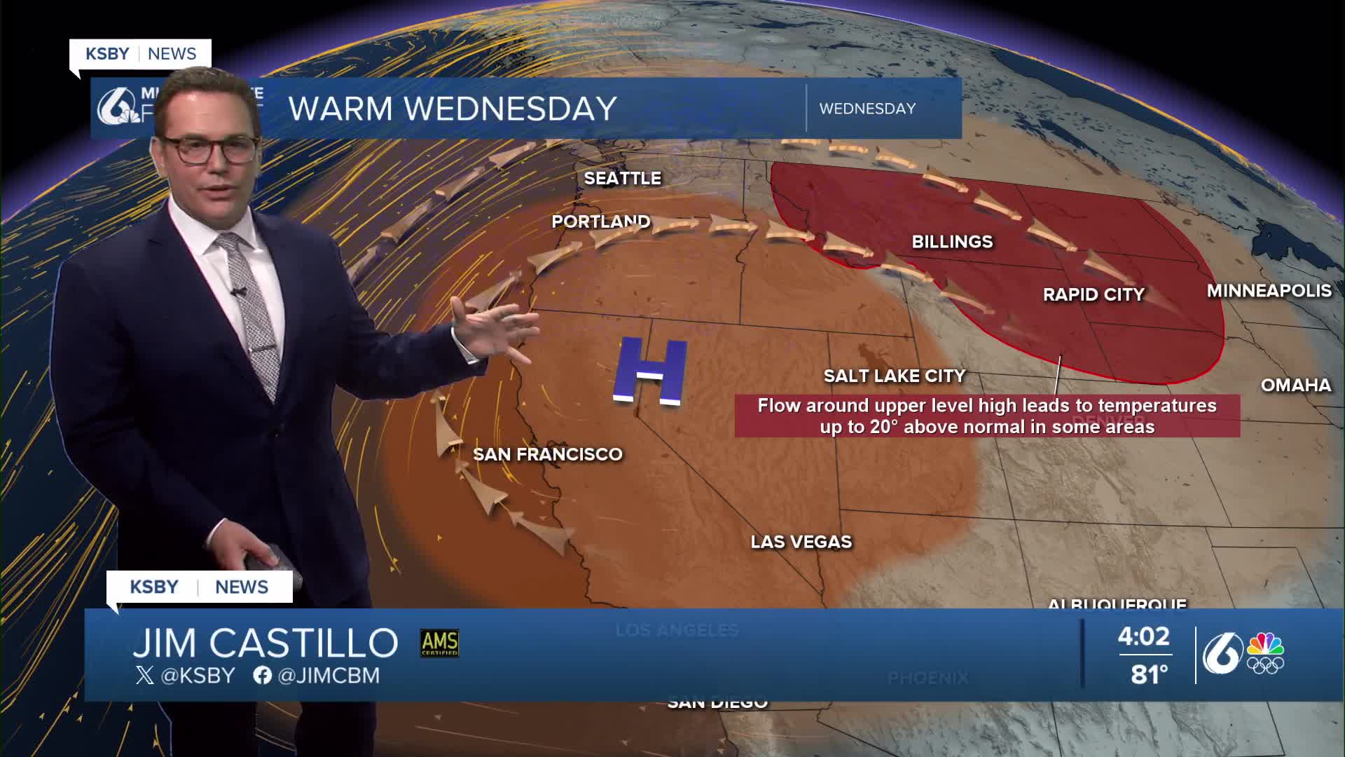
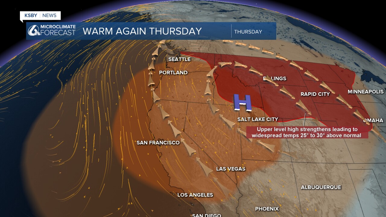
With a very strong high-pressure system dominating the Central Coast weather,
Wednesday has been the warmest day of the week, with many of us hitting the 80s.
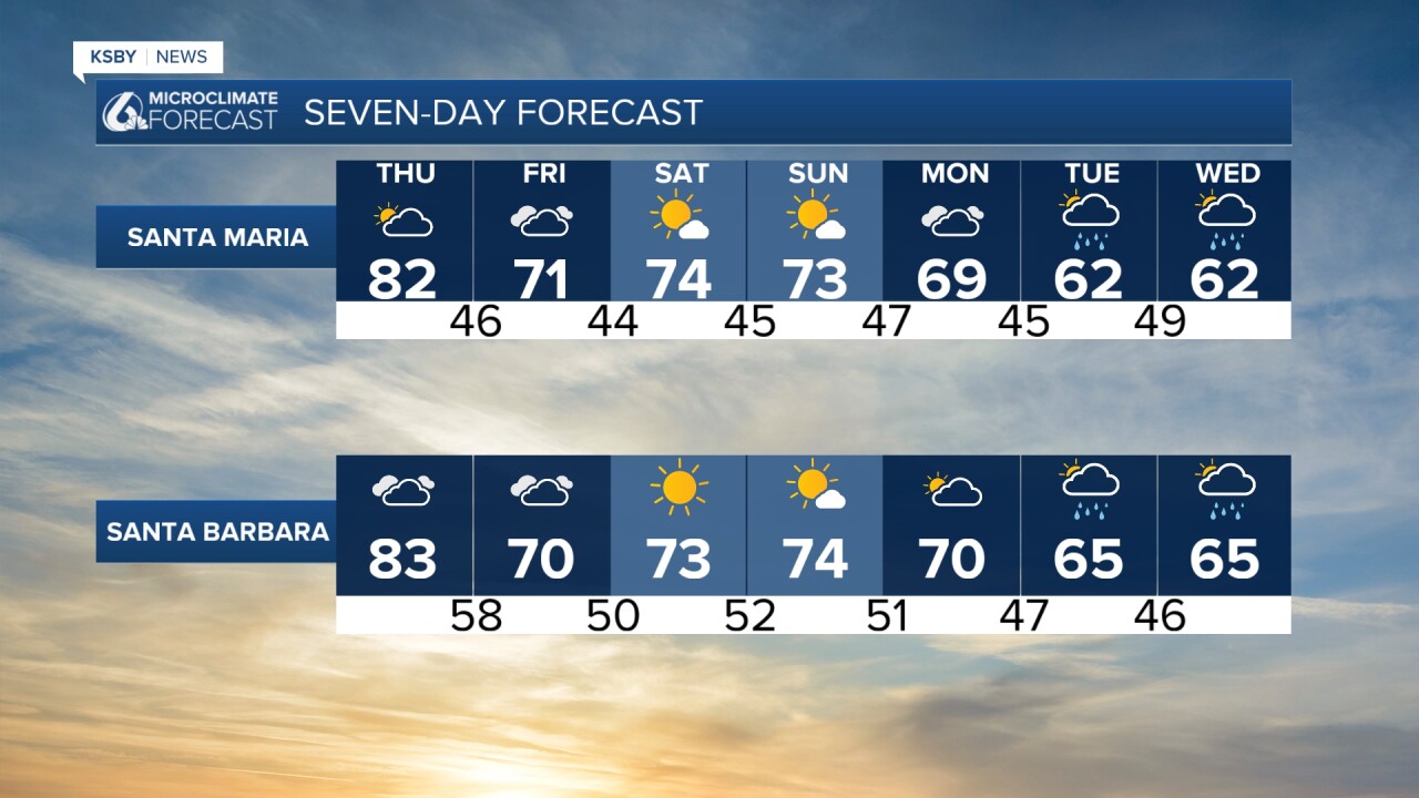
High pressure breaks down enough on Friday to see more clouds roll in and high temperatures falling
into the 60s and low 70s. The high temperatures will still be above our average high of 65 degrees in San Luis Obispo.
The upper-level pattern will finally begin to change next week, replacing the strong upper high along the Central Coast for the last month with a trough of low pressure. Weather computer models show a couple of systems coming through next week, the first one around Tuesday with a rain chance, and another possible next weekend. Neither of these looks particularly strong.
Below are the high temperatures we had Wednesday.

Below is a new High Surf Advisory that starts at midnight Thursday night and continues until 6 am on Saturday. Large breaking waves of 10 to 14 feet are forecast with dangerous rip currents.


Have a great night, Central Coast!
-Jim
