


Happy Sunday, Central Coast!
We'll stay warm and dry into the work week. Here is a look at some of the temperatures you can expect on Monday.
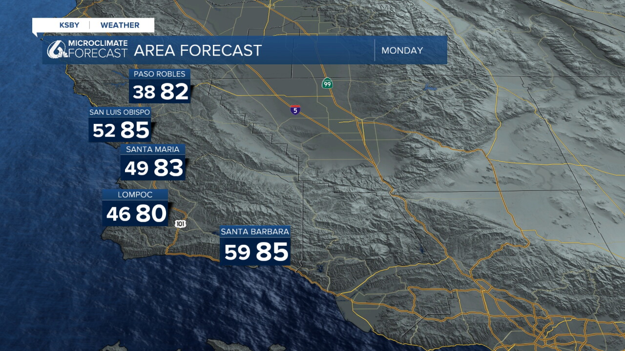
These conditions will stick around through midweek, while the Beach Hazard Statement and High Surf Advisory are expected to come to an end by Tuesday.
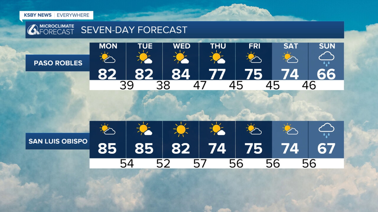
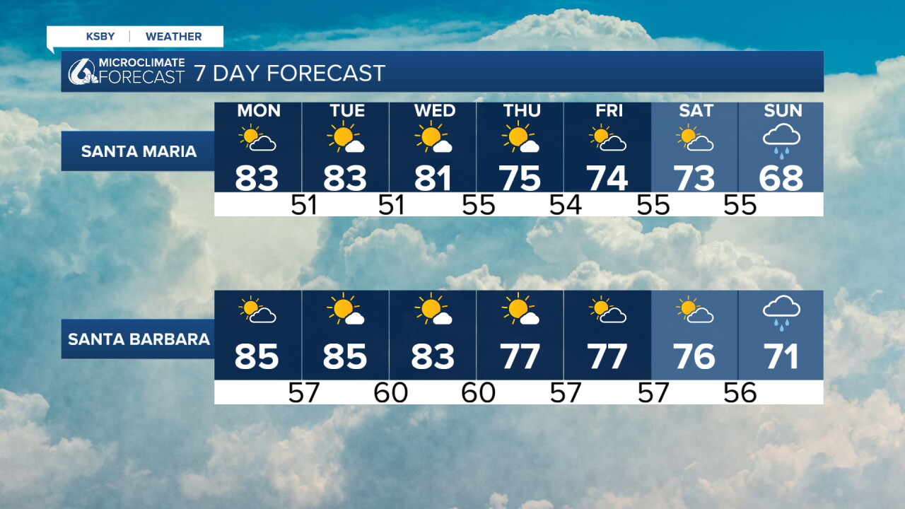
By Thursday, temperatures will begin to dip slightly, with cooler conditions continuing into next weekend. Rain chances also begin to emerge by next Sunday.
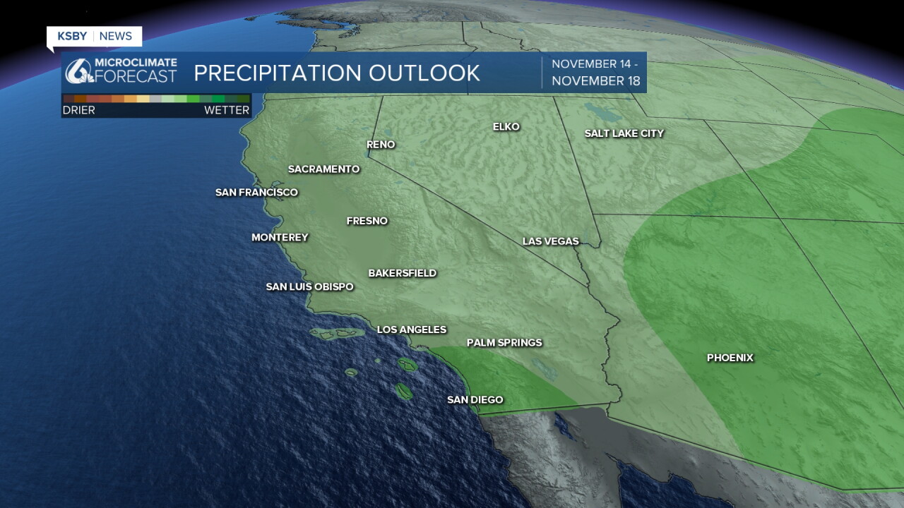
Here is a look at our extended outlook. Rain chances are still several days out, so details remain uncertain. We'll continue to keep you updated as we get a clearer picture of the potential timing and rainfall amounts.
Goodnight!
— Leslie Molina
