

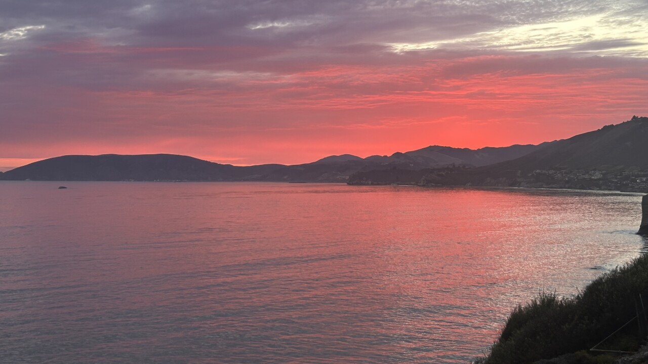


Happy Friday, Central Coast!
Current Heat Advisory Status: Most of the Central Coast remains under a Heat Advisory through Monday night. The corridor from San Luis Obispo to Santa Maria, including Nipomo and extending to Lompoc, is currently not included in the advisory as temperatures have run slightly cooler than forecast in recent days.
The Weather Pattern: A persistent ridge of high pressure centered over the Four Corners region continues to dominate our weather pattern, placing the Central Coast on the western edge of this high-pressure system. This positioning maintains our hotter-than-normal conditions, with the hottest temperatures expected through Sunday.
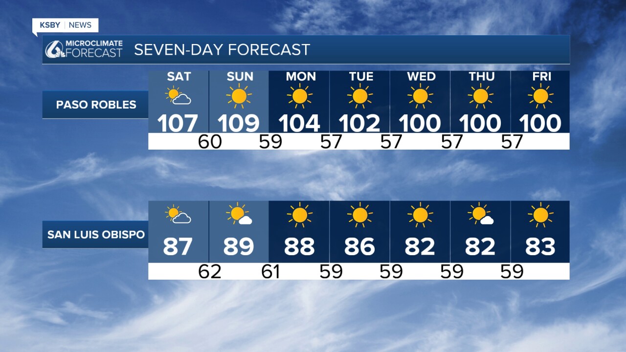
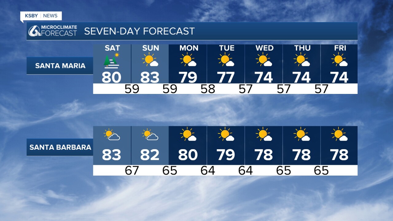
Temperature Outlook: Warmer-than-normal temperatures will persist through next week, extending this lengthy warm spell. The core of the high-pressure system will shift slightly eastward Monday through Wednesday, providing modest relief of just a few degrees. Coastal areas will experience the most noticeable temperature drop as onshore pressure gradients strengthen.
Marine Layer Behavior: Marine layer cloud coverage will return each night and morning across the Central Coast, with increasing chances along the Los Angeles coastline over the weekend. However, confidence remains very low for marine layer development along the southern Santa Barbara Coast tonight. With strengthening northwest winds expected over the Santa Ynez Mountains Saturday and Sunday, little to no marine layer cloud coverage is anticipated for southern Santa Barbara County.
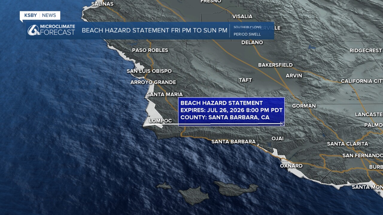
The Central Coast has a Beach Hazard Statement for a high rip current risk all weekend.
The extent of marine layer cloud coverage will be critical for high temperature forecasts, particularly for coastal and inland areas. Recent cooler-than-expected temperatures along the Central Coast have resulted from fairly expansive morning marine layer cloud coverage that has delayed the daily warm-up.
Wind Conditions: Gusty north winds will continue affecting some areas through Friday, with increasing northwest winds expected over the Santa Ynez Mountains during the weekend.
Terrain Impacts: The Santa Lucia Mountains and portions of Los Padres National Forest within San Luis Obispo and Santa Barbara Counties will experience varying temperature effects based on elevation and exposure to onshore flow patterns.
Extended Outlook: Relief from the heat will be short-lived. Ensemble forecast models, particularly European model solutions, indicate high pressure will rebuild westward after Wednesday. Some projections show the upper-level high moving directly over California, potentially bringing slightly warmer temperatures by late next week compared to current conditions.
While onshore flow is expected to remain fairly persistent, some ensemble members suggest weakening onshore flow late next week into the following weekend. If this scenario develops, coastal areas may experience the largest temperature increases next weekend compared to this weekend.
Health Precautions: In those hot spots, residents should take appropriate precautions during outdoor activities and ensure adequate hydration.
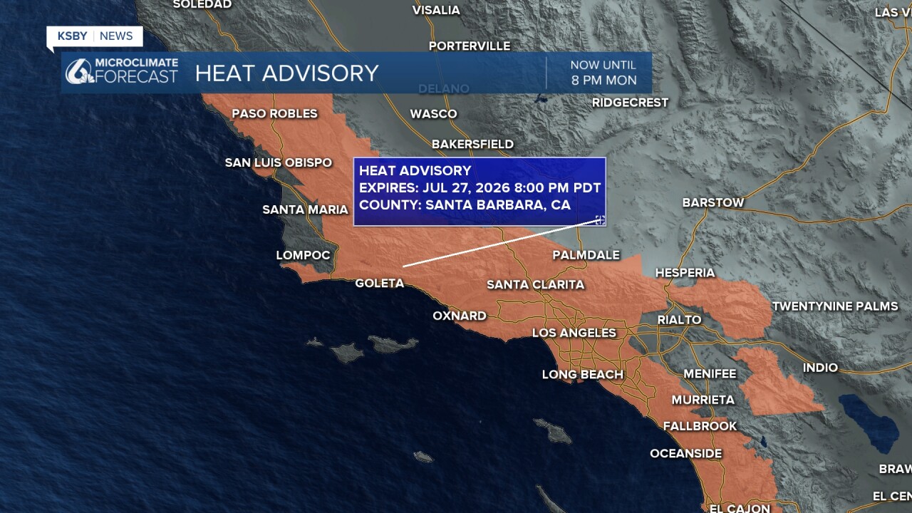
Below: San Luis Obispo, Santa Maria, Arroyo Grande, Pismo Beach, Avila Beach, Lompoc, Surf Beach are not included in the Heat Advisory. San Luis Obispo may be included sometime this weekend.

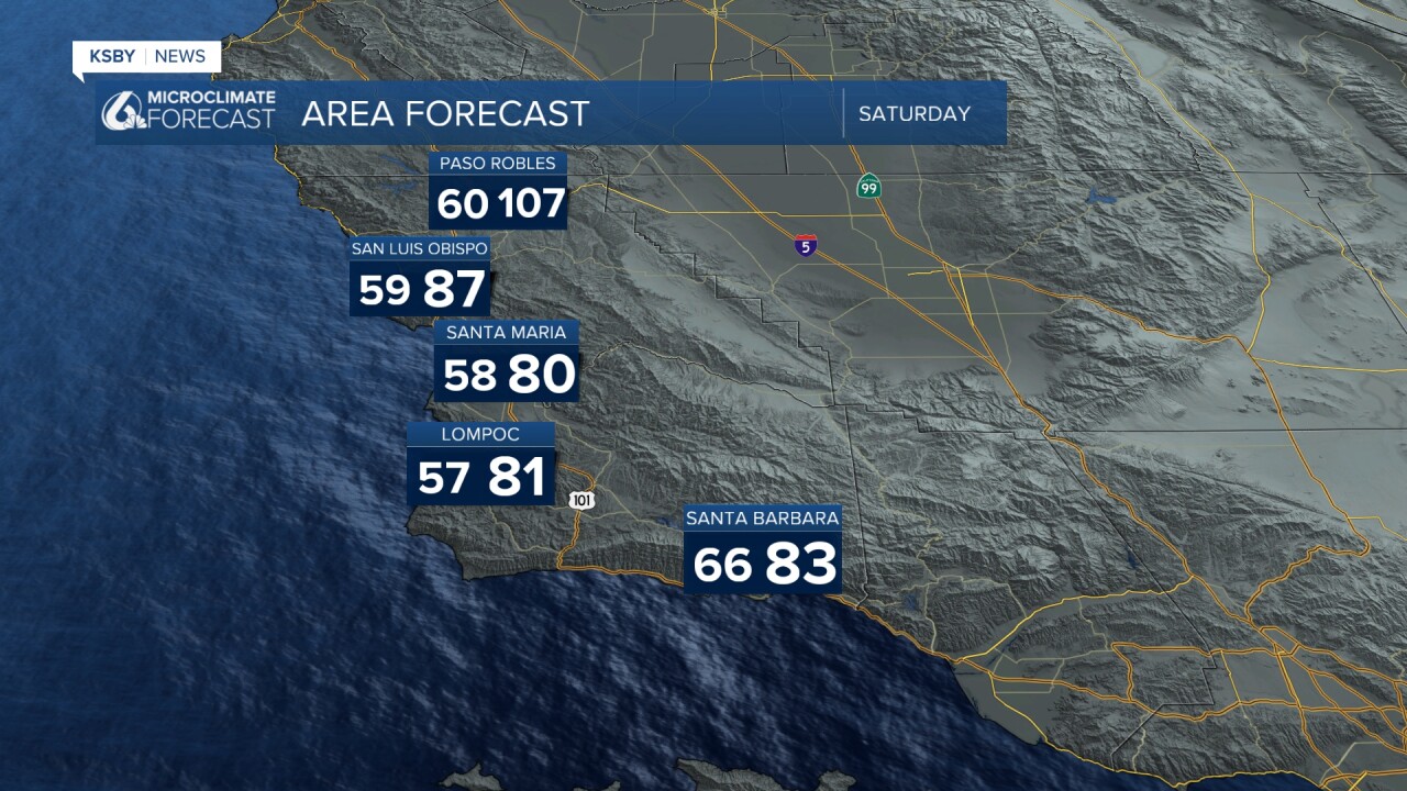
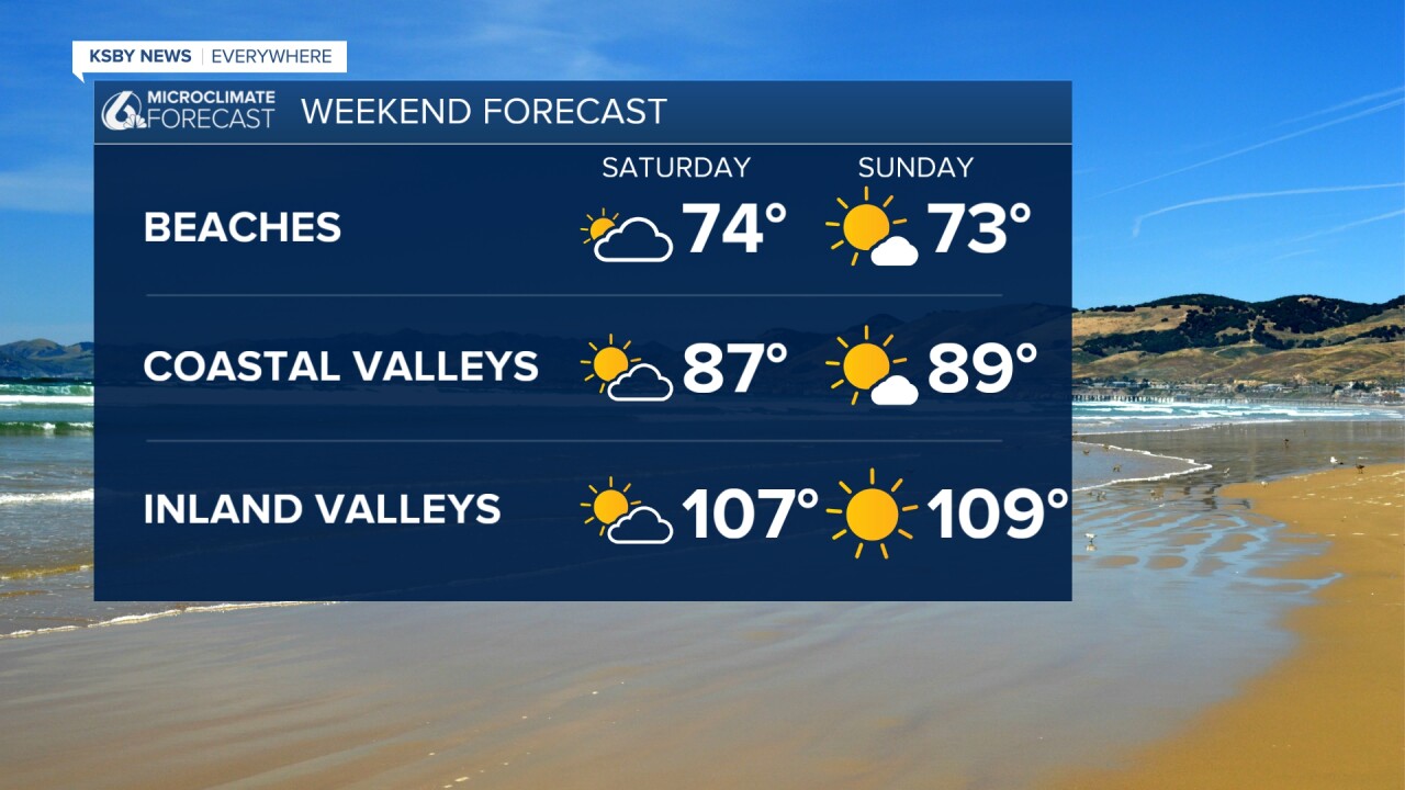
Below: Sea surface temperatures around 71 degrees off of Santa Barbara—60 to 63 degrees along the Central Coast.

Below: The Central Coast has a Beach Hazard Statement for a high rip current risk all weekend.
Below: Our reservoir capacity levels and the change over the last week.

Have a great weekend, Central Coast!
-Jim
