

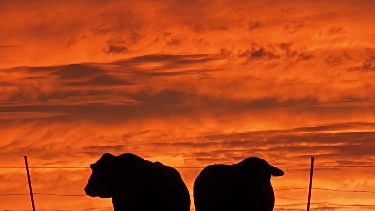


Here is your Central Coast forecast from Meteorologist Jim Castillo for Santa Barbara & San Luis Obispo Counties
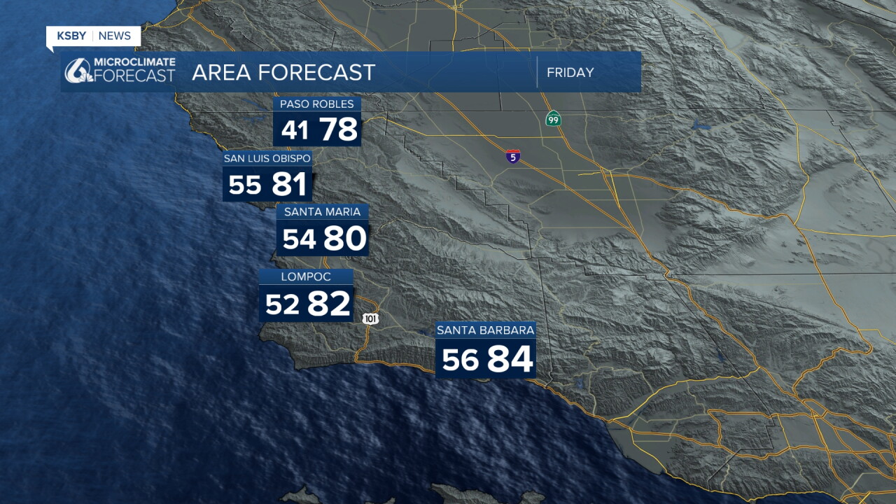
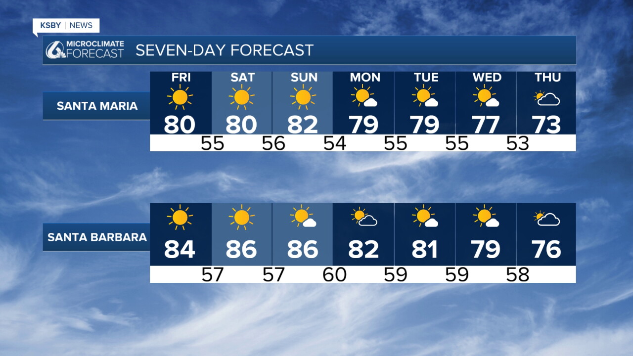
A building upper-level ridge continues to bring north and northeast offshore winds tonight into Friday, with strengthening offshore gradients, lots of afternoon sunshine, and mostly clear nights. Temperatures reach the upper 70s to low 80s Friday across coastal, valley, and foothill areas. Offshore canyon winds increase across the Santa Lucia Mountains, Santa Ynez Mountains, and Los Padres National Forest, peaking Friday morning just below advisory levels.
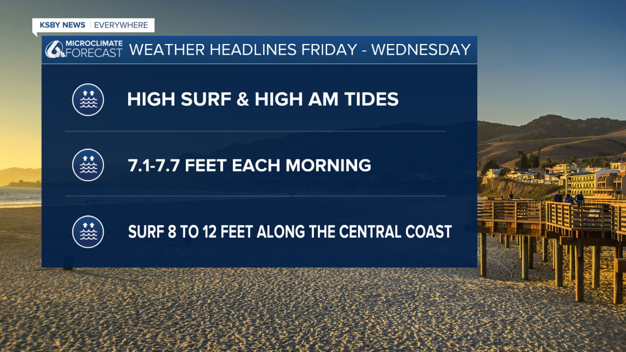
High surf and High Tides: Friday through Wednesday (Nov 6th - 11th)
Moderate risk for coastal flooding. Hazardous swimming conditions - rip currents.
High tides: 7.1' to 7.7' each morning.
Peak surf: 8 to 12 feet along the Central Coast
Weekend Outlook (Saturday & Sunday)
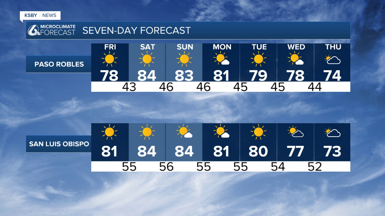
Peak heat hits this weekend under strong high pressure and persistent morning offshore breezes. Expect localized gusty winds along exposed mountain ridges. High temperatures peak in the low 80s for coasts and valleys—well above seasonal averages.
Next Week & Extended Monday & Tuesday: Weakening offshore flow lets afternoon sea breezes return, starting a mild cooling trend.
Extended: High pressure keeps conditions dry through at least next Wednesday, November 11th, Veterans Day, with long-range models signaling an active rain pattern starting up mid-November.
Enjoy the night, Central Coast!
-Jim
