


Good evening, Central Coast!
CENTRAL COAST WEATHER — Santa Barbara & San Luis Obispo Counties
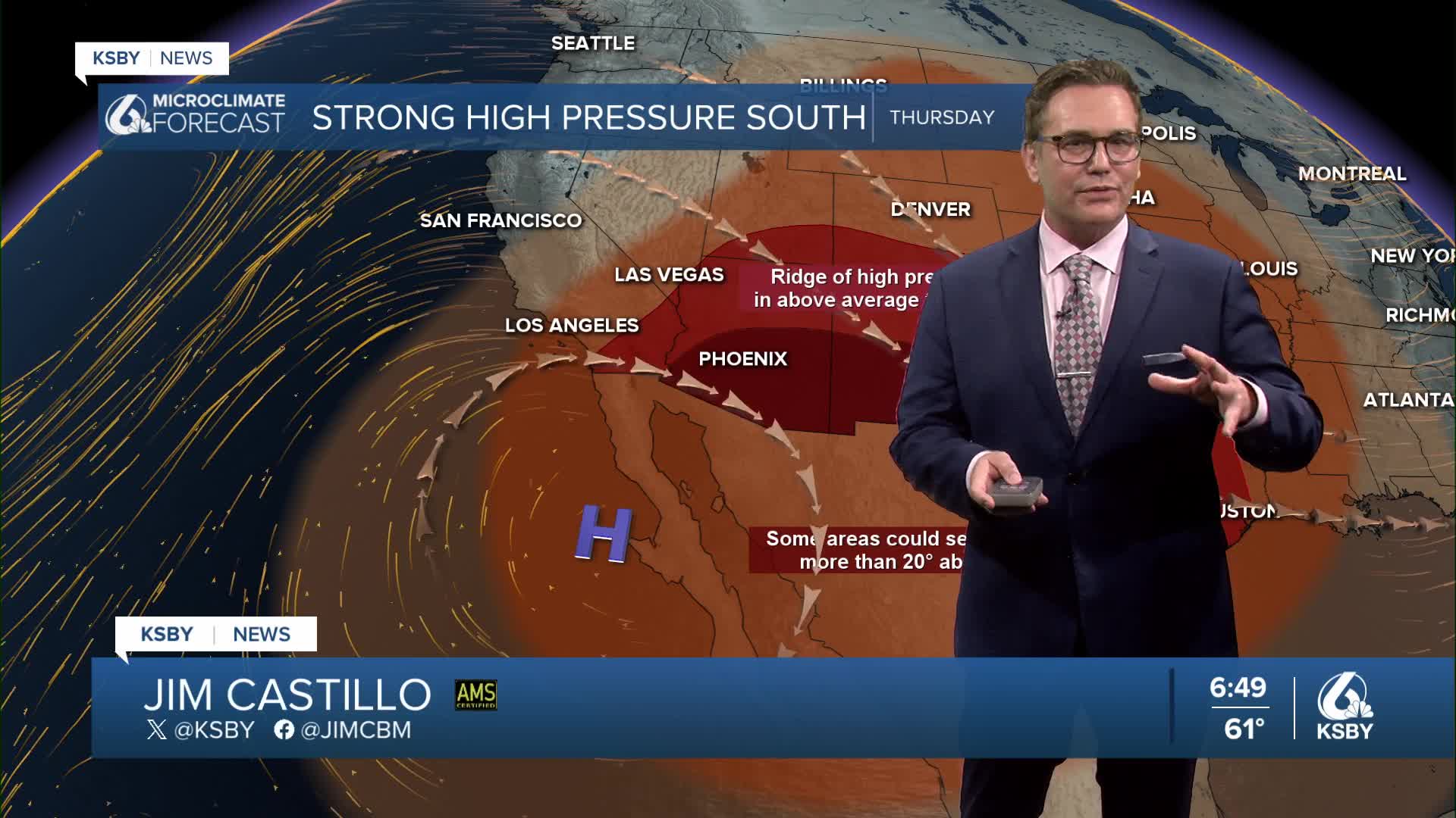
Get ready for our warmest days of the week! High pressure is building over the region, bringing mostly sunny skies after some morning fog and temperatures well above normal through the week.
Tonight: Mostly clear, but watch for low clouds and fog developing along the coast and in the interior valleys — especially late tonight into Thursday morning.
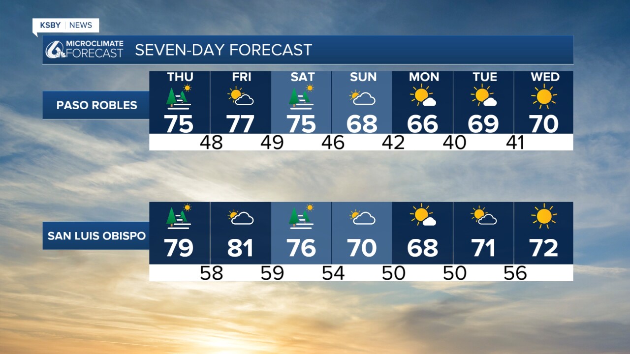
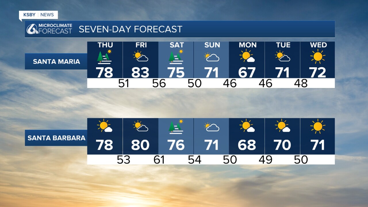
Thursday: Areas of morning fog and low clouds, then mostly sunny and warm! Highs will run 10–15 degrees above normal, with inland areas reaching the mid-to-upper 70s and low 80s. Breezy onshore winds in the afternoon.

Friday: The warmest day of the stretch. Expect daytime highs in the 80s inland — up to 15–20 degrees above normal. Some patchy low clouds are possible early in the interior valleys, clearing quickly.
Below is a snapshot of early Saturday, when a cold front pushes through the Central Coast. This cold front comes through dry, but we will cool a few degrees Saturday and even moreso on Sunday.
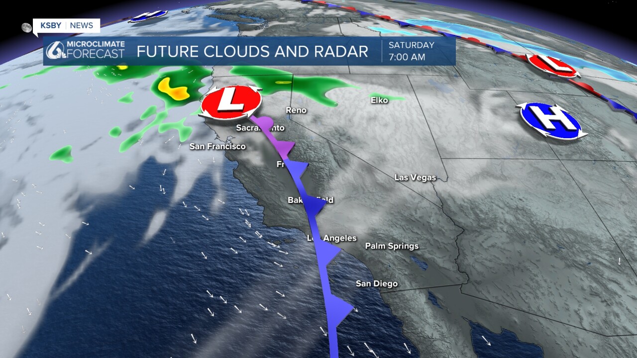
Saturday: Still warm, but a gradual cool-down begins. Expect low clouds to return to the coast, but afternoon temps remain well above normal.
Sunday–Monday: A cooling trend arrives with increasing clouds. Sunday does look mostly cloudy, but dry. Temperatures return closer to normal, but still a few degrees above average.
Tuesday–Wednesday: Dry and pleasant, with a slight warmup to around 70.
Bottom line: It's going to be very warm for a few days, Central Coast — stay hydrated and limit outdoor activity during peak afternoon hours on Friday! ☀️🌡️
Have a great night, Central Coast!
-Jim
