


Good evening, Central Coast!
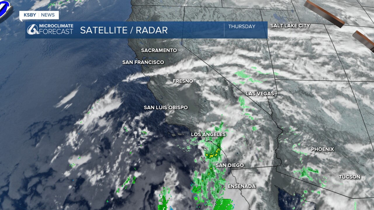
Just as the KSBY weather team predicted, some of us have experienced a few showers, and the rain has been limited to light amounts and mainly Thursday night into early Friday morning.
Below, the green shaded areas represent rainfall totals mainly from trace to a few hundredths of an inch.
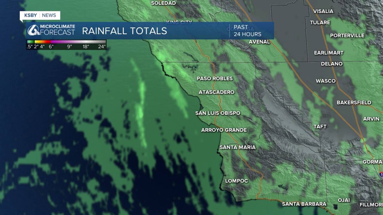
As you see below, not much rain fell across our area.

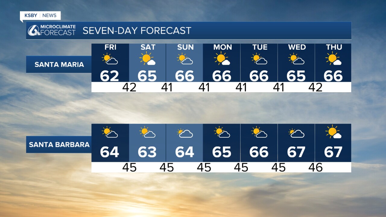
Below- or near-normal mid-60s high temperatures are expected to continue through the weekend. At upper levels, low pressure continues cutoff from the main flow of the jet stream. The center of this low is currently southwest of the Channel Islands and will move into Baja Mexico on Saturday. A weak ridge of high pressure will keep us dry this weekend with near-normal temperatures.
Clouds clear tonight, then areas of low clouds and fog will be patchy and mainly along the coast. Low temperatures will be mainly in the 40s and highs in the low 60s on Friday. Expect partly to mostly sunny conditions on Friday afternoon.

No significant winds are expected this weekend. Low clouds and fog to start in some areas and then plenty of sunshine for most areas both Saturday and Sunday. Highs will be in the low to mid 60s.

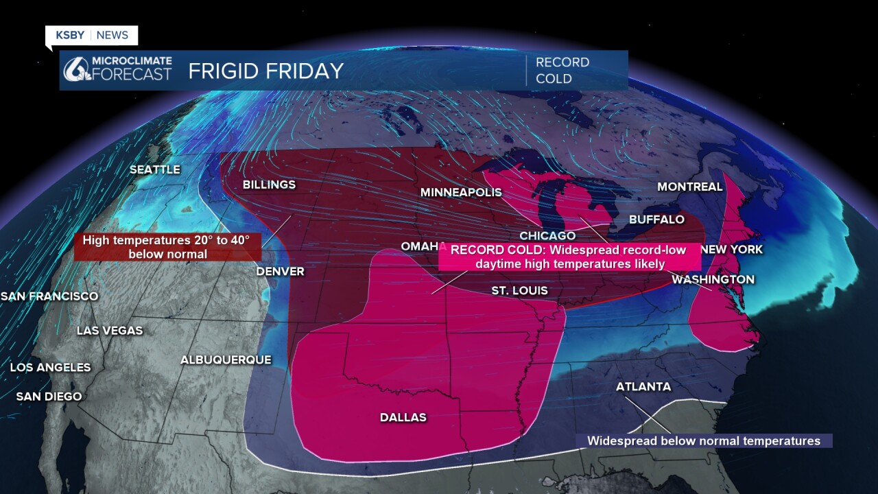
As for the rest of the U.S. weather, an Arctic front brings frigid temperatures to the eastern two-thirds of the U.S. Below-zero temperatures will spread from the Plains into the Northeast. Bitter cold reaches the western Gulf Coast on Saturday and spreads eastward through Tuesday.
Record low daytime high temperatures are expected to be widespread on Friday.
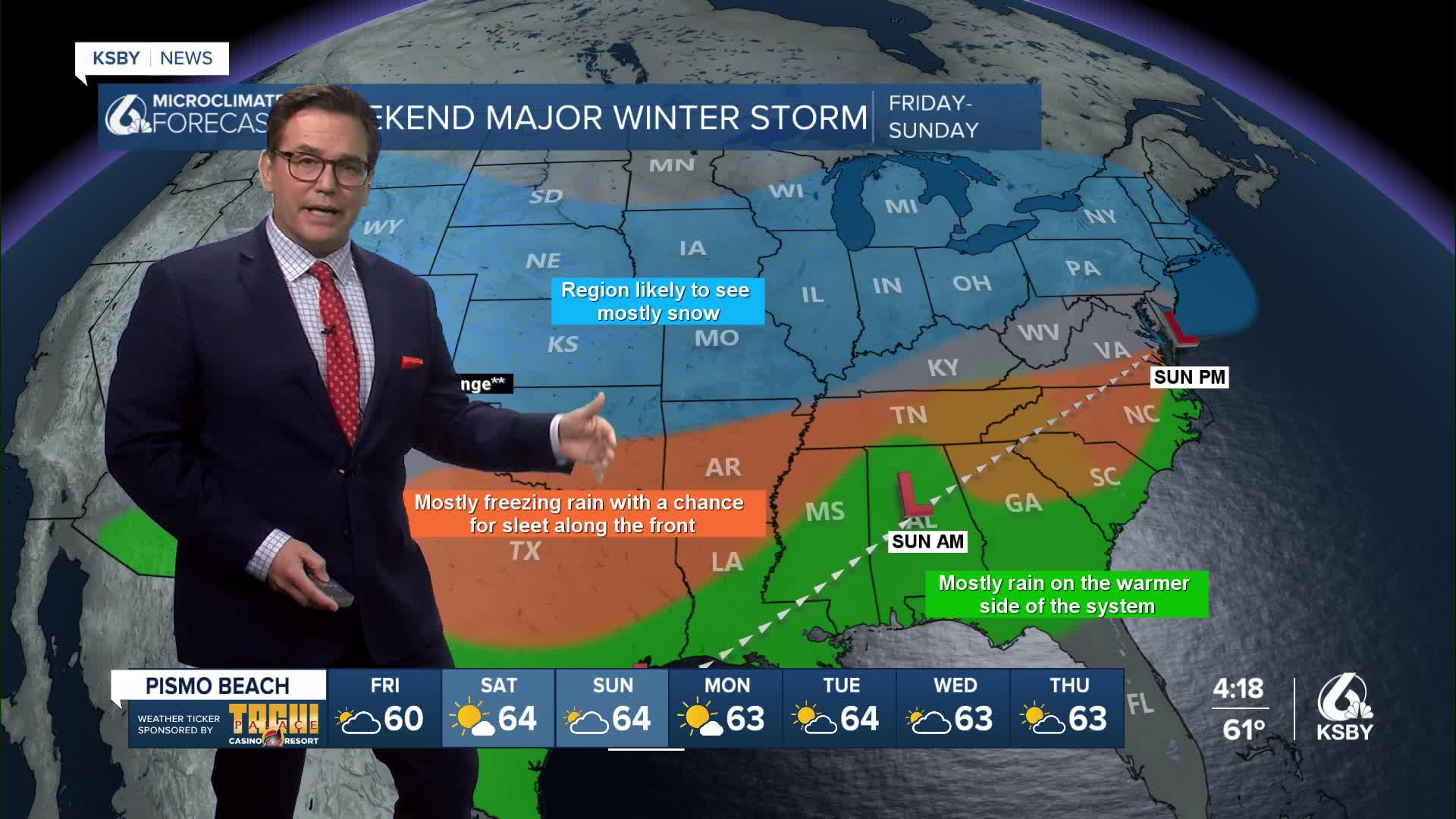
A significant, long-duration Winter storm will have heavy snow, sleet, and freezing rain from the Southern Rockies to New England and lasting through the weekend. Snowfall totals exceeding a foot are likely across the Ohio Valley, Mid-Atlantic, and the Northeast. Widespread travel disruptions are likely. Also, freezing rain is expected south of the primary snow axis. The Southern Plains, Lower Mississippi Valley, Tennessee Valley, the Southeast, and Southern Virginia will see the worst of the ice.
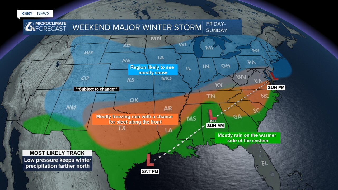


This Arctic blast will be accompanied by gusty winds, leading to dangerous wind chills.
Sleep well tonight, Central Coast!
-Jim
