


Happy Friday, Central Coast!
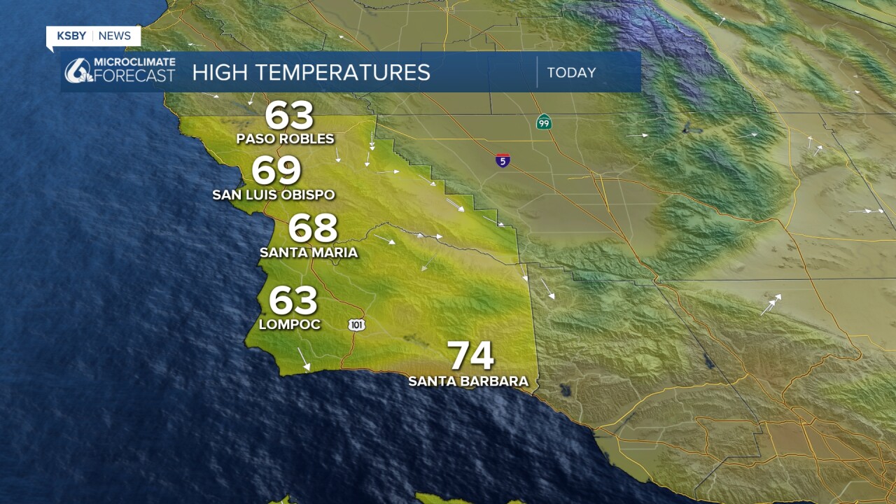
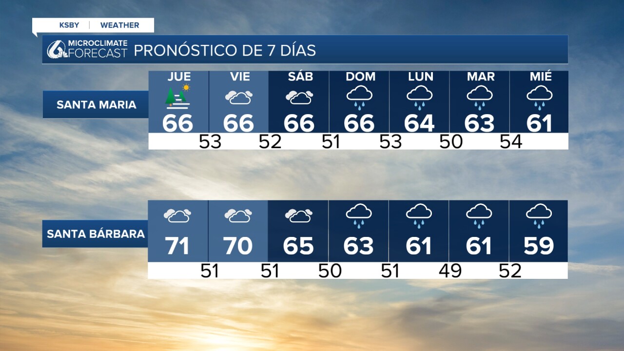
We made it to the weekend! These are the high temperatures you can expect for our region on Friday. The south coast will be slightly warmer compared to other parts of the Central Coast.
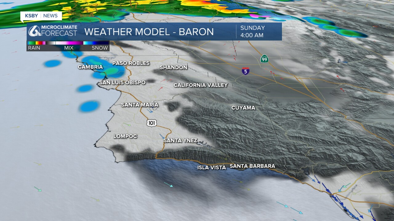
Enjoy this day and get your Christmas shopping done because it looks like these dry conditions will not last much longer! The ridge of high pressure that brought us warm and mild weather the last few weeks is being pushed out! Unlike this Thanksgiving holiday, the weather does not appear to be warm or dry. There's a chance the northwestern part of San Luis Obispo County could experience some scattered showers Sunday morning and afternoon.

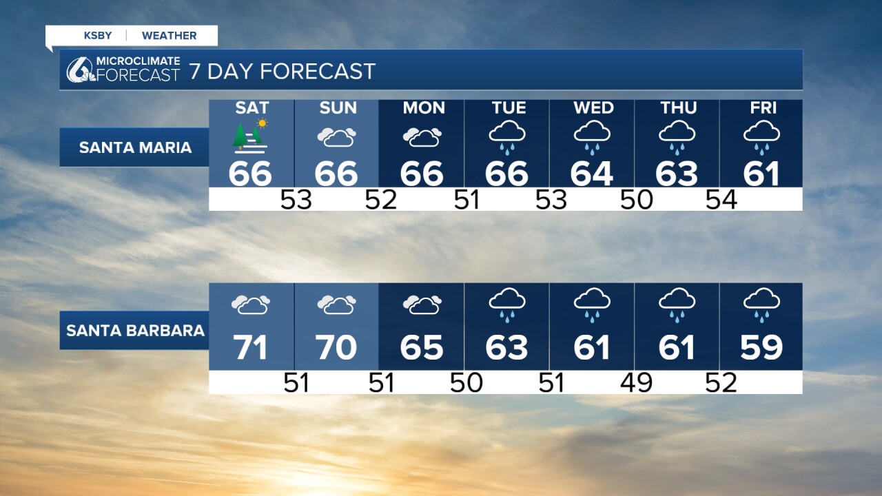
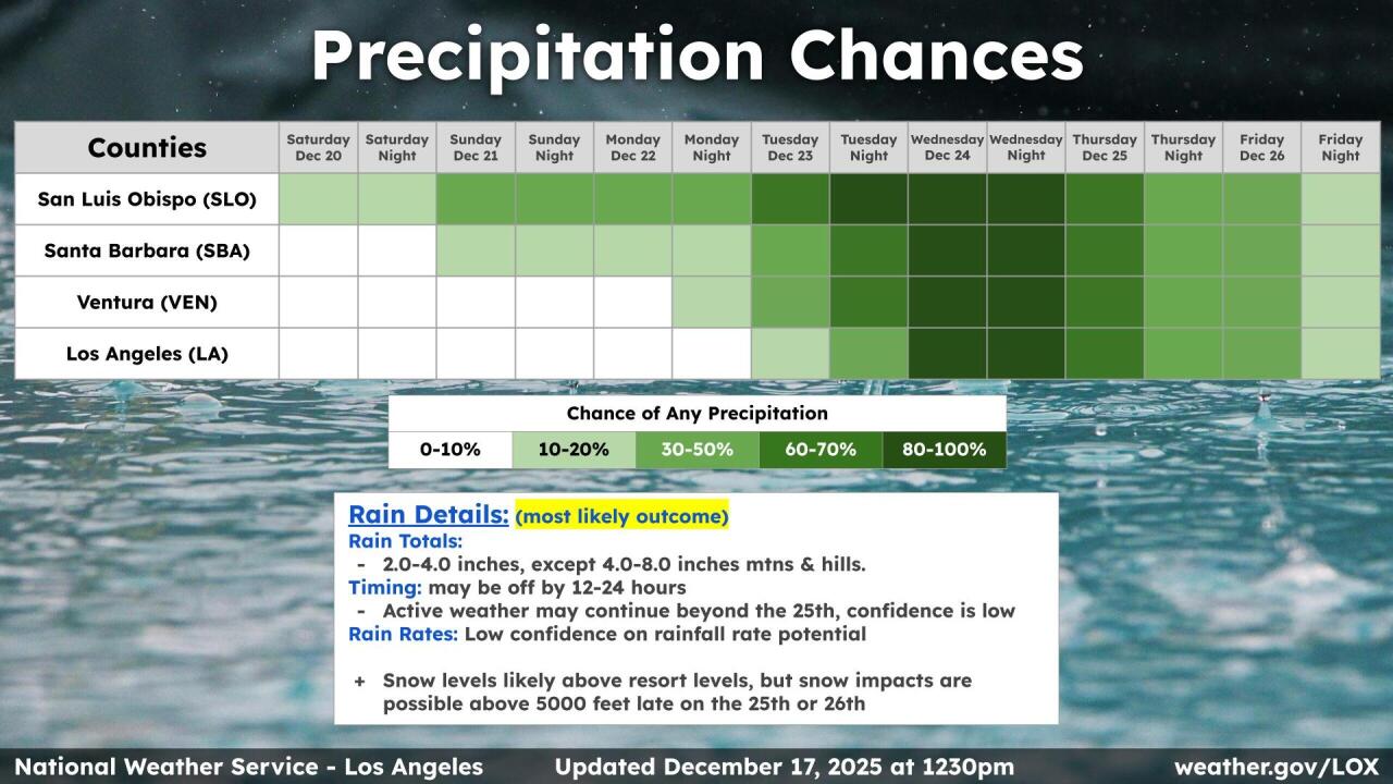
Most of the rain is expected to occur north of the Central Coast before Tuesday. We are still a ways away from the main storm headed our way, which could arrive right before or on Christmas.
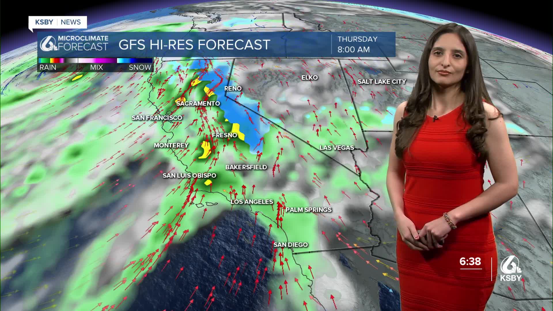
Here is a look at what those scattered showers might look like on Sunday.

Again, a disclaimer that we are still a few days away from the main storm we are monitoring. The timing is subject to change. For now, keep the time frame of December 23 through the 26th in mind and plan accordingly. Here is a look at our radar, and it looks like the first big band of rain will be well into our region in those overnight hours Tuesday through Wednesday.

Just a reminder, once again, that the timing of this could change as we get closer to Christmas. I leave you with, once again, this infographic from the National Weather Service, that covers precipitation chances next week.

Enjoy your weekend and happy holidays!
—Leslie Molina
________________________________________________________________________
¡Feliz viernes, Costa Central!
Aprovechen el tiempo agradable este viernes para terminar sus compras navideñas. ¡Este clima cambiará pronto! Las condiciones secas serán reemplazadas por lluvias a partir del domingo.

El sistema de alta presión, que causó el clima cálido que hemos tenido, está siendo desplazado por un sistema de baja presión. Primero, el nuevo sistema traerá lluvias al norte de California y el domingo se esperan lluvias dispersas en el noroeste del condado de San Luis Obispo.
Nuestro pronóstico indica que Paso Robles será una de las ciudades que verán estas lloviznas. Este fin de semana, la mayor parte de estas lluvias ocurrirá al norte de la Costa Central, pero eso cambiará el martes, cuando la tormenta alcance nuestra región. Si tienen planes de viajar, armen un plan, especialmente si van a manejar por las autopistas.
La siguiente imagen muestra las lluvias dispersas que se esperan. Nuestro modelo indica que la mayor parte ocurrirá en el noroeste del condado de San Luis Obispo la madrugada del domingo.
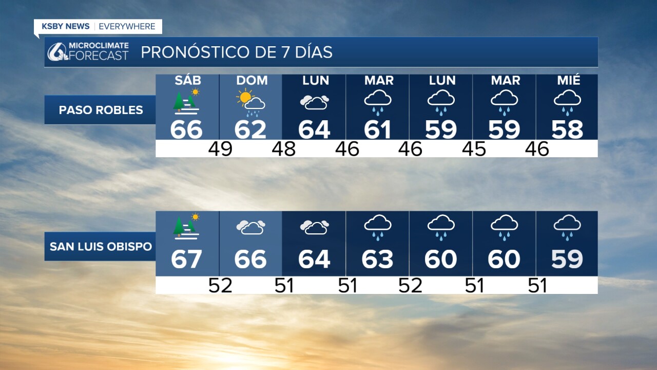
Aún falta tiempo para la tormenta navideña, así que no podemos confirmarles qué días llegarán las lluvias. Por ahora, anoten las fechas entre el 23 y el 27 de diciembre, porque durante esos días podría presentarse la tormenta. El próximo modelo indica que la primera parte llegará en la madrugada del miércoles.

Si tienen más preguntas sobre el pronóstico del tiempo, les dejo esta imagen del Servicio Meteorológico Nacional. En ella explican las probabilidades de lluvia para la próxima semana en inglés, así que les aclaro que cuanto más oscuro sea el verde, mayor es la probabilidad de lluvia en esas fechas
Lo matendremos informado este fin de semana. ¡Disfruten el resto de su día!
—Leslie Molina
