


Happy Friday evening, Central Coast!
The cooler air has arrived with a few more clouds. A slow-moving low-pressure system will slide by tonight. There have been a few showers and non-severe thunderstorms in the interior mountains, mainly in Santa Barbara and Kern counties.
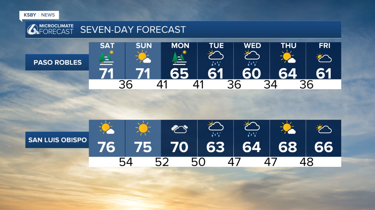
After this system passes, expect tons of sun this weekend, things warm up and dry out Saturday and Sunday with above-average highs mainly in the 70s.
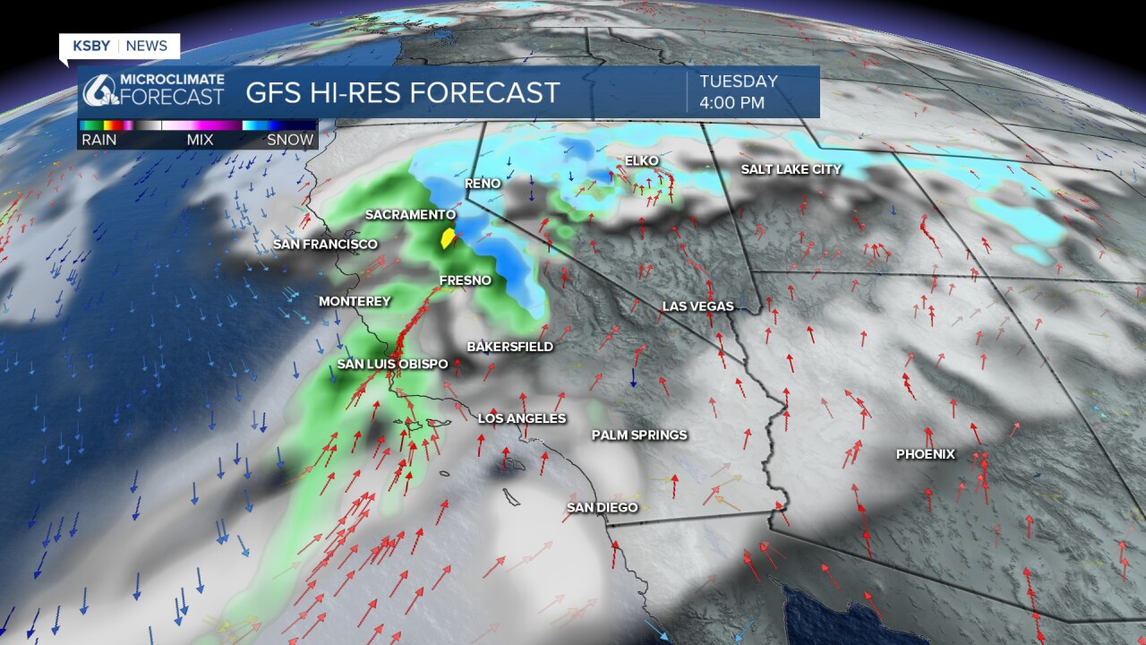
Tuesday and Wednesday, we start with a chance in the weather pattern with a moist west to southwest flow and several weak systems. Mainly light rain is in the forecast for both Tuesday and Wednesday.
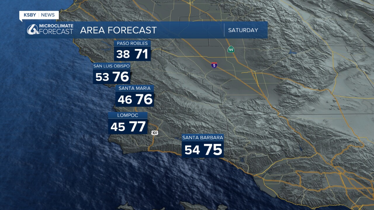
Below are the forecasted high temperatures for Saturday. With lots of sunshine, highs will be above the average mid 60s.
The High Surf Advisory continues along the Central Coast and the South Coast until 9 pm Saturday. A Small Craft Advisory continues along the Central Coast until 3 am Monday.
Large, dangerous surf with 10–16 ft breaking waves and strong rip currents.
Where: San Luis Obispo County beaches and Santa Barbara County Central Coast beaches where waves are a little less up to 8 feet.
When: Until 9 PM PST Saturday
Impacts: High risk of drowning; rip currents may pull swimmers and surfers out to sea. Waves can cause injuries, wash people off beaches and rocks, and capsize small boats near shore.
Details: Low chance of breaking waves at Morro Bay Harbor through Saturday morning.
Safety: Stay out of the water or near staffed lifeguard towers. Avoid rock jetties and rocks.

Below is a snapshot of Tuesday afternoon with light rain possible. Light amounts are expected Tuesday and Wednesday.

Have a great weekend, Central Coast!
-Jim
