



Happy Labor Day from Meteorologist Jim Castillo
Here is your weather forecast for San Luis Obispo and Santa Barbara Counties:
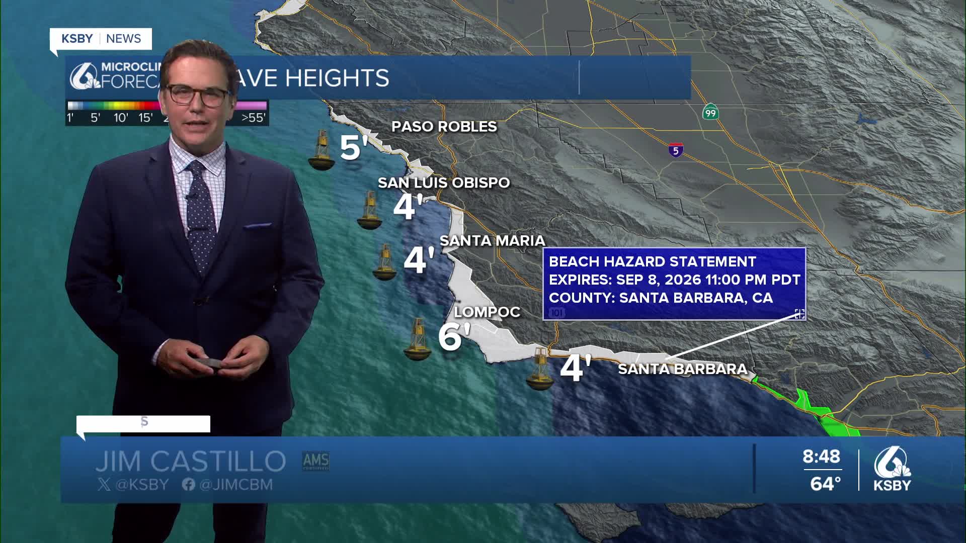
DANGEROUS SURF CONDITIONS CONTINUE. A significant southerly swell from Tropical Storm Marie continues to create hazardous surf conditions along south-facing beaches through Tuesday. Strong and potentially deadly rip currents pose serious safety concerns for beachgoers.
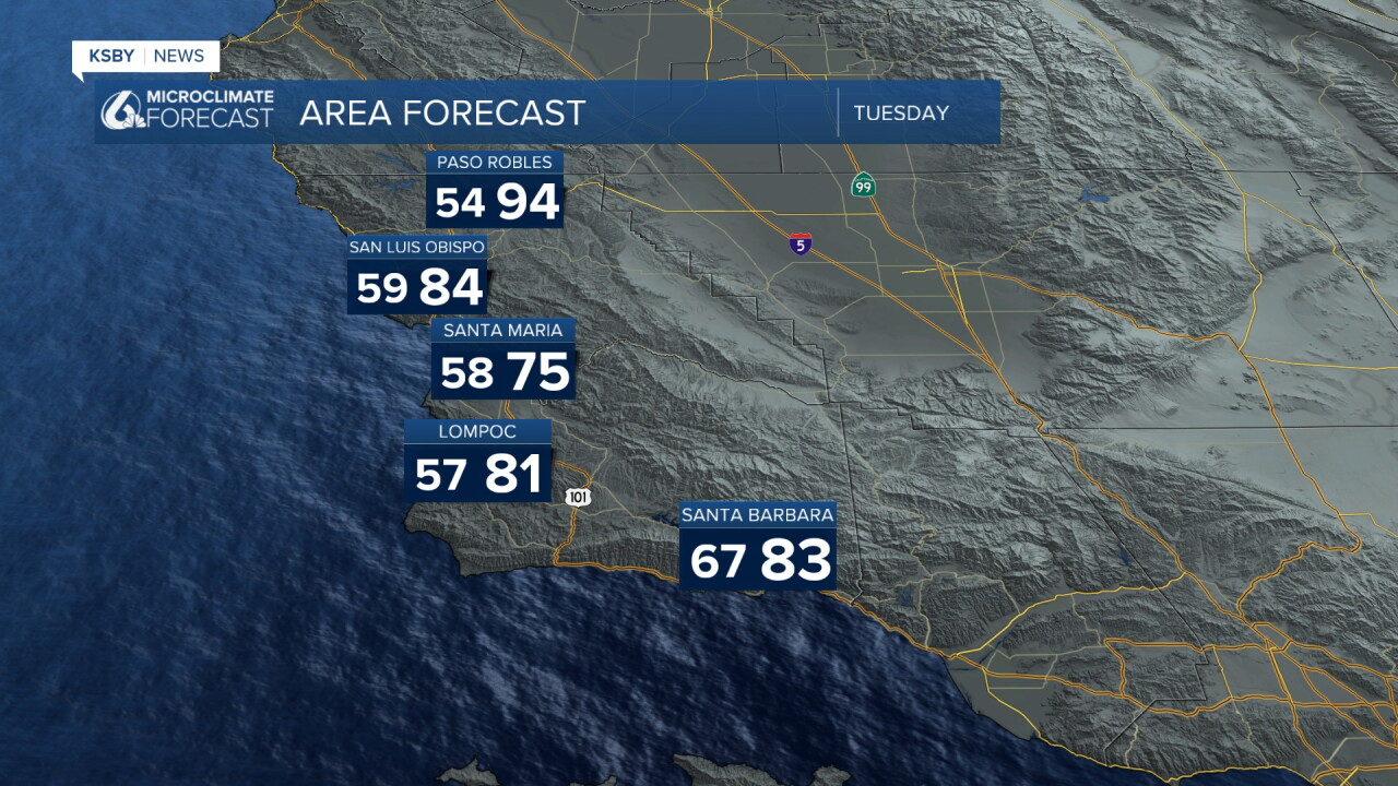
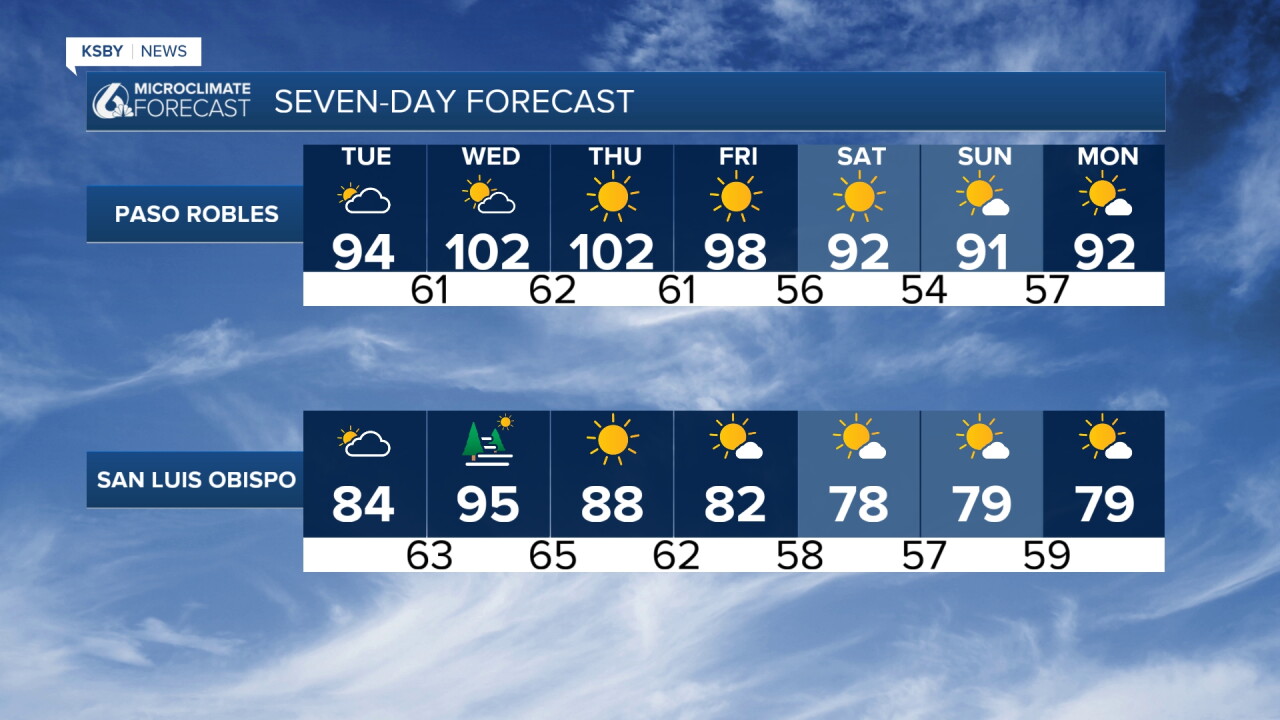
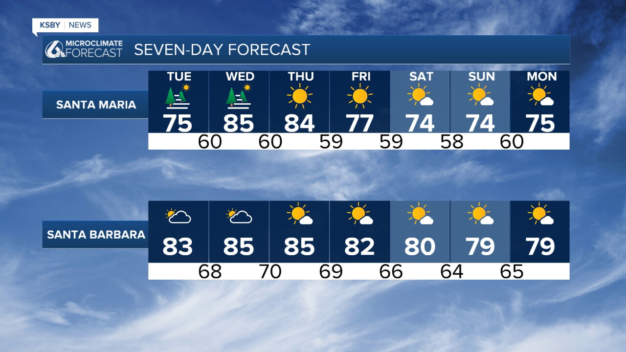
HEAT EVENT BUILDS MIDWEEK: The weather story shifts dramatically as a ridge of high pressure builds from the east, bringing the most significant heat of the week. Temperatures will climb each day through Wednesday, when upper-level heights and light offshore winds peak across the region.
WEDNESDAY: PEAK HEAT DAY Wednesday will deliver the most intense heat for most Central Coast locations, including Santa Maria and San Luis Obispo. Coastal areas face particular concern with temperatures potentially reaching 90 degrees or higher.
THURSDAY: SUNDOWNER WINDS SHIFT FOCUS The Santa Barbara South Coast may experience its warmest temperatures Thursday as Sundowner winds increase in the area, while other locations begin to moderate slightly.
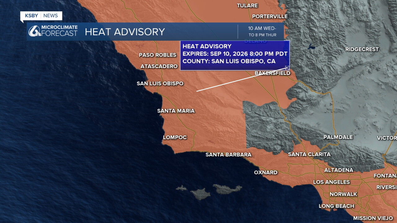
HEAT ADVISORIES IN EFFECT: Heat Advisories cover all of Santa Barbara and San Luis Obispo Counties from Wednesday through Thursday. Widespread highs will range from the mid 80s to 90s (including some coastal areas) to low 100s across interior valleys and foothills.
HUMIDITY ADDS TO DISCOMFORT: Tropical Storm Marie's moisture influence will keep humidity elevated, significantly increasing heat risk and discomfort levels. This combination may make conditions feel comparable to or worse than recent heat waves, especially along the coast.
OVERNIGHT RELIEF LIMITED Warm overnight lows will provide little relief, with widespread 70s expected and some foothill locations.
Isolated showers or a rumble of thunder possible through Tuesday, particularly over Santa Barbara County and coastal waters, thanks to very high precipitable water values from Marie. By Wednesday, any shower or thunderstorm activity will likely retreat to the highest peaks of the Santa Lucia Mountains, Santa Ynez Mountains, and Los Padres National Forest as the strengthening ridge caps the atmosphere.
WEEKEND RELIEF AHEAD: Cooler conditions are likely Friday through the weekend as the heat ridge weakens and marine influence returns to the Central Coast.
SAFETY RECOMMENDATIONS: Those working or recreating outdoors, as well as residents without air conditioning, should stay hydrated and seek cooling centers when possible.
Have a great night, Central Coast!
-Jim
