

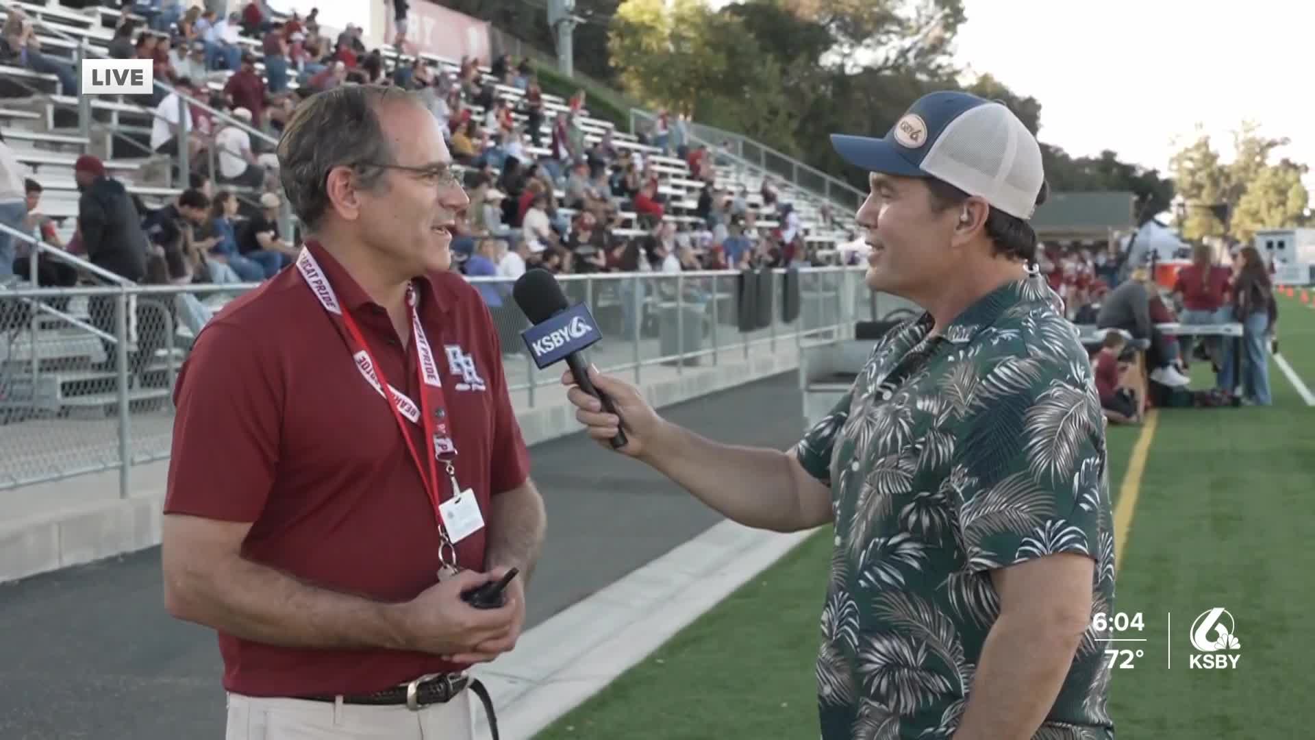


Happy Friday from Meteorologist Jim Castillo
Here is your Central Coast Weekend Weather Update for San Luis Obispo & Santa Barbara Counties
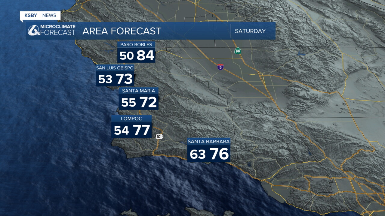
Below-normal temperatures will persist across both counties this weekend as patchy marine layer clouds and breezy onshore winds continue. While Tropical Cyclone Marie remains well offshore, its influence will bring notable changes to our Central Coast weather pattern through early next week.
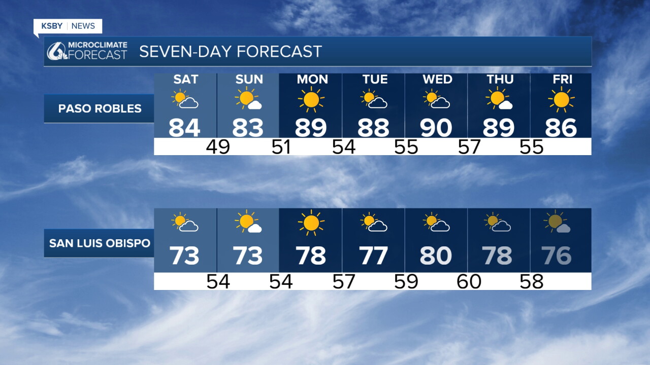
Temperature Outlook: Daytime highs will stay below seasonal averages with the marine influence keeping temperatures moderate. However, overnight lows could climb into the 70s, particularly along southern coastal areas and valleys in Santa Barbara County where cloud cover persists through Saturday night.
Marine Layer & Cloud Cover: Patchy marine layer development will continue, with increasing cloud cover expected through the weekend. This enhanced cloudiness, especially Sunday, will likely disrupt typical wind patterns, including the notorious Sundowner winds in Santa Barbara County. The disruption should result in weaker wind conditions overall.
While the main precipitation focus from Hurricane Marie targets Los Angeles County, Santa Barbara County has a small chance for light showers early Sunday morning. San Luis Obispo County is expected to remain dry. The Los Padres National Forest areas in both counties will see increased humidity but minimal chances of rainfall.
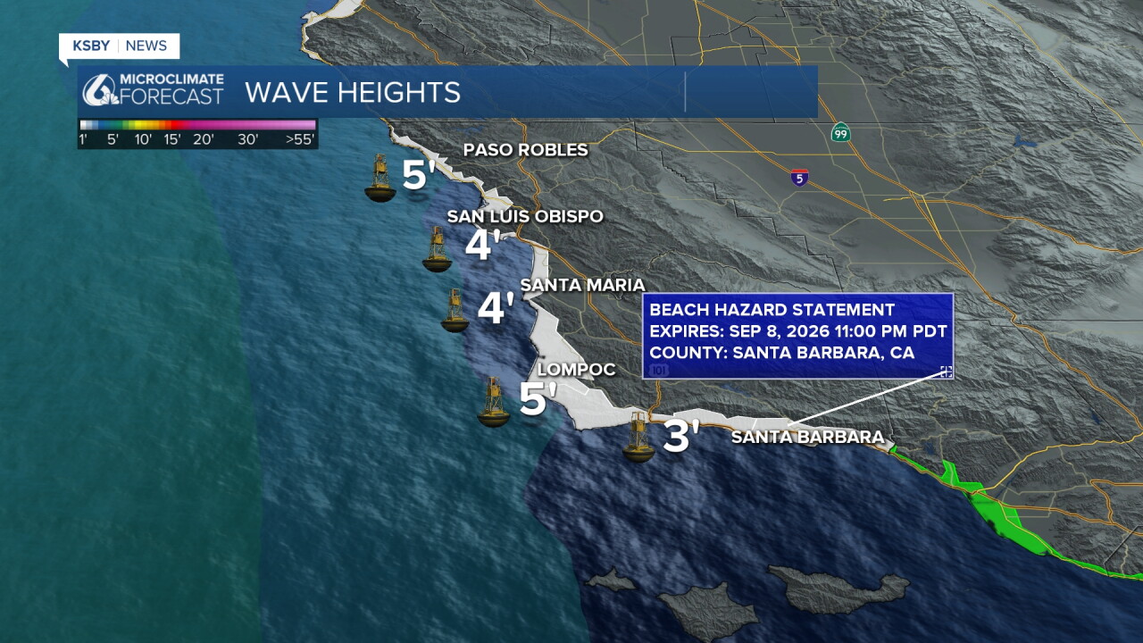
Ocean Conditions - Critical Safety Information: High confidence exists for potentially deadly rip currents and large waves this holiday weekend, particularly at south-facing beaches as southerly swell increases from Hurricane Marie. Ocean conditions will become increasingly hazardous, with the greatest threat to beaches from Point Conception southward in Santa Barbara County. The Santa Barbara Island has a High Surf Advisory for 5- to 8-foot waves, with sets up to 10 feet and a Coastal Flood Advisory.
Extended Outlook: A warming trend appears likely by midweek with temperatures returning to near or slightly above normal. Southwest California may become positioned between a ridge to the southeast and a trough to the west, potentially keeping the door open for additional tropical moisture Tuesday through Thursday with some rain chances.
This represents a very rare weather pattern for early September in our region, with the interaction of strong jet stream winds near 120 knots combining with tropical moisture to create this unusual setup for the Central Coast.
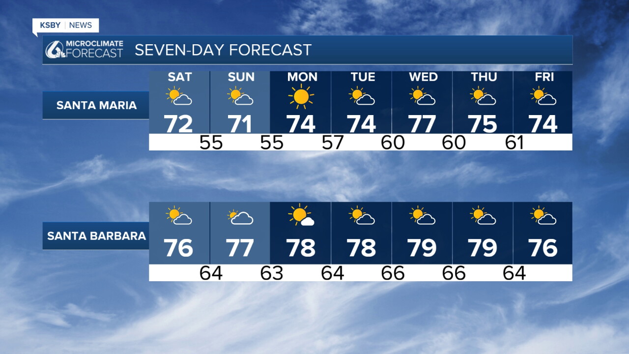
Have a great Labor Day weekend, Central Coast!
-Jim
