

Happy Friday-eve!
This Thursday has been an interesting one for the Central Coast. We started off the day with a wind advisory for the Gaviota Coastline. This region could see winds up to 45 mph in the overnight hours. Anyone driving through this region should take the necessary precautions.

Today's big story, a flood advisory issued by the National Weather Service after 3:20 PM for the southeastern portion of San Luis Obispo County, which included the Gifford and Madre Fire burn scars. Our radar shows that around 3:30 PM, the region highlighted in green saw some rain. This advisory ended the same day, at 5:15 PM. Fire typically destroys vegetation, which means the soil in a burn scar is unable to absorb water. Rainfall over these regions can lead to flooding, which is the reason this brief advisory was issued.

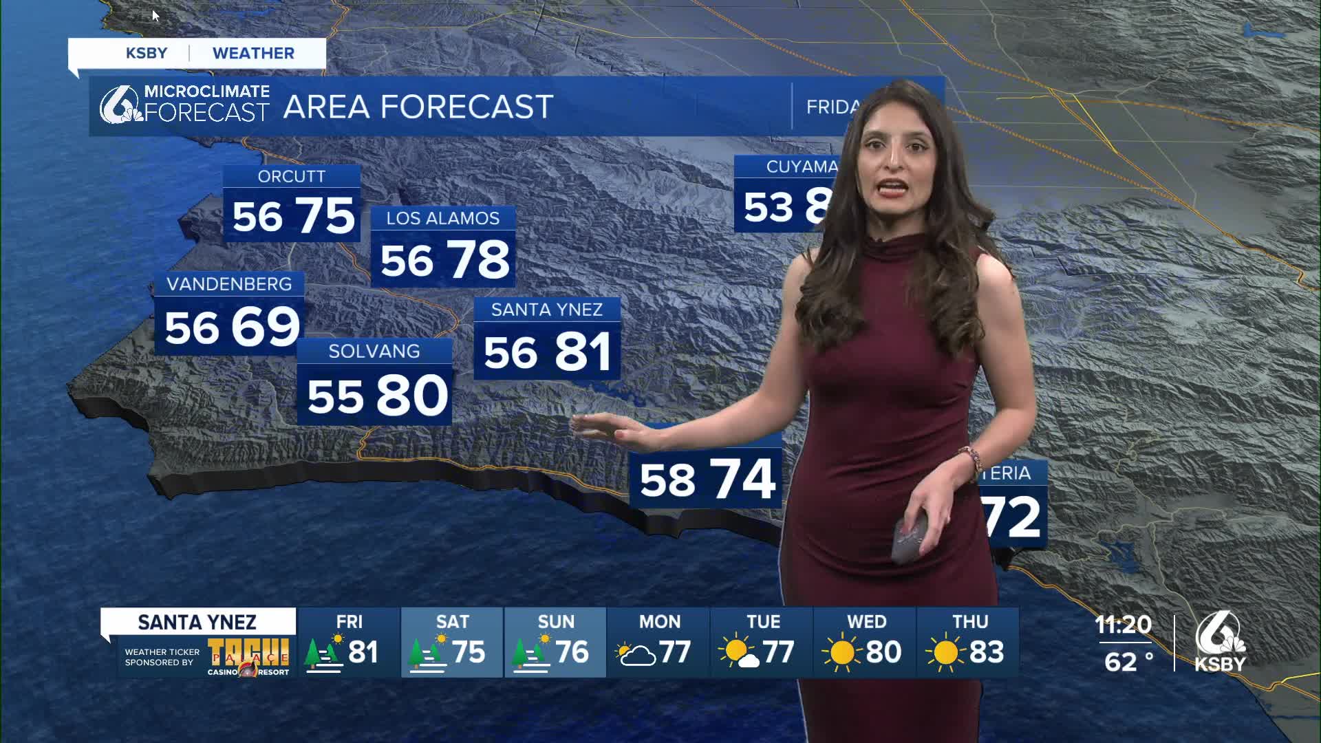
This Friday, the Central Coast will experience a slight cool down. Paso Robles will see temperatures in the upper 80s and Coastal Valleys in the 70s. Santa Barbara will experience overnight lows in the 60s and daytime temperatures in the 70s.

This cool down is expected to extend into the weekend. Paso Robles will see temperatures dip into the mid to upper 70s. San Luis Obispo will see temperatures in the 70s and experience some foggy mornings Friday, Saturday, and Sunday.

Santa Barbara will stay in the upper 70s for the next two days but cool down significantly into the low 70s into the work week. Coastal communities will also experience foggy morning and experience some stubborn clouds throughout the day.

Enjoy your evening, Central Coast!
