



Happy Friday, Central Coast, from Meteorologist Jim Castillo
Here is your weather forecast for San Luis Obispo & Santa Barbara Counties
Marine Layer & Low Cloud Pattern
Night through morning marine layer clouds will continue for coastal areas and inland valleys through the weekend, then gradually reduce in coverage each day into next week. The marine inversion will progressively lower from 2,500-3,000 feet tonight to 1,000 feet or less by Sunday night. Expect decreasing inland penetration of low clouds each morning, with patchy dense fog possible along the coast by Monday morning.
Temperature Trends
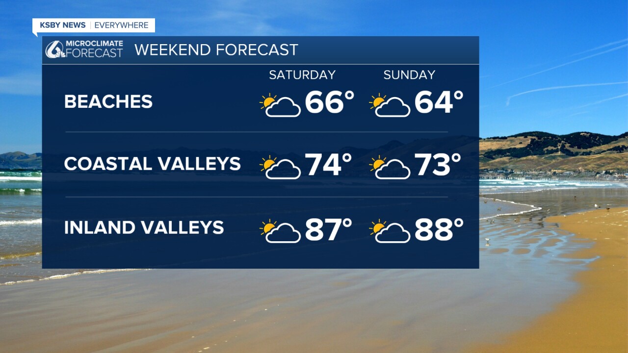
Saturday temperatures will remain several degrees below seasonal averages, warming several degrees by Monday to near or slightly below normal levels.
Much cooler-than-normal temperatures this weekend will gradually warm to near-normal levels by early next week, then possibly climb to above-normal levels by mid-week as upper-level high pressure builds over the region. Saturday temperatures will remain several degrees below seasonal averages, warming several degrees by Monday to near or slightly below normal levels.
Extended Outlook (Tuesday-Friday)
Upper-level ridging will strengthen over Southern California Tuesday through Wednesday, bringing warming temperatures. A northerly surface pressure gradient may develop early next week, potentially bringing gusty northerly winds across southern Santa Barbara County. Advisory-level Sundowner winds are possible during this timeframe.
Mountain & Forest Areas
The Santa Lucia Mountains, Santa Ynez Mountains, and Los Padres National Forest areas within both counties will see afternoon cumulus buildups possible through the weekend. Breezy to gusty southwest to west winds are expected each afternoon.
Marine Conditions
Sea surface temperatures remain in the 60s to near 70 degrees. Overnight lows will hover around 60 degrees in both counties.


Have a great weekend, Central Coast!
-Jim
