


Good Friday evening, Central Coast!
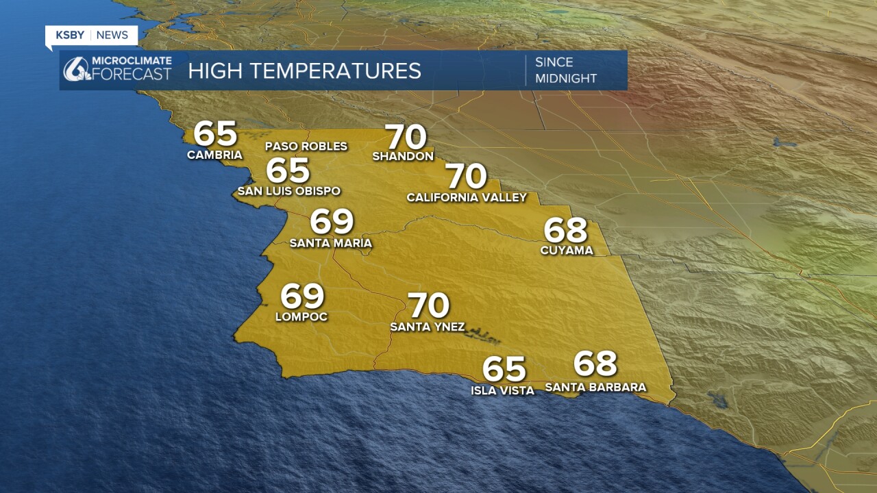
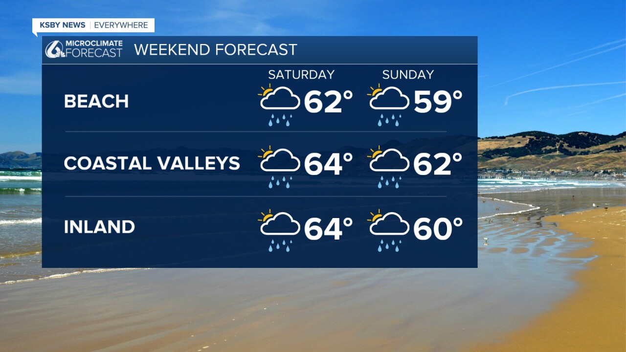
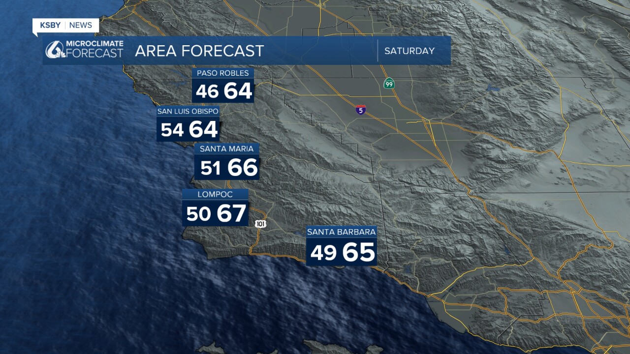
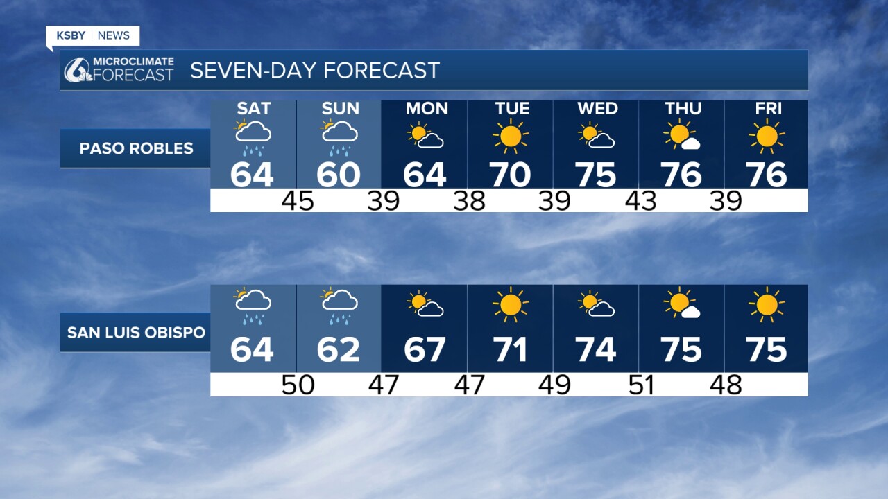
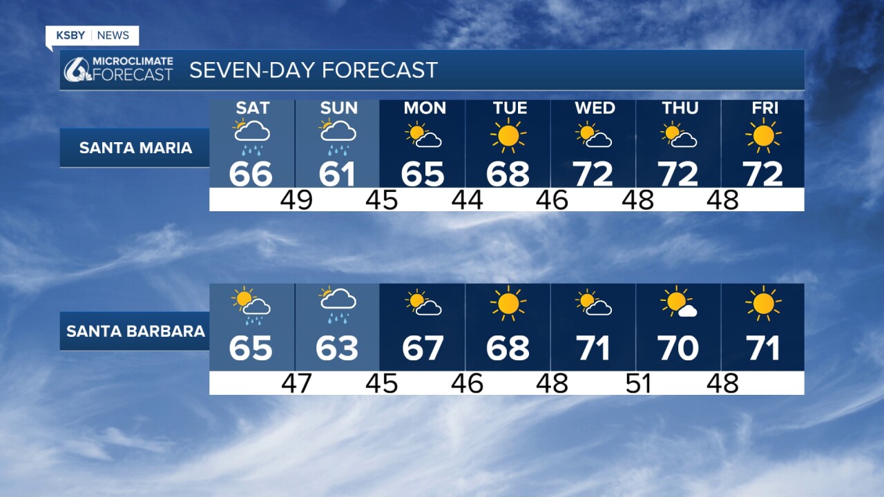
High temperatures on Friday were mainly in the 60s. The cool weather stays with us all weekend.
The first of two upper-level disturbances is moving through our area currently, bringing scattered rain showers and the risk for an isolated downpour or isolated thunderstorm. Light rain has reached as far south as Carpinteria in southeastern Santa Barbara County. Rocky Butte in northwestern San Luis Obispo County leads rainfall totals with just under half an inch.
NOW THROUGH SATURDAY AFTERNOON
High-resolution models show minimal impacts continuing tonight through Saturday afternoon. A convective boundary approaching the Central Coast, combined with afternoon heating and atmospheric instability, could trigger brief thunderstorms mainly north of Point Conception. Otherwise, expect scattered light showers producing mostly under one-tenth inch of rain, with some areas staying completely dry through Saturday afternoon.
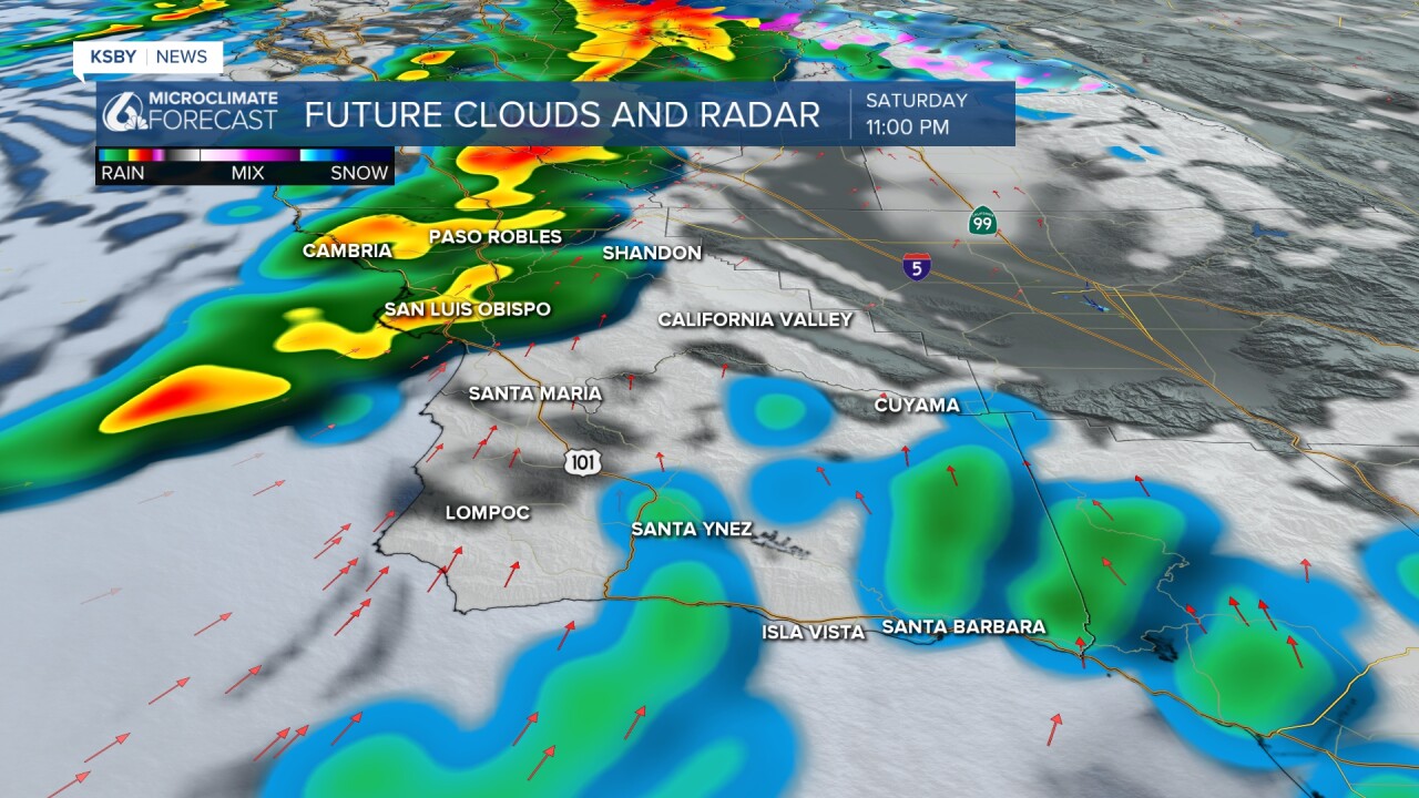
SATURDAY NIGHT THROUGH SUNDAY - THE MAIN EVENT
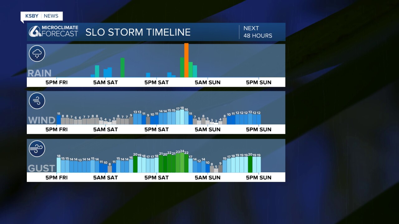
After a brief lull Saturday afternoon, the second upper low arrives Saturday night into Sunday morning. This system packs more punch, bringing a focused 3-5 hour period of steady rain and possible thunderstorms across both counties.
Atmospheric conditions will become notably unstable with CAPE values around 500 joules per kilogram - sufficient energy for convective activity, including brief heavy downpours, gusty winds, and lightning. There's even a small possibility of a waterspout given sufficient low-level wind shear.
RAINFALL EXPECTATIONS
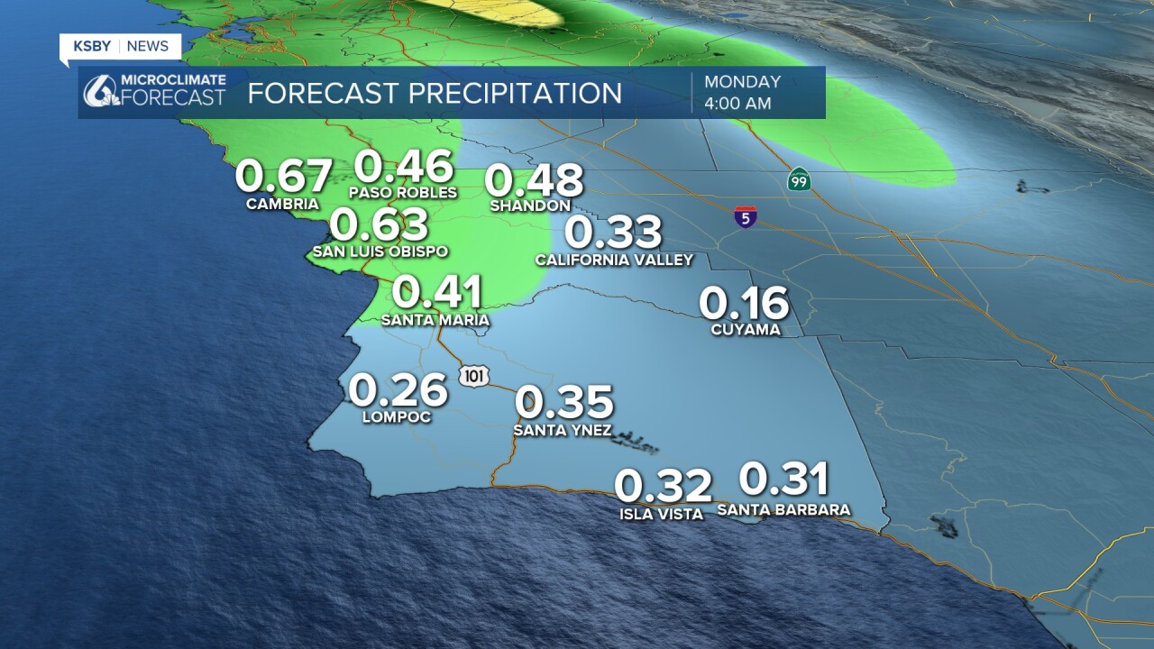
General rainfall amounts of half to one inch are forecast, with locally higher totals possible in the Santa Lucia Mountains, Santa Ynez Mountains, and elevated areas of Los Padres National Forest. The convective nature means rainfall will be highly variable over short distances. Peak rain rates will reach one-quarter to one-half inch per hour, with isolated stronger cells potentially producing three-quarters of an inch per hour briefly Saturday night.
Below: One of my favorite weather computer models with any additional rainfall totals through early Monday.
Below is the timeline for rain, wind, and higher gusts: This is not a continuous rain event. The scattered rain showers continue through Saturday with dry time. Saturday, late evening and into the night, is the time period we may have a better chance for thunderstorms and downpours for a couple of hours.
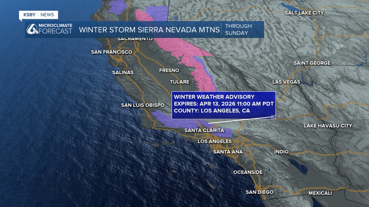
MOUNTAIN WINTER WEATHER ADVISORY FOR SNOW
A Winter Weather Advisory from 9 pm Saturday until 11 am on Monday covering elevations above 6,000 feet for the Santa Barbara County interior mountains. Snow levels start around 7,000 feet through Sunday morning, then drop to 6,000 feet for a bit lower Sunday afternoon into Monday morning. Expect up to 6 inches of snow above 6,000 feet, with 1-3 inches possible down to 5,000 feet in the higher elevations of the Los Padres National Forest.
EXTENDED OUTLOOK
Drying begins Monday afternoon with a warming trend through the week. Temperatures climb 1-3 degrees daily, reaching near 70 degrees at the coast and the mid 70s inland by midweek. Light offshore flow may develop Friday into next weekend.
This active weather pattern brings beneficial rainfall to both counties after recent dry conditions, with the Sierra mountain snowpack receiving a helpful boost from this system. This is not an Atmospheric River, so we are not expecting any flooding issues.
Have a great night, Central Coast!
-Jim
