



Here is your Central Coast weather update for San Luis Obispo and Santa Barbara counties from Meteorologist Jim Castillo
Synoptic Setup: A classic cut-off upper-level low-pressure system, detached from the main jet stream, has fully occluded off Point Conception.
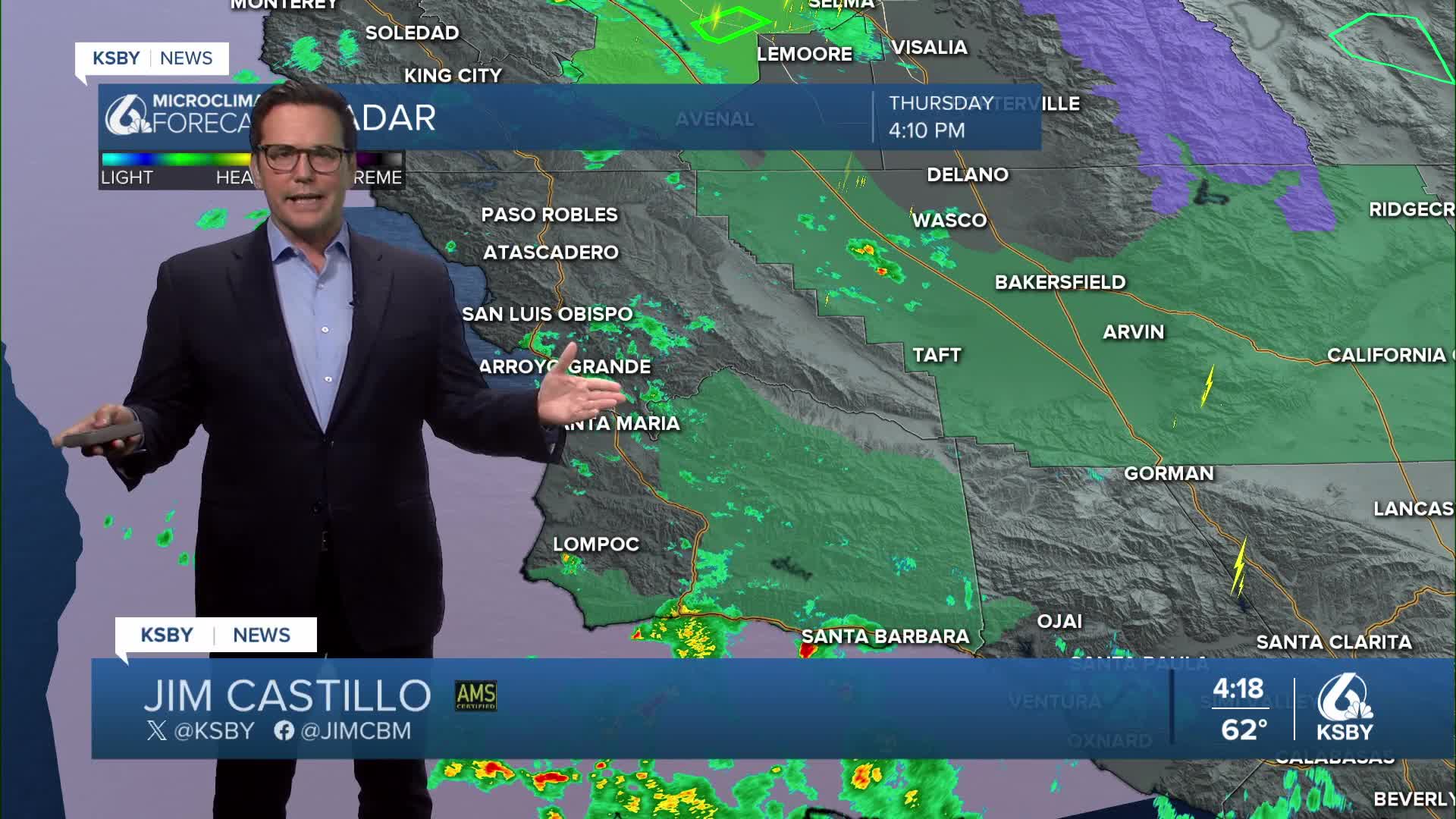
Current Radar Focus: The heaviest Thursday evening rain bands are currently pushing through Santa Barbara counties, extending south down toward the Channel Islands. A Flood Watch remains in effect and has been extended until 6:00 PM Thursday for Santa Barbara County, specifically targeting the Santa Ynez Mountains and the South Coast.
This low brought numerous hazardous weather alerts: Flood Advisories, Flood Warnings, Severe Thunderstorm Warnings, Special Weather Statements, and Special Marine Warnings across the local coastal waters.
San Luis Obispo County Impacts: While no formal Flood Watch is currently in effect for SLO County, any convective showers that form locally are may include a quick downpour.
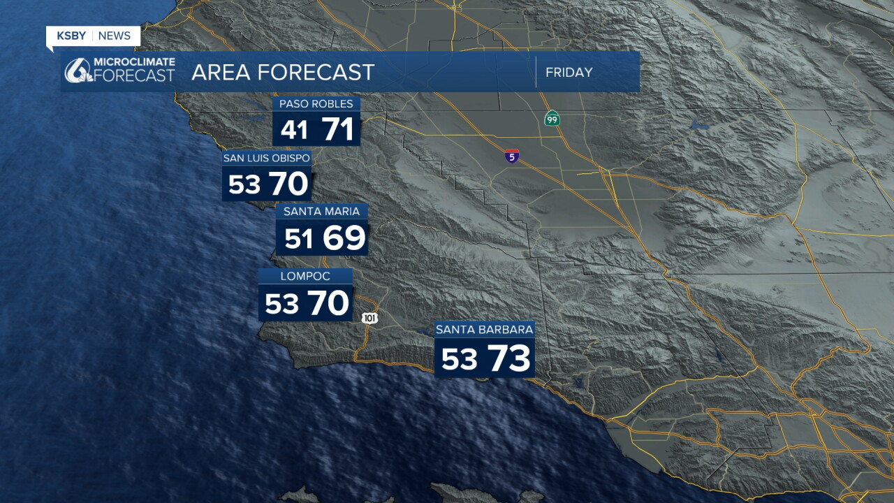
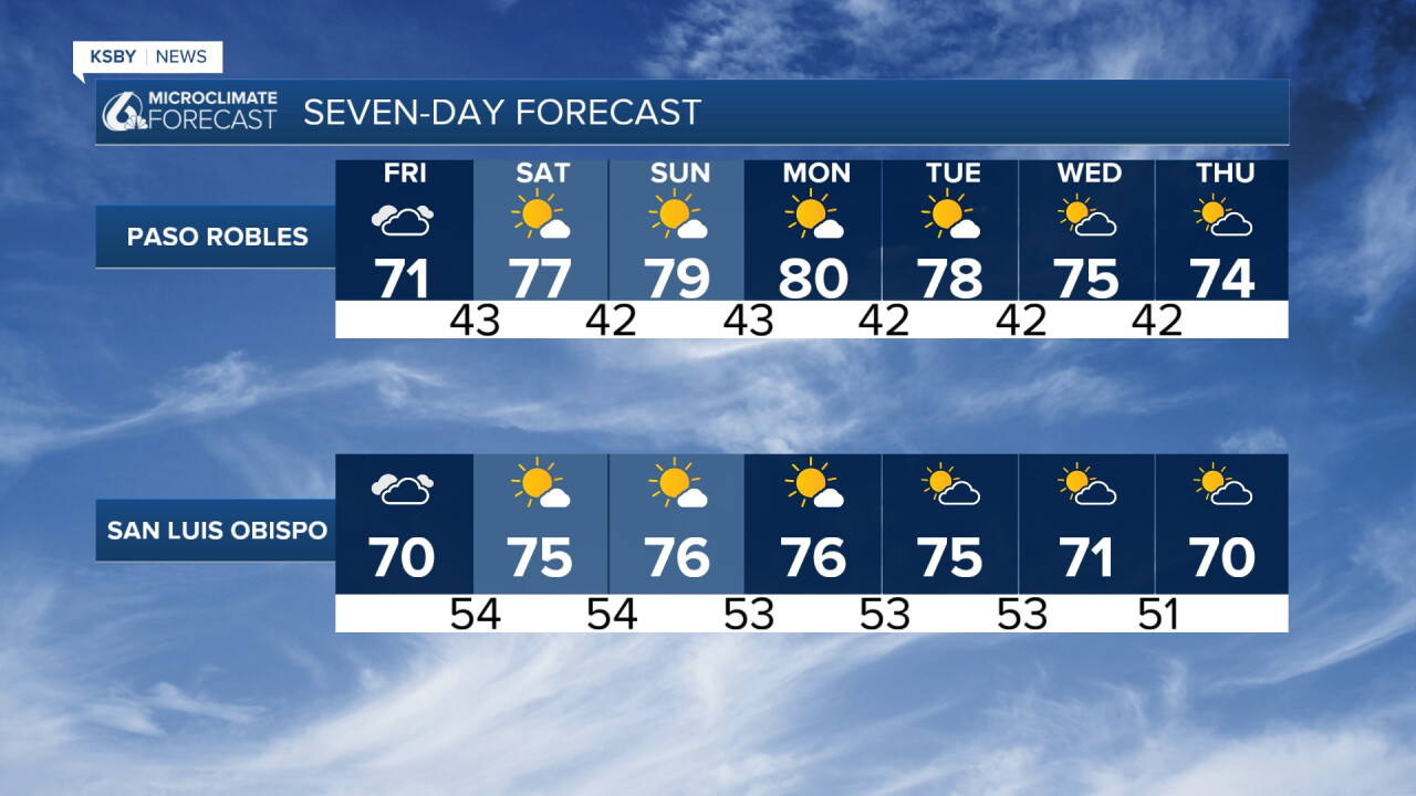
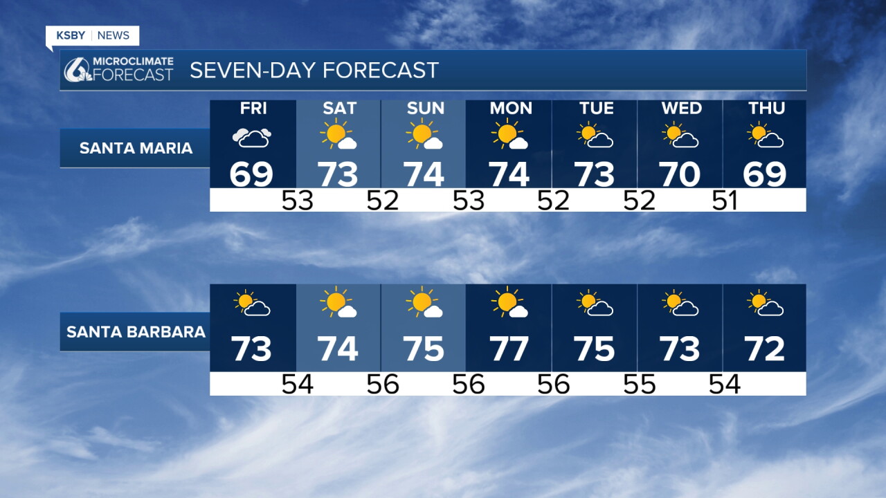
Friday & Saturday Outlook: The system exits late Thursday, bringing a quick transition to dry and warmer conditions. Light offshore winds will develop, remaining well below official advisory thresholds.
Extended Forecast: Weak, low-grade offshore winds will maintain dry and mild conditions through early next week.
Mid-Week & Beyond: Onshore flow returns by mid-week, bringing temperatures back toward seasonal averages. Long-range forecast models indicate the potential for another wet weather pattern returning around Halloween weekend.
Have a great night, Central Coast!
-Jim
