

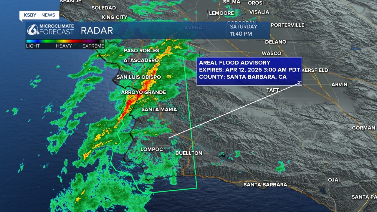
UPDATE (11:45 PM)
An areal flood advisory has been issued for most of Western San Luis Obispo and Santa Barbara counties through 3 a.m. Sunday morning.
Minor flooding in low-lying and poor-drainage areas is expected. Minor rock and mud slides are also possible.
All of this is due to the ongoing line of storms that will continue to move southeast over the next few hours.
UPDATE (10:28 PM) - As the strong storms move onshore, high winds and heavy rain are arriving. There is a special marine warning in place through midnight due to the risk of waterspouts forming along this line. Plus, there is a special weather statement in place for a few storms along the north coast, where wind gusts of 50 to 55 mph have been reported. Cambria is seeing the worst of it right now but all communities will see the storms as they progress south.

———————————————————————
Happy Saturday, Central Coast!
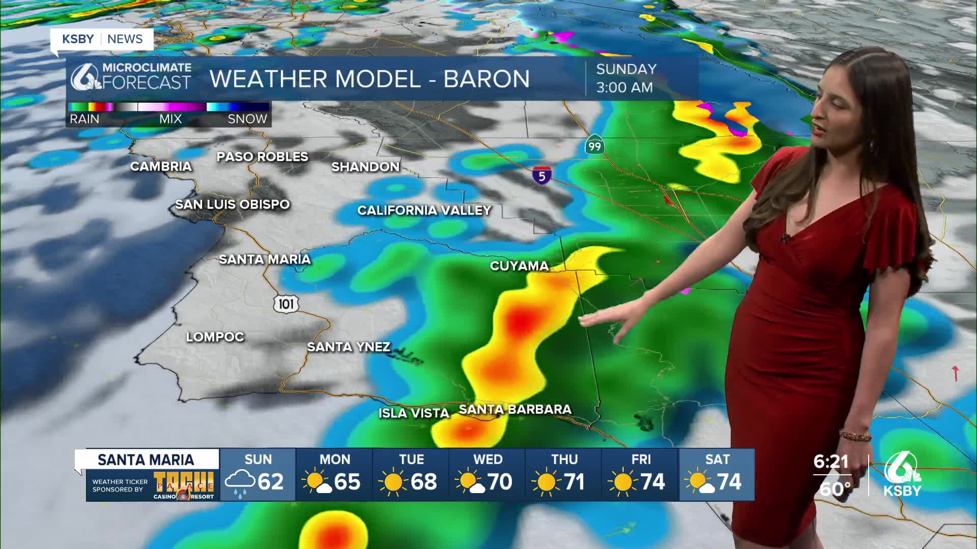
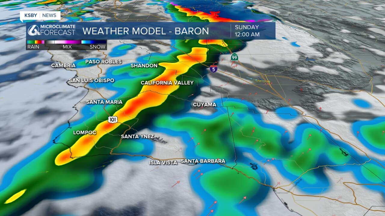
Hope you enjoyed that brief break in rain activity today. Things will start picking up this evening! The second part of the system that brought us some showers earlier this week is expected to arrive overnight. This image shows how this next round of rain will most likely play out.
Here is a different model. I like this one the best! The strongest part of this storm will begin sometime after 8:00 PM and move through our region. With this round, there is a chance of thunderstorms, hail, and a weak but brief tornado. My advice: stay off the roads tonight.
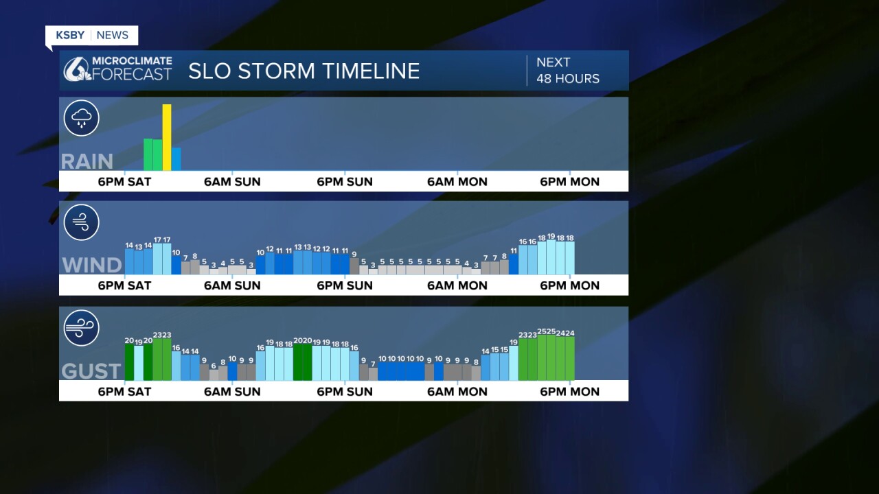
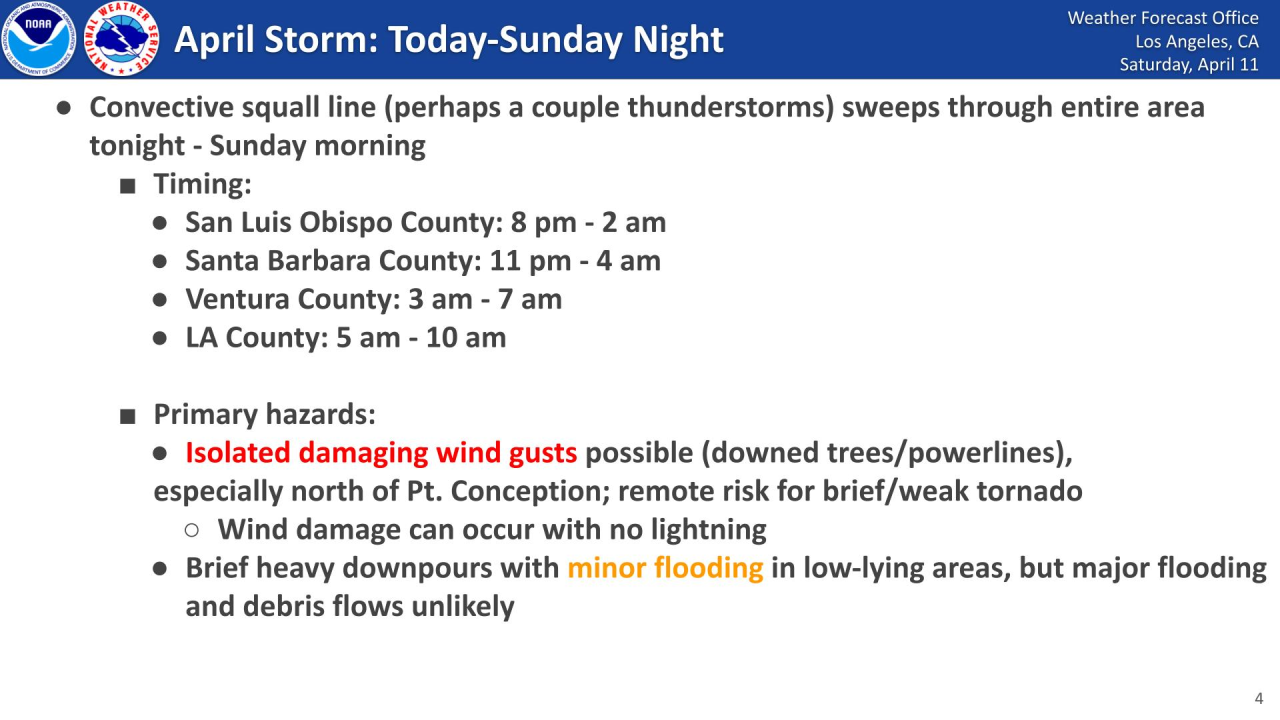
Here is a great graphic from the National Weather Service about the rain timing. It pretty much aligns with what our models are showing us!

Talking about those thunderstorm chances, here is another graphic from the NWS that goes into a little more detail. Thunderstorms could take place in SLO County anytime between 8 PM to 2 AM, and in Santa Barbara County between 11 PM to 4 AM. Expect winds to pick up overnight as well, with the remote risk of a brief or weak tornado.
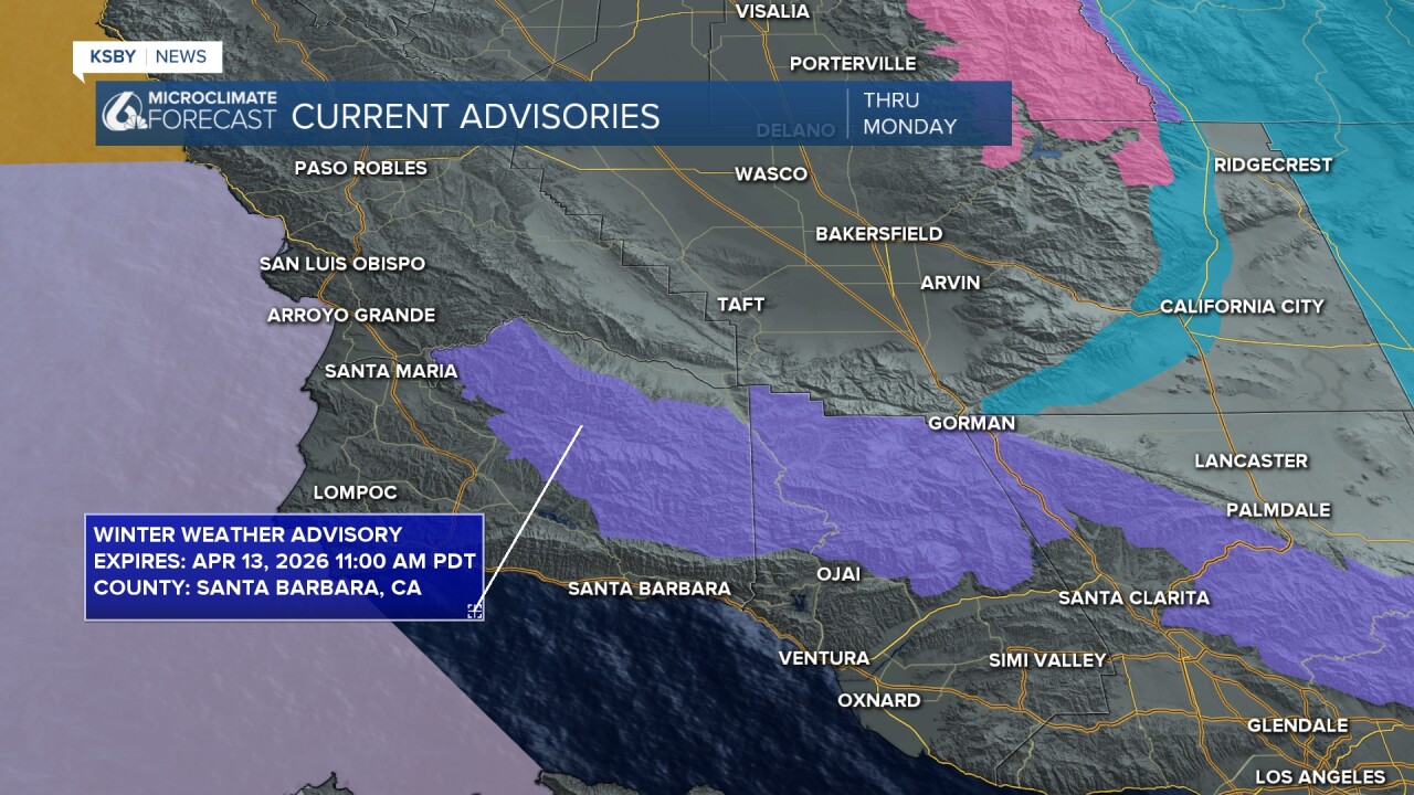
Hours away from this storm, there is a Winter Weather Advisory and a Small Craft Advisory in place.
Here is a look at some of the rain totals we can expect overnight. After the strongest part of this storm, we could experience some scattered showers Sunday into Monday.

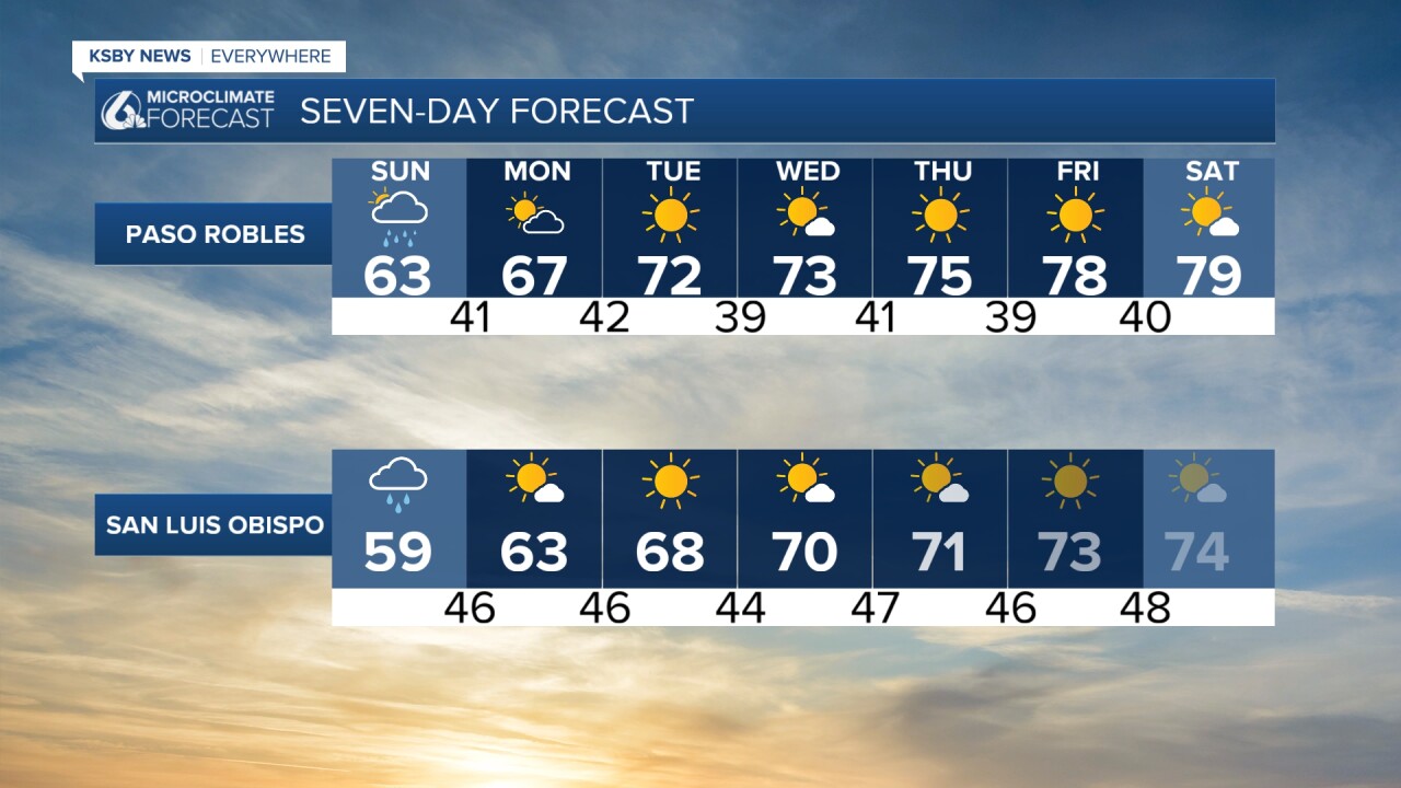
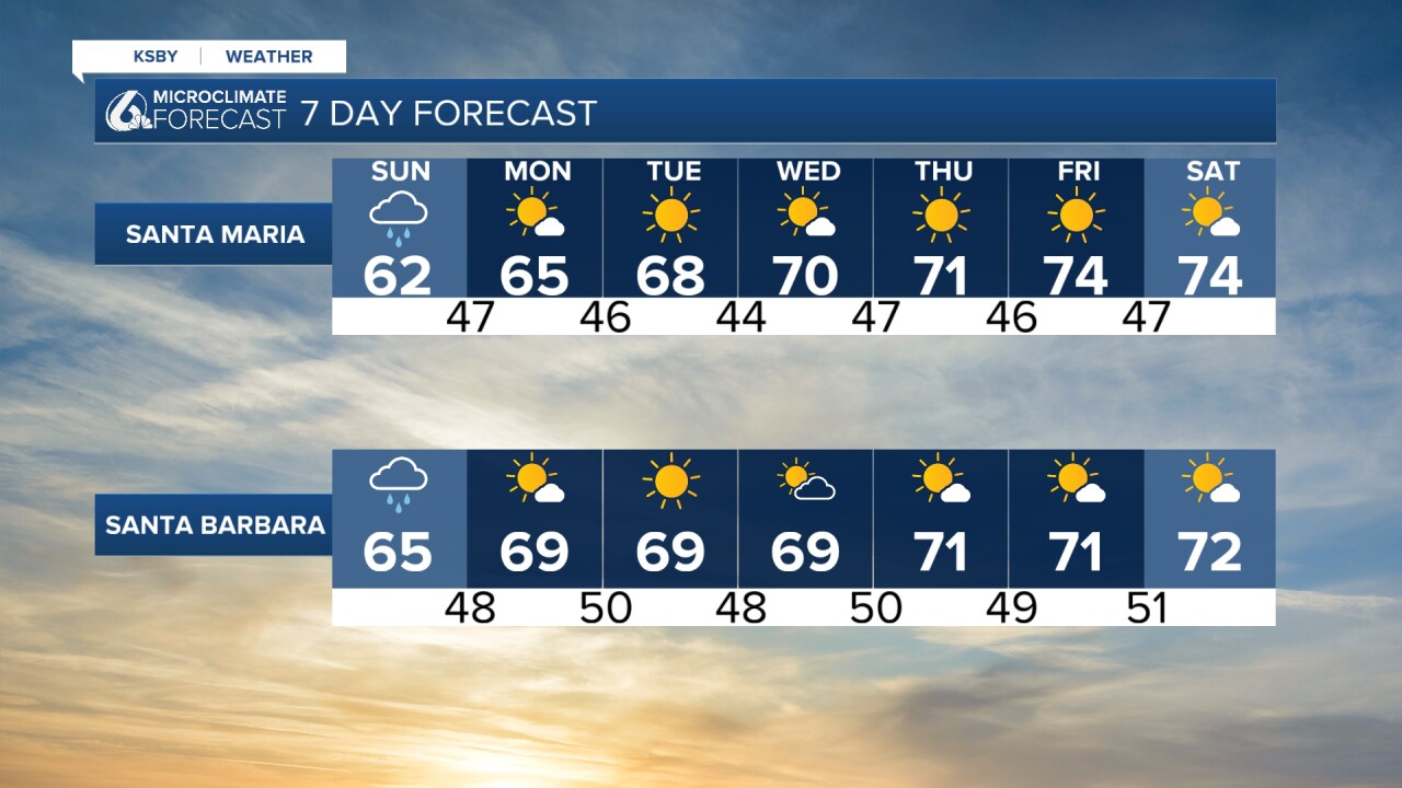
As for temperatures, I leave you with our seven day forecast!
Enjoy the rest of your evening!
—Leslie Molina
