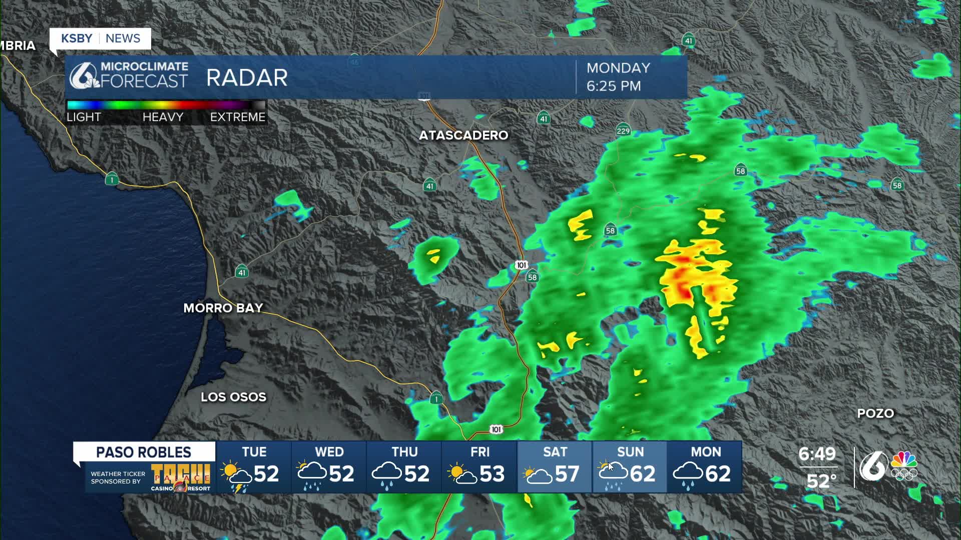


Good evening, Central Coast! Some of us have heard thunder and or seen lightning late Monday evening.
The first in a series of storms has moved through the area, but not before dumping heavy rain in spots. Los Osos had 2.40" of rain on Monday, Lompoc 1.92", Cal Poly in San Luis Obispo 1.97", Santa Barbara .59", and Cambria 1.71". Several more waves of rain and possible isolated non-severe thunderstorms are expected into the week ahead.
Most of the steady rain has ended, but satellite images show scattered showers offshore and moving toward the coast. Periods of scattered rain will continue overnight. Most areas will see additional rainfall, with the potential for brief heavy downpours and possibly an isolated thunderstorm. Through Tuesday morning, most locations are expected to receive less than a half-inch of rain. The flood watch remains in effect through midnight in Santa Barbara County.
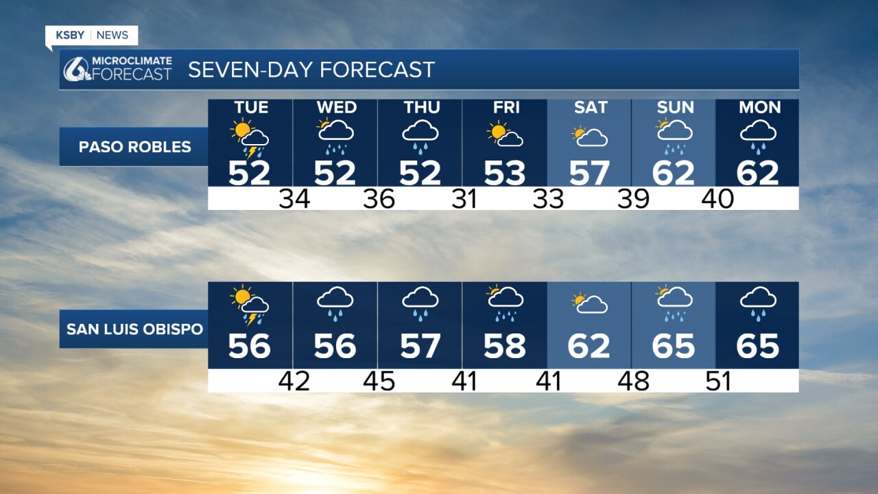
Rain will taper off early Tuesday, but another wave of heavier rain and possible thunderstorms is set to arrive Tuesday afternoon along the Central Coast and spread south Tuesday night. Average totals of about a half-inch are expected, with 1 to 1.5 inches possible in the foothills and mountains. The air temperature will continue so chilly that a few snowflakes at low levels are possible Tuesday night. The last time San Luis Obispo saw some snowflakes downtown was February 21st, 2019.
This second system will be colder, lowering snow levels to around 3,000 feet by Wednesday morning. While most precipitation should wind down by then, lingering showers could continue along north-facing slopes, including the Grapevine on Interstate 5. Snowfall of 1 to 3 inches is possible along I-5 through the Grapevine, with higher amounts in the surrounding mountains. Travelers over Interstate 5 and other mountain roads Tuesday night into Wednesday should be prepared for delays or closures. Santa Barbara interior mountains have a Winter Storm Warning from Tuesday night into early Thursday, where 1 to 4" of snow is likely between 3,500 feet to 4,500 feet.
Isolated showers are also possible on Wednesday in San Luis Obispo and northern Santa Barbara counties. Most other areas should remain dry through Wednesday evening.
Another wave of rain and downpours is expected on Thursday morning, moving from north to south. Current projections call for a half-inch of rain or less in coastal and valley areas, and up to an inch in the mountains. Snow levels will be slightly higher, making snowfall on the Grapevine uncertain.
Below is a snapshot of Thursday morning, when another .50" of rain on average is possible.

Looking ahead, most models show dry weather on Friday. Confidence decreases over the weekend, with some projections bringing light rain Saturday and a better chance of steadier rain Sunday into Monday. Rain chances may continue into the middle of next week, so stay tuned.
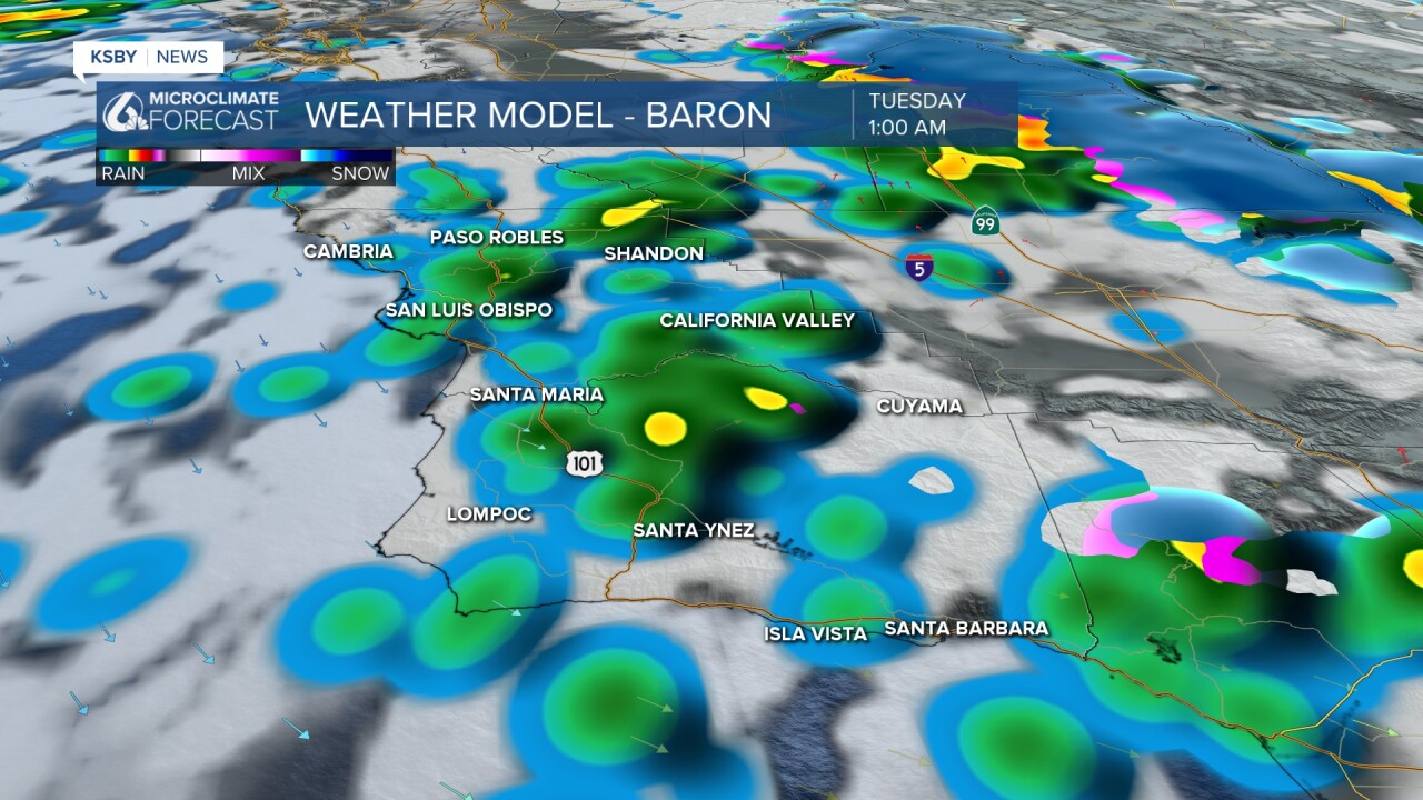
Below is the wave of possible downpours on Tuesday afternoon.

A High Surf Advisory continues through Friday at 10 pm. Large breaking waves 10-15 feet with local sets to 20 feet on Wednesday. Rip current risk is very high.
A Gale Warning continues until 8 am on Wednesday.

A Winter Storm Warning has been posting for the Santa Barbara County interior mountains from Tuesday night until Thursday morning. 1 to 4 inches of snow is likely between 3,500 feet and 4,500 feet.


The KSBY Weather team will continue to keep you posted through this stormy week with breaks in between waves.
-Jim
