


Happy Sunday, Central Coast!
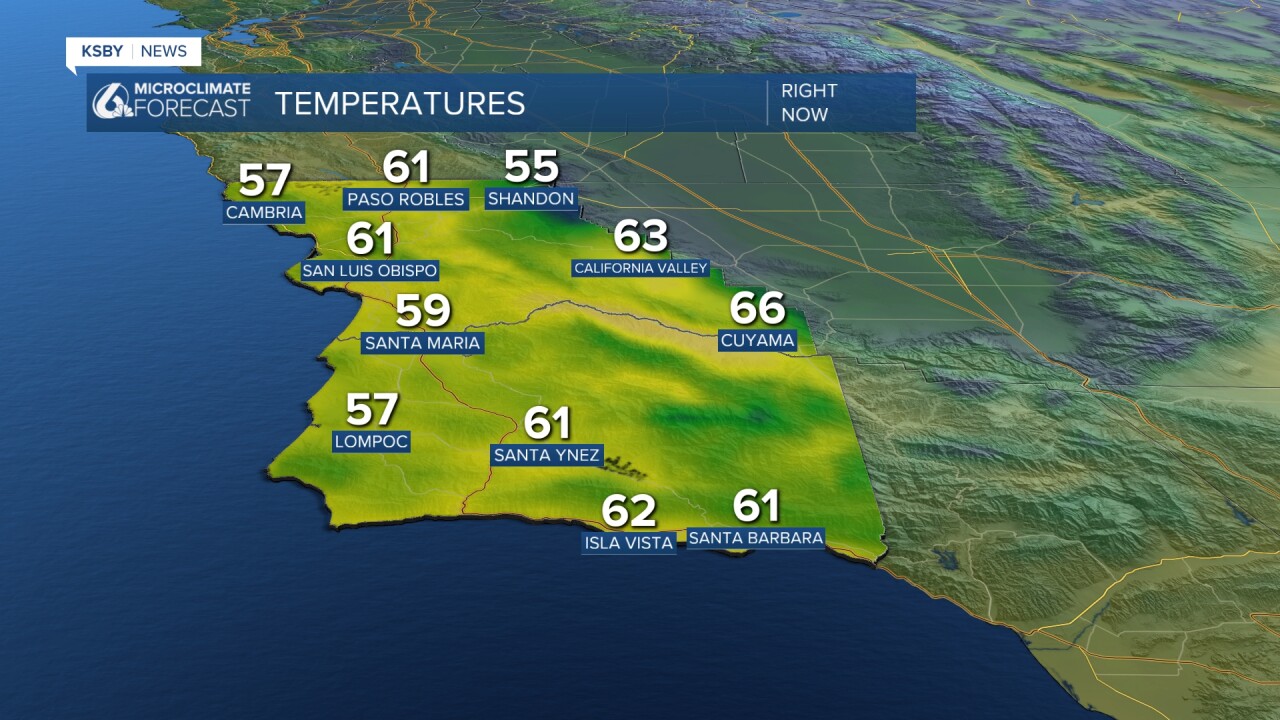
Our region is continuing to experience a cool-down in temperatures. Here are the temperatures we observed this Sunday at 4:20 PM.
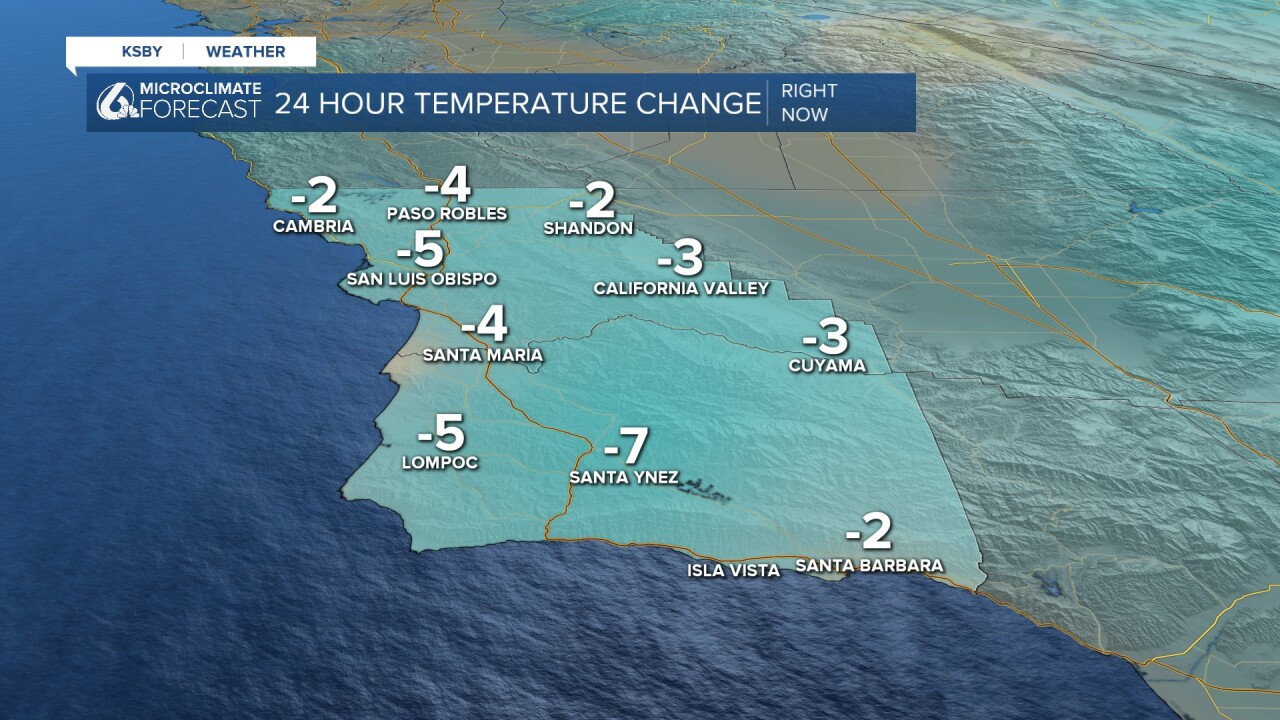
As previously mentioned, this cool-down is not drastic. Santa Ynez seems to be the location that experienced the biggest drop in temperatures, a 7-degree cool down in the last 24 hours.
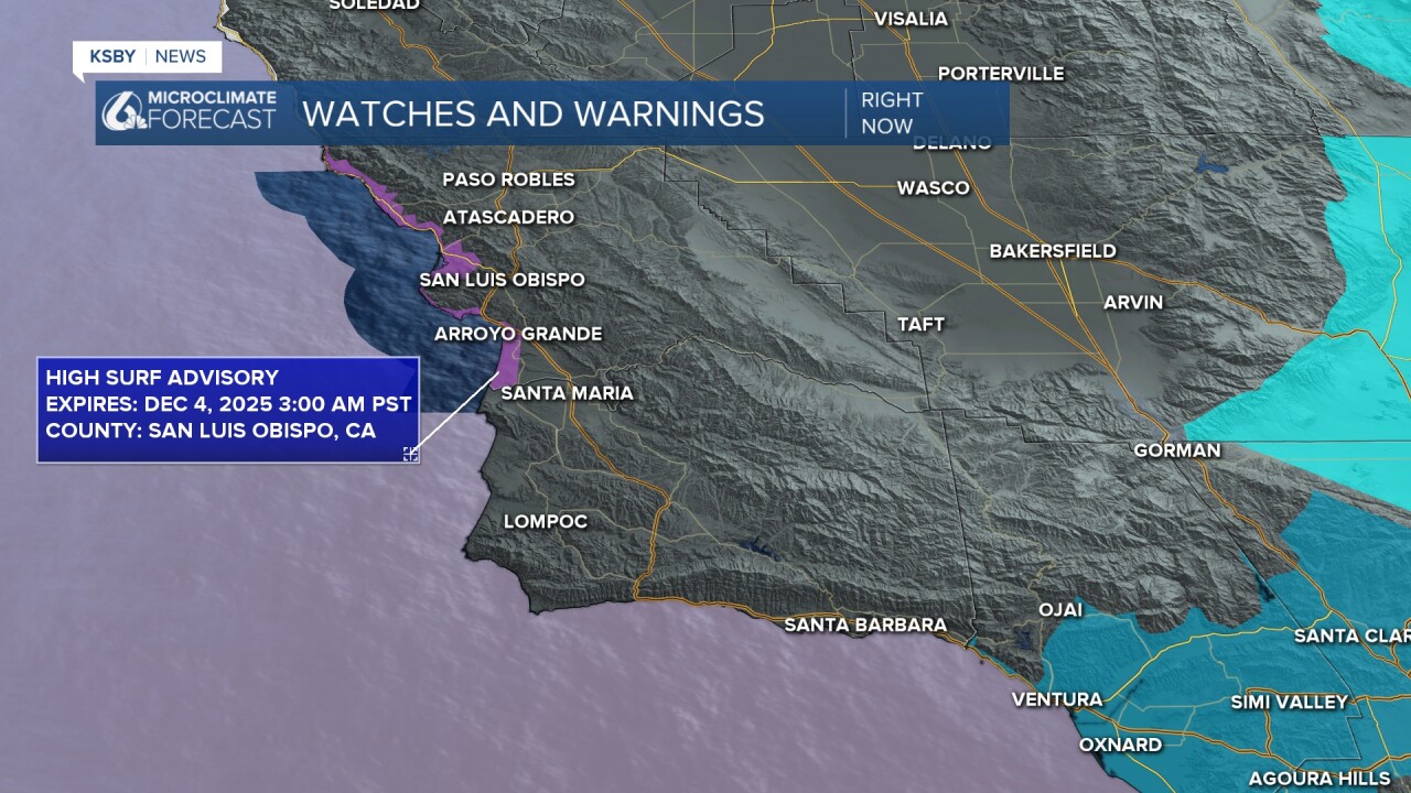
There are a few advisories in place for the Central Coast. Currently, the areas highlighted in purple are under a High Surf Advisory, which includes Avila and Pismo beaches. There is also a Small Craft advisory for the regions highlighted in the lighter purple, which ends Monday at 3:00 AM.
This Monday, we'll experience a minor increase in our temperatures. For example, Santa Barbara's Sunday high temperature was 65 degrees, and on Monday it will be 68 degrees. This warm-up will be short-lived.

Here is what you can expect for the remainder of the week. Starting Tuesday, we'll be making a return to the cooling-down trend.

There is a minor chance of some light rain on Wednesday through Thursday, mainly south of Point of Conception.

Enjoy your evening!
—Leslie Molina
_____________________________________________________________
¡Feliz domingo, Costa Central!
Después de un día de Acción de Gracias bastante cálido, este fin de semana comenzamos a observar un ligero descenso en nuestras temperaturas. La siguiente imagen muestra las temperaturas máximas registradas este domingo.

Antes de hablarles del clima para el lunes, quiero llamar a su atención a unas advertencias vigentes para la Costa Central. Una advertencia de oleaje fuerte está en efecto hasta el 4 de diciembre (zonas marcadas en morado oscuro). Durante este periodo eviten tomar riesgos innecesarios ya que hay un alto riesgo de ahogamientos.
Además, permanece en efecto hasta el 1 de diciembre una advertencia para operadores de embarcaciones pequeñas (zonas marcadas en morado claro).

Regresando al pronóstico: a partir del lunes veremos una pausa en ese descenso y observaremos un ligero aumento en las temperaturas. Además, las condiciones secas continuarán. La siguiente imagen muestra temperaturas que podemos esperar el lunes. El domingo la temperatura máxima en Santa Bárbara fue 65 grados, pero para el lunes se espera que suba a 68 grados.

Esto es lo que pueden esperar los próximos siete días. Ese ligero incremento menor de temperaturas será breve, porque el martes volveremos a observar un descenso.

A mediados de la semana laboral, de miércoles al jueves, hay una probabilidad de lloviznas al sur de la Punta de Concepción.

¡Buenas Noches!
—Leslie Molina
