



Good Tuesday evening from Meteorologist Jim Castillo
Here's your detailed weather outlook for San Luis Obispo and Santa Barbara Counties.
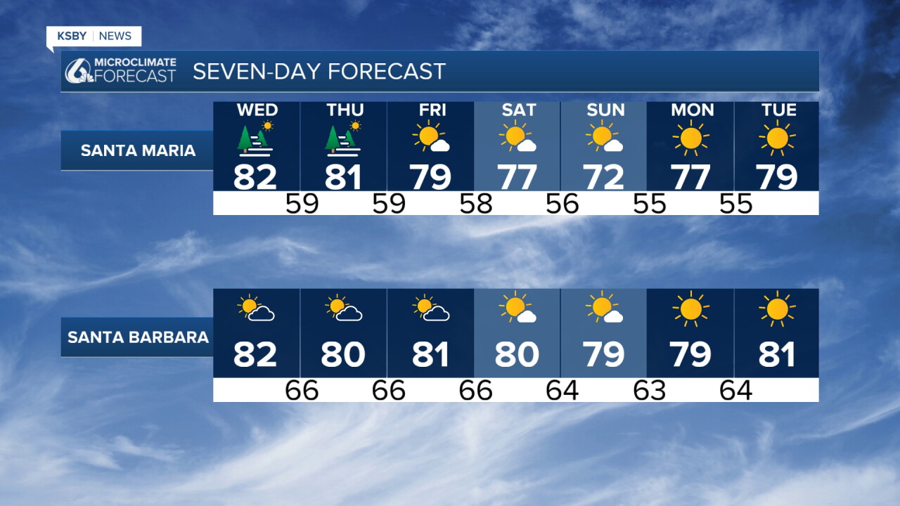
Wednesday: Peak Warmth Arrives
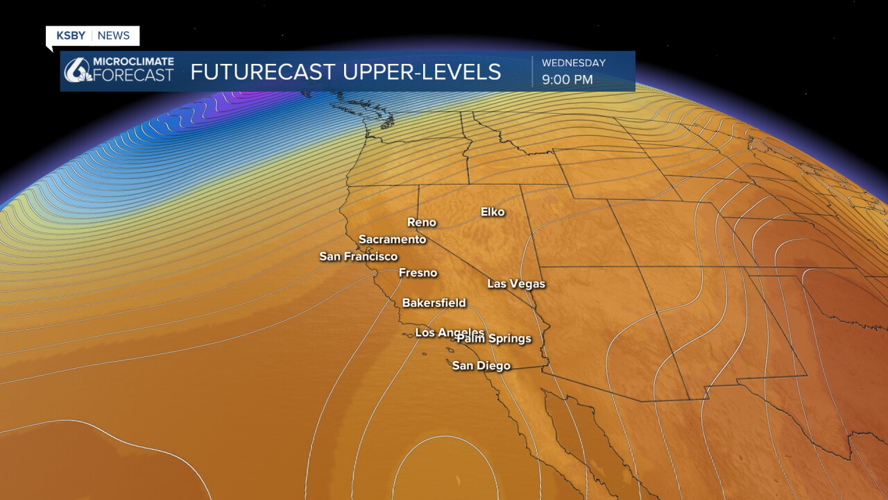
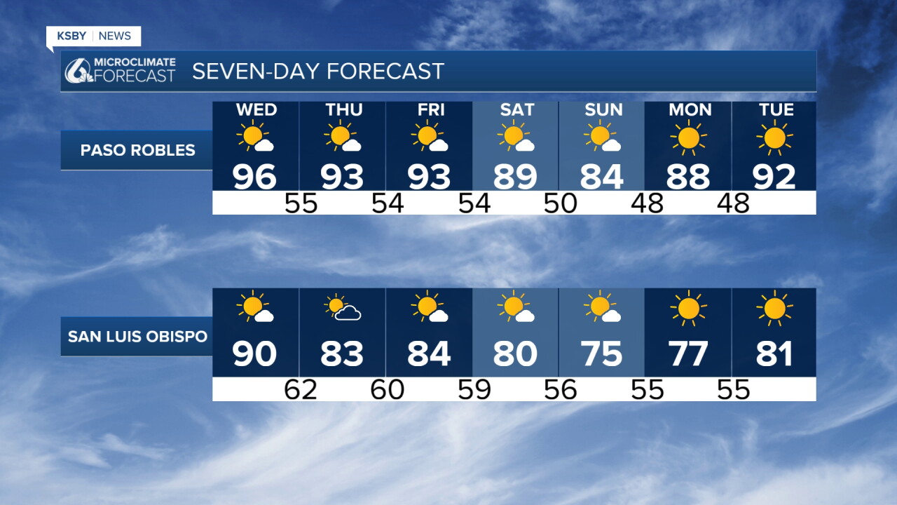
Wednesday will be the warmest day of the next seven as a small ridge of high pressure moves overhead. Expect weak offshore flow from both the east and north during morning hours, transitioning to only light onshore flow by afternoon. Morning low clouds will be very limited, staying mostly confined to the Santa Barbara County coastline.
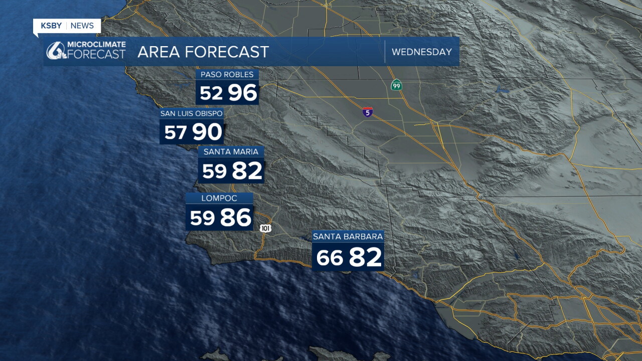
The combination of total sunshine, morning offshore flow, and the overhead ridge will drive maximum temperatures well above average. Some coastal areas will see temperatures reaching the 80s to near 90 in Avila Beach, while valley locations climb into the 90s. These readings will run about 10 degrees above normal for the Central Coast.
The good news: a dry air mass and light winds will allow for excellent evening and overnight temperature recovery, limiting heat impacts. No heat advisories are expected.
Thursday: Slight Changes Begin
Weak upper-level troughing returns with onshore flow, bringing an increase in morning low clouds along the coast. Despite this change, maximum temperatures will still remain above normal across the Central Coast.
Friday-Saturday: Gradual Cooling
Most areas will see maximum temperatures cool slightly Friday and Saturday. The best cooling will occur north of Point Conception, where the trough will have the greatest impact. Even with this cooling trend, temperatures will remain a few degrees above normal.
Sunday: Enhanced Cooling Expected
The most significant cooling will arrive Sunday across the region.
Monday: Return to Warming
Weak ridging and building offshore flow from the north returns Monday. There's a good chance of weak offshore flow from the east during morning hours as well. Expect a mostly sunny day with some warming, especially across the Central Coast. Breezy northerly winds are possible in interior areas prone to Santa Ynez Mountain wind effects.
Ocean Conditions Alert
Distant tropical cyclones to the south-southwest may send another round of swells and large surf with dangerous rip currents to south and southwest-facing coasts by late this weekend into next week. Increasing mid to high clouds are also possible well ahead of these systems. The deepest tropical moisture will likely track south and east of our area, from Baja California into Arizona and New Mexico.
Have a great night, Central Coast!
-Jim
