



Here is your Central Coast weather forecast for San Luis Obispo and Santa Barbara Counties from Meteorologist Jim Castillo
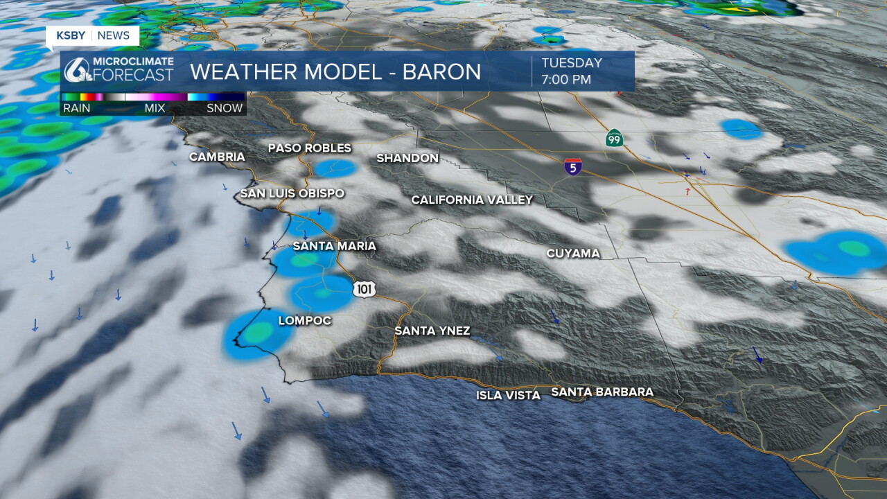
An upper-level low tracking across Northern California is dragging a mostly dry cold front through San Luis Obispo and Santa Barbara counties. Rain has been very spotty, and Election Day was cooler along the Central Coast. Clouds clear out tonight, with plenty of sun on Wednesday.
Offshore flow develops behind the exiting front. Expect northerly winds tonight through the Santa Ynez Mountains, extending toward the interior passes. Winds shift north-northeast Wednesday afternoon while staying below official advisory thresholds.
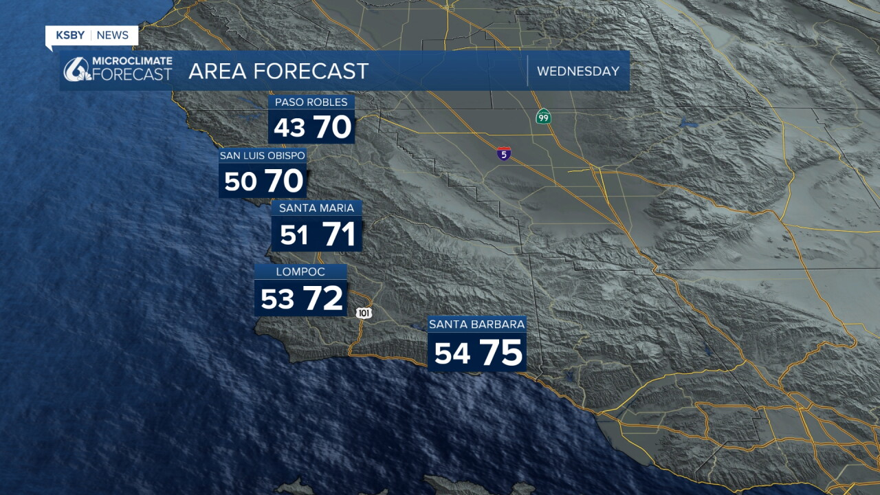
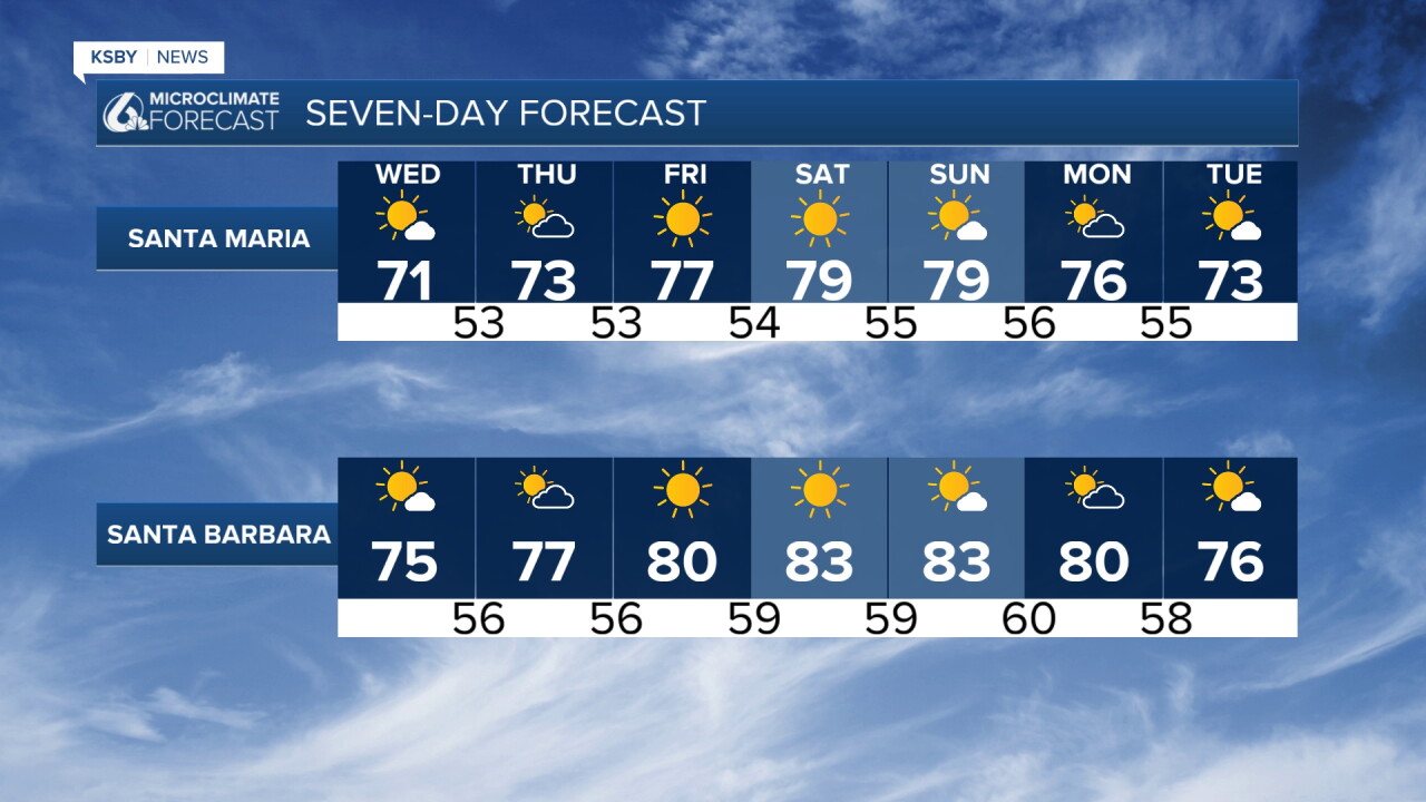
Typical November offshore flow will drop far interior valley temperatures a few degrees while coastal zones and valleys warm into the 70s Wednesday and Thursday.
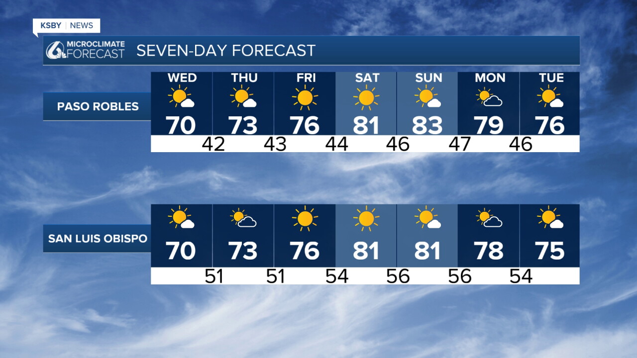
Stronger high pressure builds from the north and east, generating stronger offshore wind gusts across the Santa Ynez and Santa Lucia ranges. Low-level wind advisories may be needed for portions of the Central Coast as temperatures warm Friday through the weekend.
Friday through Sunday Peak Warmth and Winds: The strongest offshore surface pressure gradients align with an upper-level ridge pushing into California. Clear skies, strong compressional heating, and persistent upper-level wind support will push afternoon highs into the lower 80s across most coastal areas and interior valleys in San Luis Obispo and Santa Barbara counties.
Early Next Week Cooling Trend: A large upper-level low develops under the ridge on Sunday and moves east by Monday. This shift significantly relaxes the offshore surface flow and lowers heights aloft, triggering a gradual two-day cooling trend through Monday. Despite the slight cool-down, temperatures remain well above average for mid-November.
Later next week, a strong Pacific jet stream will bring some more rain chances to the Central Coast.
Have a great night, Central Coast!
-Jim
