



Good Tuesday evening from Meteorologist Jim Castillo
Here is your forecast for San Luis Obispo & Santa Barbara Counties
IMMEDIATE CONCERNS
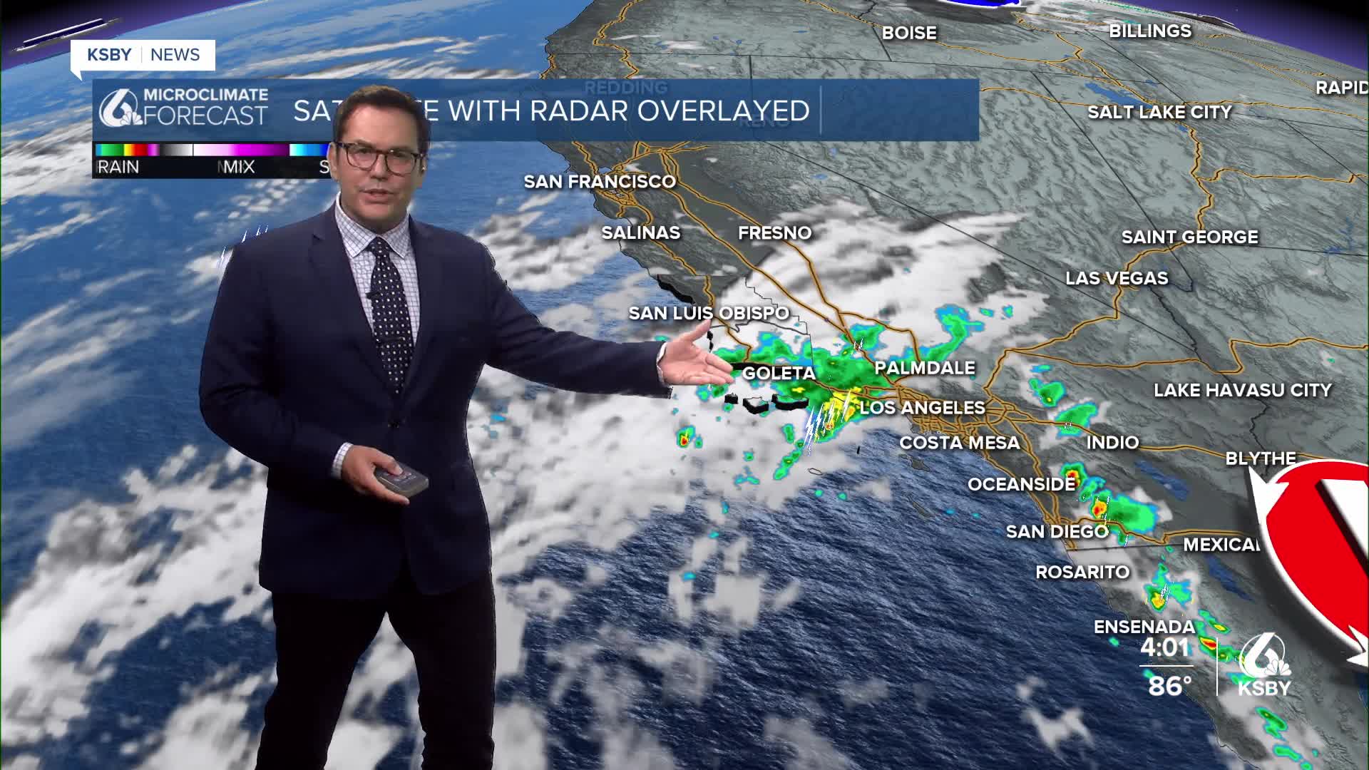
Isolated showers and some rumbles of thunder are possible through the early evening as moisture from tropical systems moves northward. While lightning is possible, rainfall amounts remain low with minimal flood concerns. Activity should dissipate by early evening. Most of the activity has been around Santa Barbara County.
Dangerous Surf Conditions A significant southerly swell continues bringing hazardous surf conditions to Central Coast beaches through Thursday in spots along the coast. Beachgoers should exercise extreme caution and stay well back from the water's edge.
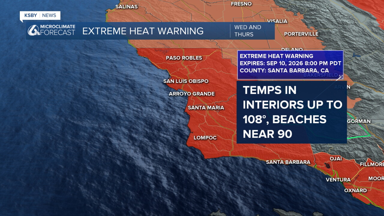
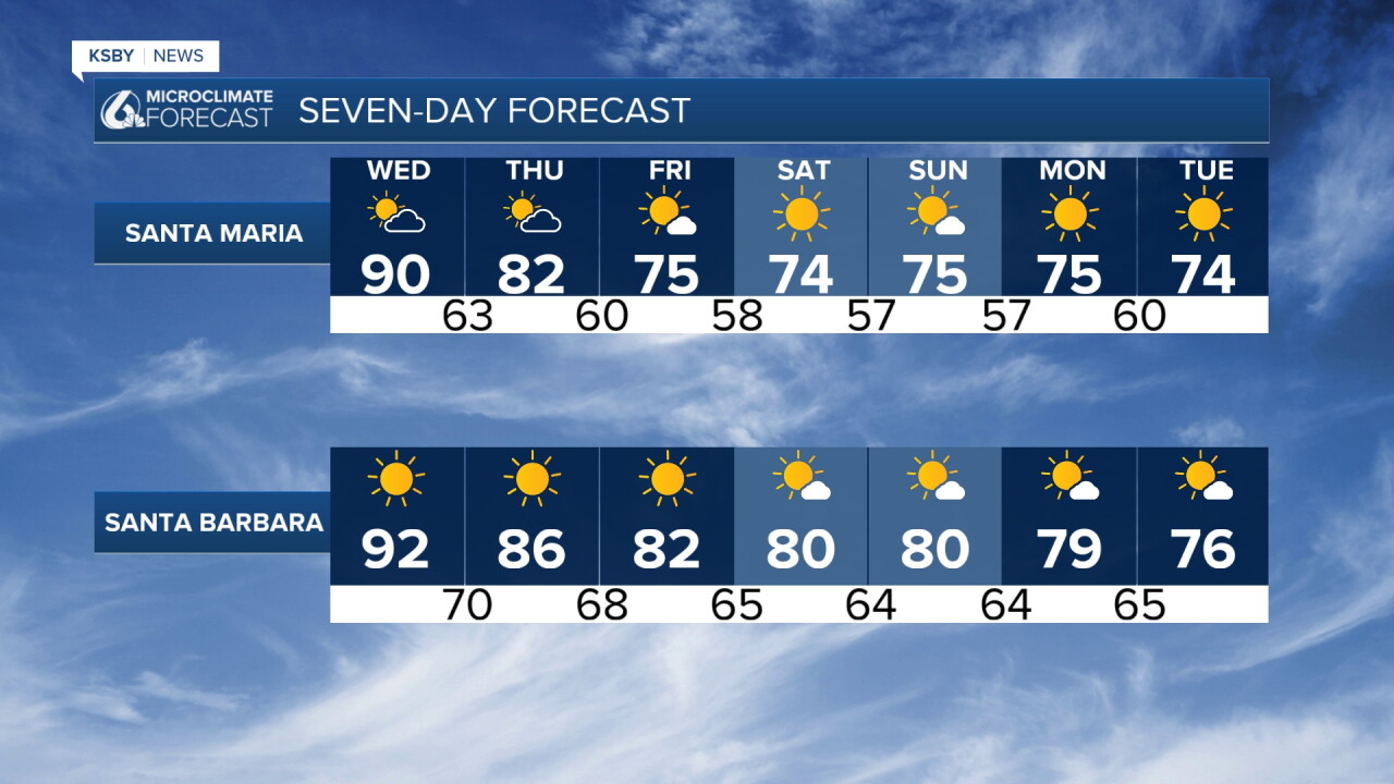
Extreme Heat Warnings have been issued for Wednesday through Thursday across both counties. This dangerous heat event will create moderate to major impacts, from the beaches to the coastal valleys and interior valleys.
WEDNESDAY - PEAK HEAT DAY
Wednesday will be the hottest day of this heat event. Upper level high pressure reaches maximum strength while weak offshore pressure gradients dominate morning hours.
Temperature Forecast:
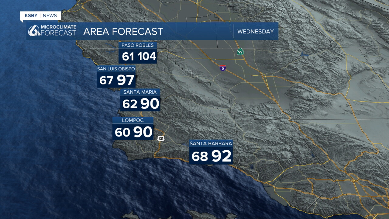
Beaches near 90
Coastal Valleys 93 to 102
Interior valleys 102 to 108
THURSDAY - STILL HOT
The upper level high weakens slightly and onshore pressure gradients strengthen, providing some relief but temperatures remain dangerously hot.
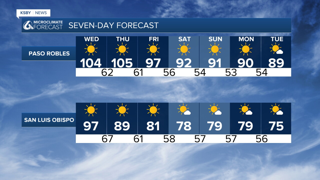
Temperature Forecast: A few degrees cooler
Overnight lows both nights will remain warm. Some areas only dropping into the 60s and low 70s.
FRIDAY - SIGNIFICANT RELIEF
High temperatures cool 4-8 degrees across all areas, greatly reducing heat risk concerns. Onshore flow strengthens, bringing much-needed relief to the Central Coast.
WEEKEND & BEYOND
Benign weather returns with mostly clear skies and comfortable conditions. Marine layer may return to coastal areas during night and morning hours. Temperatures will run 3-6 degrees below normal with decreasing atmospheric moisture creating pleasant conditions across San Luis Obispo and Santa Barbara Counties.
WIND CONCERNS
Locally gusty conditions possible across the Santa Lucia Range Wednesday morning as pressure gradients shift.
HEAT SAFETY REMINDERS
Never leave kids or pets in vehicles
Stay hydrated and seek air conditioning if at all possible
Limit outdoor activities during peak afternoon hours
Check on elderly neighbors and relatives
This heat event represents a serious threat to public health across the Central Coast. Take all necessary precautions and heed all warnings from local emergency management officials.
Have
