


Good Wednesday evening, Central Coast!
Thursday: Still some areas in the 70s as high pressure shifts east, with increasing marine layer and coastal fog in the morning, and mostly cloudy, but we stay dry.
Friday: Significantly cooler (10+ degrees) with highs in the 60s, deepening marine layer reaching coastal valleys
Weekend (Friday-Monday):
- Two low-pressure systems are moving through California from Friday through Sunday
- Showery, unsettled weather with potential thunderstorms
- Better thunderstorm chances along the Central Coast due to colder air aloft
- Very showery/intermittent precipitation typical of spring storms
- Mixed conditions - periods of heavy rain alternating with dry, sunny weather
Next Week (Sunday-Wednesday):
- Weekend remains cool and showery
- A particularly cold upper low (534 dam) will sweep through by late Sunday
- Average rainfall is about 0.5 to 1.50 inches over 3 days, but highly variable due to the convective nature of the rain
- Snow levels are around 6,000 feet through the Los Padres National Forest
- Temperatures below normal, but still in the 60s
- Dry northwest flow returns Monday with clearing skies and gradually warming temperatures

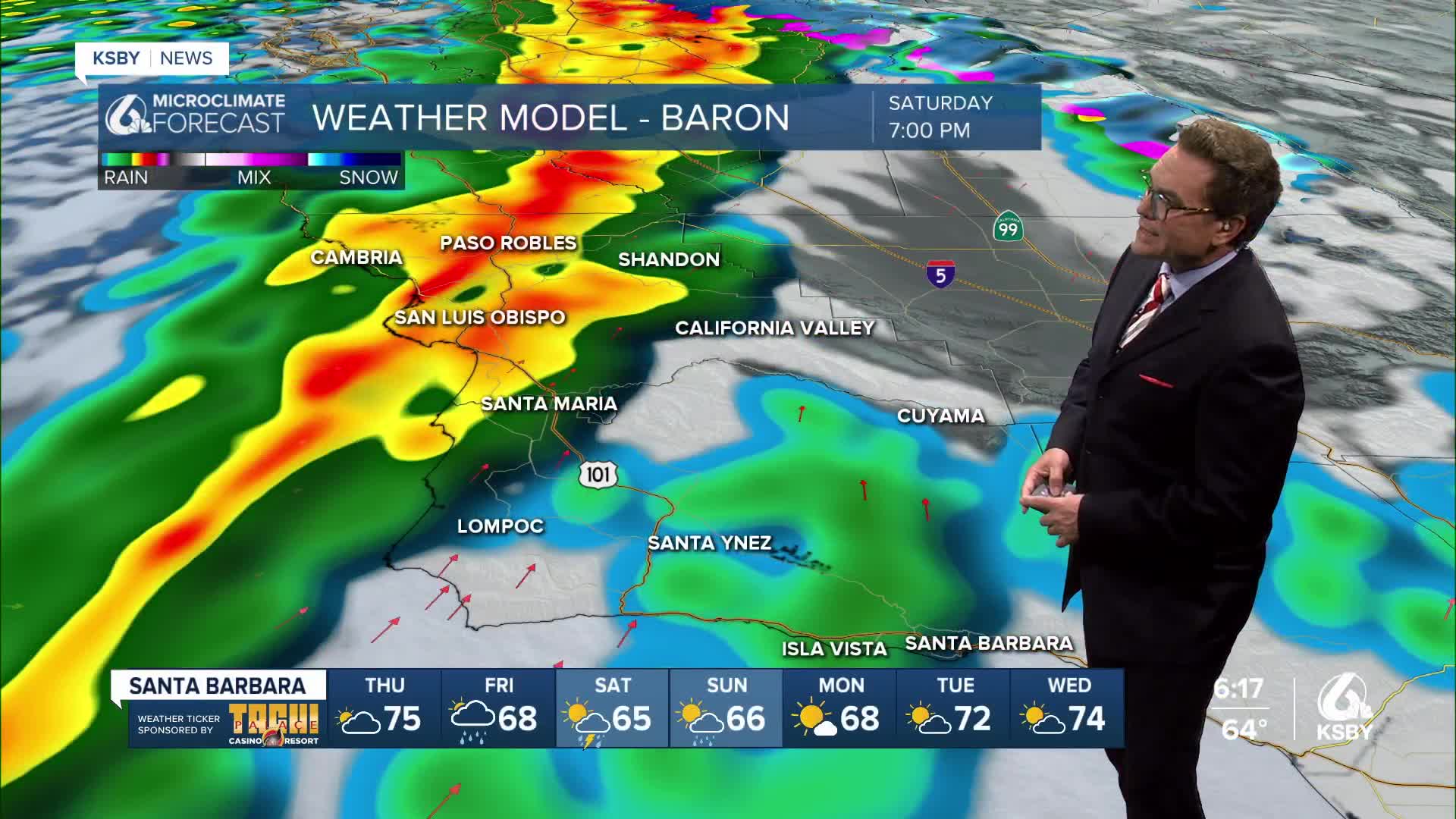
Below is Saturday night, when we see more of a ramp-up in the potential for heavier showers and scattered thunderstorms.

Below is one weather computer model prediction for the Friday through Sunday rainfall totals. If we see more thunderstorms, the totals will be higher.

Below are the future wind gusts for Saturday as the stronger of the two low-pressure systems moves in off the Pacific Ocean.


Have a great night, Central Coast!
-Jim
