


Good Monday evening, Central Coast!
High temperatures on Monday were above average as high pressure builds into the area.

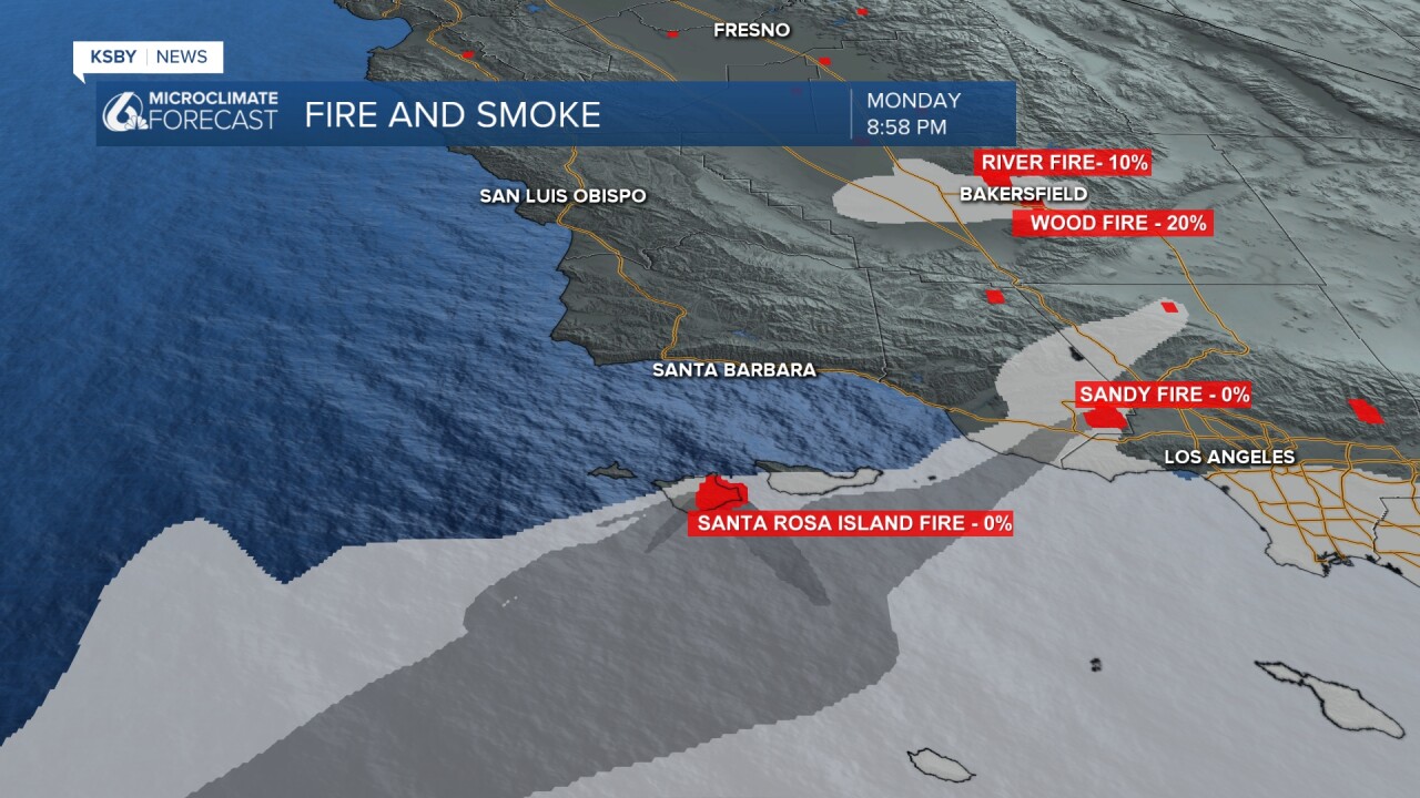
4 significant fires, 2 east of San Luis Obispo Co. and 2 south of Santa Barbara Co. - Update link to all fires click here
River fire 2,331 acres burned and 10% containment east of Bakersfield in Kern Co.
Wood fire 294 acres burned and 20% containment southeast of Bakersfield
Sandy fire 1364 acres burned and 0% containment in Ventura Co.
Santa Rosa Island fire 14,600 acres burned (obviously the largest) and 0% containment
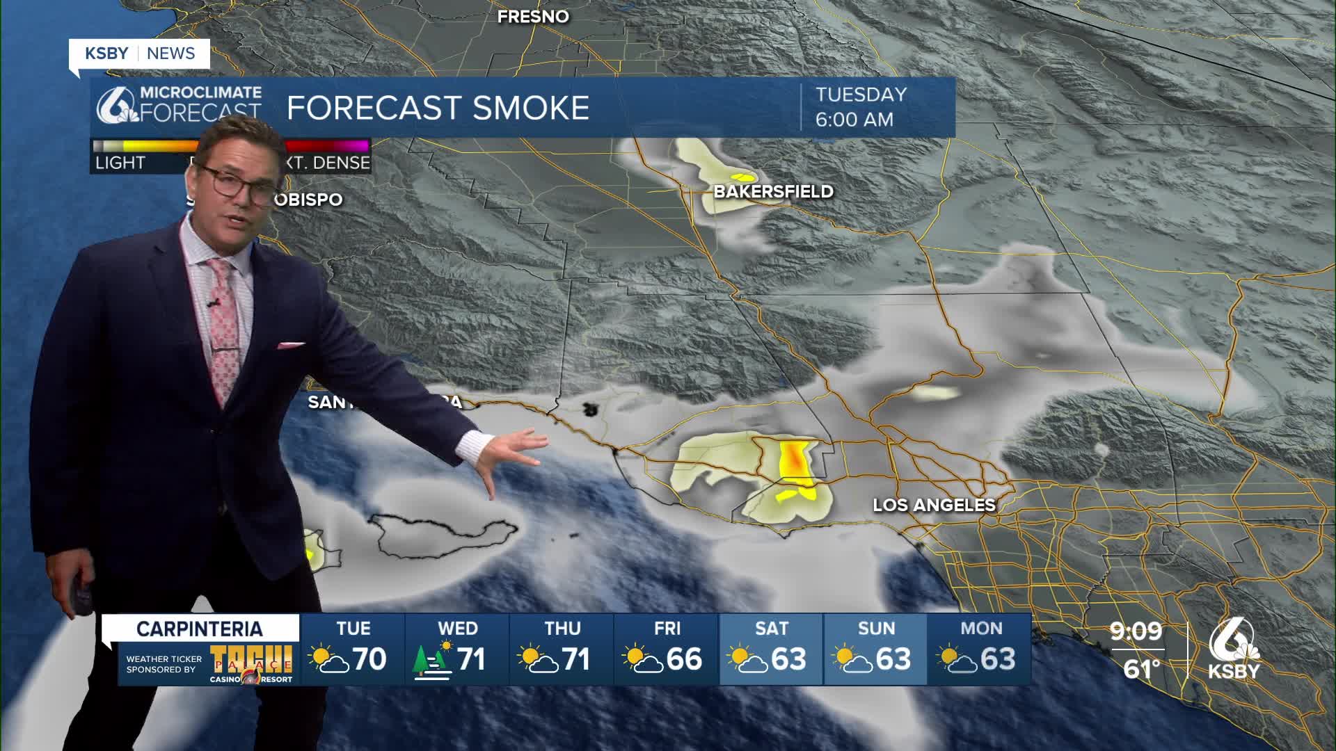
Below: Some of our weather models are showing possible smoke for the south coast of Santa Barbara County starting Tuesday morning. We will keep an eye on the air quality in that area.

The Sandy Fire in Simi Valley demonstrated how quickly grass fires can spread under Santa Ana wind conditions.
Otherwise, TONIGHT THROUGH TUESDAY Mostly clear with offshore winds, and they will continue through Tuesday afternoon. These northeast winds will create elevated fire weather conditions.
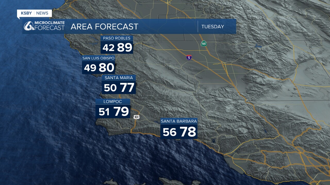
PEAK WARMTH Wednesday will mark the warmest day of this weather pattern. High temperatures will climb into the 80s across both coastal and interior valleys of San Luis Obispo and Santa Barbara counties. Coastal areas will see temperatures in the 70s.
The wind pattern will shift dramatically on Tuesday afternoon as onshore flow begins to develop. This onshore flow will become increasingly prominent on Wednesday and strengthen further on Thursday, initiating a cooling trend for areas on the coastal side of both the Santa Lucia and Santa Ynez mountains.
The marine layer has been notably absent, but that will change. The first possible return of night and morning low clouds and fog could occur Wednesday morning, though Wednesday night into Thursday morning is more likely as onshore flow becomes more established. By Thursday night into Friday morning, expect all coastal areas and even some lower valleys in both counties to become entrenched in marine layer cloud coverage.
EXTENDED OUTLOOK The forecast period will remain relatively quiet with weak winds aloft. A slight temperature decrease is possible on Friday and Saturday, but overall day-to-day changes will be minimal.
A more robust marine layer pattern will establish itself, developing each night through morning. Some coastal areas may struggle to clear each day. Marine layer clouds will attempt to move into the coastal valleys by the weekend as onshore flow continues to increase and then remains steady through Monday.
Fire weather concerns remain elevated through Tuesday across all elevated terrain due to the offshore wind pattern and continued dry conditions.

Wave heights have gone down since the weekend, to 4 to 6 feet on average tonight.


Have a great night, Central Coast!
-Jim
