

Happy Saturday, Central Coast!
We've had some foggy conditions in our coastal communities, while our interior valleys have not. We've seen a good amount of temperature variation across our region this Saturday! Despite the fog making it look a bit gloomy for a few communities, we're still experiencing above-average temperatures. Temperatures will peak on Sunday and will be followed by a cool down that will bring us closer to the temperatures we typically see for this time of year.
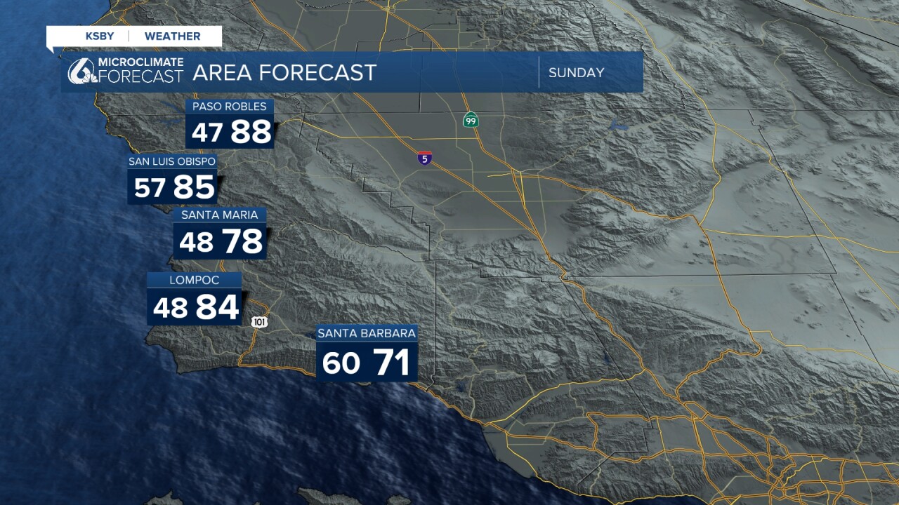
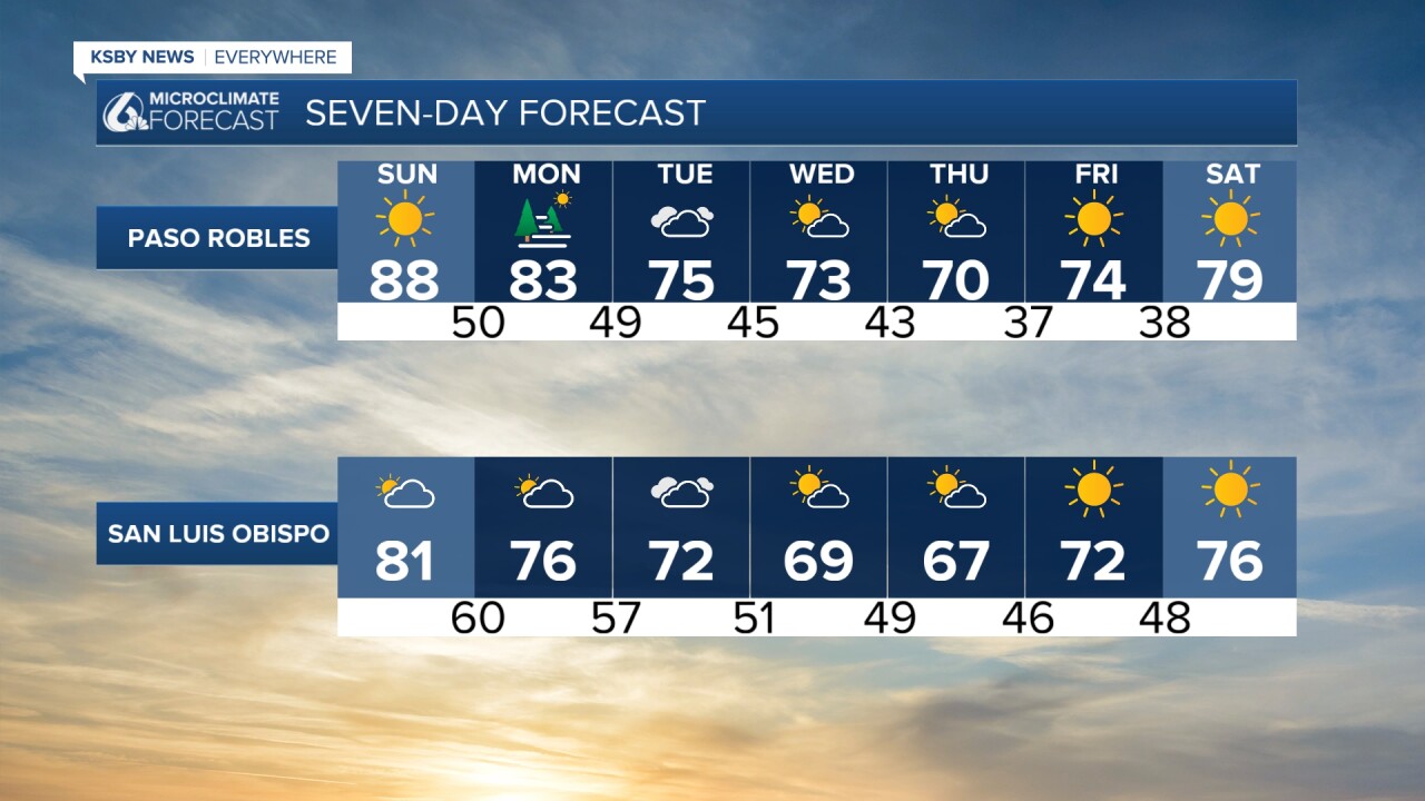
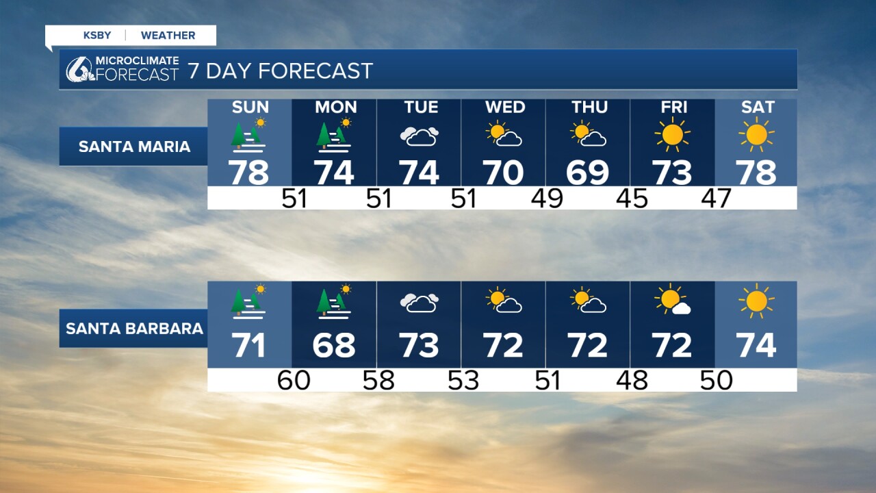
Here is a look at our seven-day forecast! We could see some pockets of dense fog for many communities on Saturday night. It looks like that marine layer could be sticking around for most of the week.
Now, the big story outside of the cool-down is those rain chances we've been talking about for most of the week. As of this Saturday, it seems like those rain chances have turned to at most some possible showers sometime Tuesday. If we're being generous, it's looking like anywhere from 0.10 to 0.25 inches.
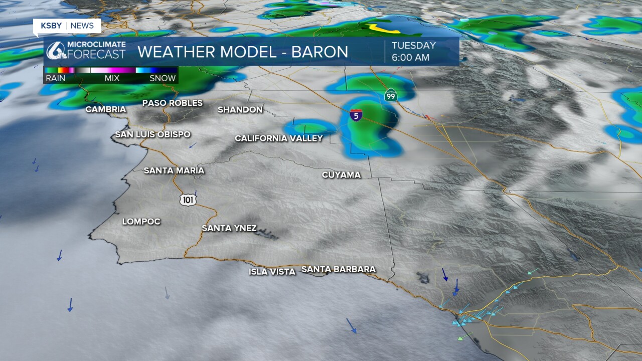
Our models are showing a growing, decreasing chance of substantial rain. Still light showers and a cool-down are much welcomed after this period of prolonged heat. Here is what one of our more generous models is showing us as of 8:00 PM. We could see some light showers on Tuesday morning in northern SLO County.
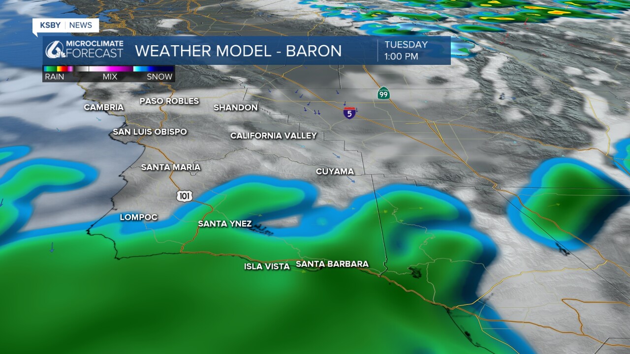
This is what conditions are predicted to look like on Tuesday afternoon. By Wednesday, these showers are expected to be done.
This is quickly changing, and we'll be keeping you informed. Enjoy the rest of your evening!
-Leslie Molina
