

Happy Saturday, Central Coast!
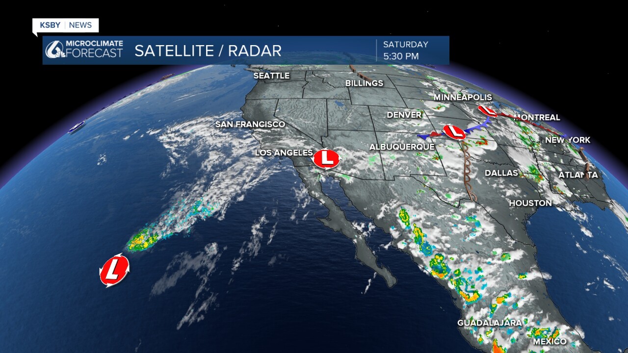
Let's talk about what happened weather-wise today. If you were outdoors, despite the slightly warmer temperatures, you might have noticed a few brief scattered showers in the evening. Especially in the Five Cities or San Luis Obispo area! The reason for this is pictured in the image below. This moisture was the remnants of Tropical Storm Douglas.
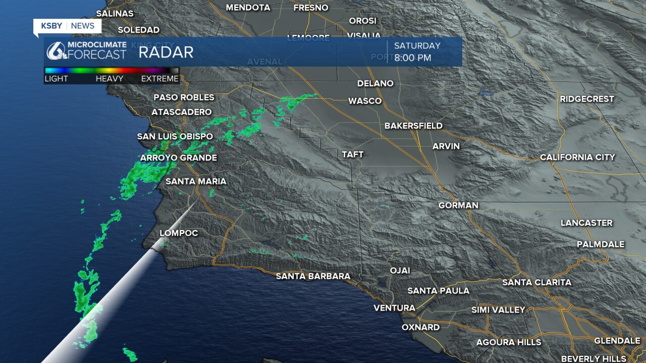
Here is a closer look at the brief band of showers around 8:00 PM! I will mention that there is still a minor, a 5 to 10 percent chance of brief showers or thunderstorms this evening and overnight, mostly over areas north of Point Conception.
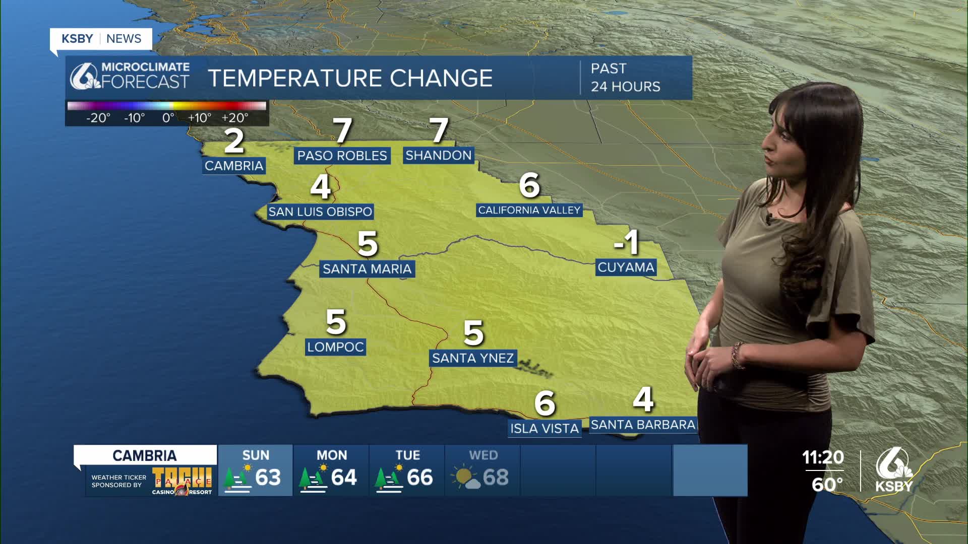
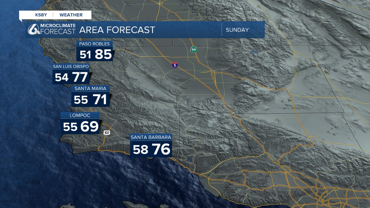
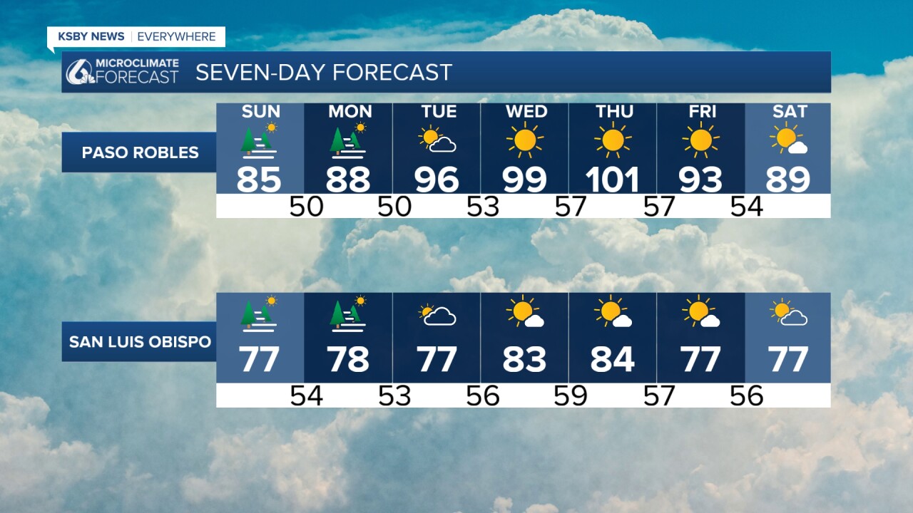
Other than that, onshore flow will continue to bring low clouds to the coasts and coastal valleys each night through morning. Temperatures will take a slight dip on Sunday, but still trend warmer than what we saw in the past week.
Temperatures will once again increase on Monday and continue through Thursday. We could experience a return to above-normal temperatures in some areas, meaning there is a chance some heat advisories could pop up midweek as a result.
Enjoy the rest of your evening!
— Leslie Molina
