


Good Wednesday evening, Central Coast!
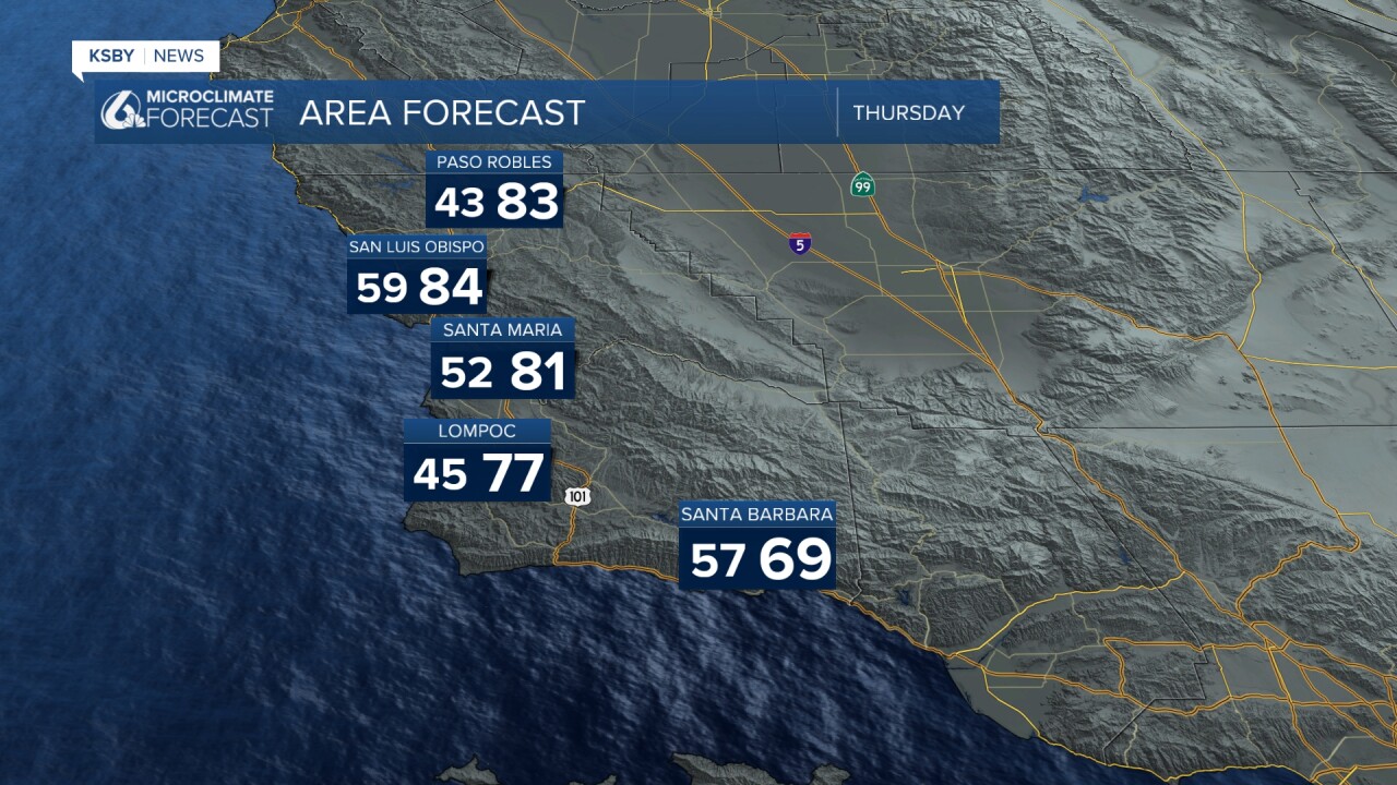
LOW / HIGH official for Wednesday 3/25/26
San Luis Obispo 51/81 norms are 45/67
Santa Barbara 58/63 norms are 47/67
Paso Robles 42/86 norms are 40/69
Santa Maria 48/74 norms are 45/67
Here's the Central Coast Forecast for Santa Barbara & San Luis Obispo Counties:
Temperatures will remain above normal across inland valleys through the weekend, while the marine layer keeps coastal areas mainly south of Point Conception on the cooler side through Thursday. Expect conditions similar to recent days, coastal fog in the mornings with some 80s inland, before light offshore flow returns for the weekend. Increasing northerly winds across the mountains, particularly in Santa Barbara County, will drive a warming trend from Friday into Saturday. Saturday will be the warmest day, with a chance of broken temperature records.
Sunday stays warm, though coastal areas may see an earlier sea breeze. A cooling trend begins in earnest on Monday and continues through next week. Rain is becoming more likely Tuesday and Wednesday, with the best timing window Tuesday, though it could arrive as early as late Monday night. Current estimates suggest most areas would see a quarter to a half-inch of rainfall. Lets hope for the rain and I will keep you posted.
Below: Rain chances are looking more likely by Tuesday.

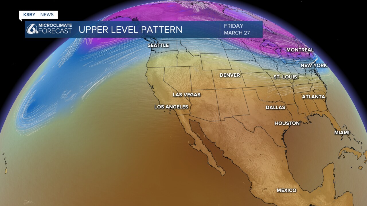
Below is a snapshot of the upper-level winds with a ridge of high pressure keeping the Central Coast warm through the weekend as the Jet Stream stays up into the Pacific Northwest.
Below is a snapshot of Tuesday's upper-level winds with the Jet Stream taking a dip south of the Central Coast with cooler temperatures and rain chances.


Have a great night, Central Coast!
-Jim
