



Good morning, Central Coast!
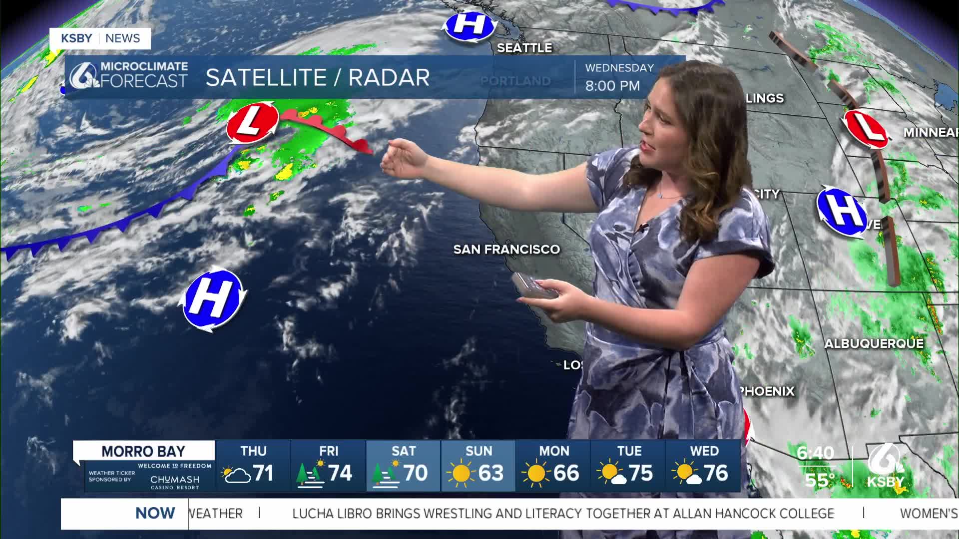
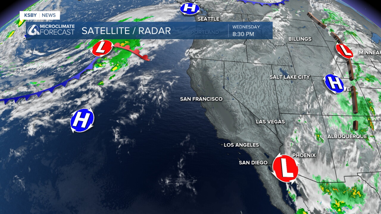
Wednesday brought temperatures flirting with triple digits to the region alongside some gusty winds that caused concern for the firefighters along the Grade Fire. Much of that warmth was due to a high pressure system sitting to our West that brought the warmer weather. Today though it is pushing back West and will allow for some cooling for beaches and coastal valleys. It will still be hot in the interior valleys.
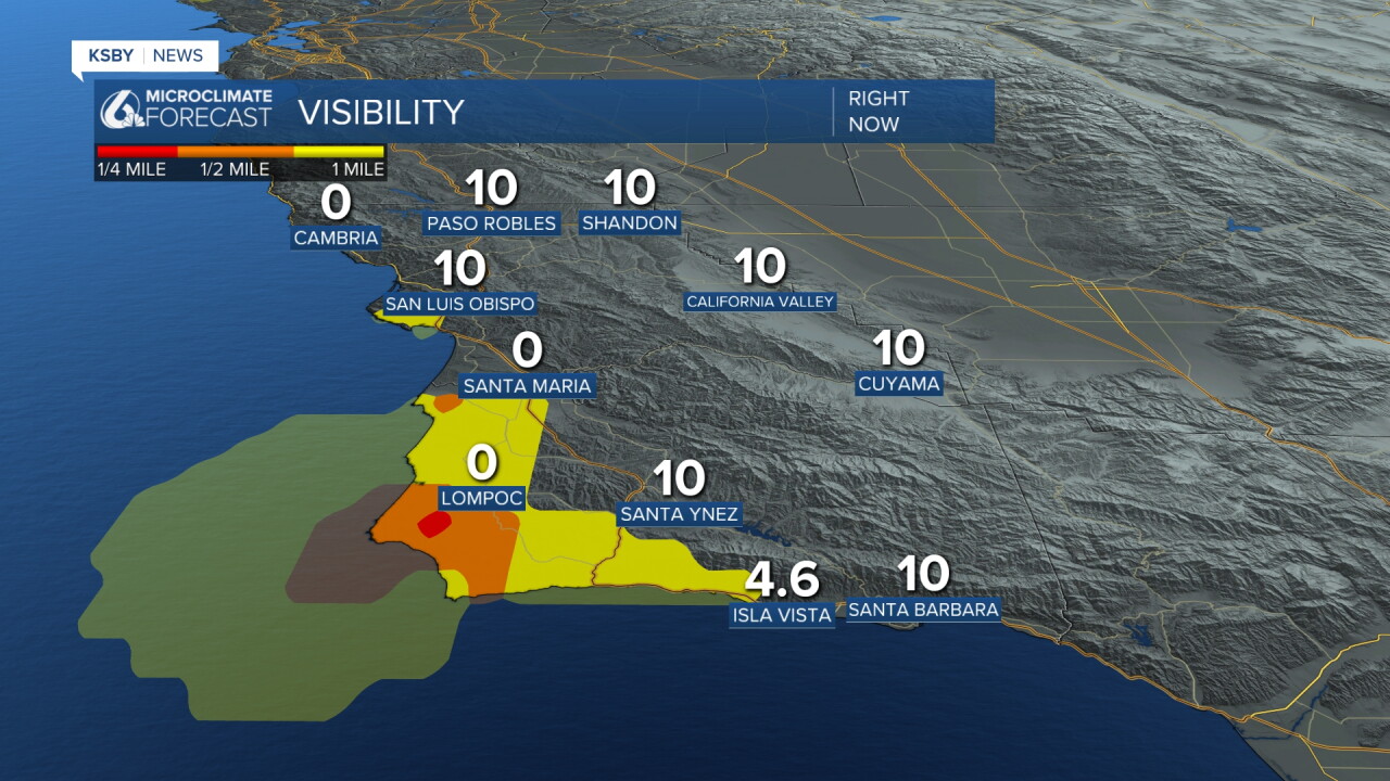
Despite the afternoon sunshine we will see some fog Thursday morning. Take caution if your morning commute runs into lowered visibility.
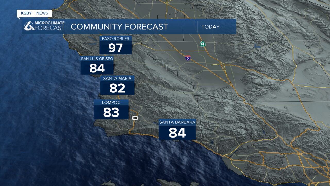
Because that high pressure is still close by high temps in the interiors will stay hot. Upper 90s and some triple digits are expected for interiors. Coasts will see temps fall a few degrees (as compared to Wednesday) but will still stay above normal for this time of the year.
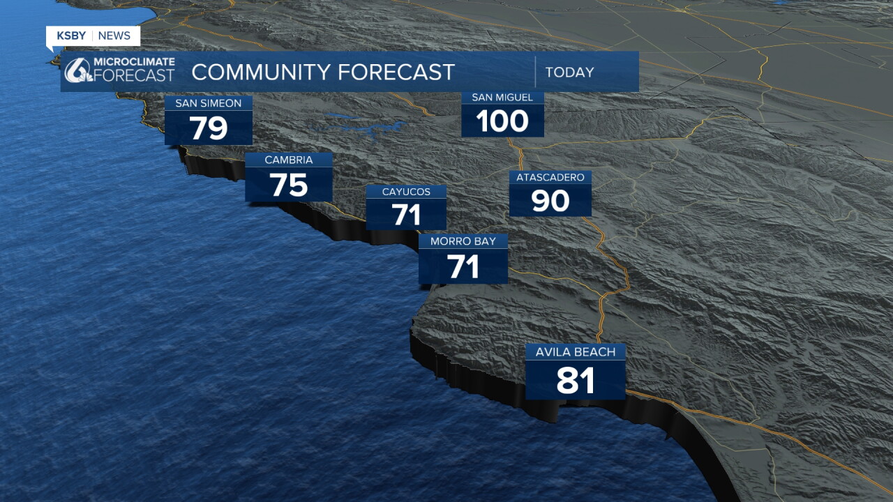
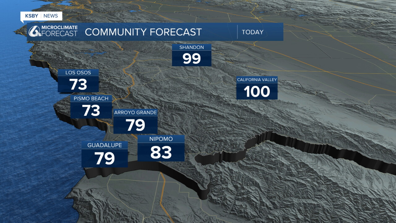
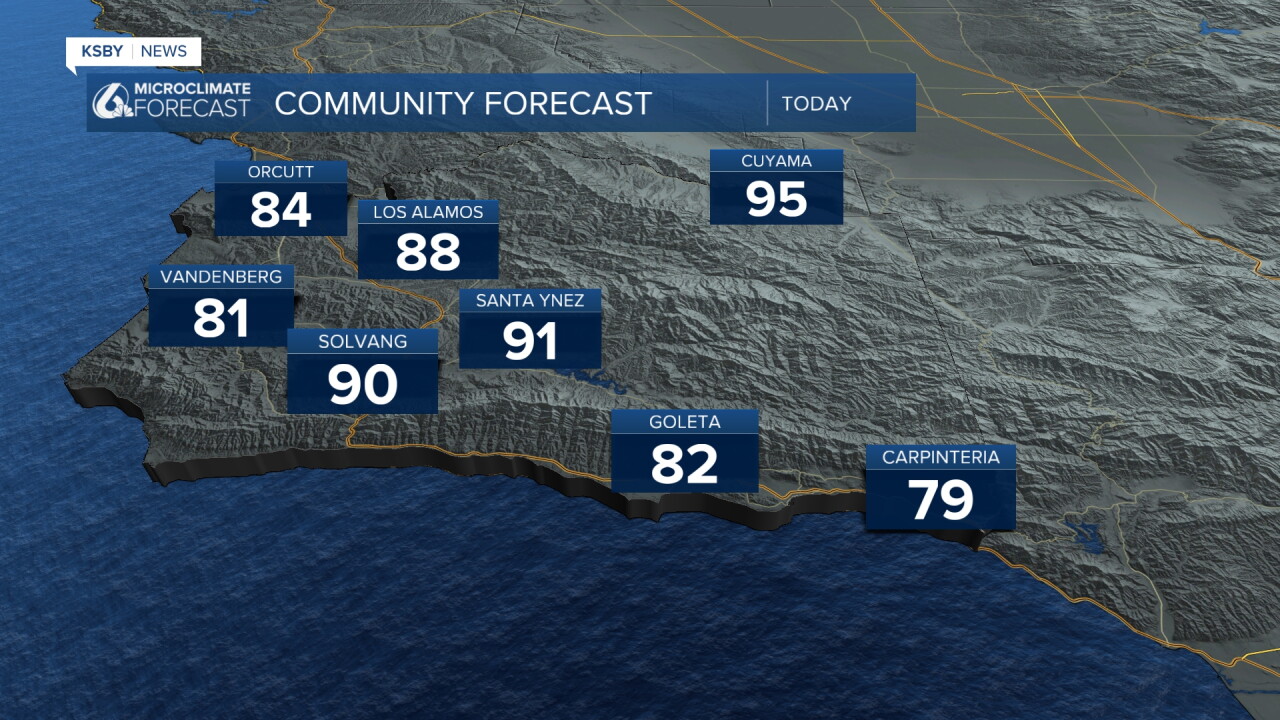
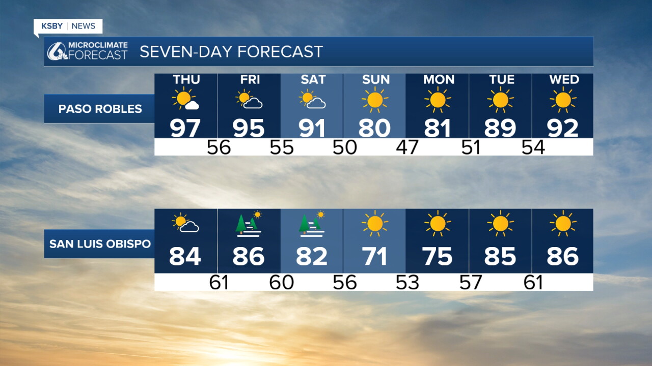
Temps will fall a few degrees into Friday and Saturday but late Saturday the bigger change arrives. A cold front will push through and will drop temps ten degrees for most spots. Here is what that looks like on the 7 day forecast!
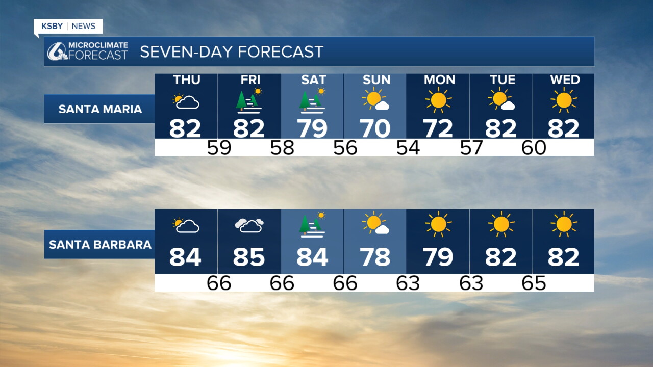
Have a wonderful day, Central Coast!
-Vivian
