

Good morning, Central Coast!
As we kick off our Monday morning, it is a cooler and cloudier one across the region. That is compiling on top of the time change, which may be causing a slow start to the morning.
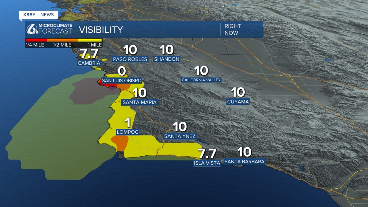
The fog won't last too long, mainly along the western beaches, limiting visibility through the next few hours.
Once the fog clears our we can expect sunny skies but still a cooler day. That is thanks to a low-pressure system sitting just to our south. That is bringing rain into Southern California and the Desert Southwest today.
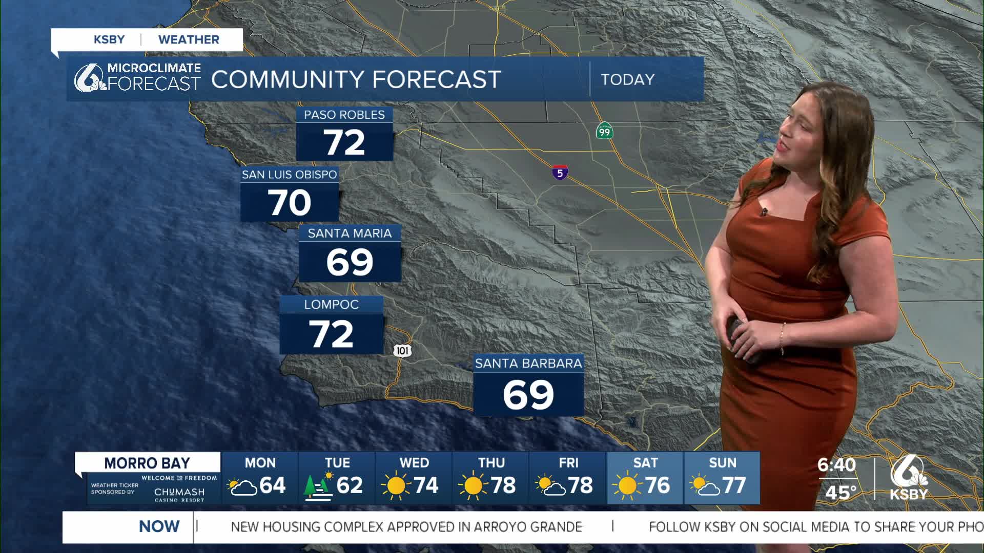
For us, it just means cooler weather. Temps will only reach the low 70s and upper 60s today. Here is a look at the daytime highs.

Tuesday will be even cooler with widespread fog and another cool day.
The cooldown won't last too long, though. Wednesday morning, high pressure will return, and temps will soar. Mid 80s are expected to end the week, and some spots may even see highs in the 90s on Thursday.
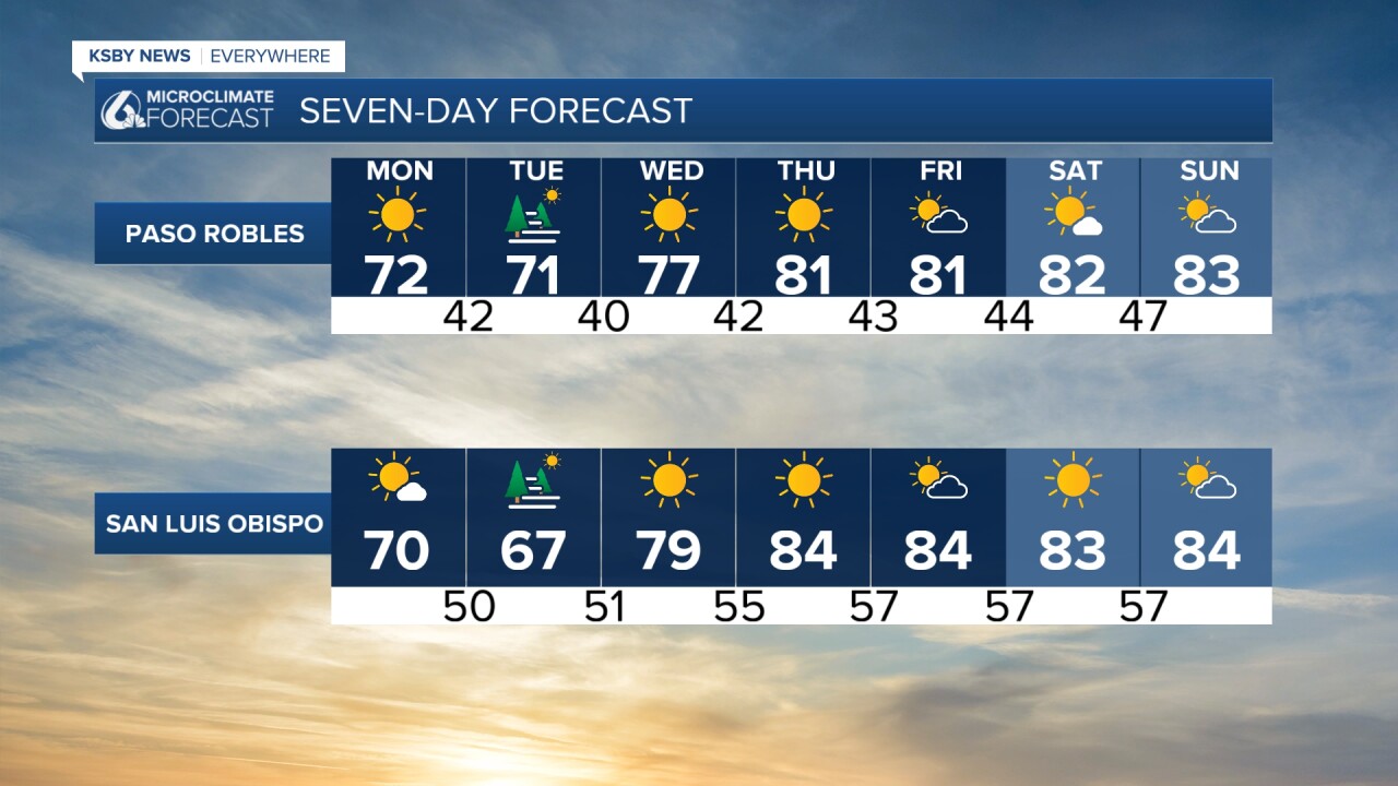
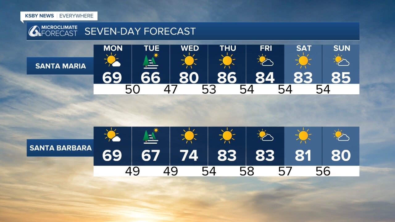
Even into the extended forecast, we can expect the warm (bordering on hot) weather to continue. Abundant sunshine and much warmer-than-average weather will last through next week.
Have a wonderful day and week ahead, Central Coast!
-Vivian
