


Good morning, Central Coast!
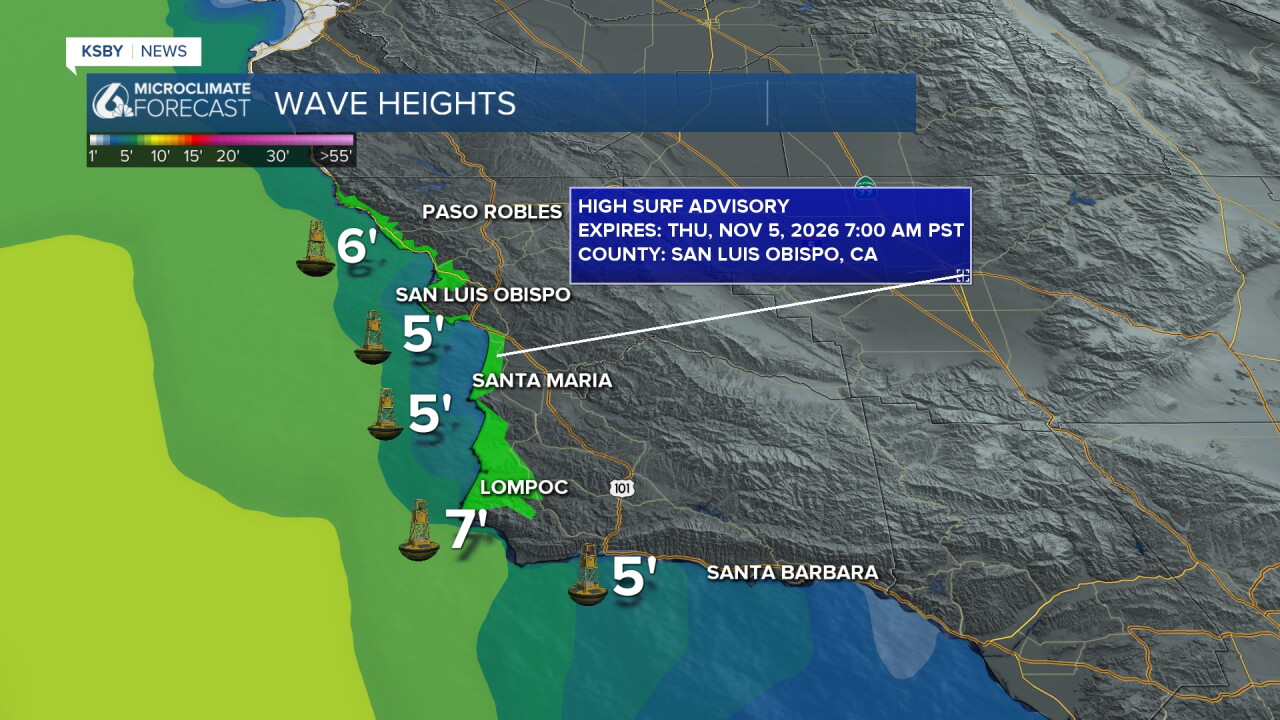
As we kick off our morning, there is a high surf advisory in place for our western beaches. It will clear by 7 a.m. but there is rip current risk in place through the end of the week.
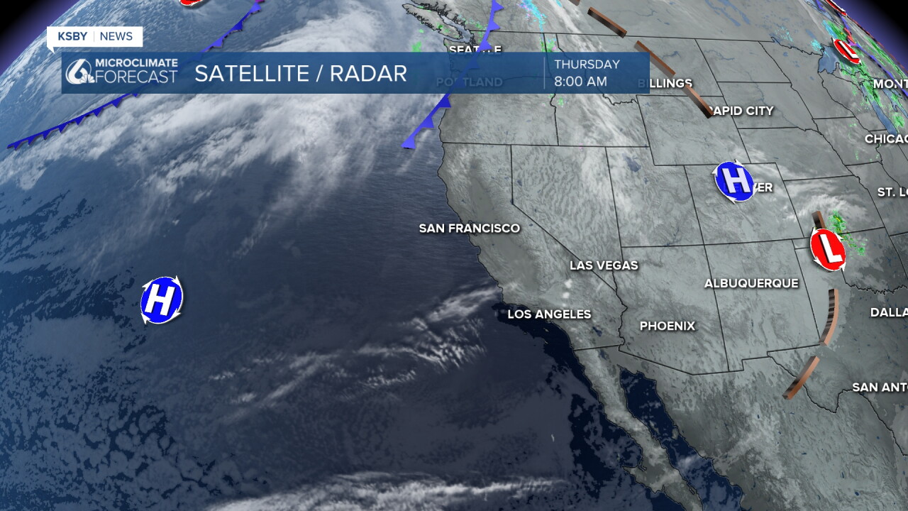
The 'why' behind our forecast is a high-pressure system building into the region.
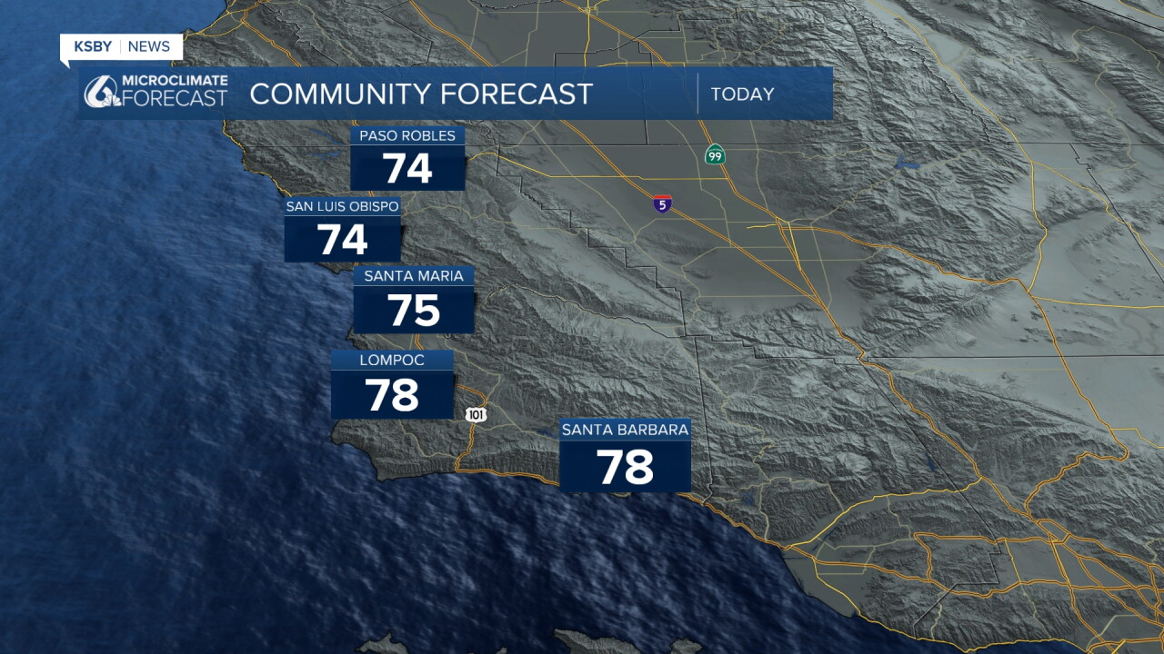
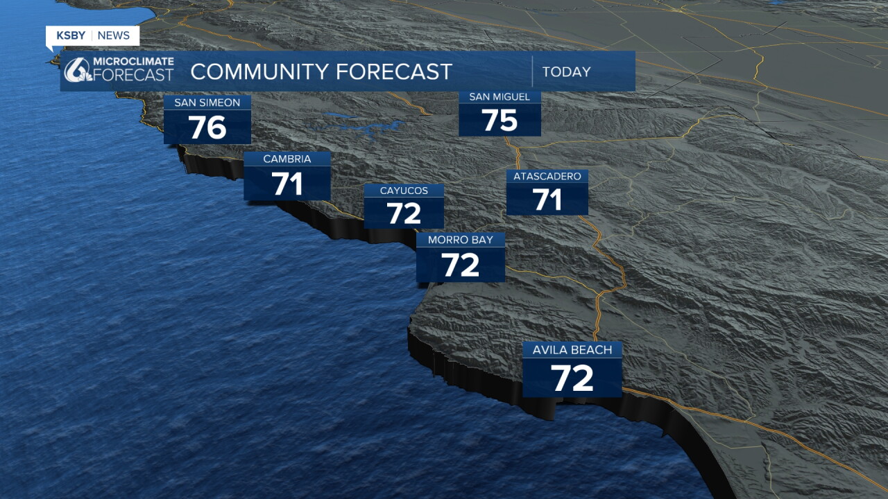
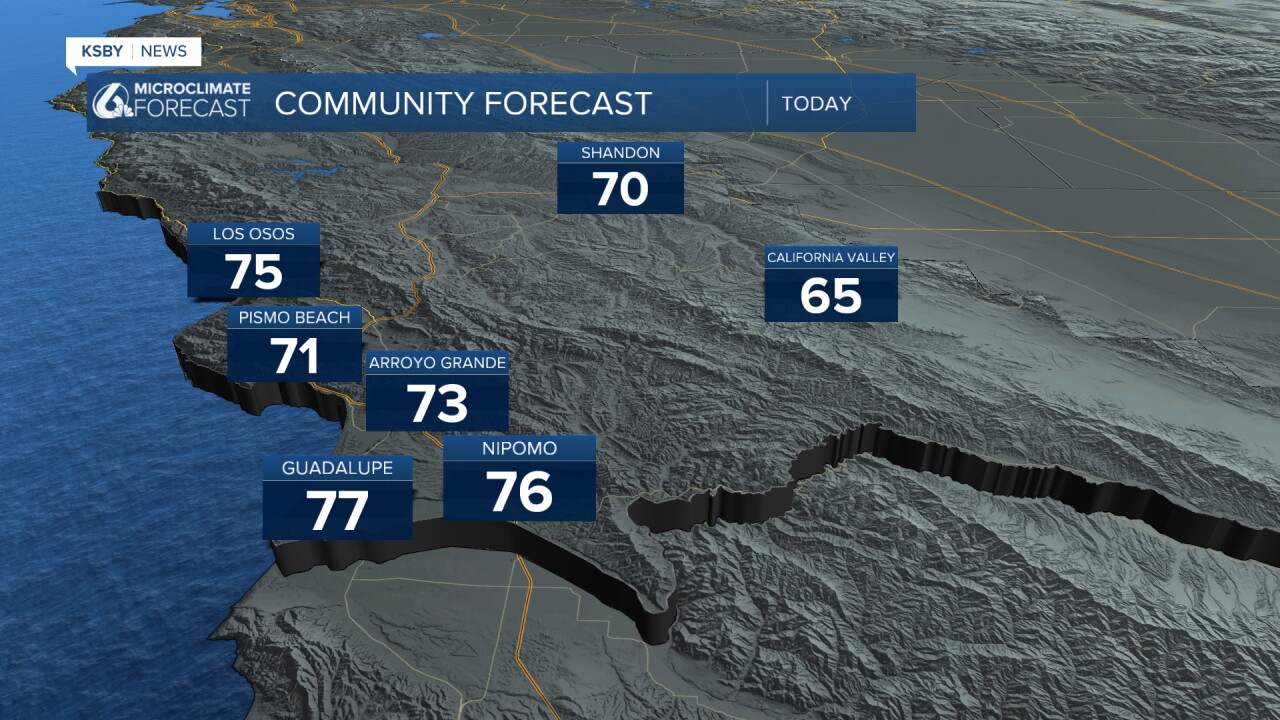
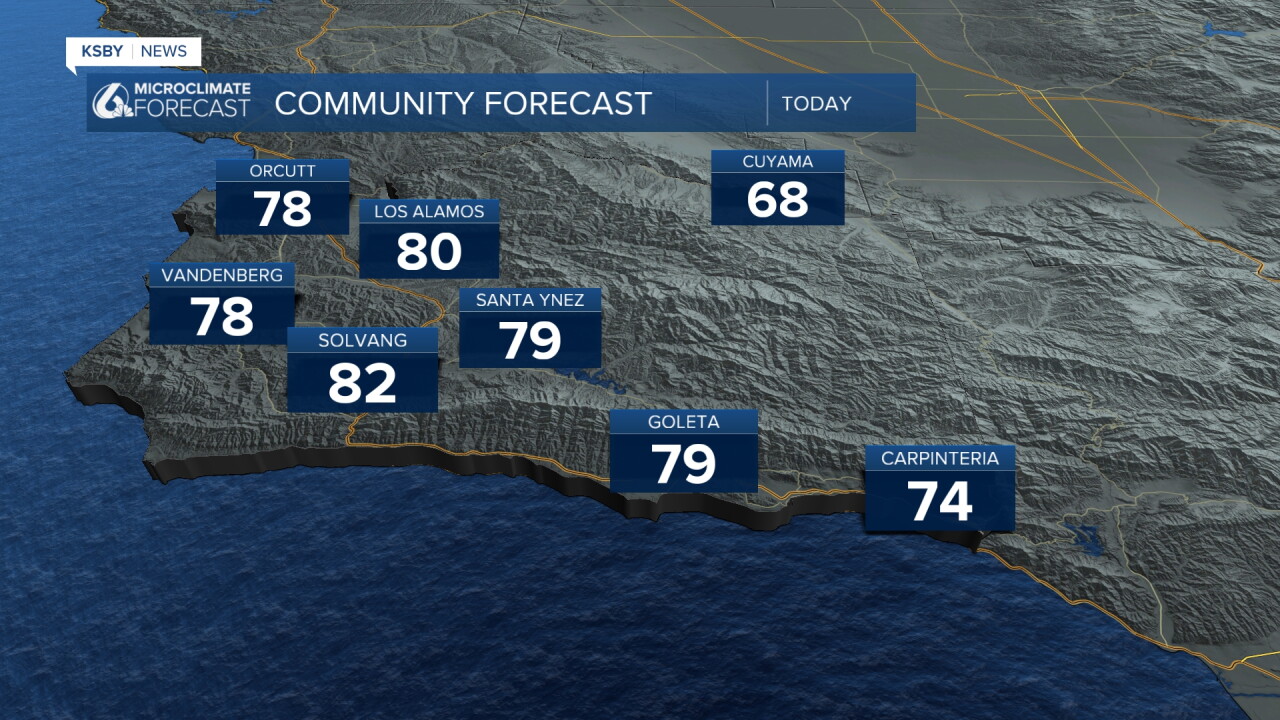
Today those high temperatures will continue the pattern and tick up. Upper 70s and low 80s are expected today. Here is a look at the highs.
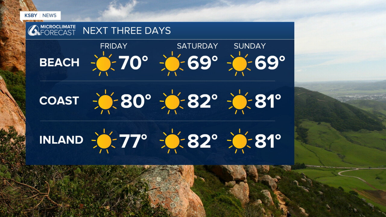
The weekend will be filled with sunshine and warmer temperatures. 80s will be widespread across the region.
Here is a look at the events going on this weekend across the Central Coast!
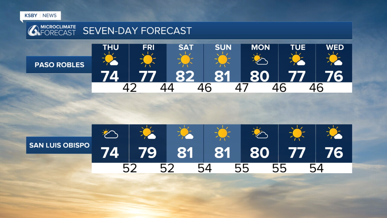
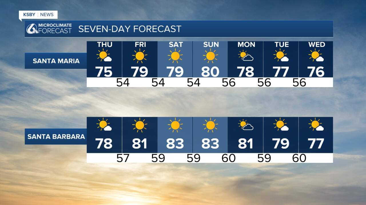
Monday will start the week on a warm note. Temps will be in the 80s and will slowly fade into the end of next week, when more clouds will move in.
Here is all of that on the 7-day forecast!
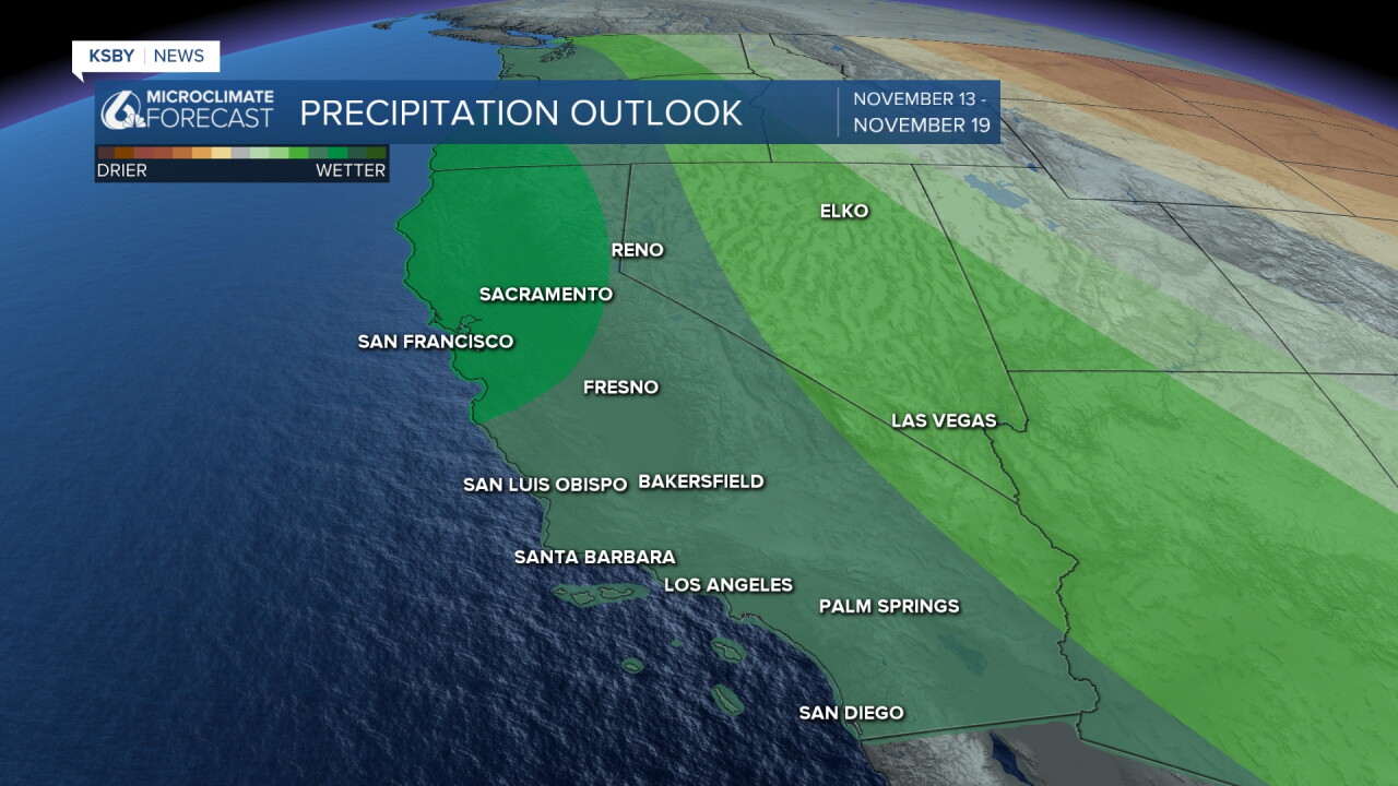
Next week will start to shift; a storm system is headed towards us that brings the potential for a storm to the region. It is still a long way out, but we are watching for a wet second half of November.
Have a wonderful day, Central Coast!
-Vivian
