



Here's your storm forecast for San Luis Obispo and Santa Barbara County from Meteorologist Jim Castillo
The first rain event and storm of the season is on the way for the Central Coast! Here is what you need to know.
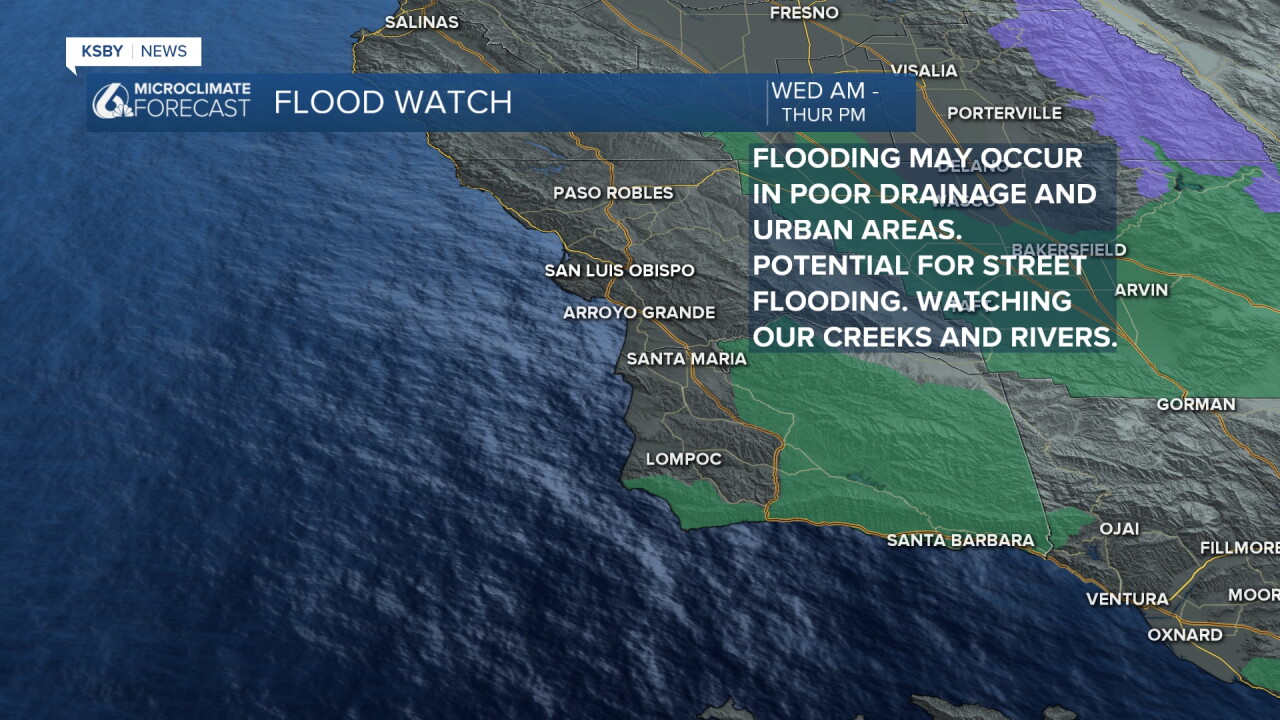
Timeline & What to Expect: A Flood Watch has been issued for most of Santa Barbara County from Wednesday morning through Thursday afternoon.
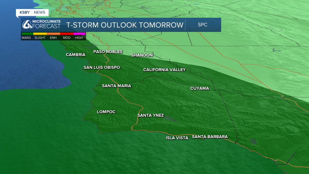
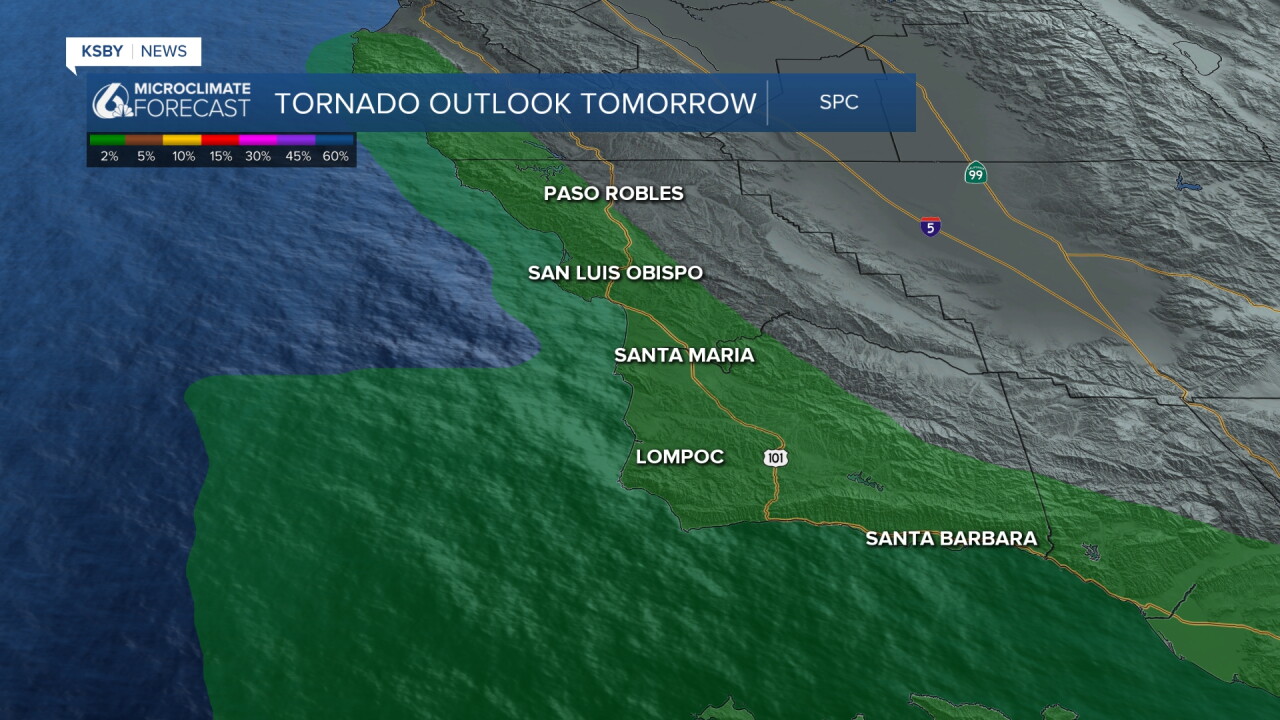
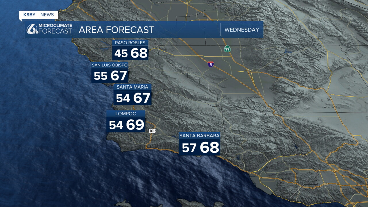
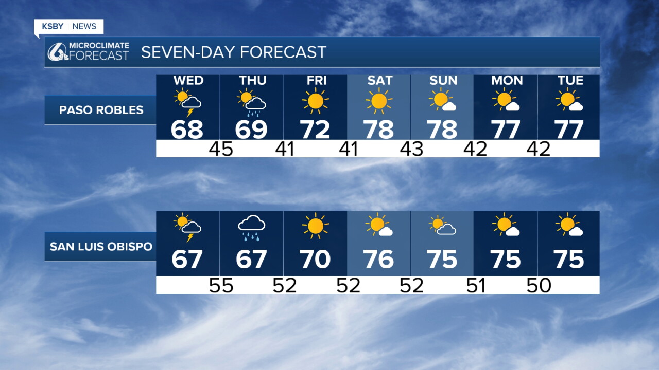
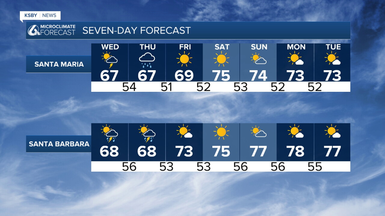
Wednesday Morning & Afternoon: Rain develops across San Luis Obispo County and spreads south into Santa Barbara County. Highs will stay cool in the 60s. The entire area also has a marginal risk of severe thunderstorms; even an isolated, small spin-up tornado can't be ruled out Wednesday into Wednesday night.
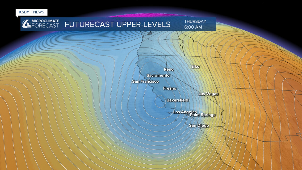
Wednesday Night - Thursday Morning: Peak storm dynamics arrive as an upper low tracks near Point Conception. Expect widespread rain, heavy at times, and a good chance of embedded thunderstorms. Watching any burn scars for debris flows.
Thursday Afternoon: Showers and isolated thunderstorm chances taper off from north to south.
Friday - Weekend Outlook: Quick clearing with high pressure moving in. Gusty north-to-northwest offshore winds return Friday before shifting to a milder offshore pattern Saturday through Monday, with highs rebounding into the 70s.
Projected Rainfall Totals
Coasts & Valleys: 0.50" to 1.25"
South-Facing Slopes & Mountains: 1.25" to 2.25"+ (Santa Barbara, the Santa Ynez mountains & Santa Lucia foothills, also the Los Padres National Forest)
Below: The Flood Watch for most of Santa Barbara County Wednesday into the first half of Thursday.
Below: Cold air aloft on Wednesday and Thursday makes our atmosphere very unstable along the Central and South Coast.
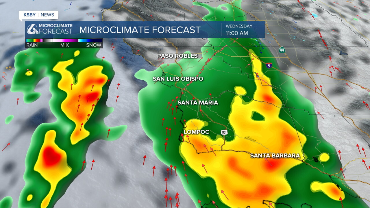
Below: The Storm Prediction Center has most of San Luis Obispo County and all of Santa Barbara County in a marginal low-level one risk of severe thunderstorms with wind gusts near 60 mph a potential along with flooding and the small chance of a small spin-up tornado possible.
Below is the small chance of a quick spin-up tornado within any thunderstorms that develop along the Central or South Coast on Wednesday.
Always stay weather-aware, Central Coast!
-Jim
