



Good Tuesday evening from Meteorologist Jim Castillo
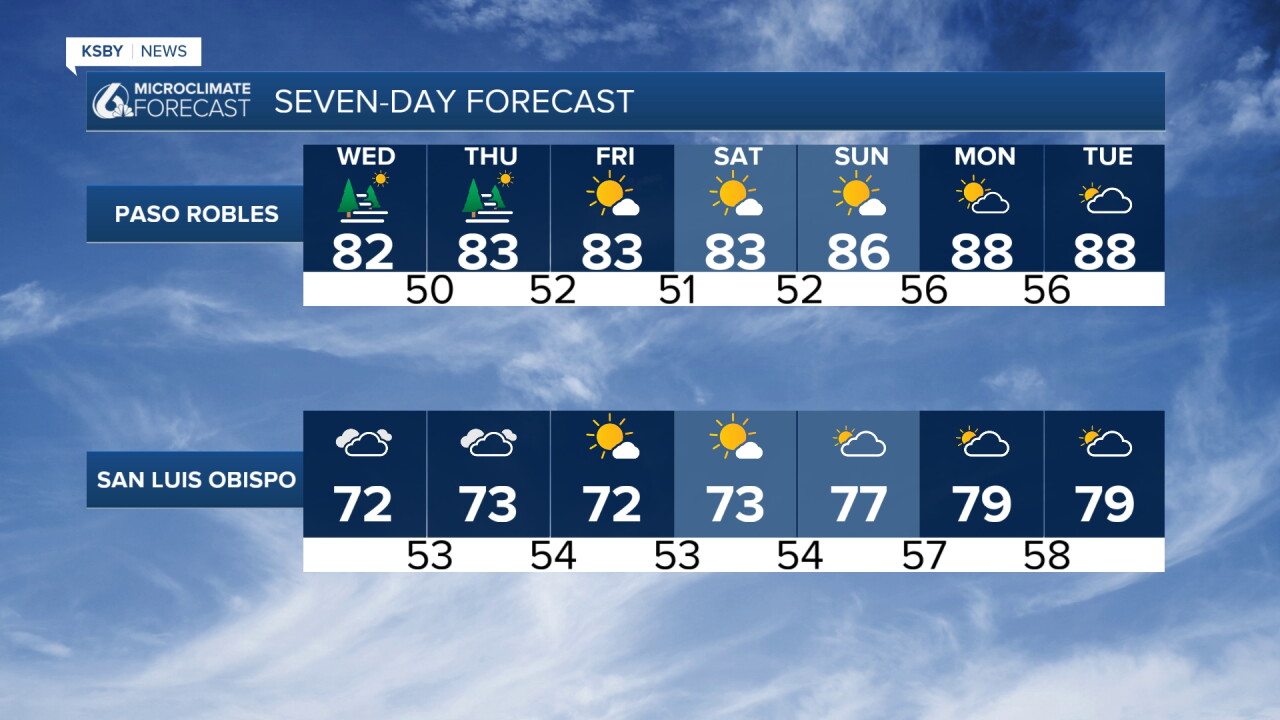
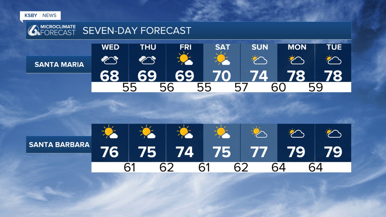
A persistent weather pattern will keep the Central Coast locked into below-normal temperatures through Friday. Expect patchy marine layer clouds each morning and moderate Sundowner winds affecting southwestern Santa Barbara County. The wildfire smoke has not been as thick today around San Luis Obispo to Santa Maria, but it has been thick up around Paso Robles to Cambria.
UPPER LEVEL PATTERN: A trough remains positioned over the West Coast with cool nights and cool days. At the surface, moderate onshore flow continues from the east with some offshore flow from the north.
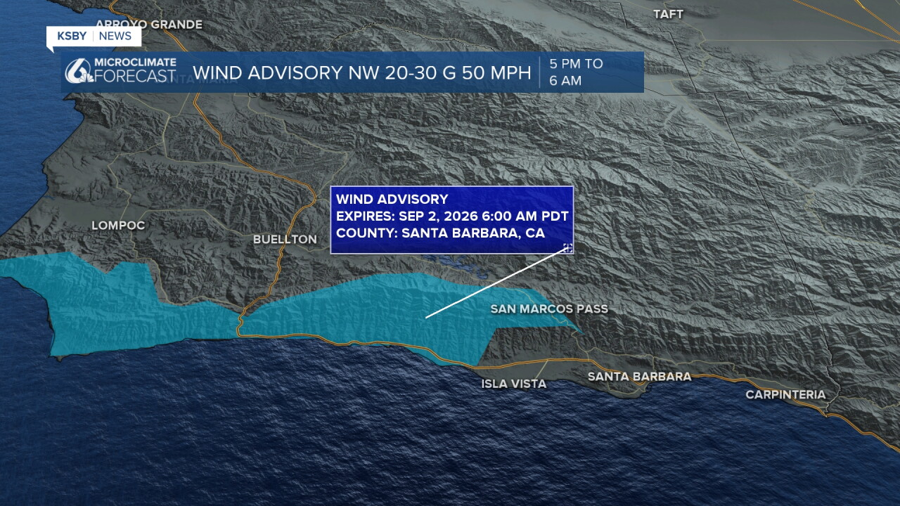
WIND CONCERNS - SANTA BARBARA COUNTY: The primary weather concern involves Sundowner winds across southwestern Santa Barbara County. Stronger winds are forecast across the western Santa Ynez Mountains with northwest winds 20-30 mph gusting to 50 mph overnight.
A Wind Advisory remains in effect for the western Santa Ynez Range and adjacent coastal areas through 6 AM Wednesday. Wednesday night, models indicate even stronger northerly flow, so advisory-level winds will likely continue across southern Santa Barbara County.
MARINE LAYER DETAILS: Marine layer stratus and fog will develop each night and morning across the coastal plain and some coastal valleys due to persistent onshore flow. Beyond any marine layer, skies should stay mostly clear through Friday.
LABOR DAY WEEKEND UNCERTAINTY: An upper low will wobble over the Pacific Northwest through Labor Day weekend.
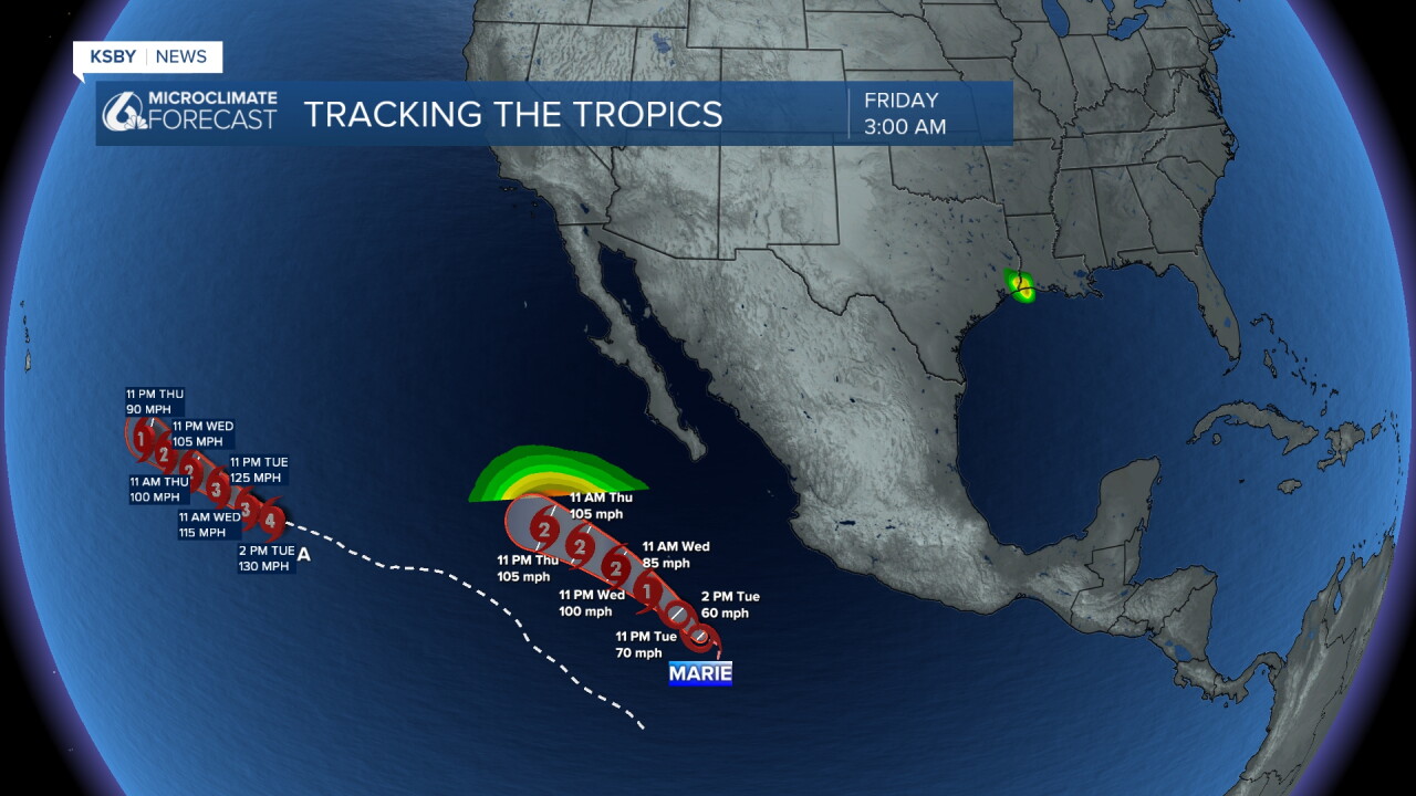
TROPICAL STORM MARIE IMPACTS: Currently located far south of Cabo, Tropical Storm Marie is forecast to intensify to hurricane strength Wednesday while tracking northwest through Labor Day weekend and far off the coast and away from the coast.
Despite the high likelihood of Marie maintaining a westward track away from the coast, some impacts are possible for the Central Coast. Moisture from Marie will be advected over the area during Labor Day weekend, but amounts look low at this time.
Current projections show a decent chance of widespread light rainfall Sunday through Tuesday with amounts of 0.10-0.25 inches possible across San Luis Obispo and Santa Barbara Counties, including areas near the Santa Lucia Mountains, Santa Ynez Mountains, and Los Padres National Forest.
ADDITIONAL CONCERNS: There's a small chance of moderate to strong easterly winds ahead of any rainfall, which could create fire weather concerns. High confidence exists for significant coastal impacts. Higher surf and higher rip current risk will be the main issues.
Have a great night, Central Coast!
-Jim
