



Good Thursday evening from Meteorologist Jim Castillo
Here is your Central Coast weather forecast for San Luis Obispo & Santa Barbara Counties
Marine layer clouds will continue affecting coastal areas, primarily north of Point Conception, through much of this week. These night and morning clouds will remain confined to the immediate coastline while inland areas experience warm conditions. Expect slight cooling Friday through the weekend.
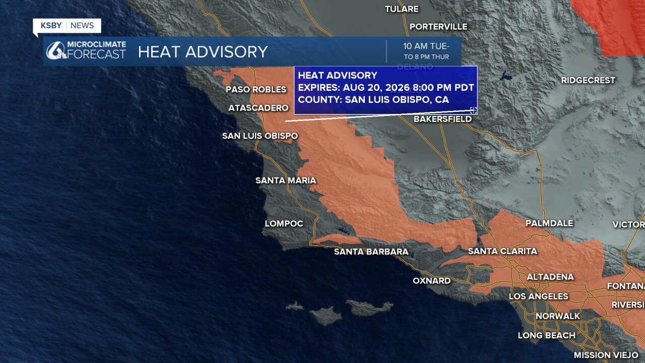
Heat Advisory ended at 8 pm for the interior valleys
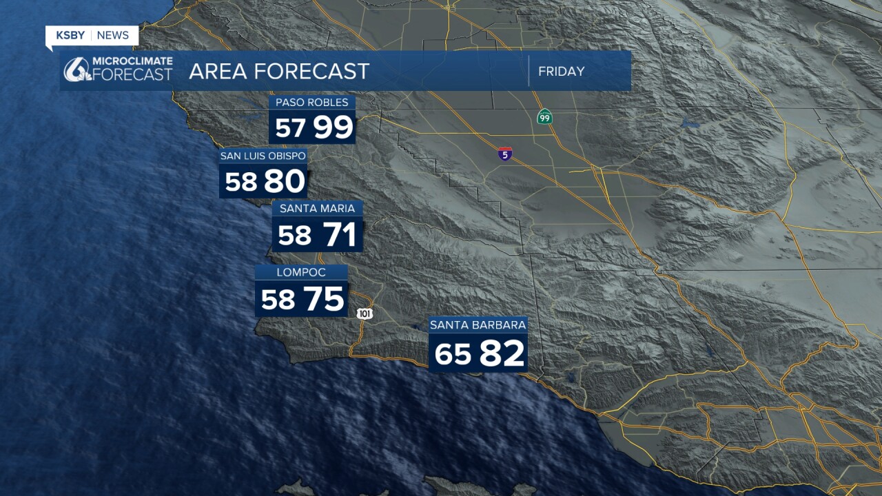
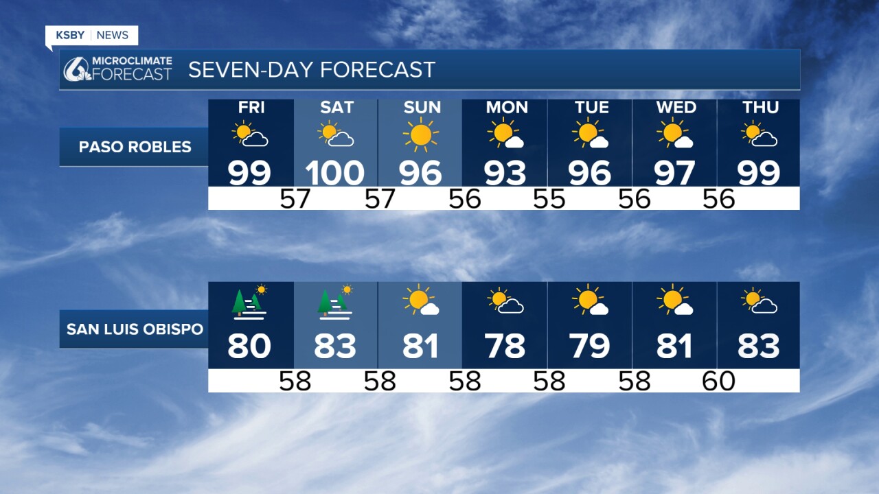
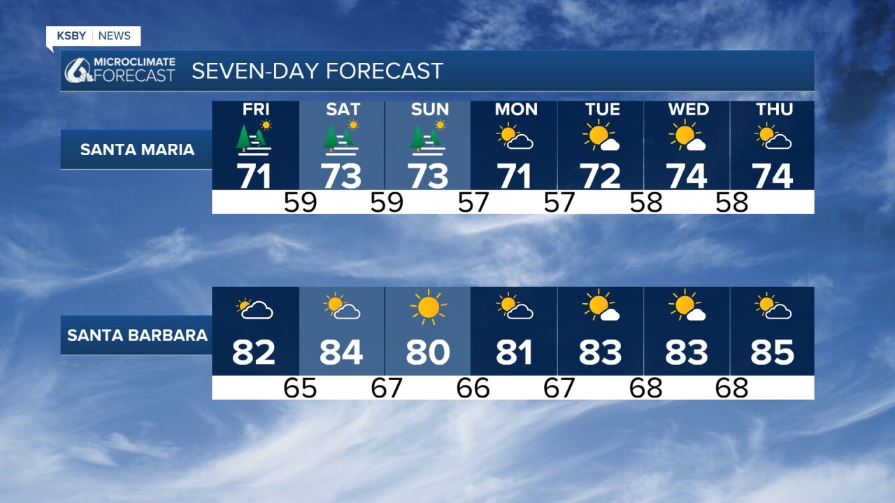
Friday brings modest relief with slight cooling across most areas due to increased mid-level cloud cover and a slightly thicker marine layer. However, rising humidity levels will offset some of the temperature decrease. The Heat Risk forecast shows reduced moderate-risk areas on Friday, so current Heat Advisories will NOT extend beyond tonight.
Weekend temperatures will stabilize near current levels, keeping most inland locations above normal. While no additional heat advisories are expected.
Northerly offshore wind gradients will persist through the weekend. The western Santa Ynez Range will experience locally gusty north winds, with advisory-level conditions remaining confined to the Gaviota and Refugio corridors.
These Sundowner wind events will continue each night across southern Santa Barbara County, particularly affecting the Gaviota Pass and Refugio areas where terrain channeling enhances wind speeds.
Extended Outlook
A stagnant weather pattern dominates the extended forecast. The upper-level high pressure system will remain anchored over Arizona and New Mexico with minimal changes to atmospheric heights over the Central Coast.
Monday features slight cooling, followed by warming Tuesday through Thursday. Inland areas will generally stay above seasonal averages throughout the period.
Marine Layer Forecast
Coastal communities will continue experiencing night and morning stratus and fog. The marine layer depth will remain shallow, typically clearing by late morning to early afternoon along the immediate coastline. Inland low clouds will be limited, rarely extending beyond the Highway 101 corridor.
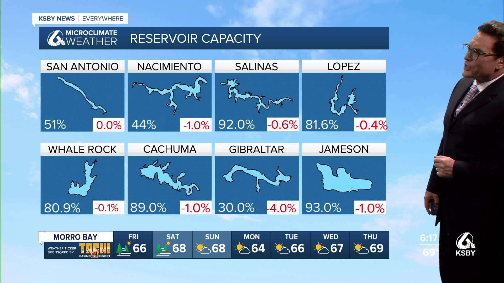
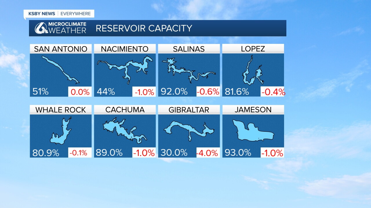
Below: The current reservoir levels and the change from one week ago.
Have a great night, Central Coast!
-Jim
