



Good Tuesday evening, Central Coast!
The Heat Advisory remains in effect through Friday for inland valleys and lower mountain areas of both San Luis Obispo and Santa Barbara Counties
The strong ridge of high pressure continues to grip the Central Coast through Friday, maintaining moderate heat risk across inland areas of San Luis Obispo and Santa Barbara Counties. This ridge is peaking Wednesday and Thursday.
TEMPERATURE BREAKDOWN:
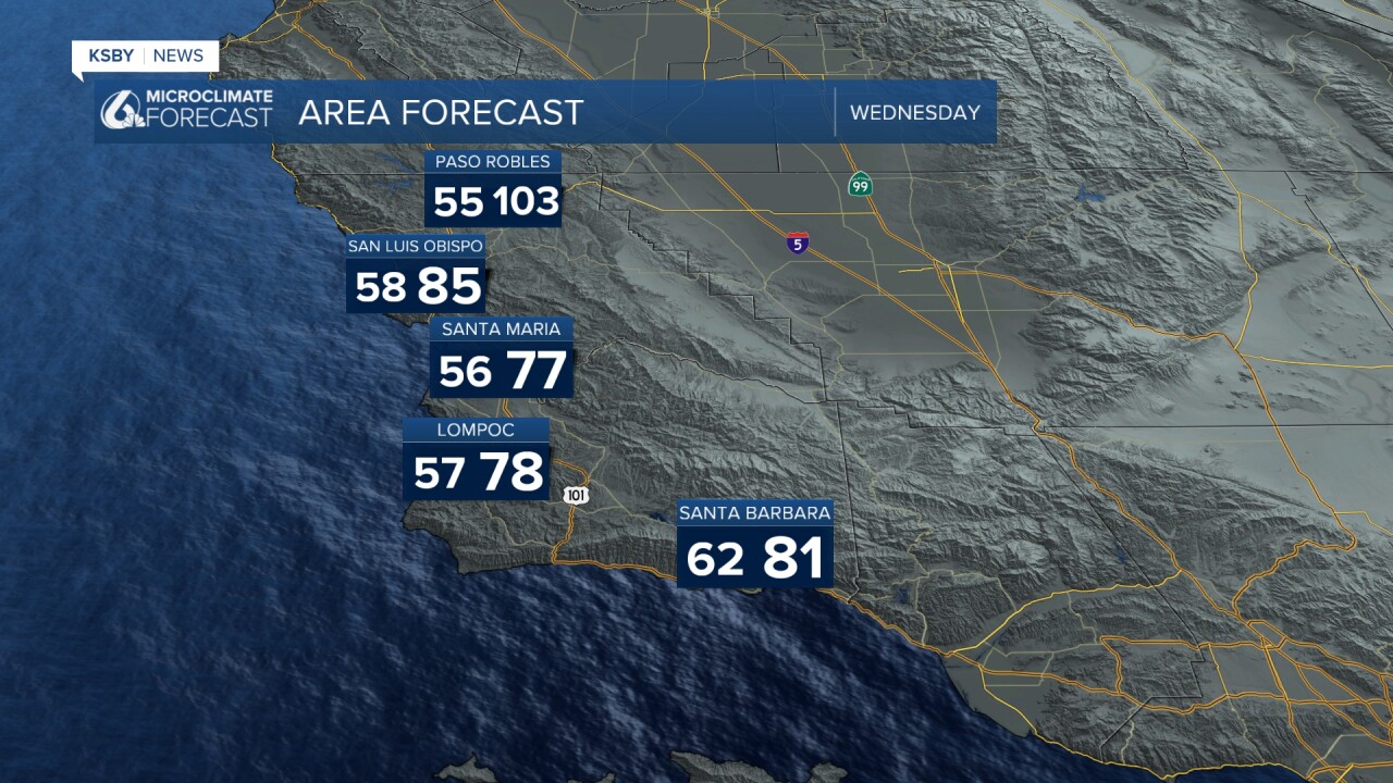
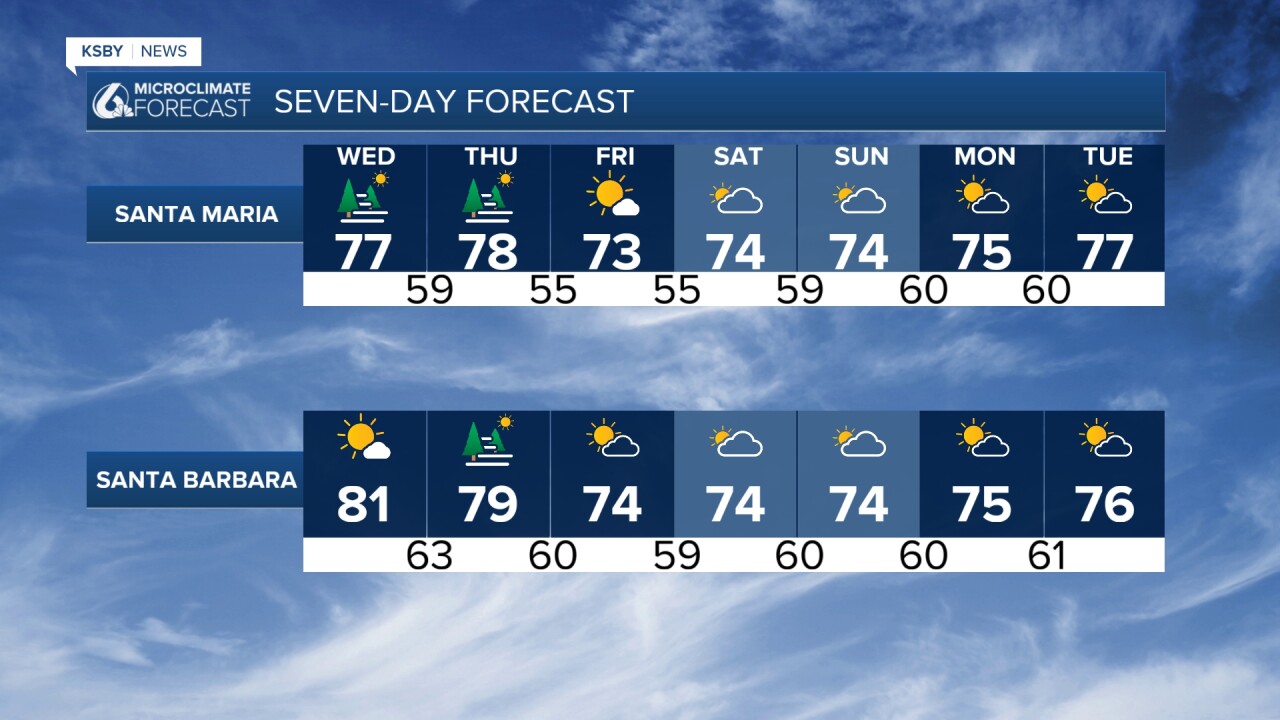
- Coastal areas: Highs in the 70s to mid-80s
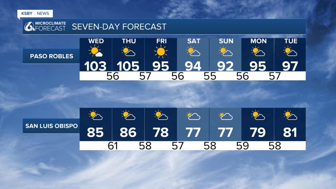
- Interior valleys: 90-105 degrees (Heat Advisory zones)
WIND CONCERNS: Advisory-level Sundowner winds are forecast again tonight across Southwest Santa Barbara County, with similar conditions possible Wednesday and Thursday evenings. These hot, dry, downslope winds combined with elevated temperatures create elevated fire weather conditions across interior portions of both counties.
MARINE LAYER IMPACTS: The building ridge is compressing the marine layer, limiting coastal fog primarily to the immediate coastline. However, an eddy circulation from the Sundowner wind pattern may push pockets of low clouds and dense fog inland during overnight and morning hours.
WEEKEND PATTERN CHANGE: Some relief arrives this weekend as the ridge weakens and shifts toward the Four Corners region. This opens the door for southeast to southerly flow aloft, bringing a 10-20 percent chance of monsoon moisture. The highest probability for afternoon and evening thunderstorms will be across the higher elevations of the Santa Lucia Mountains and Los Padres National Forest.
LOOKING AHEAD: The ridge may rebuild by mid-next week, potentially bringing heat closer to coastal areas with added humidity from lingering monsoon moisture, maintaining at least low to moderate heat risk regionwide.
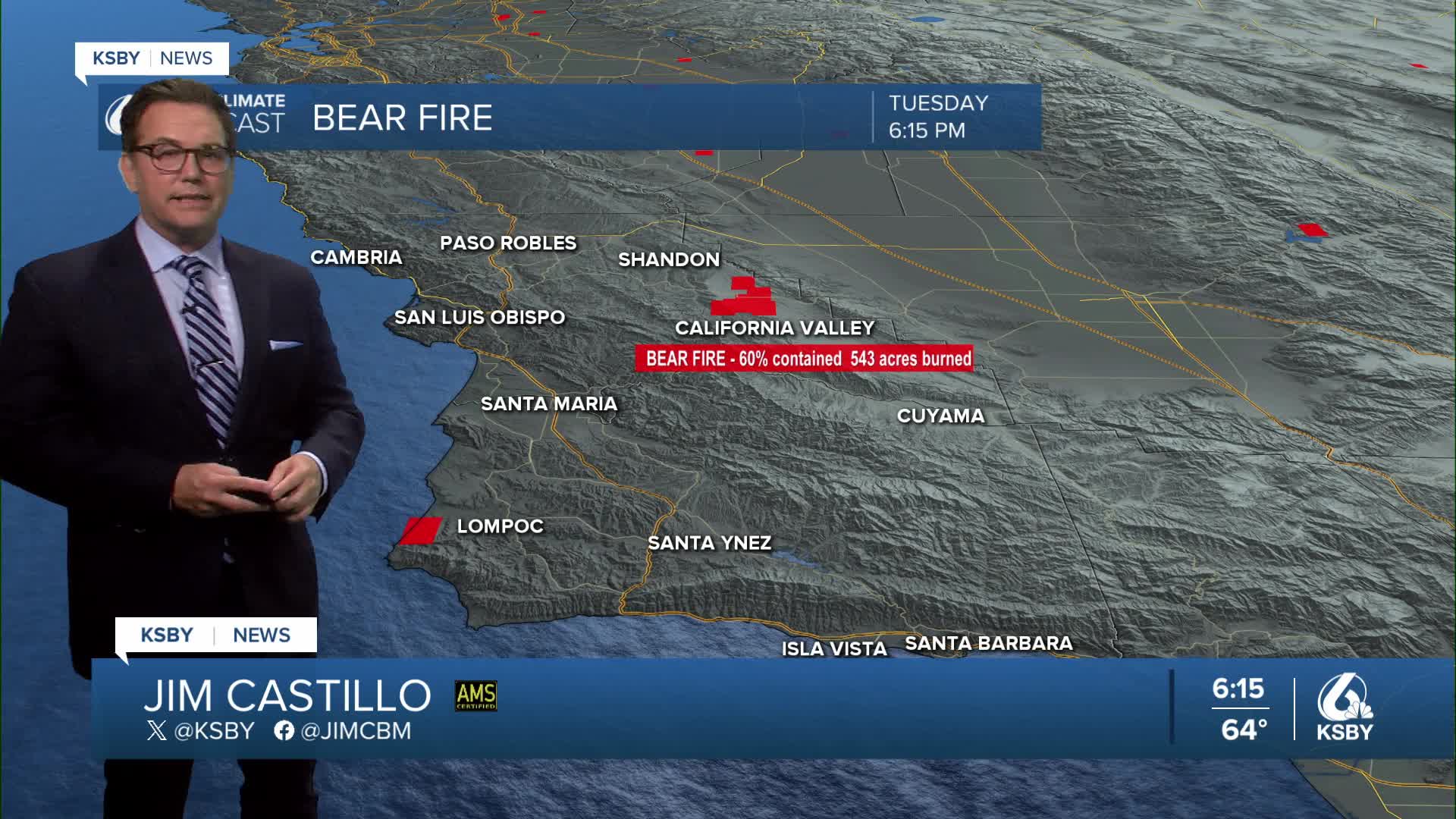
Below: Update on the Bear Fire around California Valley as of 8:46 pm Tuesday—now 80% contained, with 543 acres burned.


Have a great night, Central Coast!
-Jim
