



Good Wednesday evening from Meteorologist Jim Castillo
Here is your Central Coast weather forecast for San Luis Obispo and Santa Barbara Counties
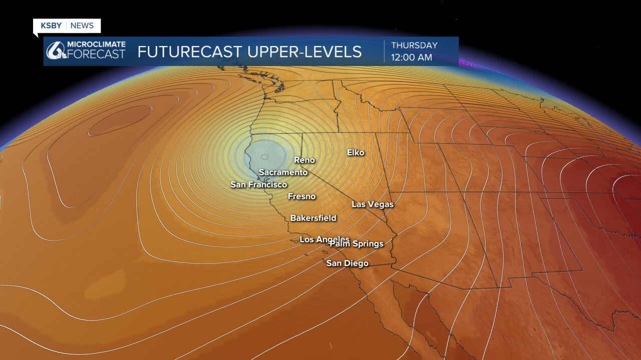
Current Pattern: An upper level low positioned north of the region continues driving persistent onshore flow, creating an exceptionally deep marine layer for mid-September conditions across the Central Coast.
Tonight Through Thursday:
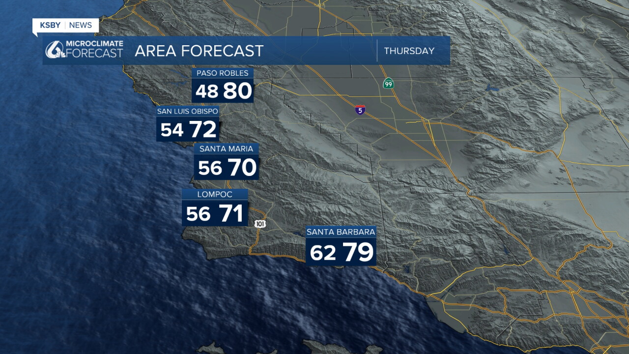
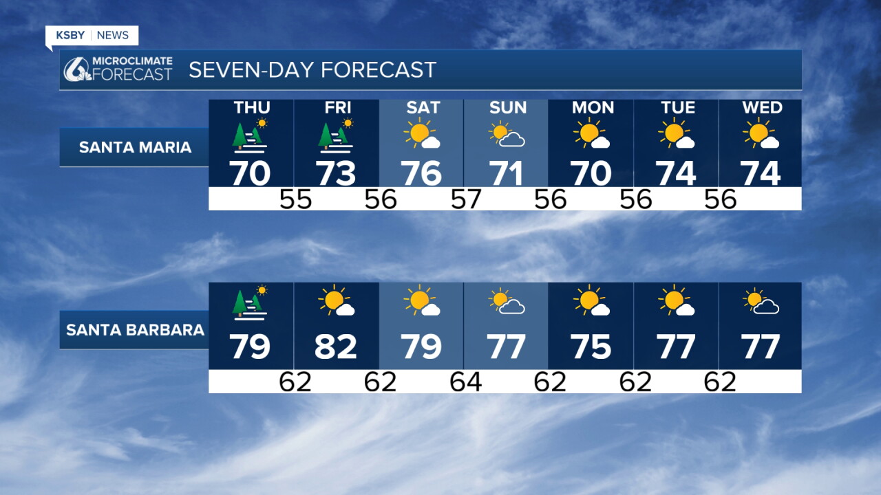
The robust marine layer will persist overnight, bringing another gray morning to most areas Thursday. Expect better clearing compared to Wednesday, though temperatures will remain slightly cooler than seasonal averages. The marine influence will be strongest along coastal areas and valleys with patchy mist or drizzle for some.
Friday Into Weekend:
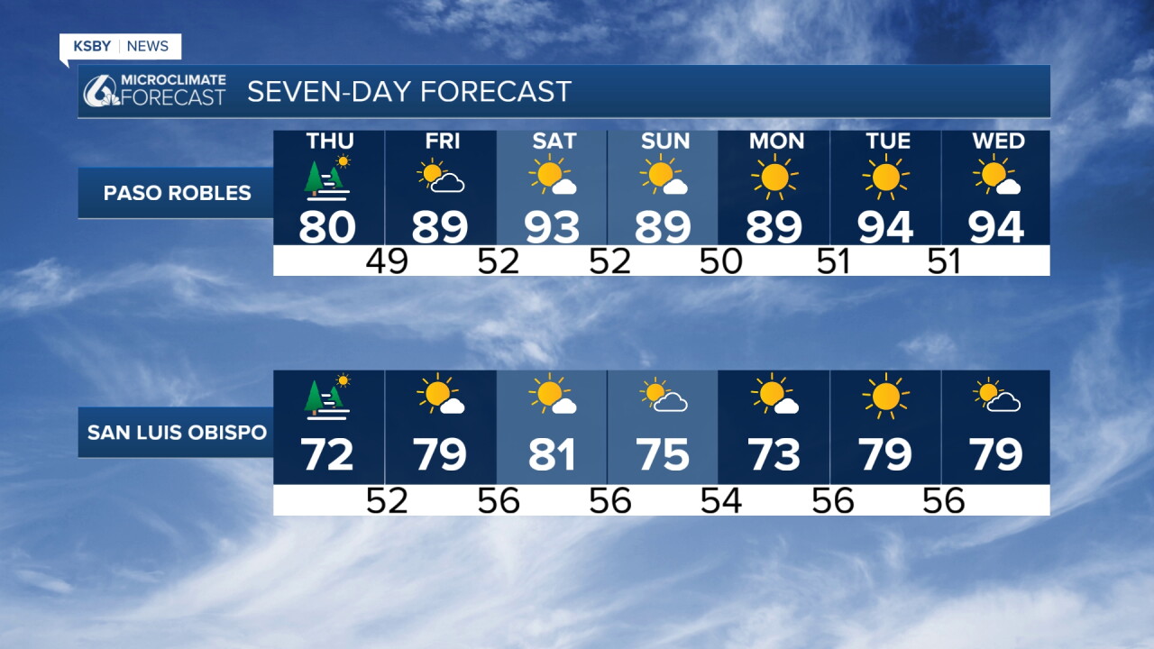
A notable shift begins Friday as onshore flow weakens significantly. A short-lived ridge of high pressure moves into the area Saturday, bringing:
- Light to locally moderate northerly winds across interior mountains
- Northeast winds developing across the Santa Lucia Mountains
- Dramatically reduced marine layer coverage starting Friday morning
- Mostly clear skies Friday and much of Saturday
- Gradual warming trend through the weekend
Extended Outlook:
Quiet weather continues Sunday and likely through the extended period. A weak upper level low approaches Sunday, potentially remaining overhead through Monday and possibly Tuesday. This system will likely bring:
- Slightly cooler temperatures returning
- Deeper, more expansive marine layer
- Potential for morning drizzle along the coast and valleys
Mountain Areas:
The Santa Lucia Mountains, Santa Ynez Mountains, and Los Padres National Forest areas within San Luis Obispo and Santa Barbara Counties will see the most dramatic changes as northeast winds develop Friday. These areas should experience the clearest conditions during the weekend warming trend.
Have a great night, Central Coast!
-Jim
