


Good Tuesday evening, Central Coast!
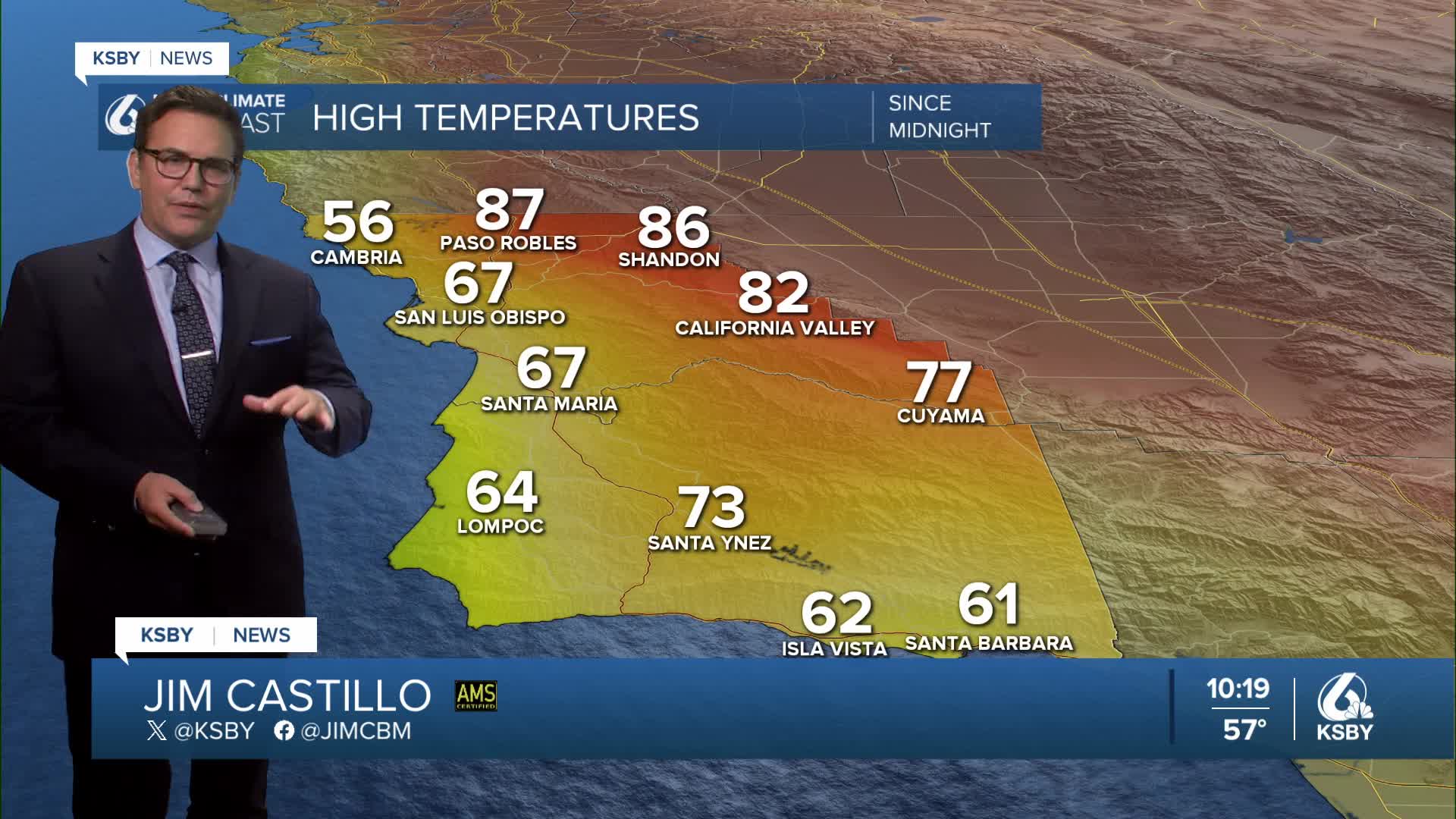
CURRENTLY: The marine layer has significantly deepened over the past 24 hours, driving the cooling trend across our coastal valleys. Strong onshore flow and a robust inversion layer have kept low clouds stubborn throughout the day, particularly west of the Santa Lucia Mountains.
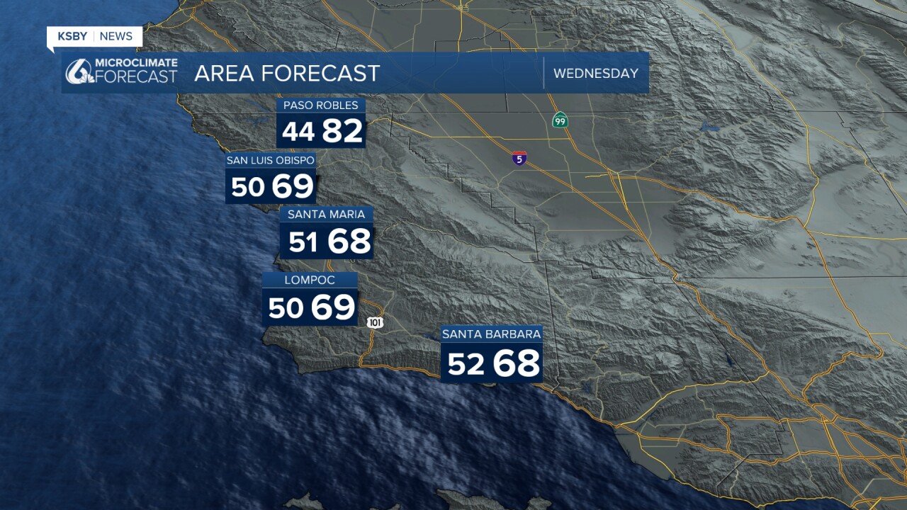
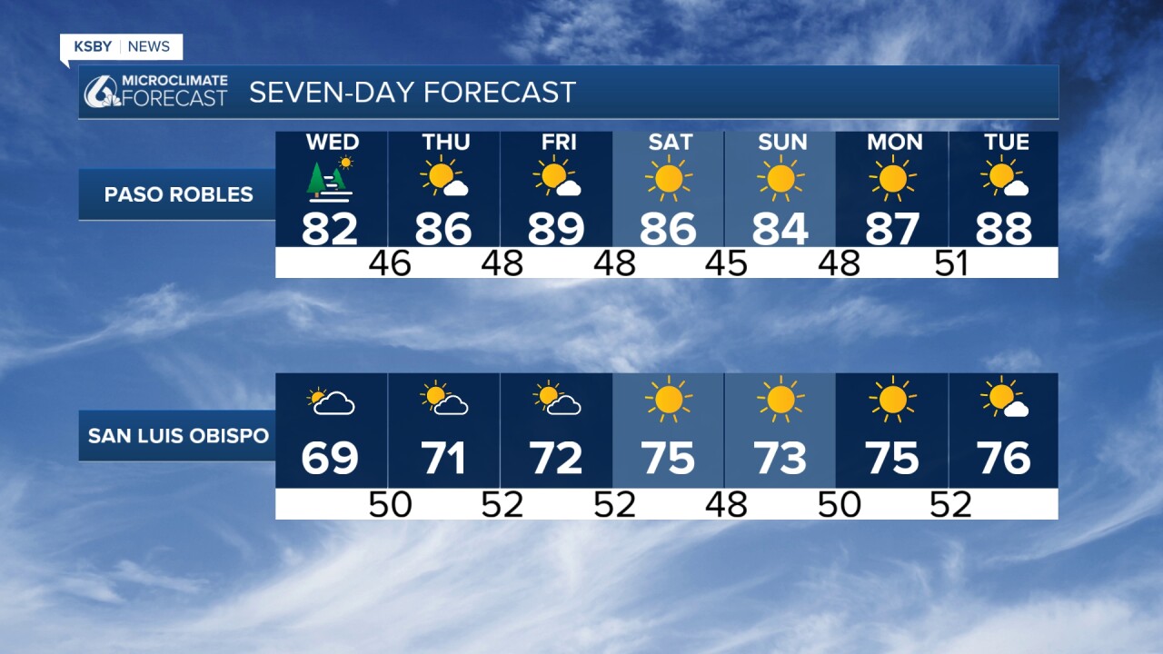
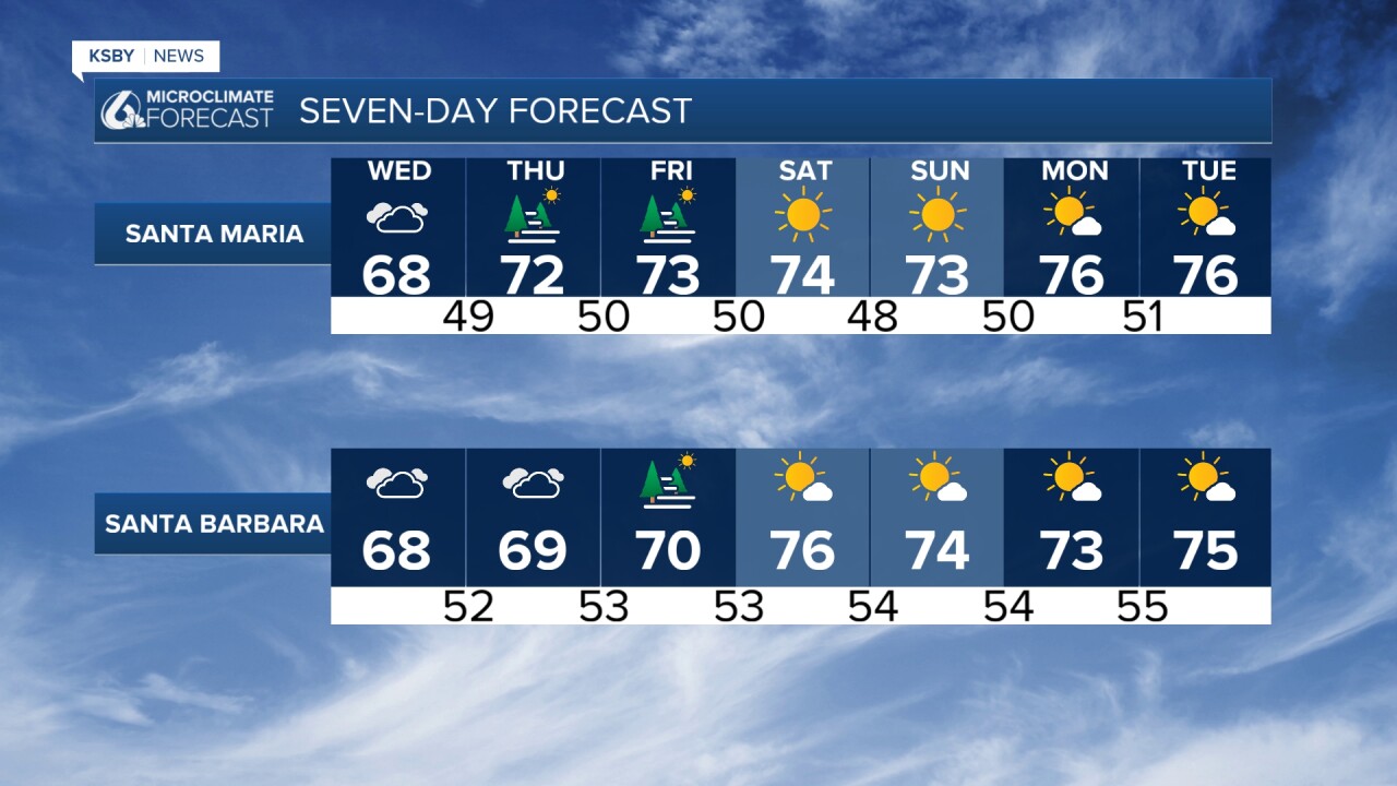
THROUGH WEDNESDAY: A weak upper-level trough passing overhead will push the marine layer even deeper. This will send today's cooling trend further inland across both counties, bringing temperatures back to near-normal for mid-May.
The deeper marine layer may produce spotty drizzle, especially in foothill areas. Wednesday will likely see slow clearing or no clearing at all of low clouds, with a possible reverse-clearing pattern in which coastal areas clear before the valleys and foothills.
WIND CONCERNS: Breezy northwest to southwest winds are expected each afternoon through evening. Southwestern Santa Barbara County faces a higher wind threat on Wednesday evening and again Friday afternoon.
THURSDAY-FRIDAY OUTLOOK: Weak ridging will build into the region, shrinking the marine layer closer to the coast and initiating warming trends. However, temperatures will remain cool for many areas.
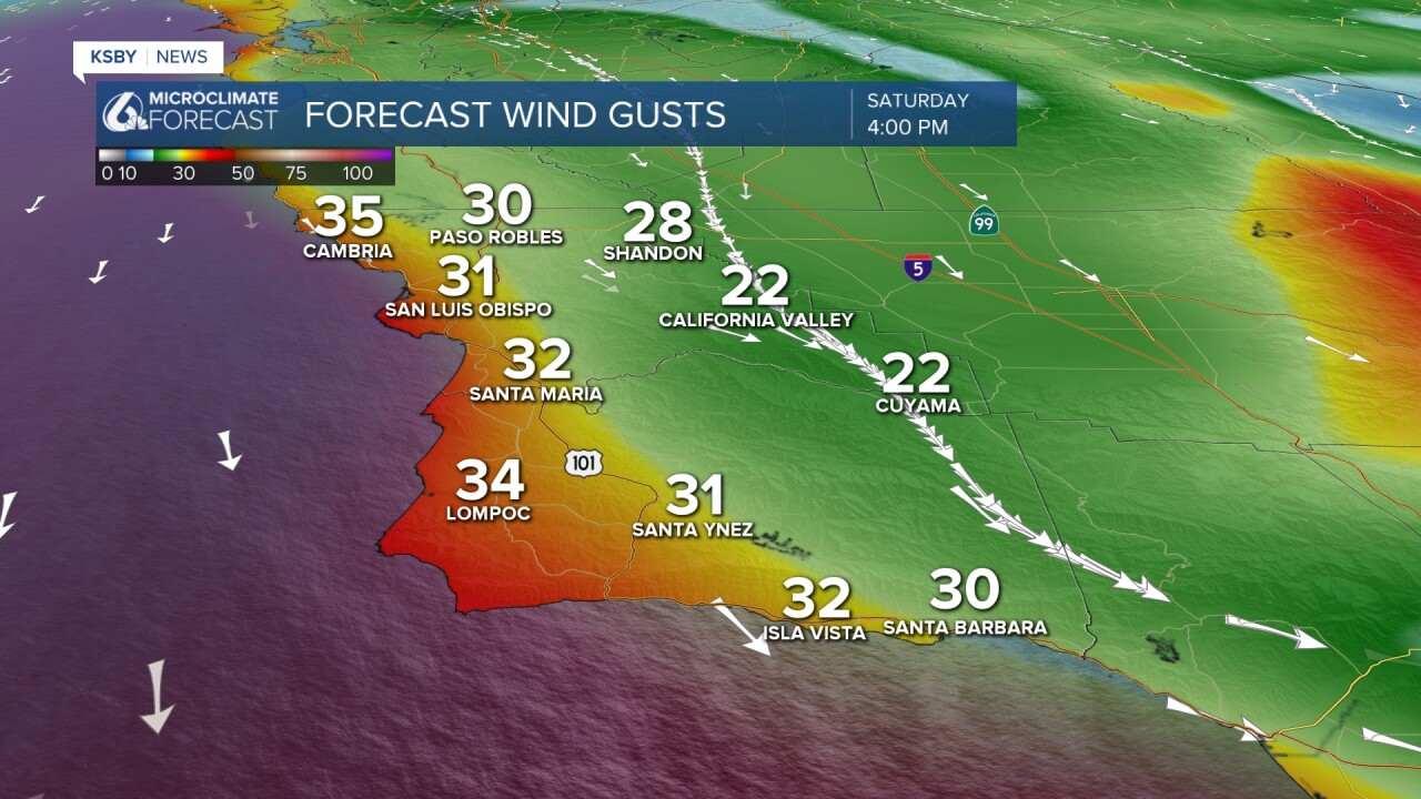
WEEKEND WEATHER PATTERN: A sharp May trough approaches Saturday. Current models suggest an inland track that would bring near-normal temperatures but gusty winds Saturday and Sunday. There's potential for offshore wind development with notable warming and drying trends into Monday.
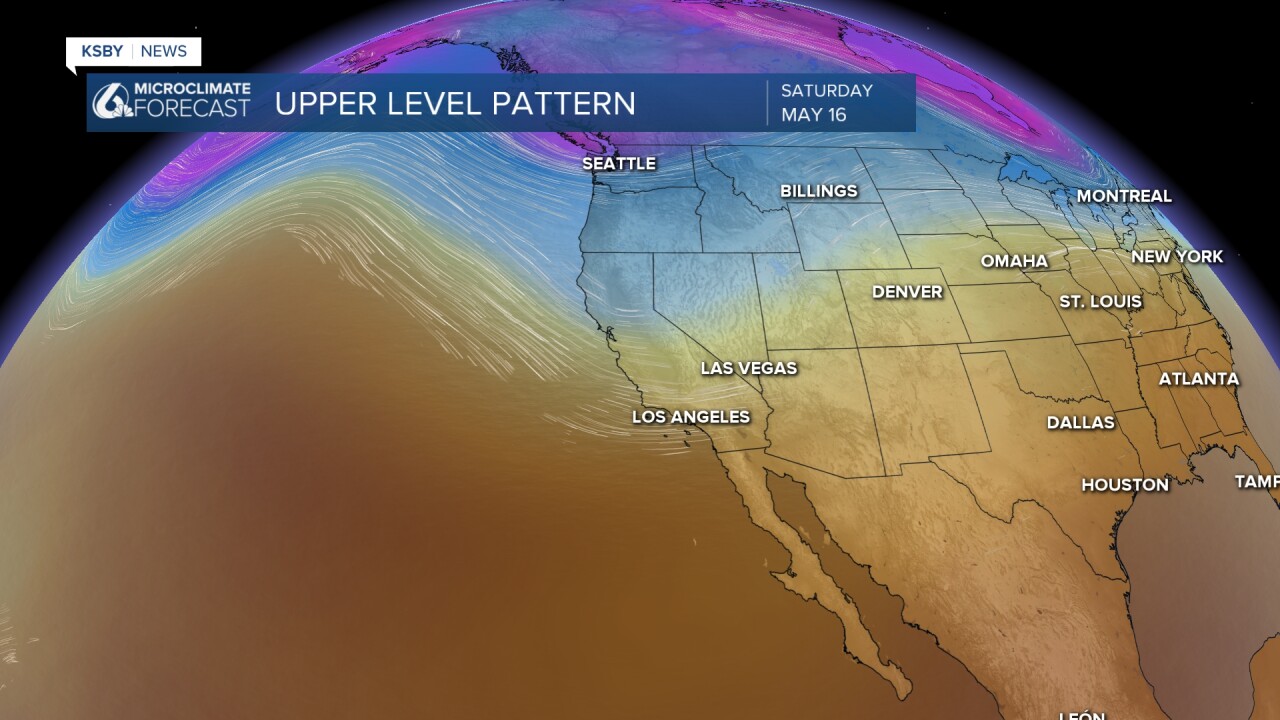
Below: A snapshot of Saturday afternoon and evening, when it looks windy as a strong trough digs into the west coast.
Have a great night, Central Coast!
-Jim
