


Good evening, Central Coast!
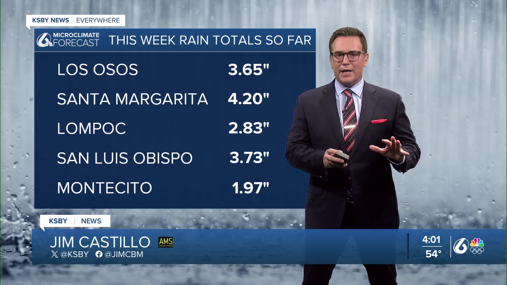
Below are the rain totals from our 1st and 2nd storm systems with another on the way overnight into early Thursday.

Our break in the rain and wind won’t last long.
Next Storm Arrives Overnight
The next system is already on the way. Rain is expected to reach the Central Coast late tonight into Thursday morning.
Below is a snapshot of the future rain and downpours at 3 am through the Thursday morning commute.

This will be a fast-moving storm, bringing about six hours of occasionally moderate rain and more downpours. Most of the wet weather should wrap up early Thursday.
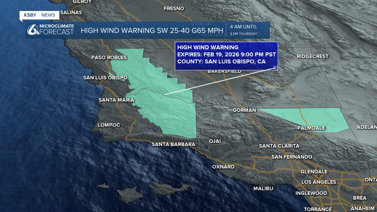
Winds will once again be gusty up to 40 mph on the coast and in the valleys, but in the mountains, gusts of 50 to 65 mph are possible. While lower elevations won’t be quite as windy as last night’s storm, winds will ramp up Thursday as they shift to the west, increasing to 20 to 40 mph across much of the region.

Additional rain Totals
Rainfall totals are forecast to range from a quarter to a half inch for most coasts and valleys, and most of it falling Thursday morning, with up to an inch in the mountains.

The system remains on track to move out Thursday afternoon, followed by cool and breezy west to northwest winds.
Mountain areas above 5,000 feet could see several more inches of snow. Snow levels are expected to drop to around 4,000 feet Thursday morning and again Thursday night into Friday morning. That means snow could accumulate near Interstate 5, including over the Grapevine.

Cold and Frosty Friday
Friday looks dry but very cool. Depending on how quickly skies clear and winds diminish overnight, some valley locations could see morning frost or even freezing temperatures.
Looking Ahead: A Break, Then More Chances
Saturday is shaping up to be the nicest day of next week. A weak ridge will bring mostly sunny skies, dry conditions, and a warming trend. Highs should be reaching the 60s.
Another Gulf of Alaska system will drop into the Pacific Northwest on Sunday, bringing renewed chances of rain to the Central Coast. Forecast models vary quite a bit, so rain chances remain from Sunday through Tuesday. At this point, it does not look like a prolonged or especially impactful rain event like we just went through.
Stay tuned for updates as the forecast becomes clearer.


Sleep well tonight, Central Coast and get ready for the Thursday morning rain.
-Jim
