



Good Thursday evening from Meteorologist Jim Castillo
Here is your Central Coast weather update for San Luis Obispo & Santa Barbara Counties
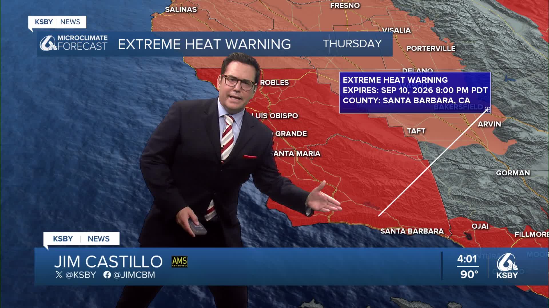
THURSDAY'S HEAT WAVE FINALE Still hot, but many areas were cooler compared to Wednesday. This is the last day of truly oppressive conditions for the Central Coast. Extreme Heat Warnings ended at 8 pm on Thursday. Temperatures have generally trended downward today due to improved onshore flow that kicked in much earlier than yesterday, providing relief to coastal areas.
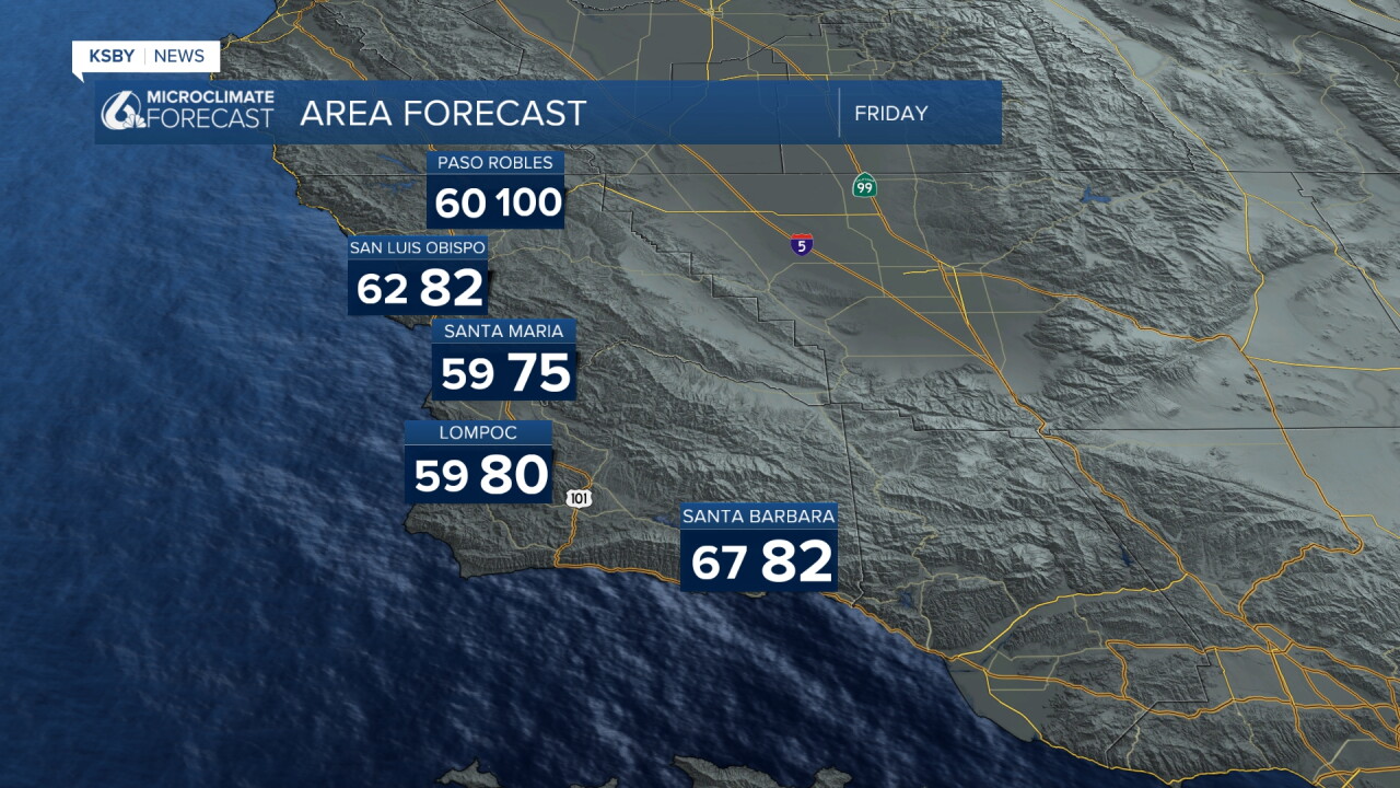
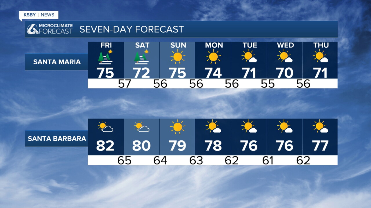
MAJOR COOLING TREND Significant cooling Friday and the cooling continues through the weekend with maximum temperatures dropping below normal for mid-September. The sticky tropical air from remnant Hurricane Marie will finally exit the region by this weekend, affecting Santa Barbara County through Southern California.
WEEKEND WEATHER PATTERN The upper level ridge that trapped the tropical moisture and brought scorching temperatures will flatten out starting tomorrow. An upper level trough swinging into the Pacific Northwest will usher in this cooling trend. By Saturday and Sunday, expect temperatures in the 70s at the coasts and 80s inland across both San Luis Obispo and Santa Barbara Counties.
MARINE LAYER RETURNS Marine layer clouds will likely return to many coastal areas as early as tonight, with best chances this weekend. The Central Coast has the highest probability for marine layer formation. Evening and morning coastal clouds expected.
WIND CONCERNS Onshore flow will increase each day, bringing breezy conditions this weekend. However, Sundowner winds across southwestern Santa Barbara County will create challenges through Saturday night. A Wind Advisory has been issued for tonight. These winds may inhibit marine layer formation in southern Santa Barbara County and keep coastal temperatures from dropping below normal.
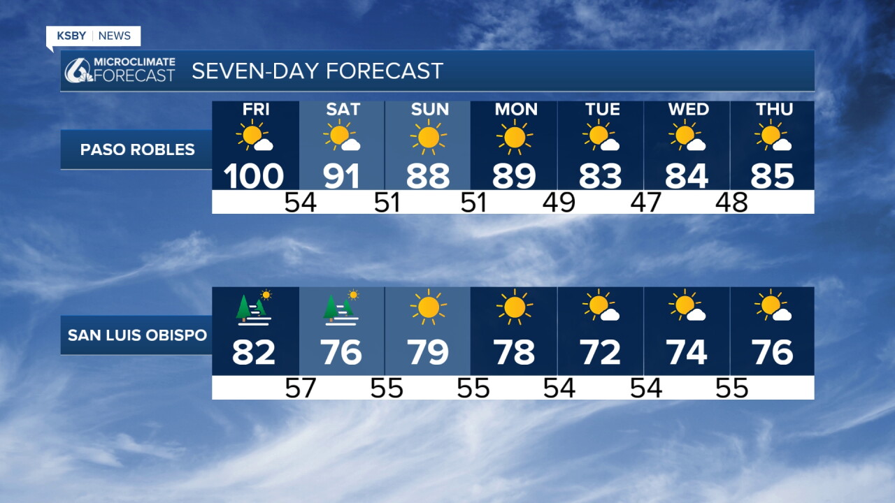
EXTENDED OUTLOOK The cooler, less humid pattern continues through Wednesday with temperatures remaining below seasonal normals. Morning low clouds expected daily, especially across the Central Coast. By Thursday, models suggest the ridge may begin rebuilding westward, potentially bringing gradual warming, though nothing approaching this week's extreme heat.
The combination of cooler temperatures and drier air will create significantly more tolerable weather conditions across the entire Central Coast region.
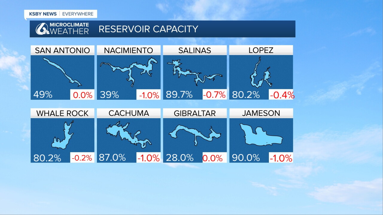
Below: It's Reservoir Thursday! Here are the current reservoir levels and the change from one week ago.
Have a great night, Central Coast!
-Jim
