


Good Wednesday evening, Central Coast!
A spotty light shower is still possible, but most areas will stay dry and cool tonight.
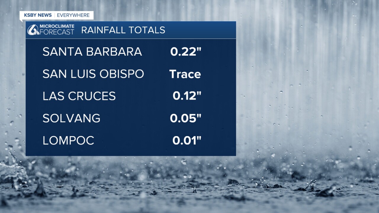
Below are the rainfall totals from the weak weather system that continues moving through the Central Coast. Santa Barbara almost had a quarter of an inch of rain.
Central Coast Weather Update:
What to Expect for the rest of the week:
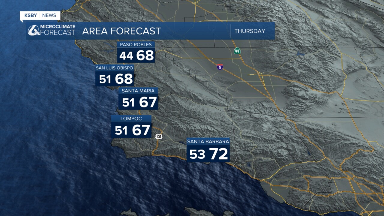
Tonight through Thursday: Very spotty, light showers are still possible tonight, with most of us staying dry. Some additional showers are expected Thursday morning in the mountainous areas of both counties. Also, this is the last of the rain we'll see for a while.
Below is a Wind Advisory for the South Coast of Santa Barbara County until 11 pm on Thursday for a north wind with gusts up to 50 mph.

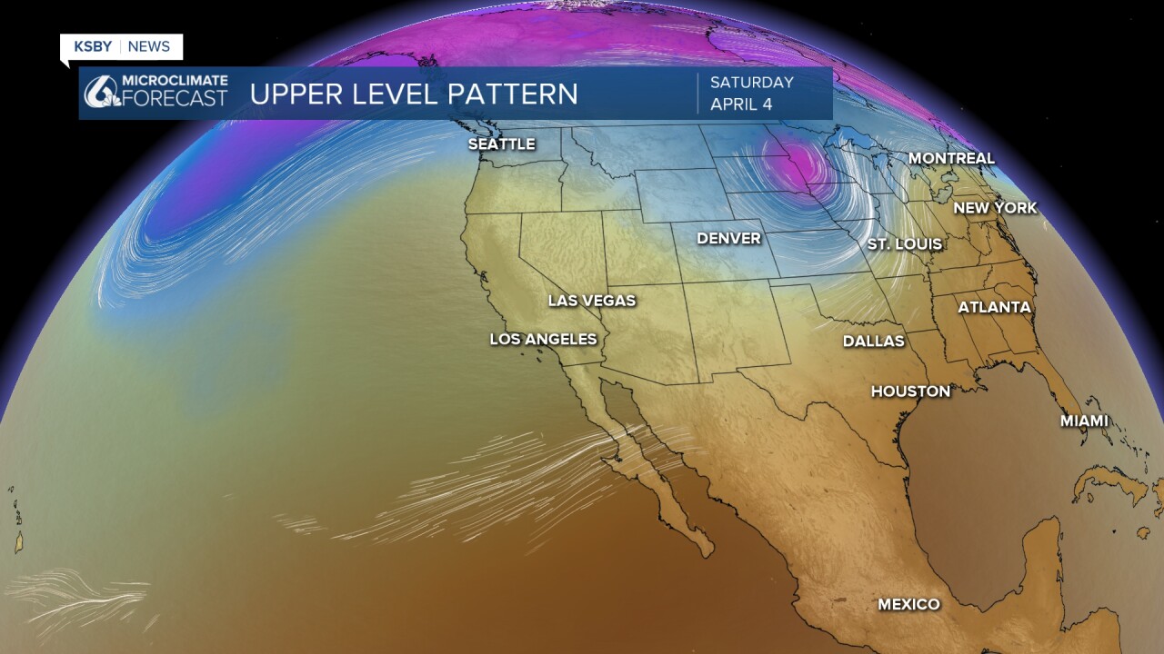
A cold low-pressure system currently off the Washington Coast will push through the Pacific Northwest on Thursday and dive into
Utah on Friday. This will drive our winds for the rest of the week.
Thursday night gusty Sundowner winds: Things will get breezy Thursday night as gusty northeast winds develop, particularly in areas like the Gaviota Pass, Refugio, and parts of southern Santa Barbara County. Sundowner wind gusts could reach 35-45 mph in these typical windy spots. A Wind Advisory has been issued for the interior mountains of Santa Barbara County and the Eastern Santa Ynez Range starting at 11 pm on Thursday until 5 am on Friday.

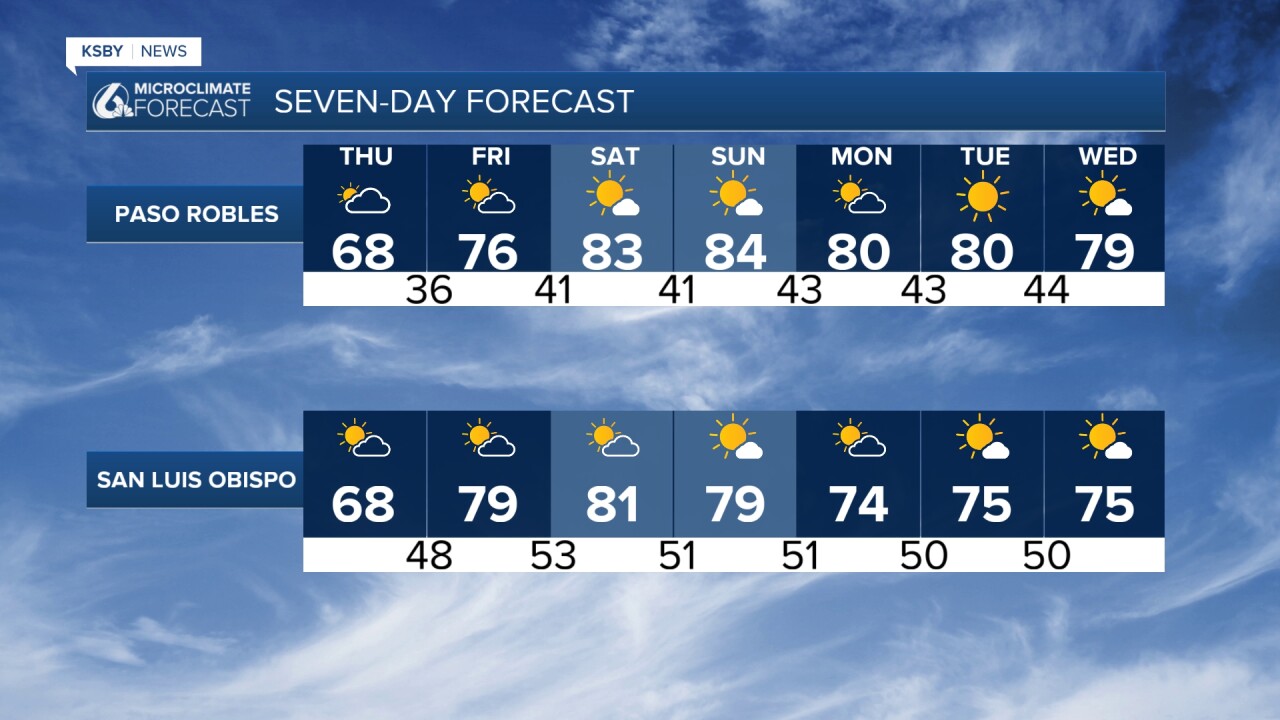
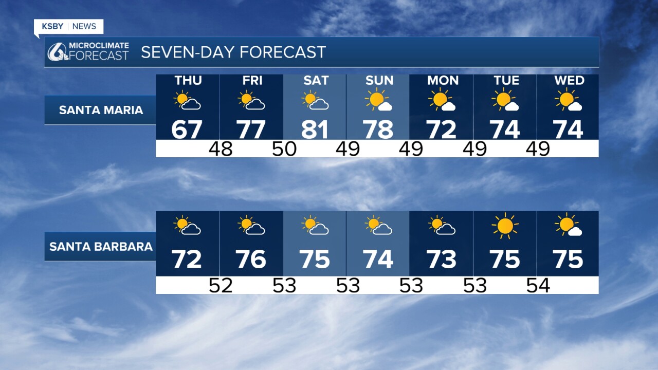
Friday-Saturday - Big Changes Ahead: Get ready for a dramatic turnaround! An offshore wind pattern will bring moderate to locally strong northeast winds Friday through Saturday. More importantly for your weekend plans, temperatures will push into the 80s and only slightly cooler along our beautiful coastline. That's quite a jump from this week's chilly conditions!
The Weekend Outlook: Saturday looks to be the warmest day, with those summer-like temperatures perfect for beach trips or outdoor activities.
Looking Ahead: The warm weather continues into Sunday before we see a gradual cooling trend early next week, though temperatures will still remain pleasantly above normal and not too hot.
Have a great night, Central Coast!
-Jim
