


Good Friday evening, Central Coast!
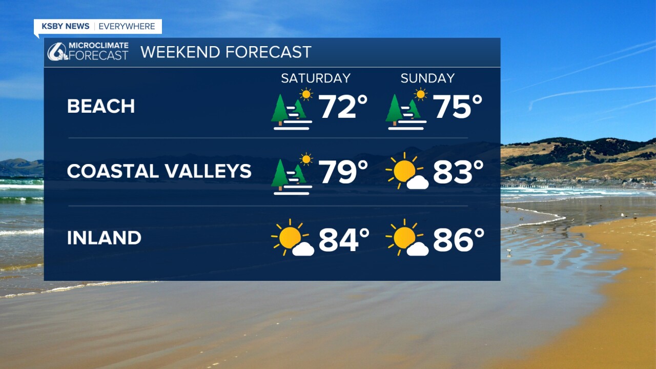
Great news for your weekend plans! Temperatures will stay pleasantly warm and it's dry through Monday. The warmest weather is expected on Sunday, with lots of sun for outdoor activities!
However, early birds along the coast should plan accordingly - expect areas of dense fog each morning through Saturday or Sunday that could impact your morning commute or beach walks.
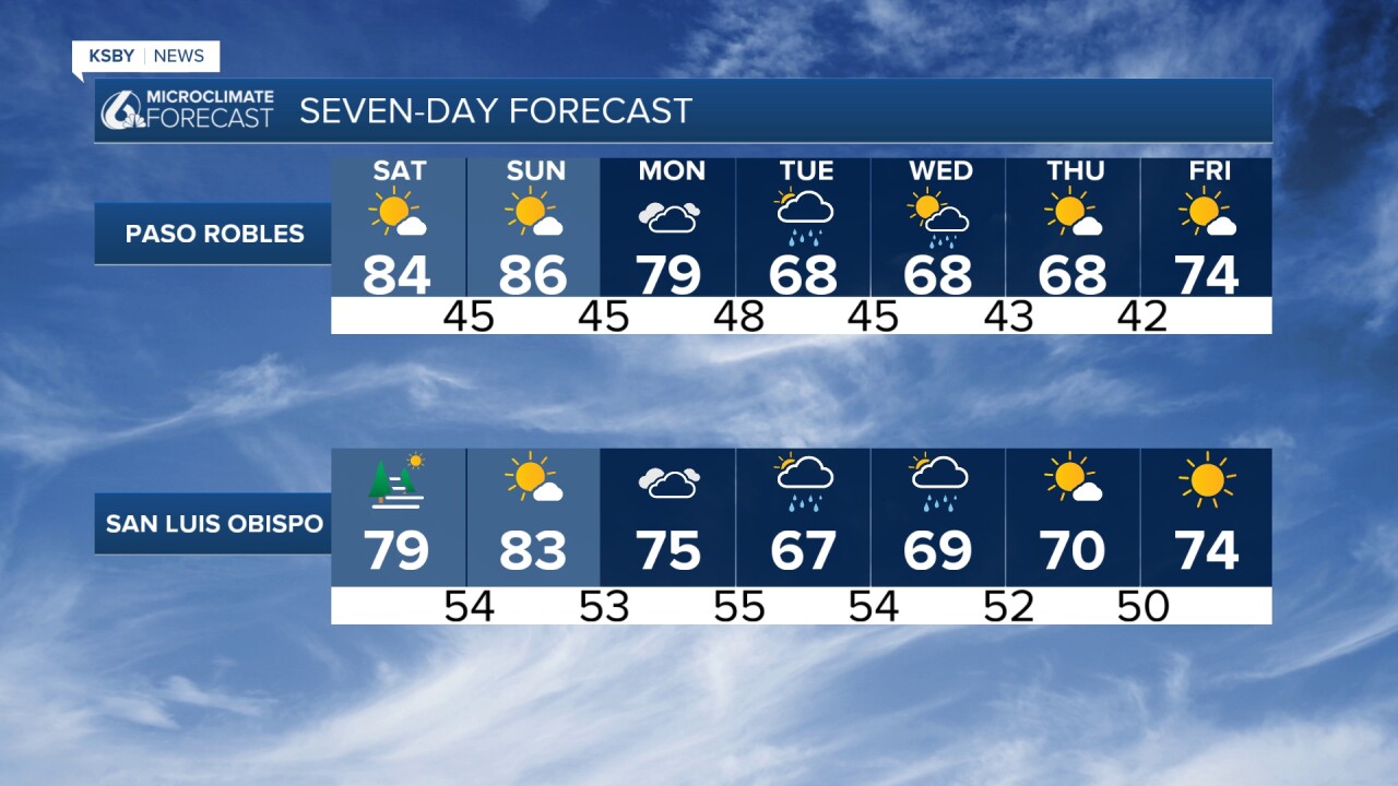
Big changes coming next week: Much cooler and more seasonal temperatures return Tuesday, along with our first real chance of rain since the 19th of February and some gusty winds are also in the forecast.
THIS WEEKEND (TODAY THROUGH SUNDAY)
Temperature-wise, it's going to feel more like summer than spring! Inland valleys and mountain areas will see highs running 10 to 20 degrees above normal - but nothing extreme enough to cause heat concerns.
For your weekend plans:
Coast: Expect morning fog and low clouds, especially Friday night into Saturday morning. Perfect beach weather once it clears!
Inland: Warm and mostly sunny with just some high, thin clouds drifting overhead
Winds: Typical afternoon sea breezes, nothing to worry about
NEXT WEEK (MONDAY THROUGH THURSDAY)
The pattern completely flips! A trough of low pressure develops along the west coast, and this will bring much more comfortable temperatures - only 2-5 degrees above normal.
Rain chances return to the Central Coast! Tuesday into Wednesday brings our best chance of measurable rainfall in over a month. Most areas should expect around half an inch or less, with the best chances in northwest San Luis Obispo County and the foothills.
Looking ahead: The weather pattern looks dry again from April 3rd through the 11th.


Have a great weekend, Central Coast!
-Jim
